More Tropical Waves to Watch This Week

It can be jarring how quickly things can change during Hurricane Season. It feels like we see this a lot: off to a quiet start and with the snap of a finger it's wave after wave that need to be watched. One of these waves ended up turning into Erin - not saying that's what to expect later this week, however.
RELATED ARTICLE: Latest on Hurricane Erin
Our next wave has emerged off of the western coast of Africa, a known breeding ground for tropical systems around the peak of the season.
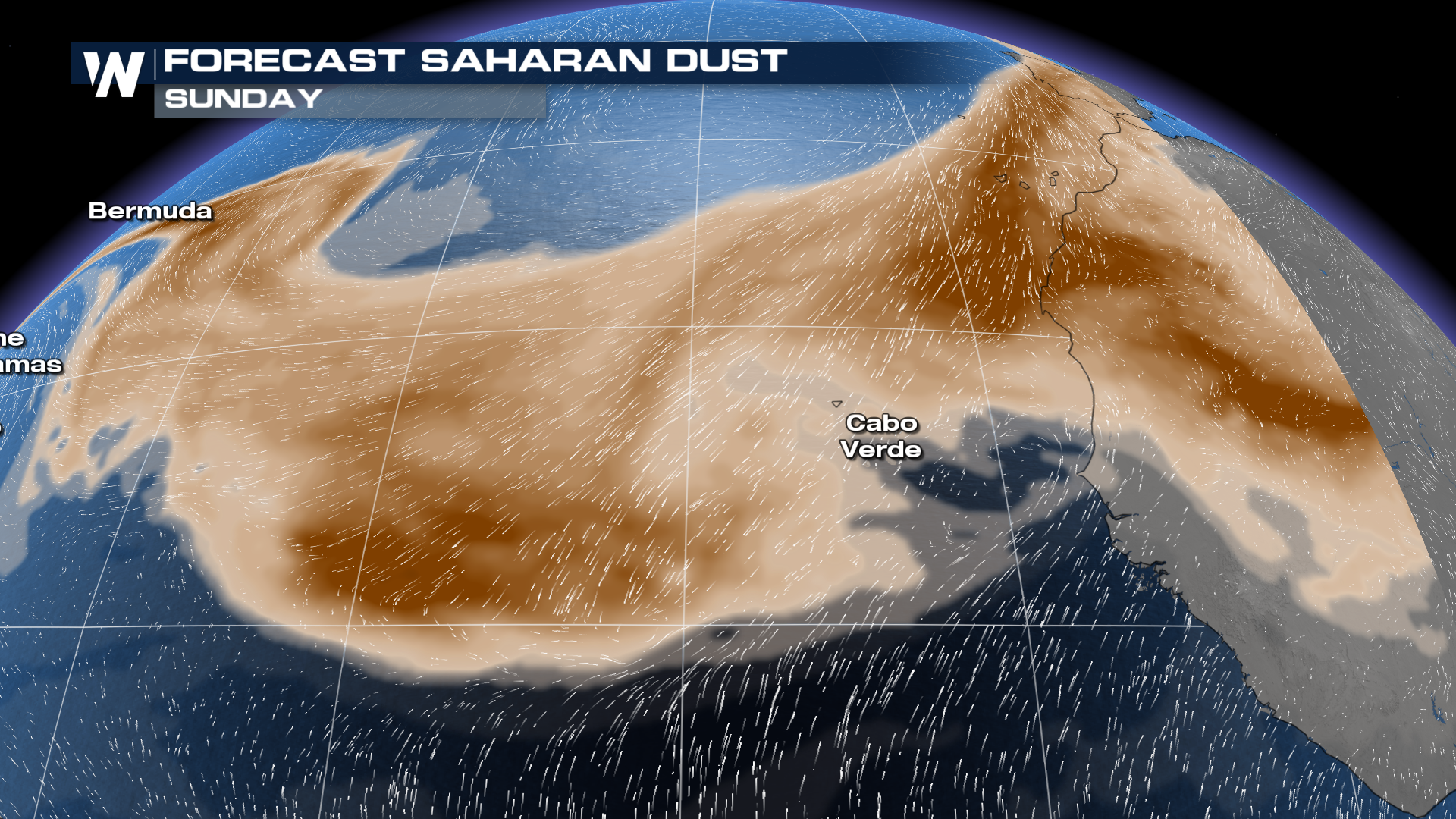
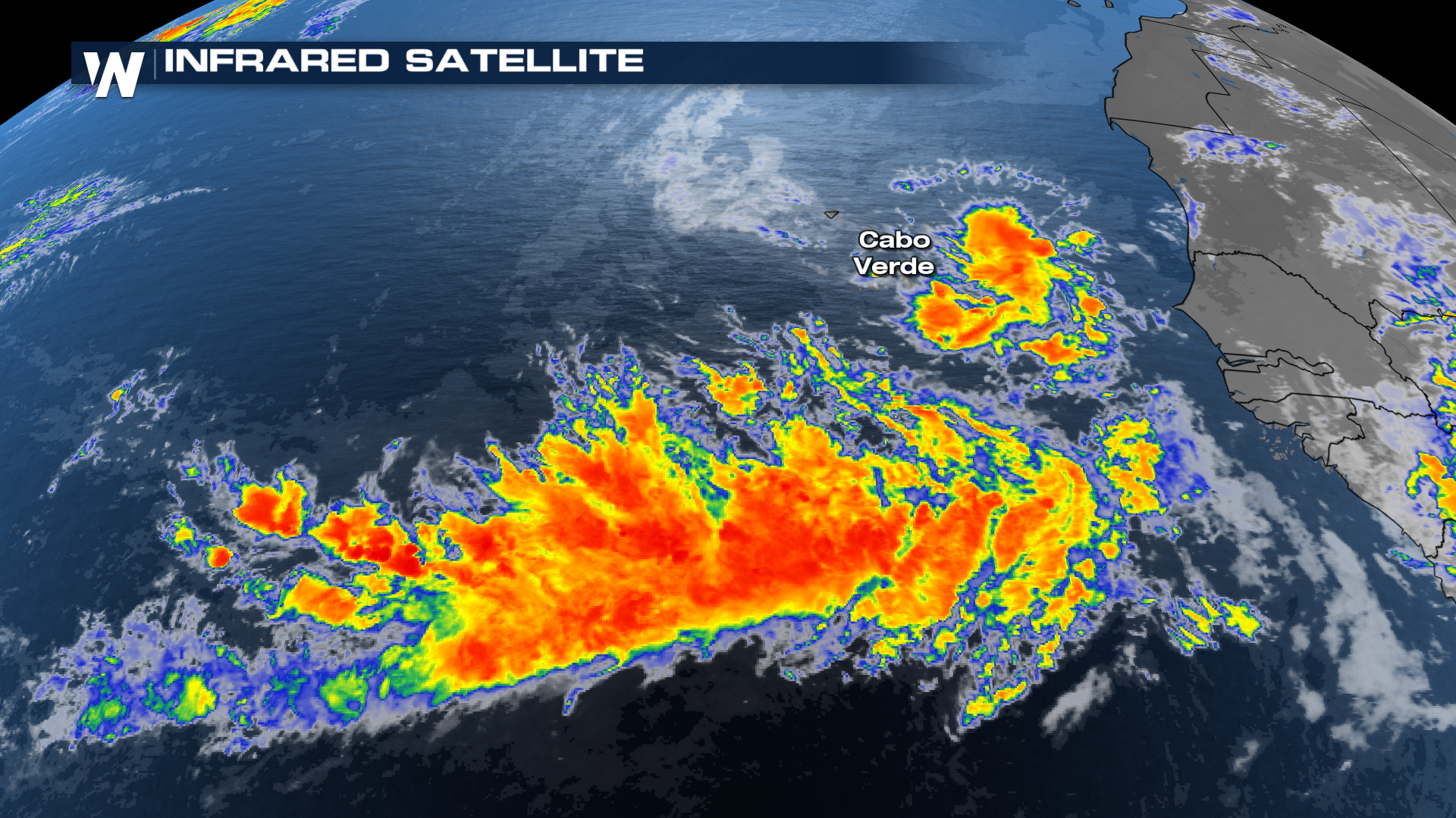 It's a little less organized than what became Erin, but that can always change as it progresses westward. Much like its predecessor, it will have to battle a lot of Saharan Dust in the early stages. It appears that is going to temper expectations in the short term.
 Another wave will exit over the next day or so, which will also bear watching but has all of the other limitations on it. By Thursday, that's when we might see some signs of life. The GFS model, for example, has a pair of waves that traverse the Atlantic, and would threaten the Leeward Islands late this week. It's far too early to start talking specifics with either of these waves. At this juncture, just monitor reliable weather messengers. If you have a hole in your Hurricane Plan, fix it!
 Don't freak out. Don't fall for the clickbait. Either or both of these waves could never develop - that's what we'll root for over the coming days.


