Flooding Concerns in the Upper Midwest
Special Stories
10 Oct 2018 8:04 AM
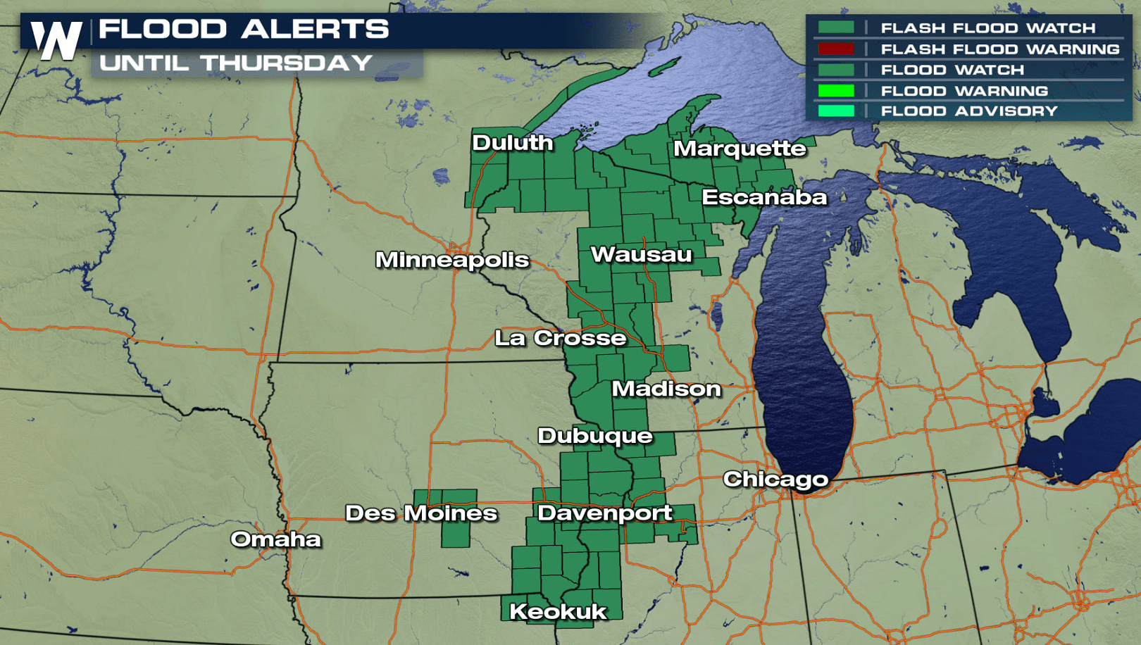
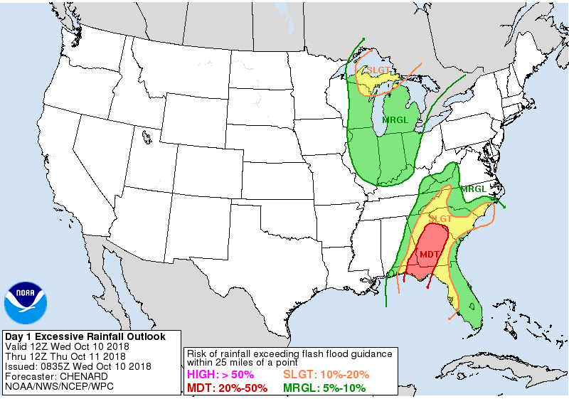
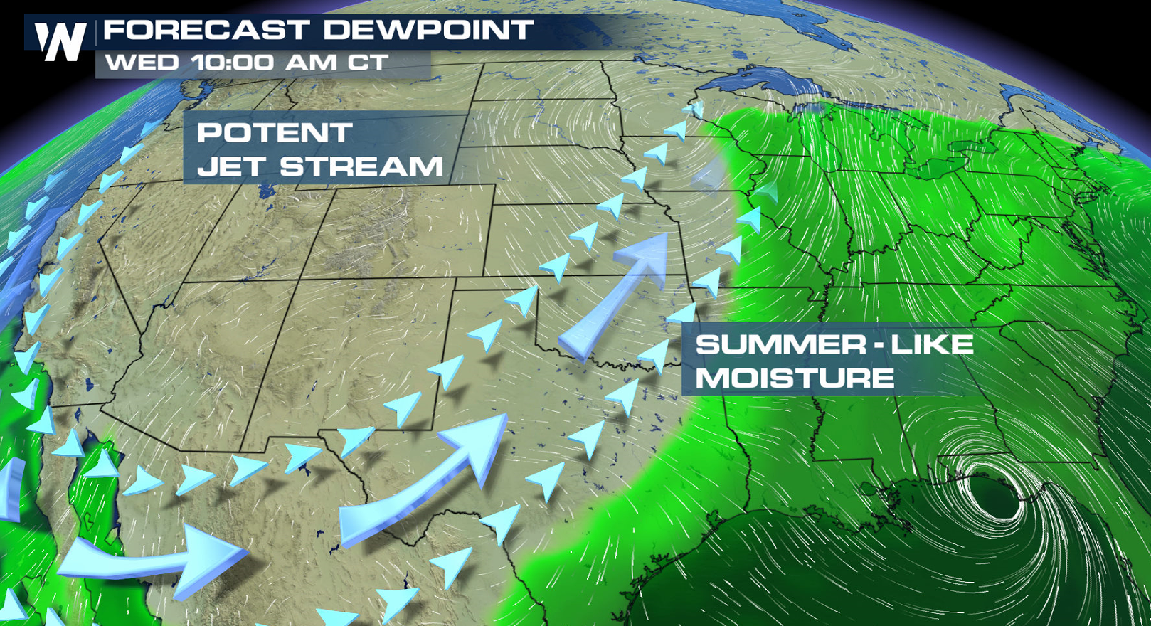
A slow moving cold front continues to produce numerous showers and thunderstorms in the Upper Midwest and western Great Lakes. A rich feed of humidity has been funneling northward along the front, fueling the heavy rainfall. Flood Watches remain in effect from the Upper Peninsula of Michigan to northeastern Missouri.
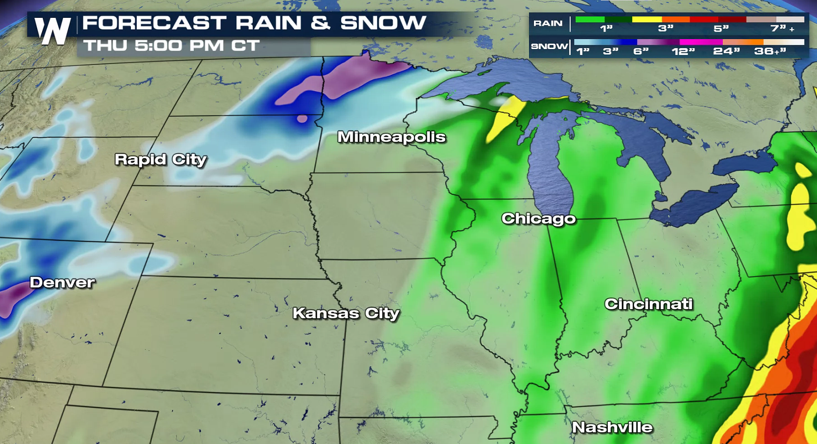 An additional 1" to 2" of rain is possible through Thursday. Due to the already saturated ground from the rain that has occurred over the last week, rivers and streams will be susceptible to quick rises. There may be flooding in low-lying and poor drainage areas, including downstream of dams and other hydrological projects.
 For WeatherNation: Meteorologist Mace Michaels
An additional 1" to 2" of rain is possible through Thursday. Due to the already saturated ground from the rain that has occurred over the last week, rivers and streams will be susceptible to quick rises. There may be flooding in low-lying and poor drainage areas, including downstream of dams and other hydrological projects.
For WeatherNation: Meteorologist Mace MichaelsAll Weather News
More
Wildfire Outbreak in the Pacific Northwest
Conditions have been incredibly dry out west.
2 Aug 2026 12:20 PM


More Storms for the East Sunday and Monday
A low-pressure system crashing through the Mi
2 Aug 2026 2:20 AM

After Reaching Category 5, Genevieve Weakens in the Pacific
PacificGenevieve formed on last Friday south
2 Aug 2026 1:30 AM

Flooding, Severe Storms Target the Midwest Again
After an active week of storms across the nor
1 Aug 2026 1:40 AM

Flooding Risk Increases as Heavy Rain Targets the Tri-State Area
Tuesday, heavy rainfall moved across the Nort
30 Jul 2026 12:25 AM

Severe Weather: Energy From the Midwest Now in the Southeast
UPPER MIDWEST - Through Monday, dangerous tor
29 Jul 2026 10:30 PM