Flooding Potential Along the Ohio River
Special Stories
16 Aug 2018 8:43 AM
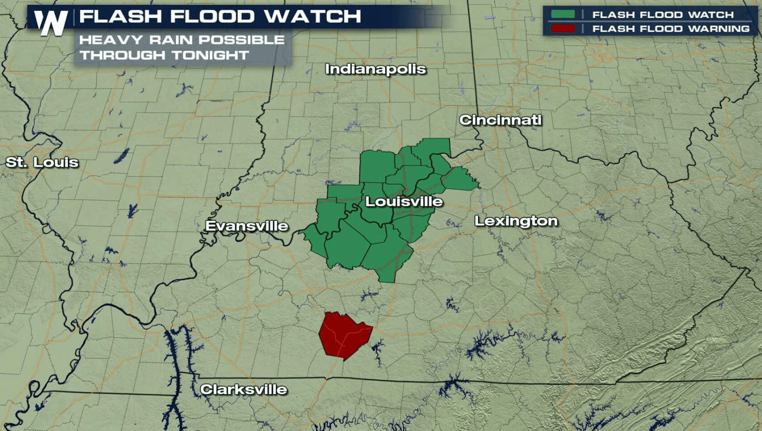
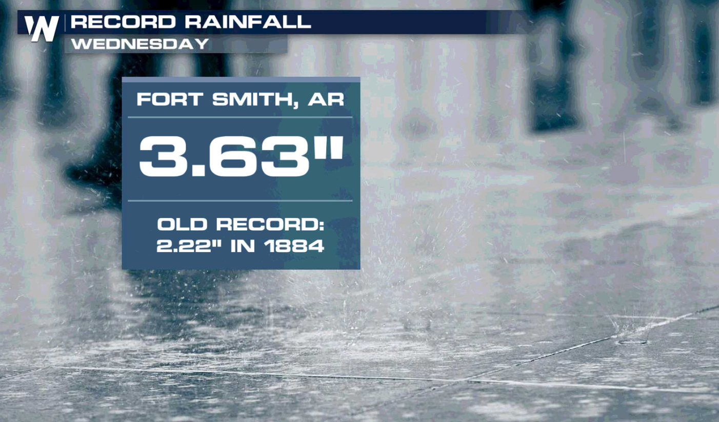
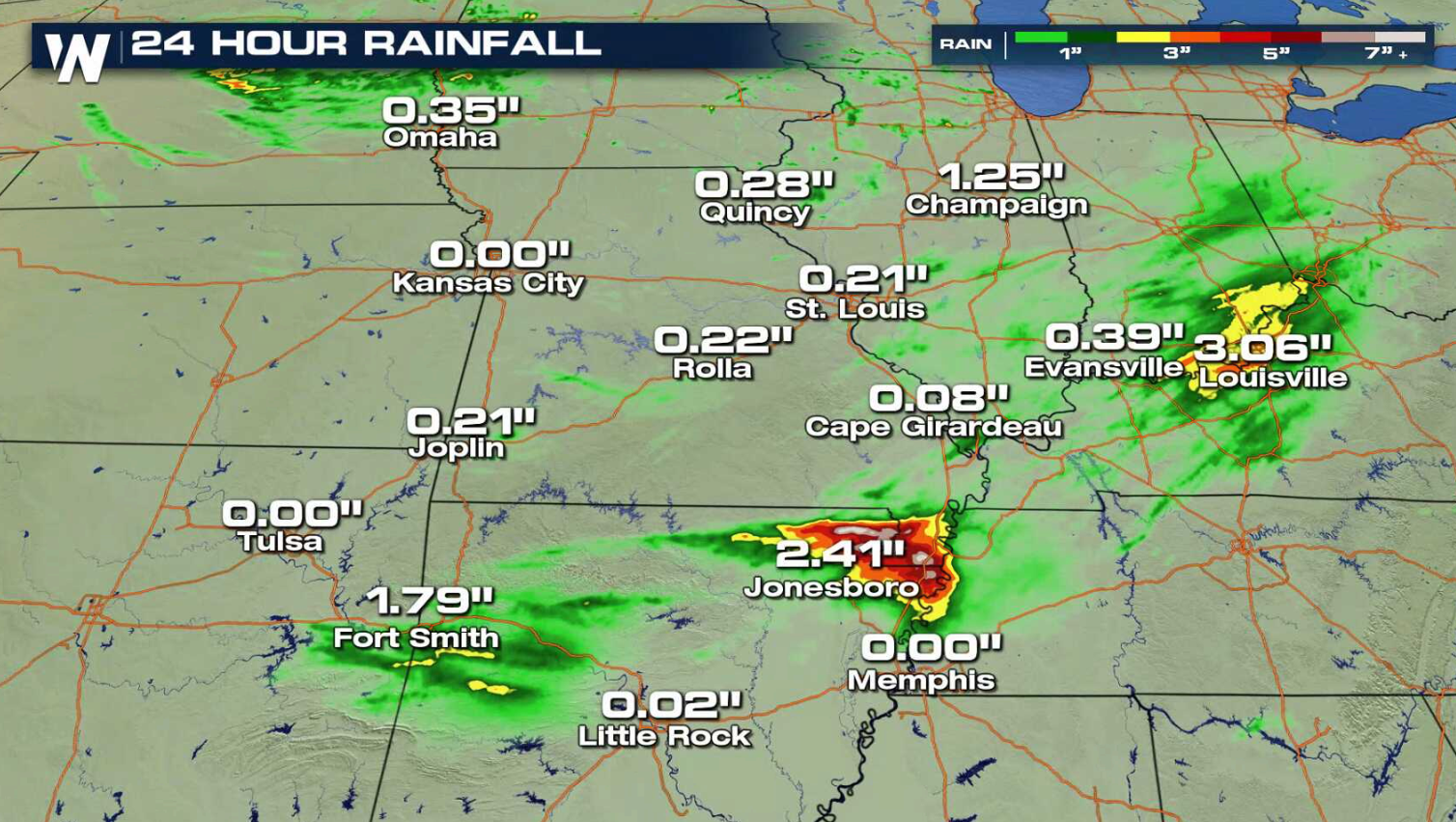
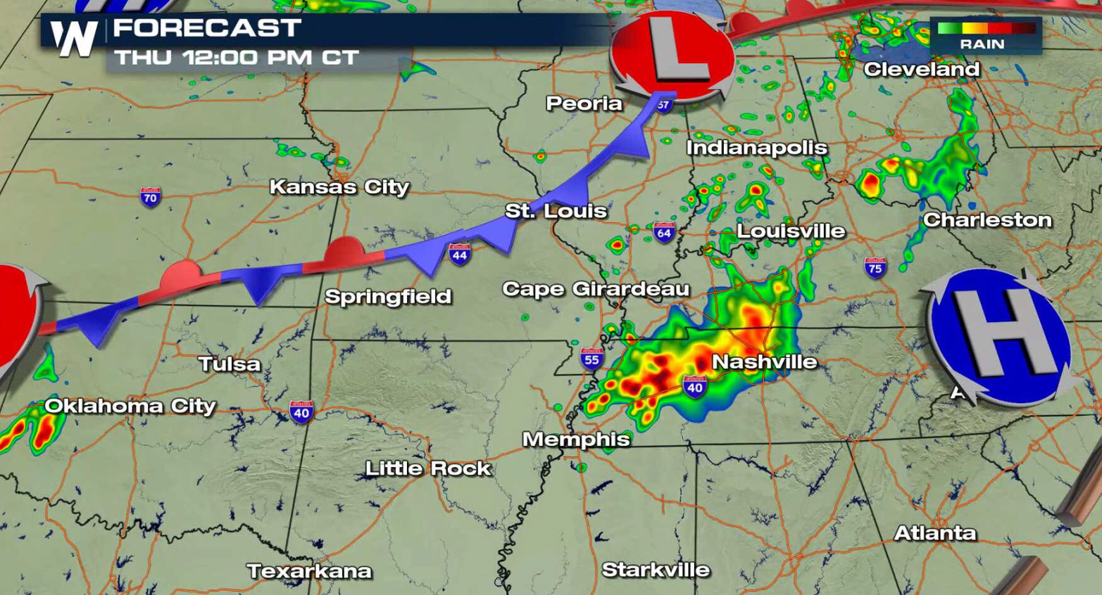
Numerous showers and thunderstorms fell from the Plains into the Ohio Valley on Wednesday, producing more than 3" of rain in some areas with flooding. More thunderstorms are ahead today (Thursday) with a risk for flooding in Indiana and Kentucky along the Ohio River. Flash Flood Watches have been issued into this afternoon, centered near Louisville.
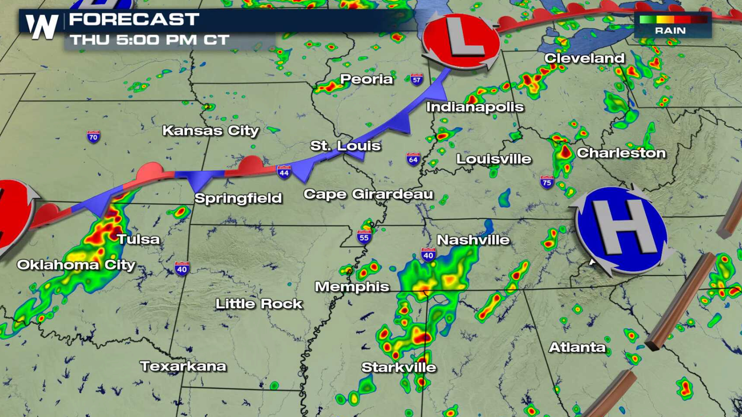
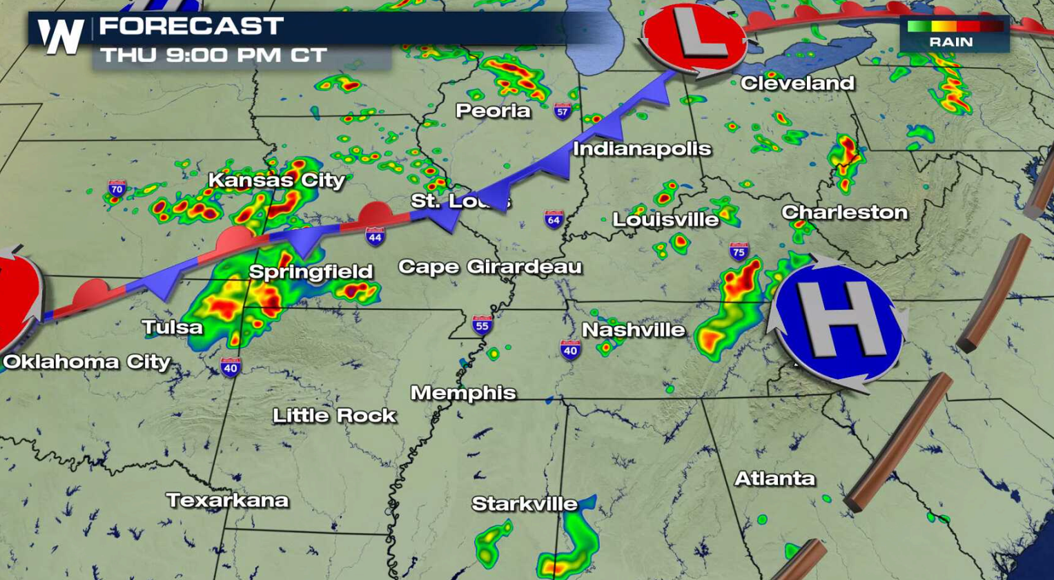
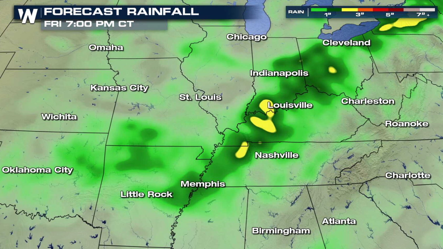 A front is dropping slowly south from the Great Lakes to the Plains. High humidity ahead of the system will provide significant moisture for thunderstorms to produce heavy rainfall. Coverage will be scattered and not widespread, but amounts could reach higher than 3" in the heaviest storms. This could lead to flooding, especially in areas where soils are over-saturated.
 For WeatherNation: Meteorologist Mace Michaels
A front is dropping slowly south from the Great Lakes to the Plains. High humidity ahead of the system will provide significant moisture for thunderstorms to produce heavy rainfall. Coverage will be scattered and not widespread, but amounts could reach higher than 3" in the heaviest storms. This could lead to flooding, especially in areas where soils are over-saturated.
For WeatherNation: Meteorologist Mace MichaelsAll Weather News
More
Severe Storms in the Midwest Could Dampen Holiday Plans
NORTHERN PLAINS - A frontal system is expecte
4 Jul 2025 3:20 AM

Near Seasonal Temperatures for Many Come July 4th!
AAA is expecting over 70 million travelers to
4 Jul 2025 3:15 AM

NHC Monitoring Front in the Southeast Ahead of 4th of July
Tropical downpours for a long holiday weekend
4 Jul 2025 3:10 AM

Flossie is No More, Eastern Pacific Remains Active
Post Tropical FlossieThe National Hurricane C
4 Jul 2025 3:05 AM


Northwest Heat Met With Thunderstorm Risk
NORTHWEST - Today, portions of Montana are un
3 Jul 2025 12:00 AM

Severe Weather Threat Continues in the Midwest
It has been an active, severe season across t
30 Jun 2025 9:00 PM