Flooding Risk from the Ohio Valley to the Northeast
Special Stories
1 Nov 2018 10:01 AM
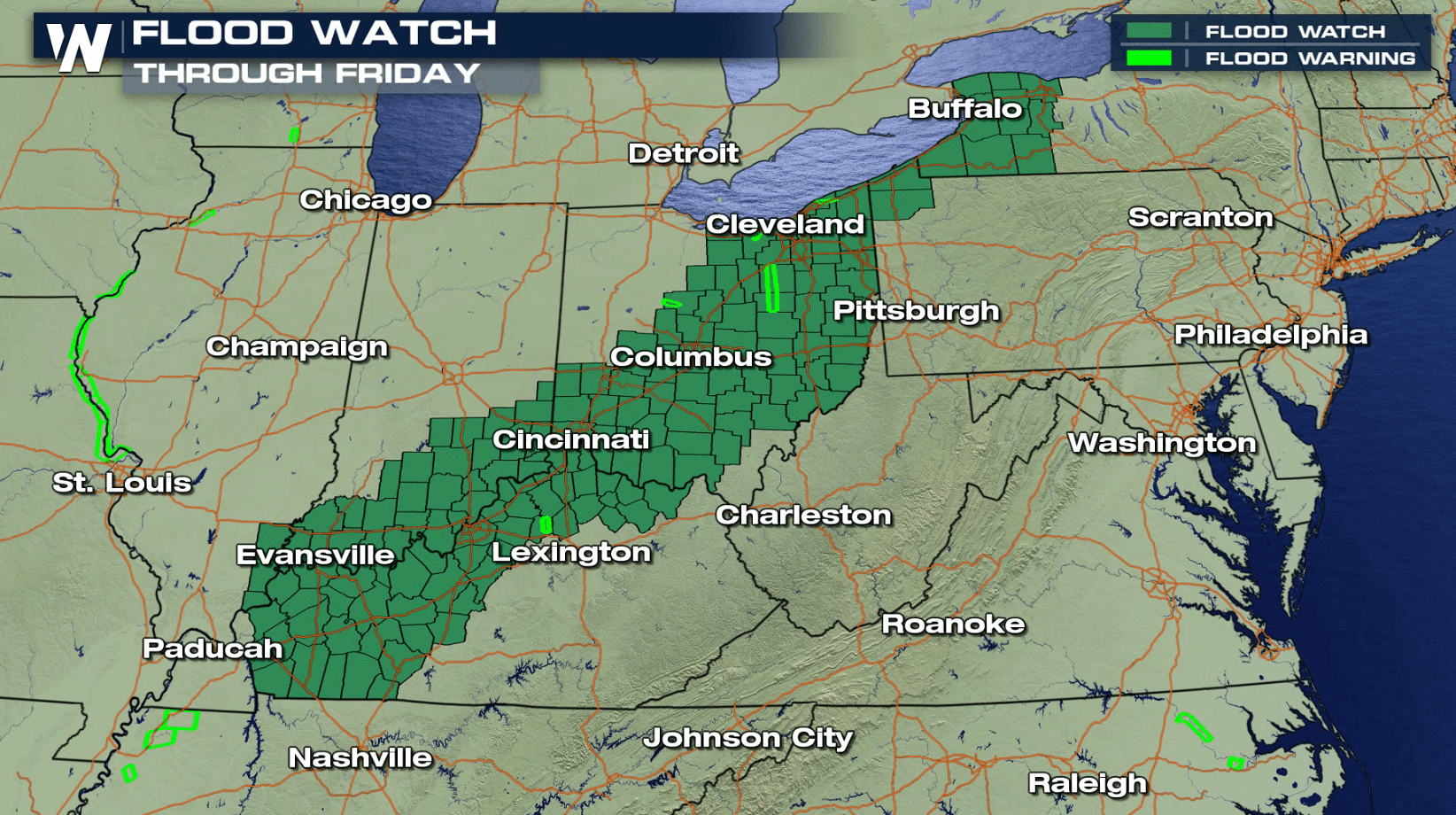
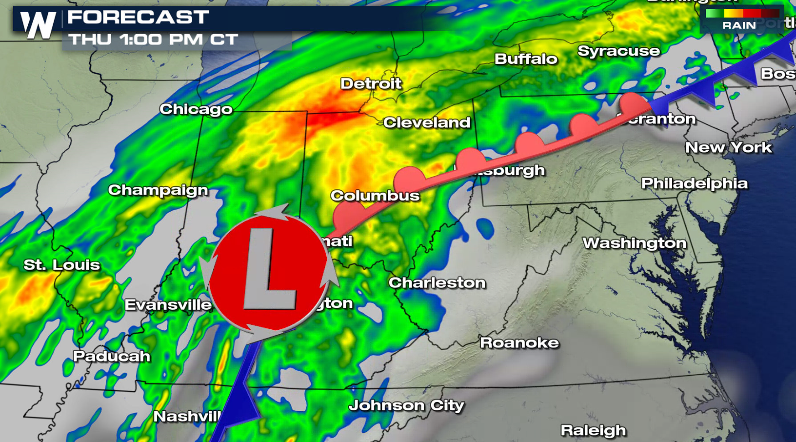
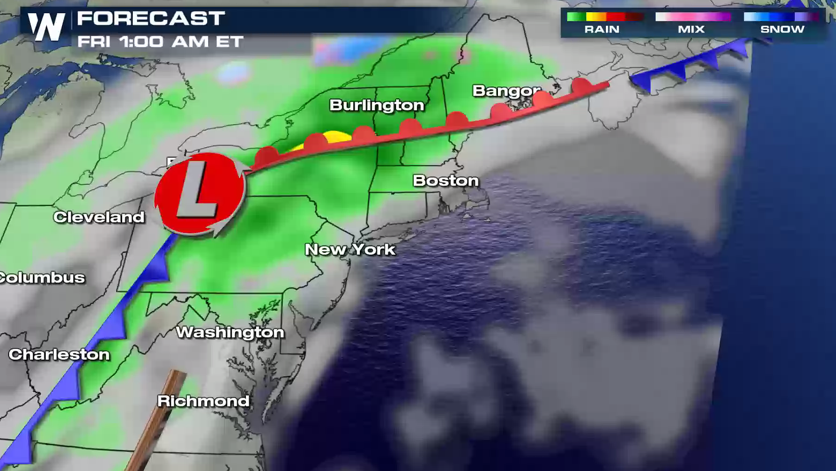
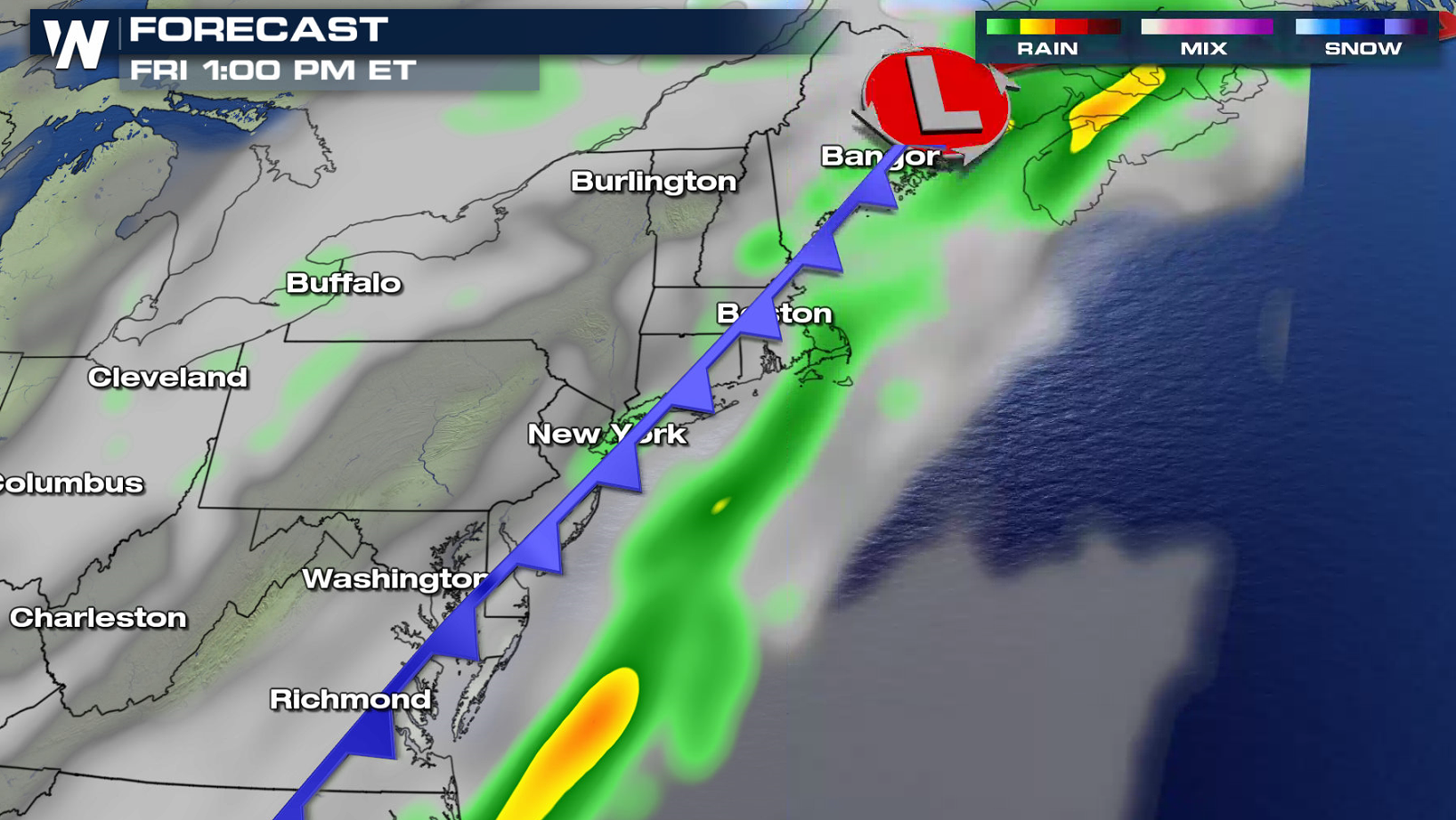
A cold front and low pressure center moving from the Ohio Valley into the Northeast will produce heavy rainfall through Friday. Flood-prone and low-lying areas will likely experience flooding issues. Rises on area creeks, streams, and rivers are expected. Urban street flooding may also occur. Rainfall totals will reach up to 3" in some areas.
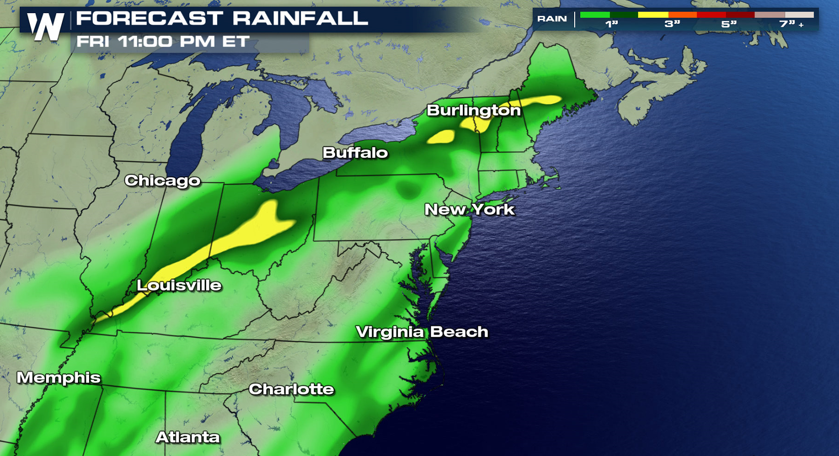
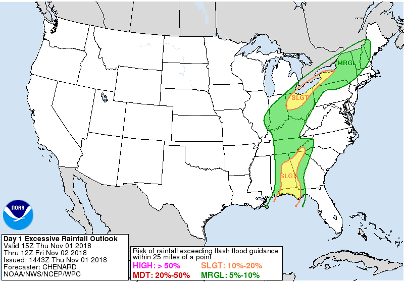
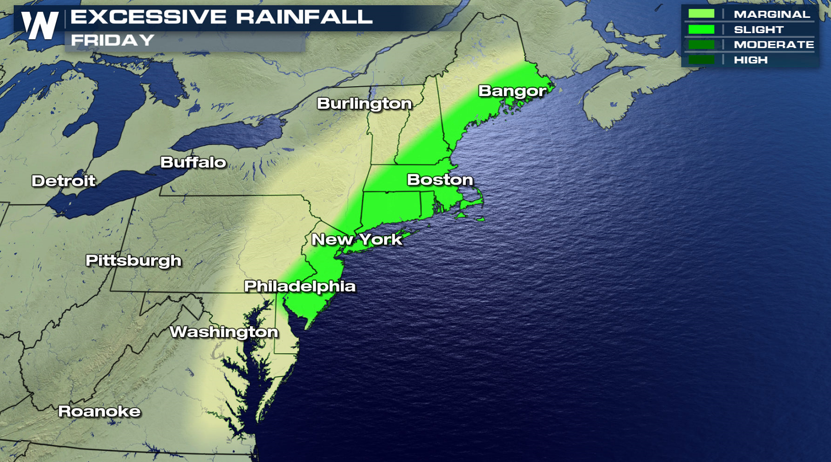 Heavy rain will continue across the Ohio Valley into this evening (Thursday) as the storm system slowly pushes to the north and east. The low pressure center will move into the Northeast on Friday, bringing a threat for excessive rainfall. The system will move into the Atlantic Ocean by Saturday, ending the risk for flooding.
 For WeatherNation: Meteorologist Mace Michaels
Heavy rain will continue across the Ohio Valley into this evening (Thursday) as the storm system slowly pushes to the north and east. The low pressure center will move into the Northeast on Friday, bringing a threat for excessive rainfall. The system will move into the Atlantic Ocean by Saturday, ending the risk for flooding.
For WeatherNation: Meteorologist Mace MichaelsAll Weather News
More
Severe Storms For the East Coast Through Tuesday
A cold front moving through a moist airmass h
2 Jul 2025 1:00 AM


Western Heat Continues With Some Relief
A large dome of hot high pressure remains acr
1 Jul 2025 11:00 PM

NHC Monitoring Front in the Southeast Ahead of 4th of July
SOUTHEAST - A frontal boundary moving through
1 Jul 2025 10:35 PM

Where Rain Could Dampen Holiday Travel Plans
AAA is expecting over 70 million travelers to
1 Jul 2025 4:35 PM

Severe Weather Threat Continues in the Midwest
It has been an active, severe season across t
30 Jun 2025 9:00 PM