Flooding Threat Continues Across the Country

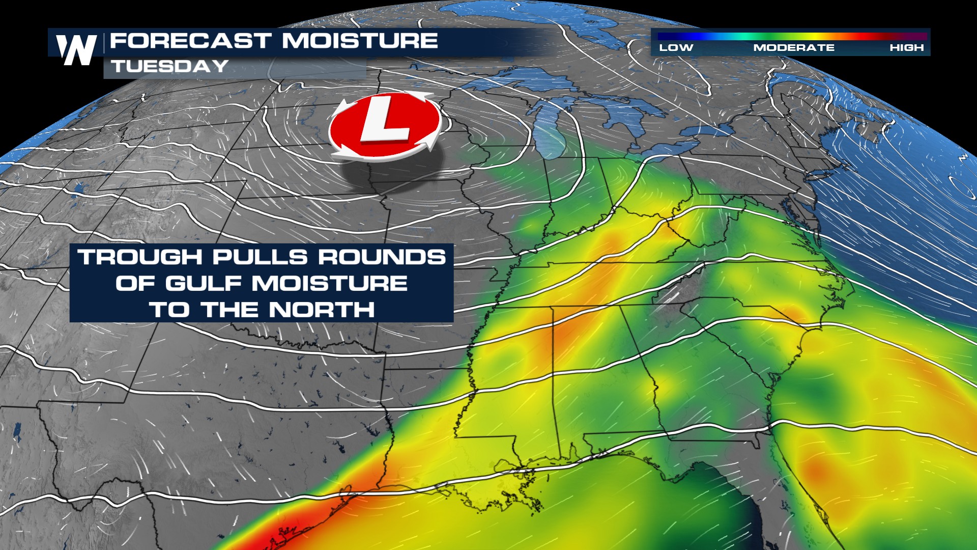
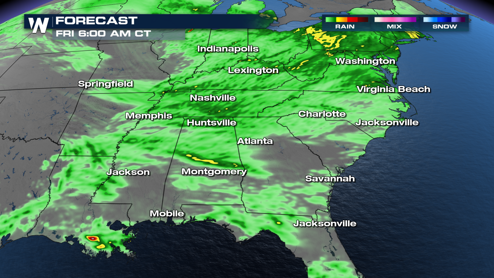
Showers and storms will rumble through midweek, delivering not only a severe weather threat but also the potential for significant flooding. With abundant moisture in place, storms will be efficient rain-producers, and it's the multiple rounds of rain that will elevate the flooding risk.
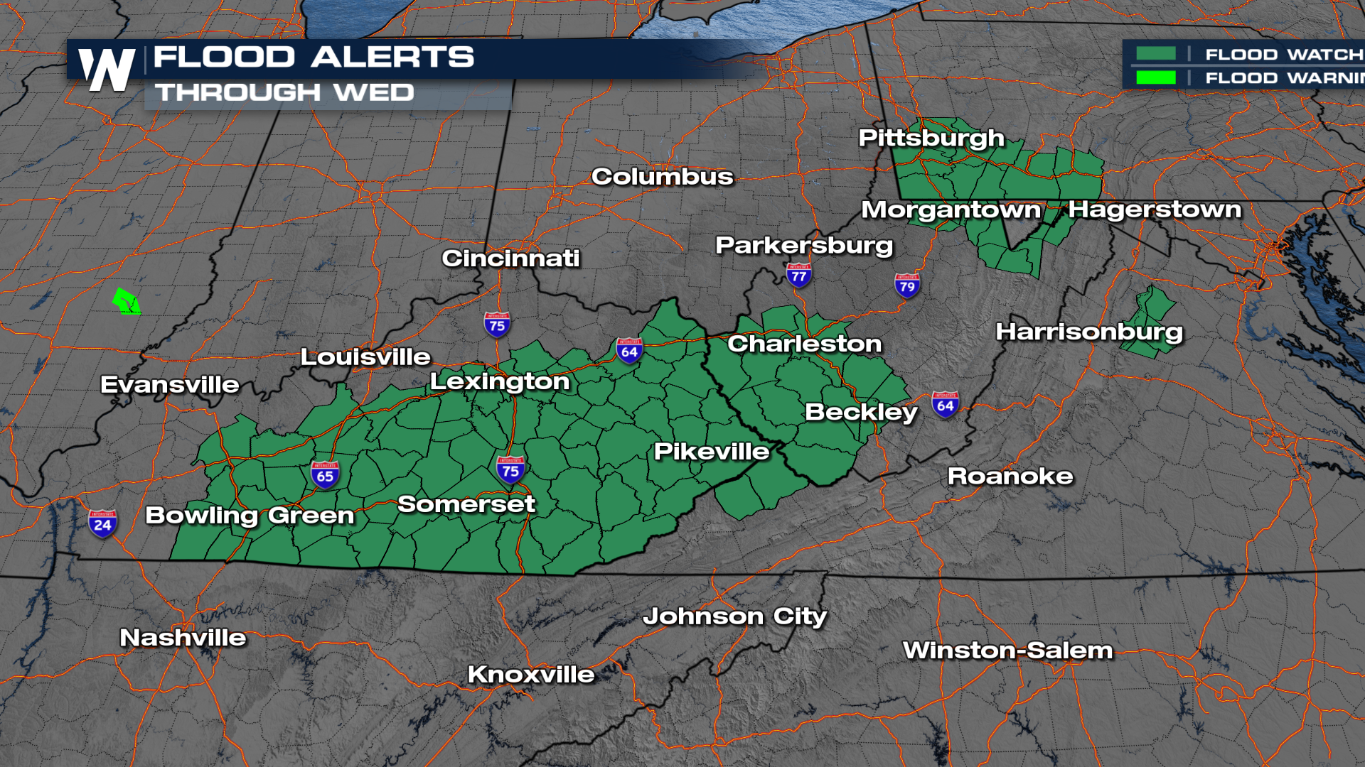
 Flood Watches are in effect from Kentucky through the Appalachian Mountains of West Virginia, with additional watches now posted for parts of Pennsylvania, West Virginia, and Virginia through Thursday.
Rainfall totals of 1-4 inches are possible, with locally higher amounts in areas hit by repeated rounds of storms.
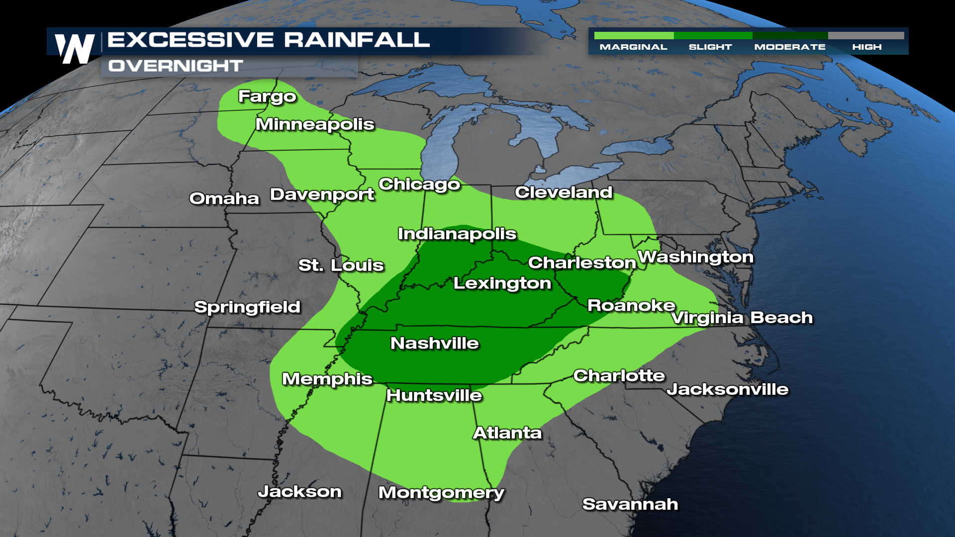
 Further north into Minnesota and the Dakotas, rainfall won’t be as intense, but persistent rain will still lead to accumulating totals over time.
 As always with flooding:
Never drive through flooded roadways; just one foot of water can float most vehicles.
Know your flood risk at home, and have a plan in case you need to move to higher ground during a Flash Flood Warning.


