Flooding Threatens the Mid-Atlantic
Top Stories
4 Aug 2021 7:45 AM
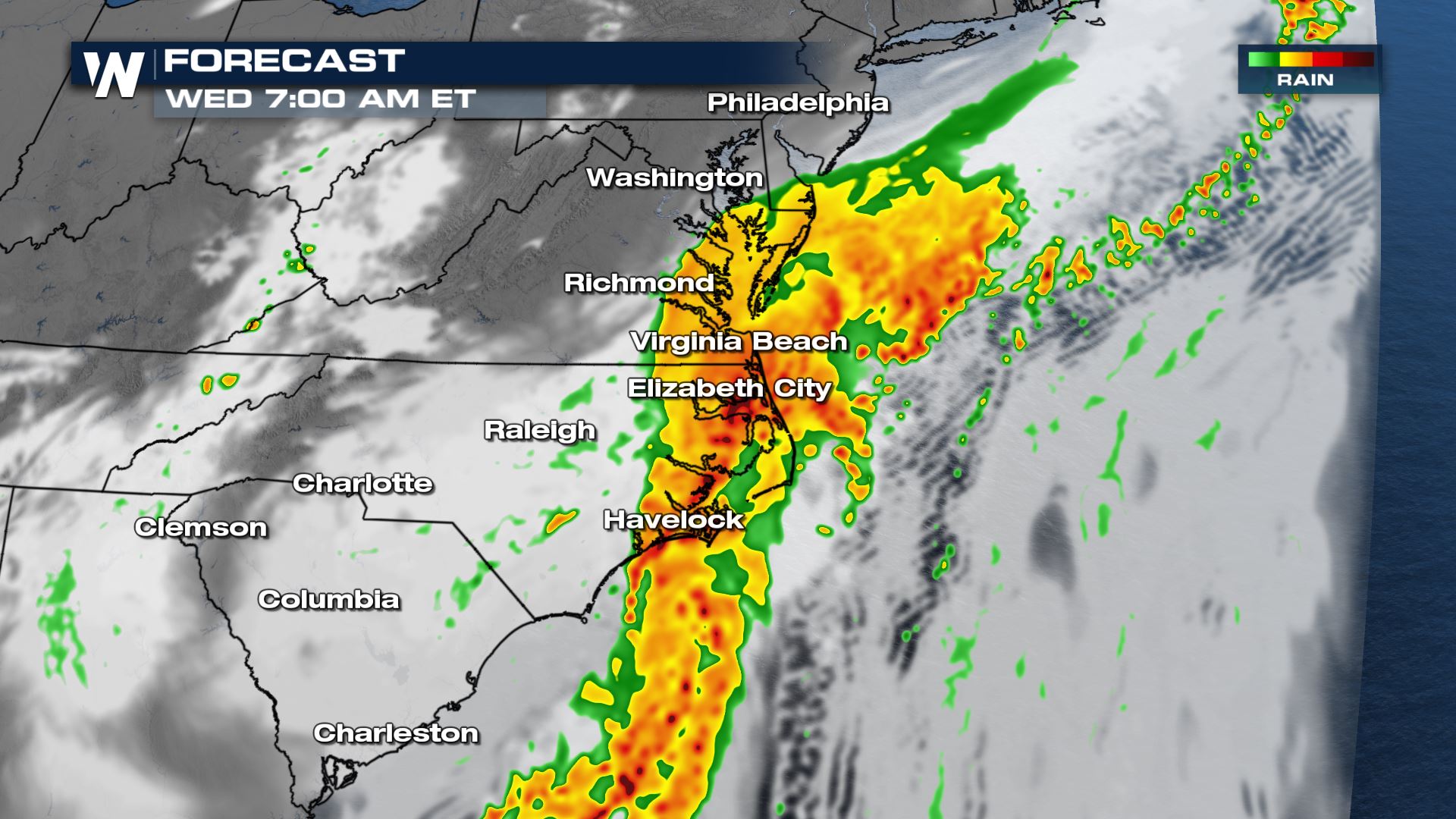
The stationary front finally has some eastward momentum. However, as waves of energy and low pressure centers develop along the boundary, the threat for heavy rain shifts from the Mid-Atlantic region to the northeast. Heavy rainfall rates will lead to flooding.
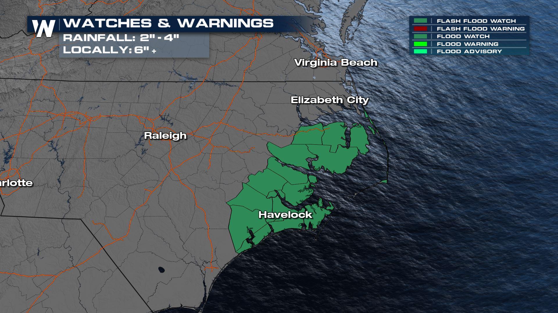
 Flash Flood Watches continue with the amount of accumulation still on the way for Wednesday.
 Accumulations are high as storms are training over the same areas at a slow pace. The totals are expected to be 3" to 6" through the rest of the morning hours.
 As the morning storms move away, coastal conditions will still be monitored for waterspouts and gusty wind.
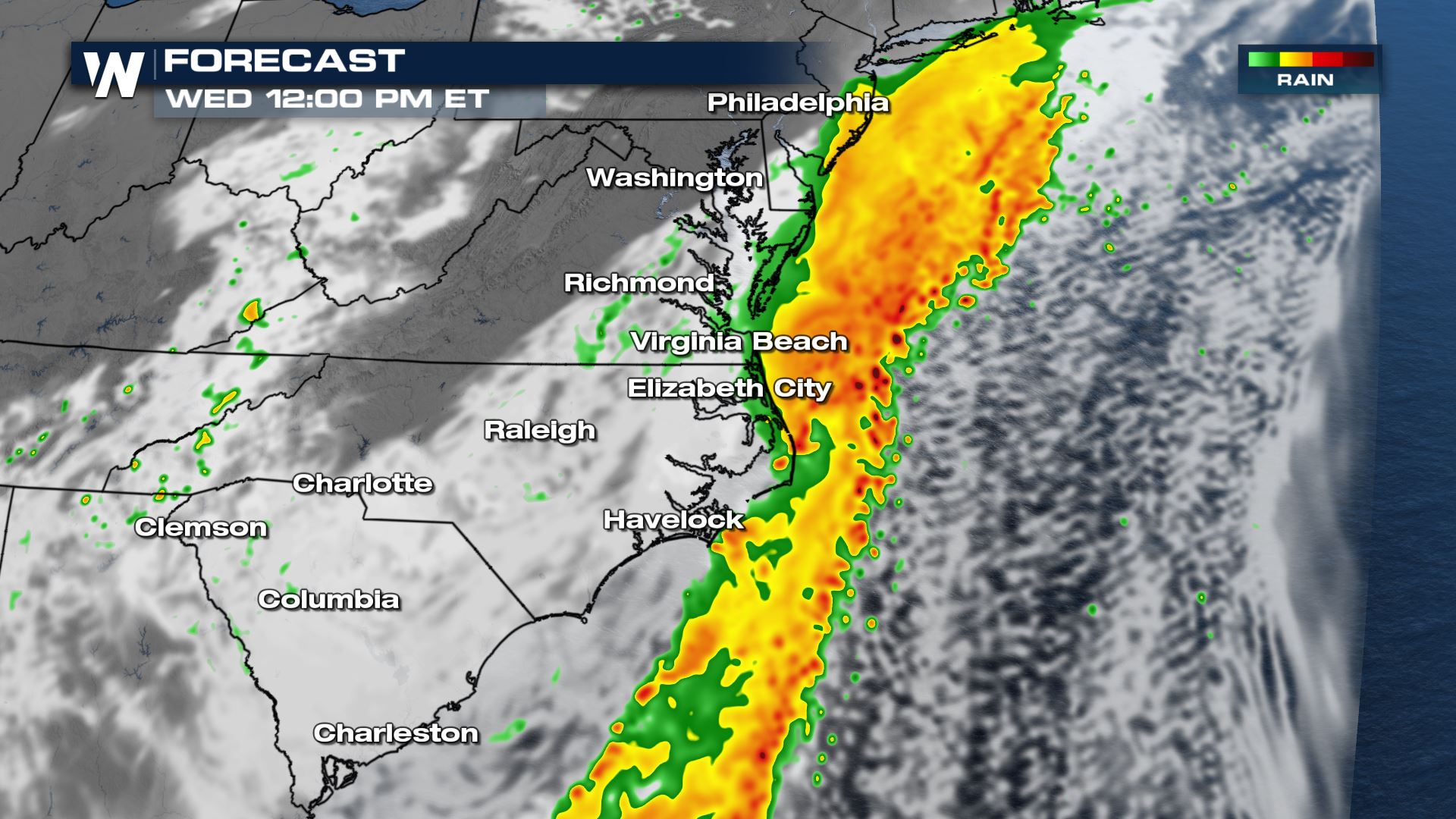 Check back with WeatherNation on-air and online for updated severe weather forecasts if you are in the risk areas.
Excessive Rain Outlook
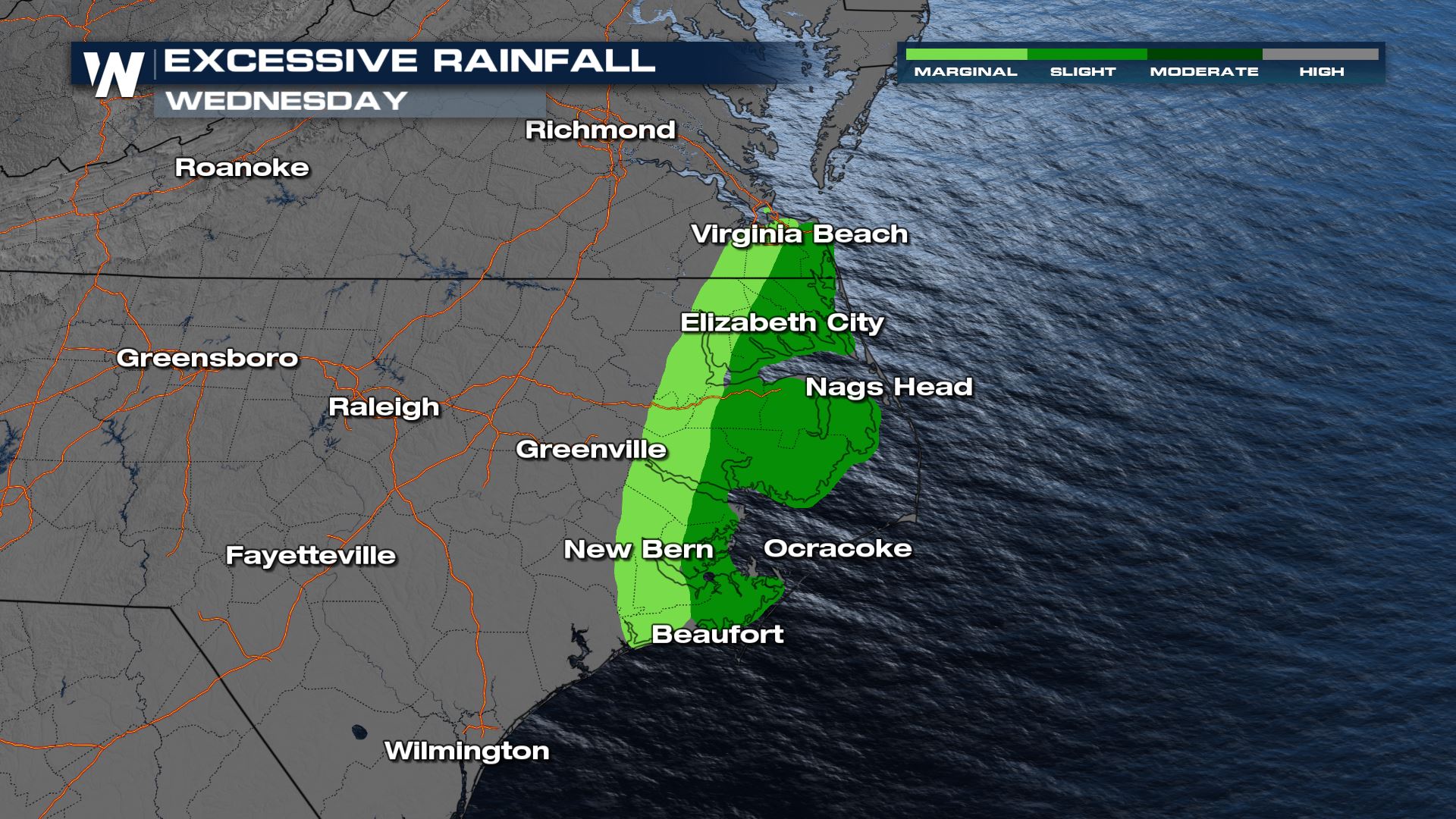
With high humidity, thunderstorms will produce heavy rainfall. The highlighted areas are expected to see the higher threats for high water and rapid flooding.
Flash Flood Watches continue with the amount of accumulation still on the way for Wednesday.
Accumulations are high as storms are training over the same areas at a slow pace. The totals are expected to be 3" to 6" through the rest of the morning hours.
Timing
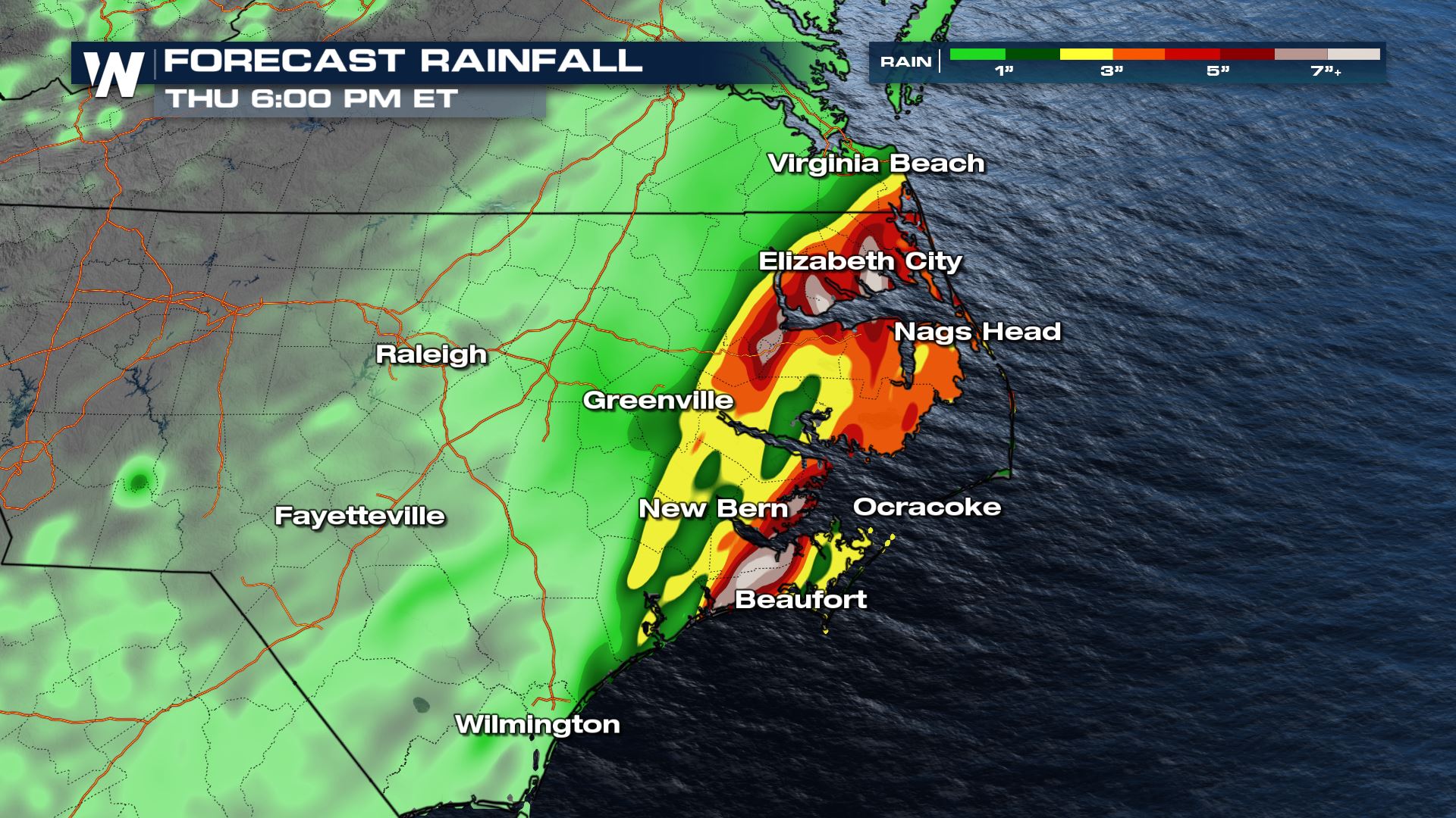
The latest forecast is showing how the track of the stalled boundary creates a very localized risk into the eastern parts of North Carolina. A lot of the storms remain in the open Atlantic waters.
As the morning storms move away, coastal conditions will still be monitored for waterspouts and gusty wind.
Check back with WeatherNation on-air and online for updated severe weather forecasts if you are in the risk areas.All Weather News
More
Wildfire Outbreak in the Pacific Northwest
SPOKANE, WA - On Saturday, August 1st, the Ol
3 Aug 2026 1:55 AM

More Storms for the East Through Monday
A low-pressure system that moved through the
3 Aug 2026 1:50 AM


After Reaching Category 5, Genevieve Weakens in the Pacific
PacificGenevieve formed last Friday south of
3 Aug 2026 12:30 AM

Flooding, Severe Storms Target the Midwest Again
After an active week of storms across the nor
1 Aug 2026 1:40 AM

Flooding Risk Increases as Heavy Rain Targets the Tri-State Area
Tuesday, heavy rainfall moved across the Nort
30 Jul 2026 12:25 AM

Severe Weather: Energy From the Midwest Now in the Southeast
UPPER MIDWEST - Through Monday, dangerous tor
29 Jul 2026 10:30 PM