Florence Rainfall Compared to an Average September in the Southeast
Special Stories
17 Sep 2018 8:47 AM
Among the key messages meteorologists have been stressing about Hurricane Florence is that storm surge and winds were not the only threats from this storm. Inland flooding due to heavy rainfall has been a major concern. One way to put the rainfall amounts into context is to compare them to how much rain these areas would receive during an average September.
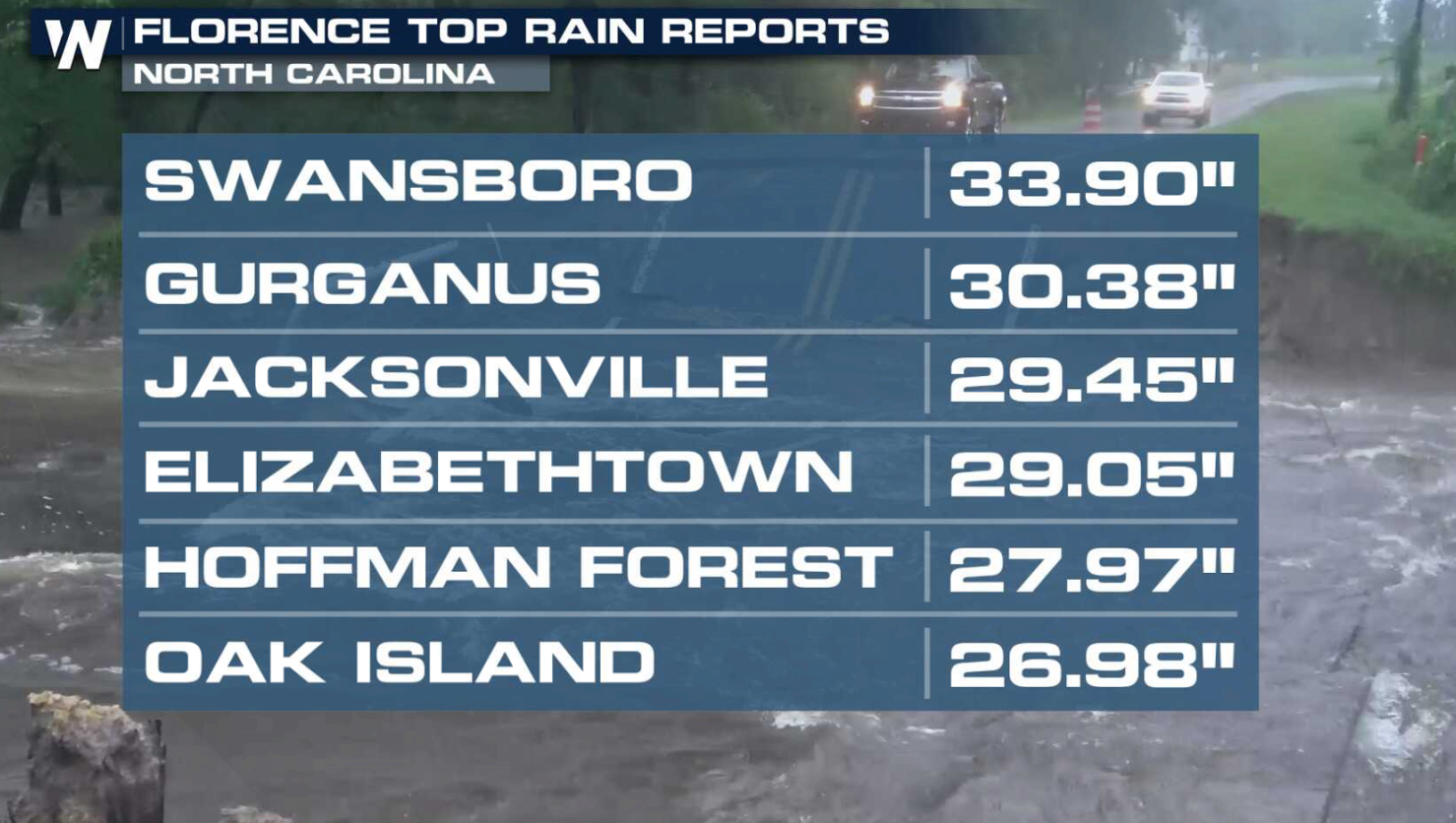
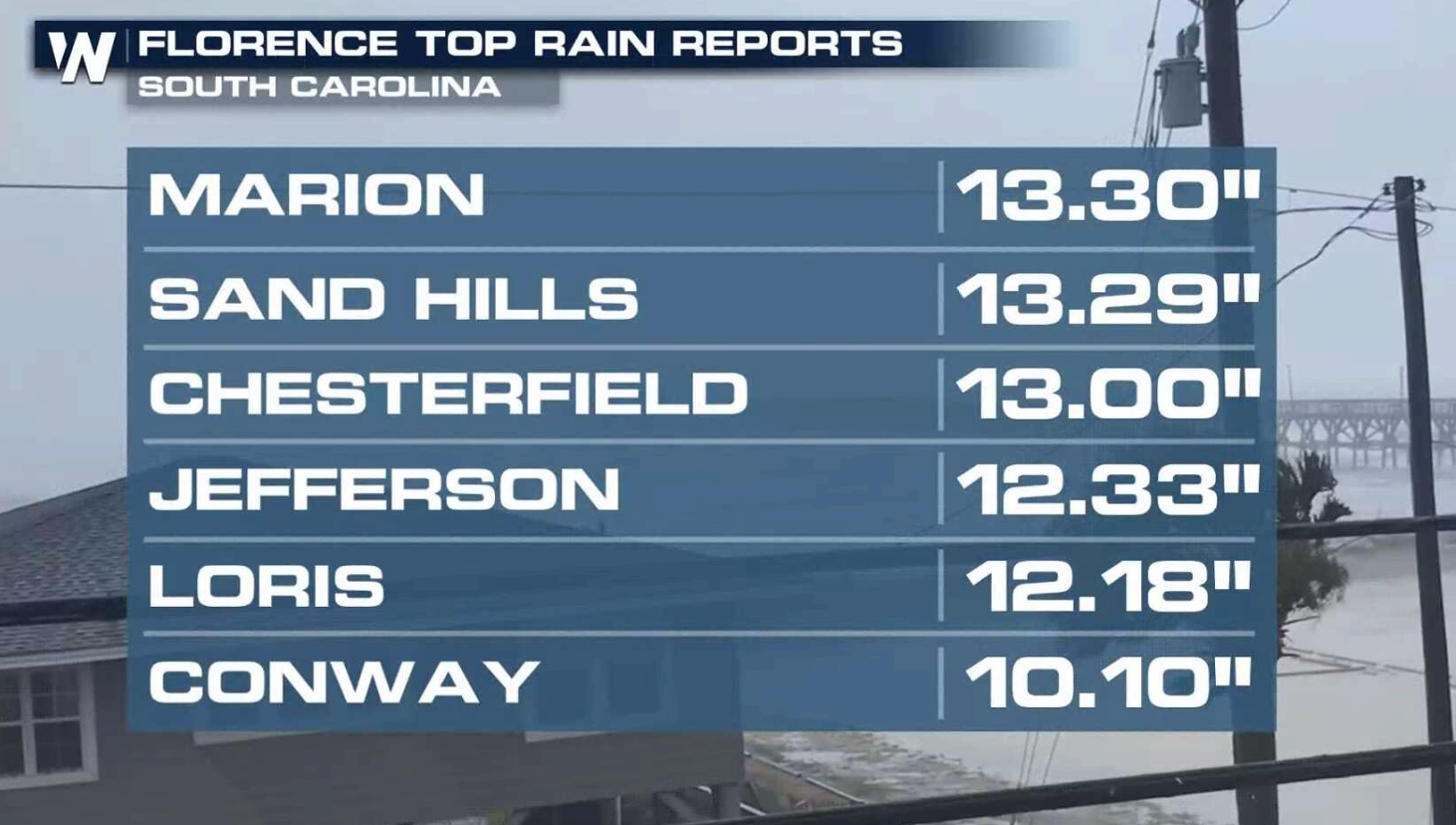
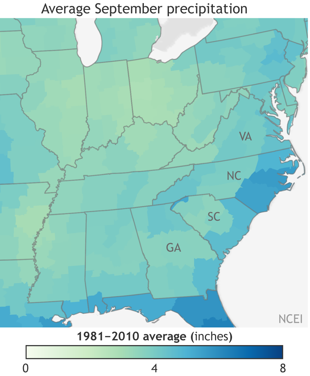 The map at above shows the average September precipitation in each U.S. climate division in the eastern United States from 1981–2010. Much of North and South Carolina have seen, or will see, more than double or triple their average monthly rainfall in the coming week. Some areas have seen more than 2 feet of rain in North Carolina from Florence, with more than a foot in parts of South Carolina.
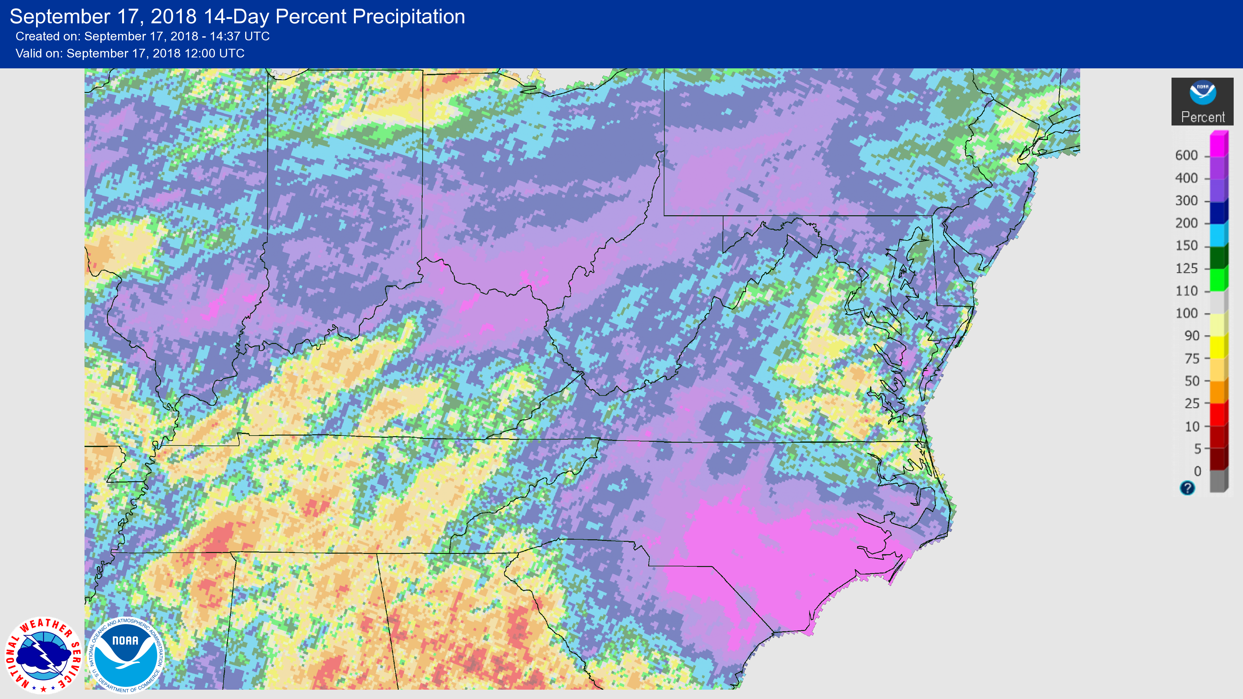
 Even at the edges of the Florence-affected area, including in parts of Virginia and West Virginia, 7-day rainfall totals will approach the monthly average. That’s still a lot of rain to get in such a short amount of time, especially considering that precipitation amounts in the first half of the month have already been estimated to be 600 percent of normal in some parts of the area (map below). Flooding will remain a major concern with any additional rainfall received.
 Some information from NOAA Climate, Rebecca Lindsey
For WeatherNation: Meteorologist Mace Michaels
 The map at above shows the average September precipitation in each U.S. climate division in the eastern United States from 1981–2010. Much of North and South Carolina have seen, or will see, more than double or triple their average monthly rainfall in the coming week. Some areas have seen more than 2 feet of rain in North Carolina from Florence, with more than a foot in parts of South Carolina.

 Even at the edges of the Florence-affected area, including in parts of Virginia and West Virginia, 7-day rainfall totals will approach the monthly average. That’s still a lot of rain to get in such a short amount of time, especially considering that precipitation amounts in the first half of the month have already been estimated to be 600 percent of normal in some parts of the area (map below). Flooding will remain a major concern with any additional rainfall received.
 Some information from NOAA Climate, Rebecca Lindsey
For WeatherNation: Meteorologist Mace Michaels
Some information from NOAA Climate, Rebecca Lindsey
For WeatherNation: Meteorologist Mace MichaelsAll Weather News
More