Friday Severe Thunderstorm Outlook
Special Stories
9 Aug 2019 8:28 AM
The Middle Atlantic, Upper Midwest, and Northwest may see a few severe thunderstorms today (Friday). Those areas have been highlighted by the Storm Prediction Center with a slight risk for severe weather. **There is an enhanced risk of severe weather in South Dakota today.**
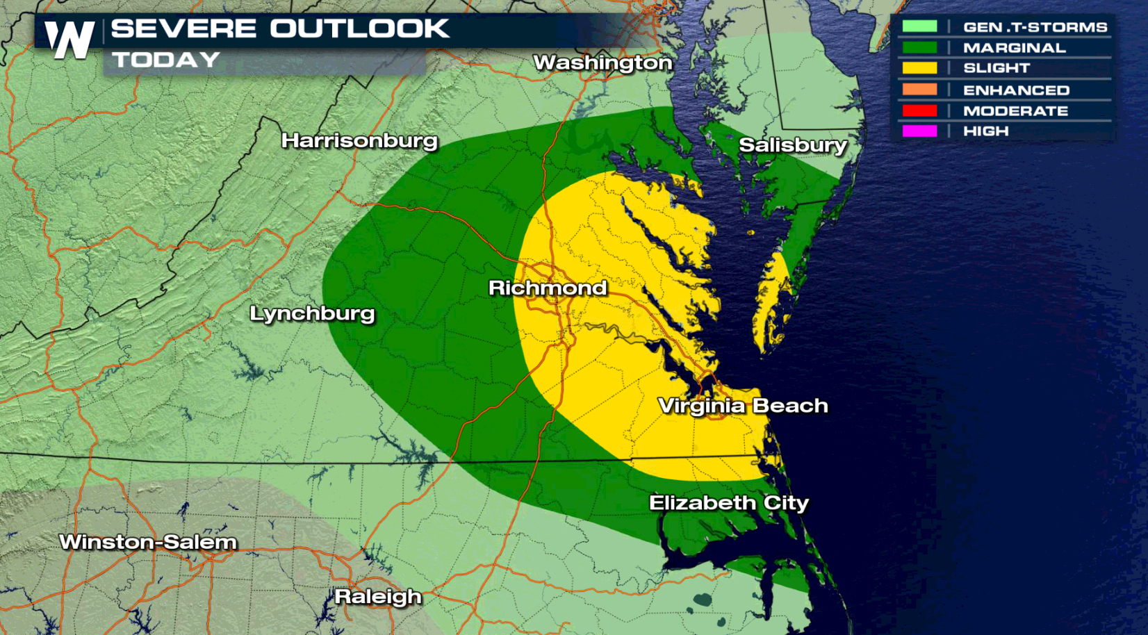
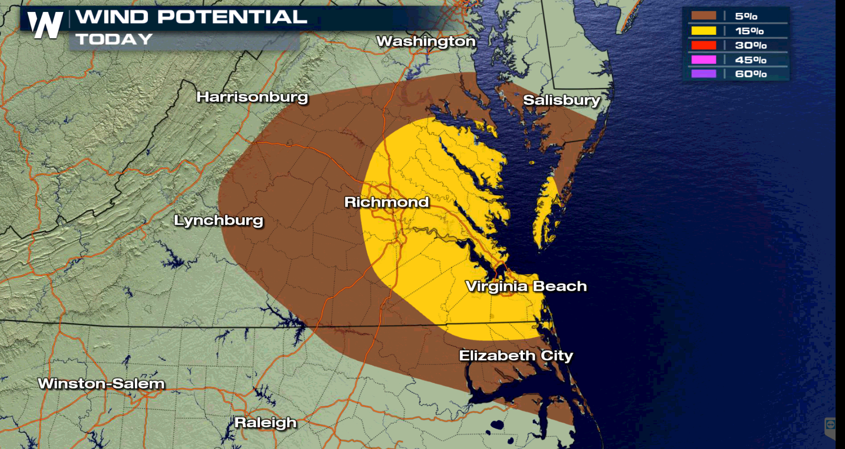
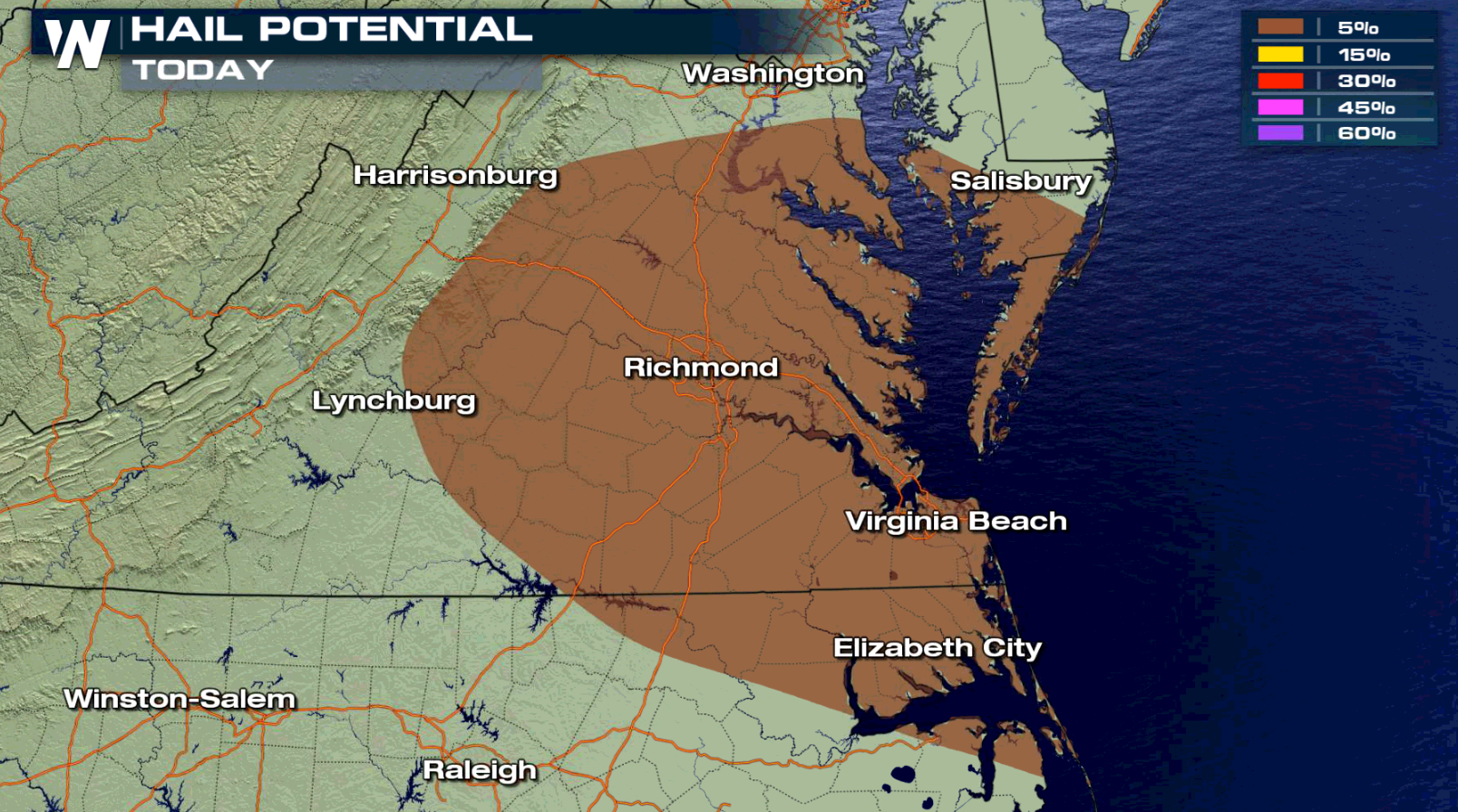 In the Middle Atlantic, the risk areas is focused along the southern sections of Chesapeake Bay into the Hampton Roads. Strong wind gusts are the biggest threat, with a few storms producing large hail.
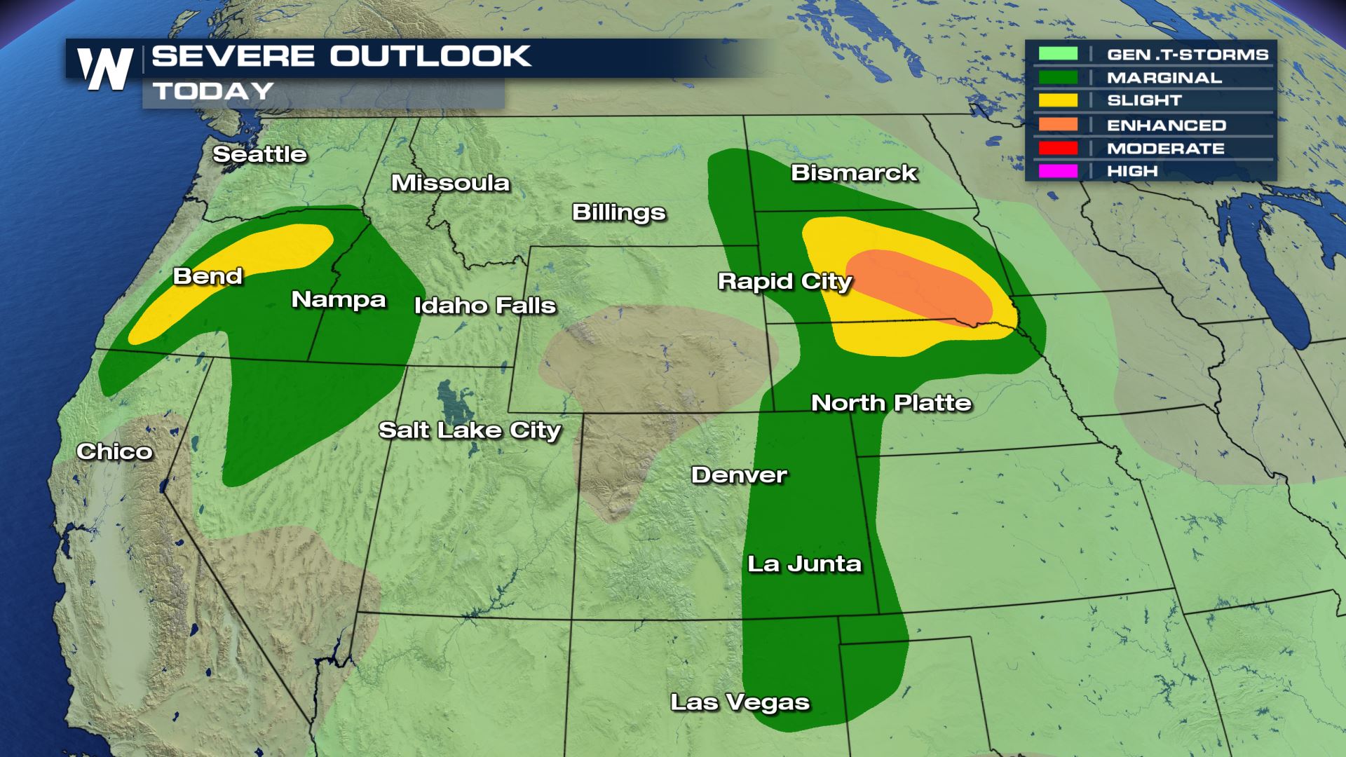
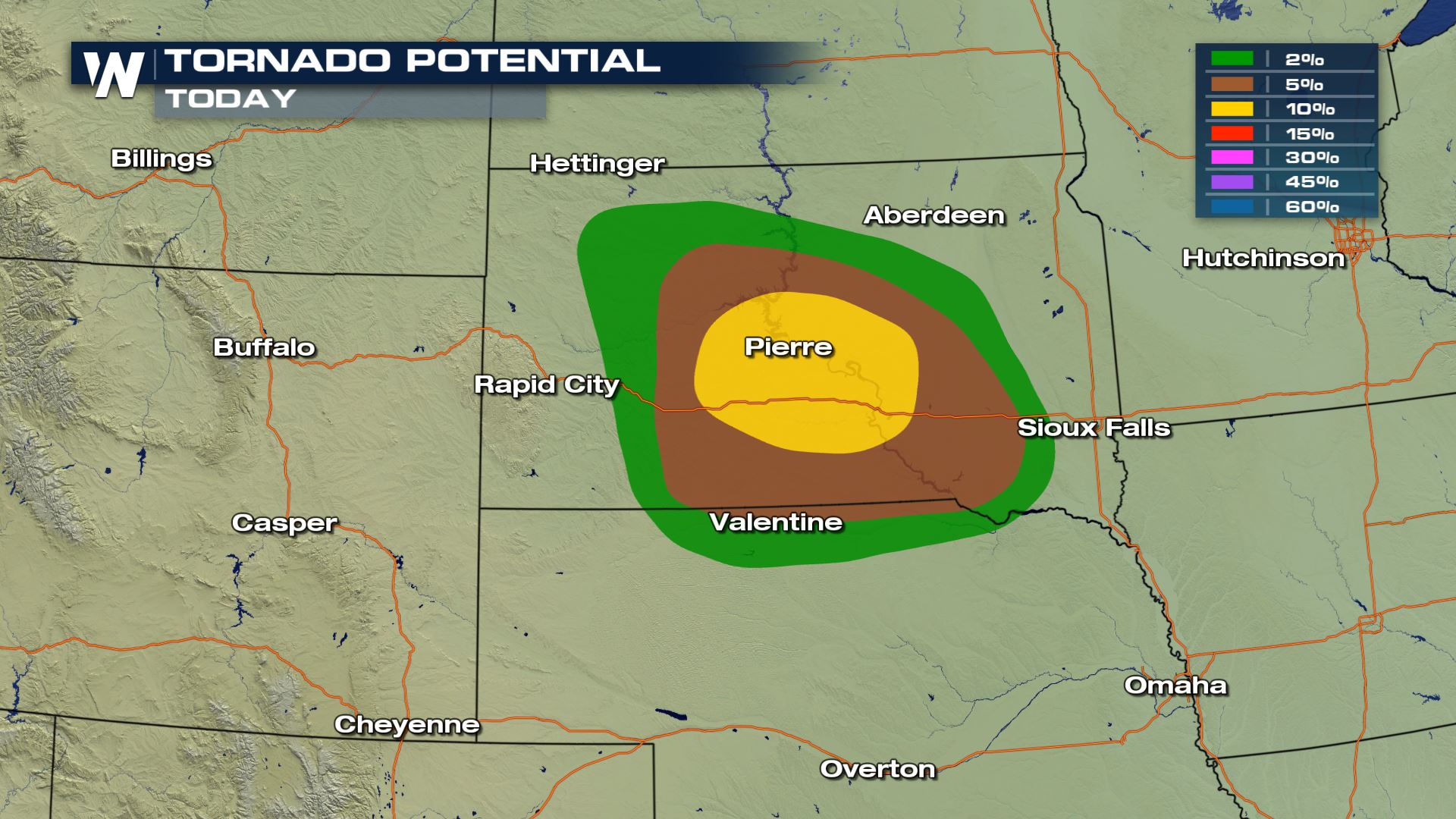
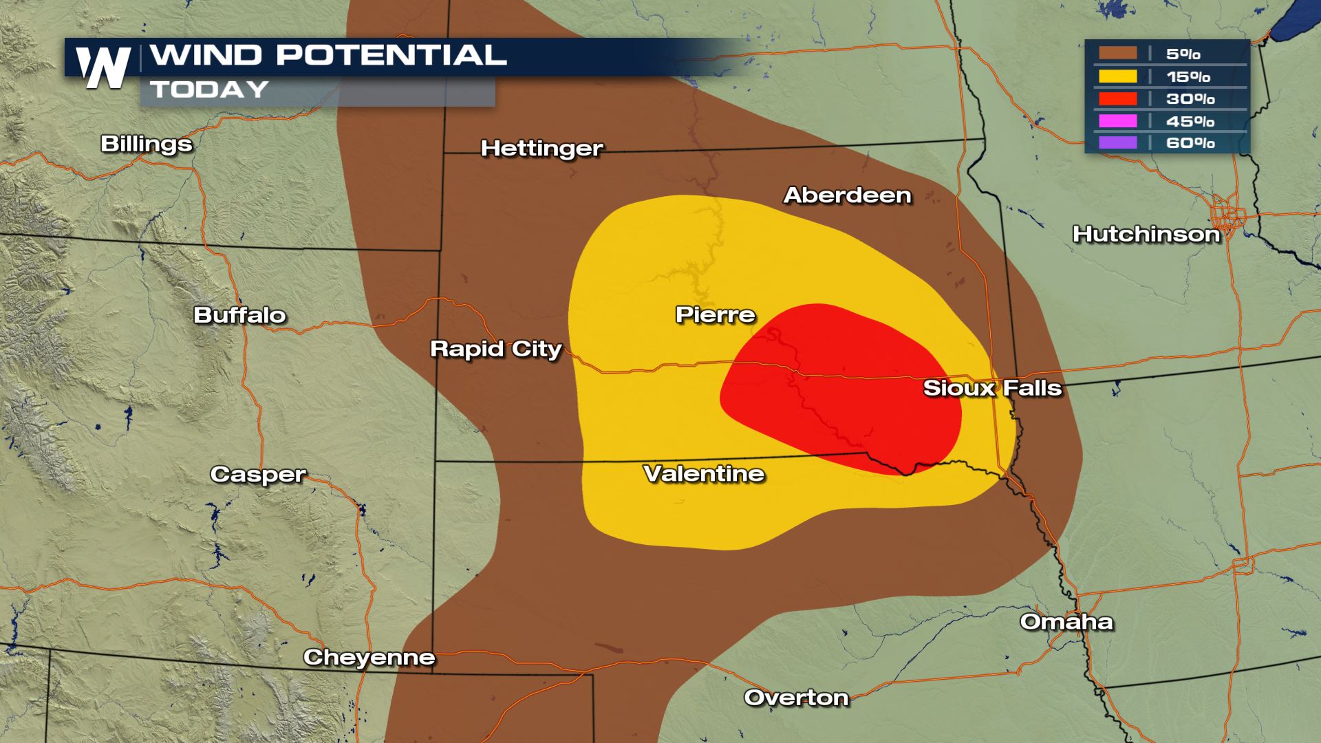 The High Plains and Front Range may see a few severe thunderstorms this afternoon and evening. Isolated tornadoes may occur in Central South Dakota and Northern Nebraska. Large hail and strong wind gusts may also occur.
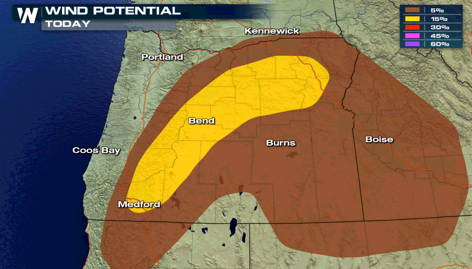
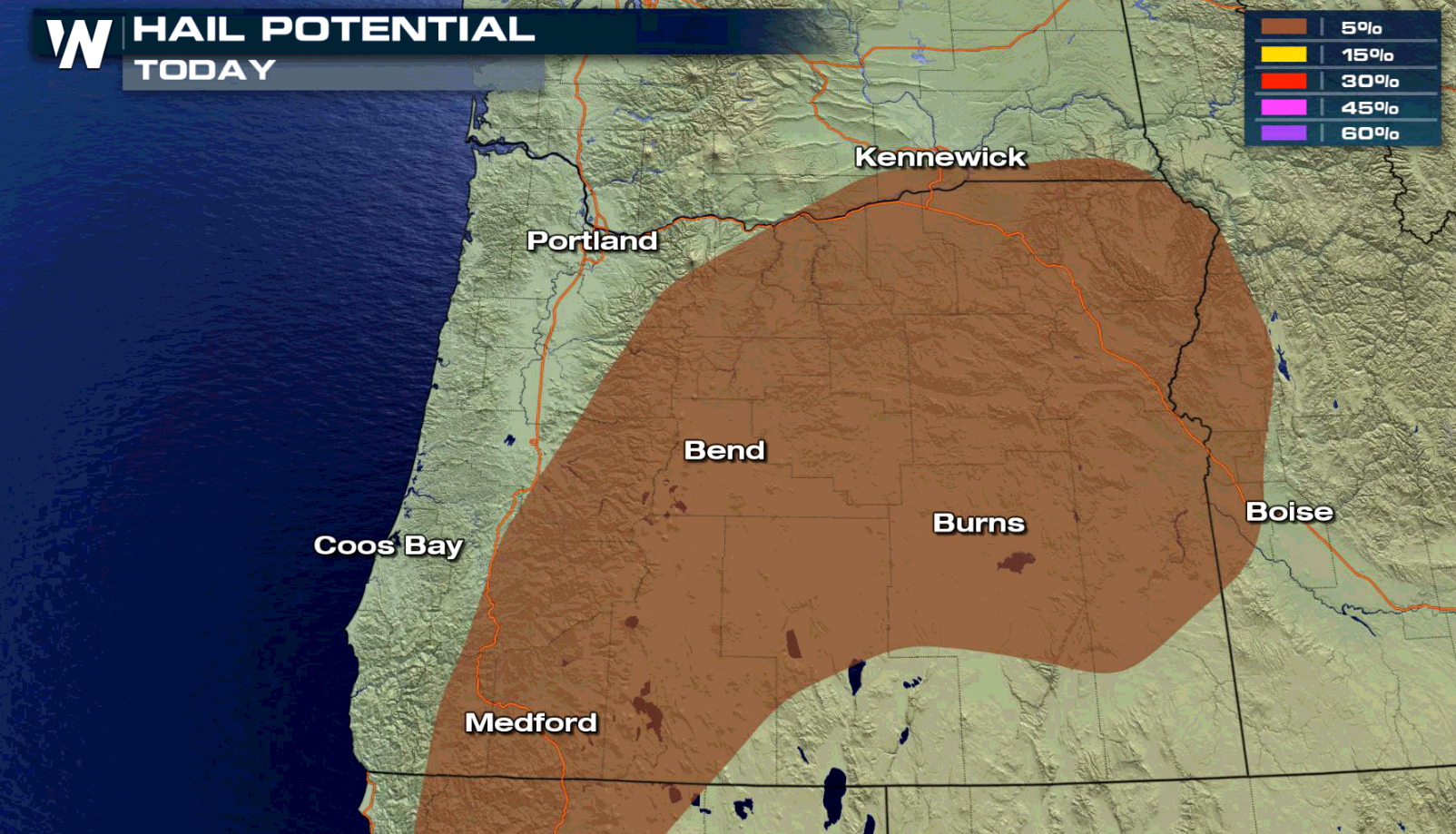 In the Northwest, areas along the Cascades into interior sections of Oregon have the threat to see severe weather. Damaging wind gusts are also the biggest threat in this area, with large hail a lesser concern.
WeatherNation will keep you posted on the potential for severe weather on-air and online. Check back for updates.
For WeatherNation: Meteorologist Mace Michaels


 In the Middle Atlantic, the risk areas is focused along the southern sections of Chesapeake Bay into the Hampton Roads. Strong wind gusts are the biggest threat, with a few storms producing large hail.


 The High Plains and Front Range may see a few severe thunderstorms this afternoon and evening. Isolated tornadoes may occur in Central South Dakota and Northern Nebraska. Large hail and strong wind gusts may also occur.

 In the Northwest, areas along the Cascades into interior sections of Oregon have the threat to see severe weather. Damaging wind gusts are also the biggest threat in this area, with large hail a lesser concern.
WeatherNation will keep you posted on the potential for severe weather on-air and online. Check back for updates.
For WeatherNation: Meteorologist Mace Michaels
In the Northwest, areas along the Cascades into interior sections of Oregon have the threat to see severe weather. Damaging wind gusts are also the biggest threat in this area, with large hail a lesser concern.
WeatherNation will keep you posted on the potential for severe weather on-air and online. Check back for updates.
For WeatherNation: Meteorologist Mace MichaelsAll Weather News
More