Friday Severe Weather Outlook in the Plains
Top Stories
14 May 2021 3:15 PM
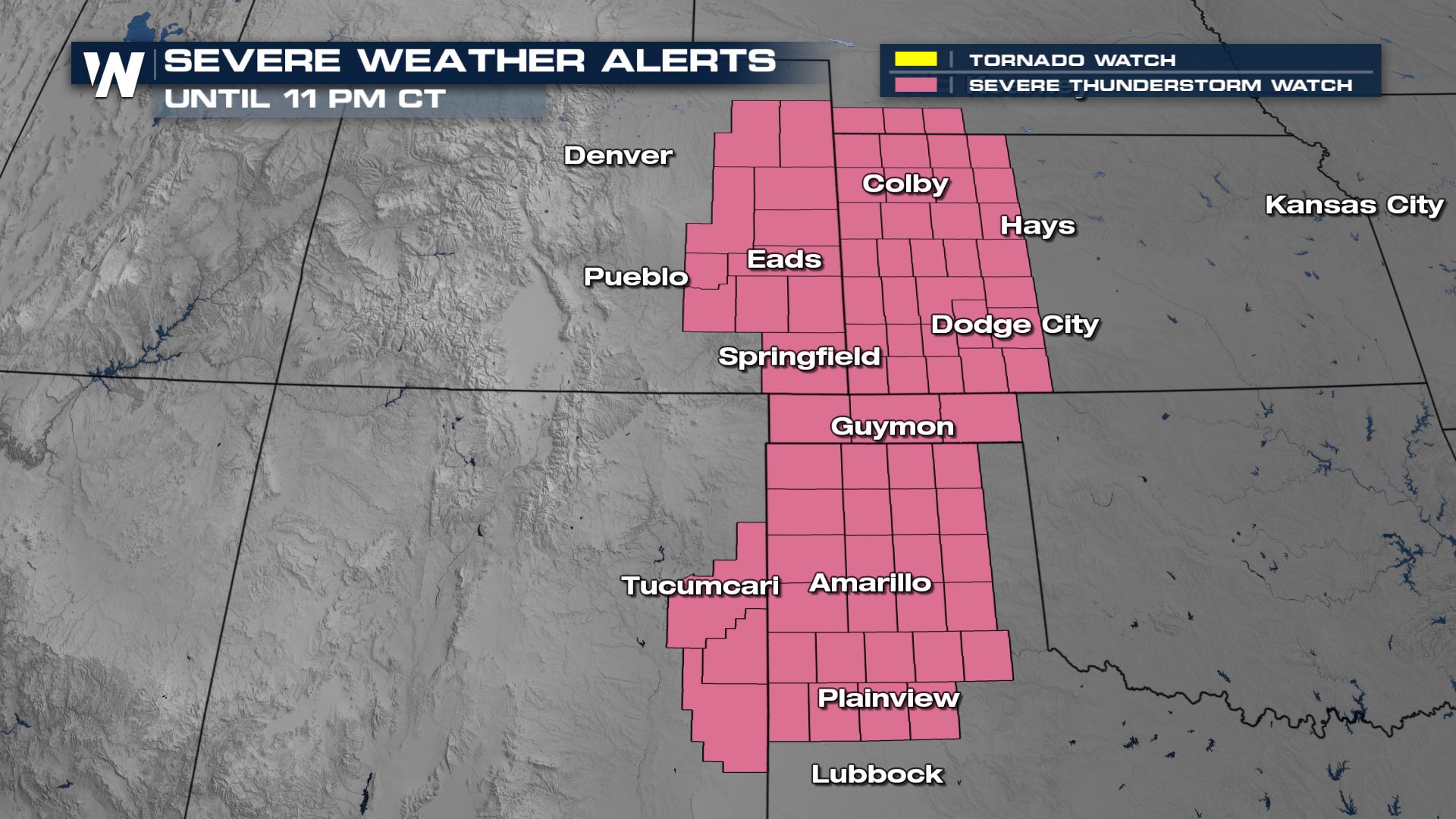
Severe storms will continue into Friday evening. A Severe Thunderstorm Watch has been issued for portions of the high plains through 11 PM CT tonight.
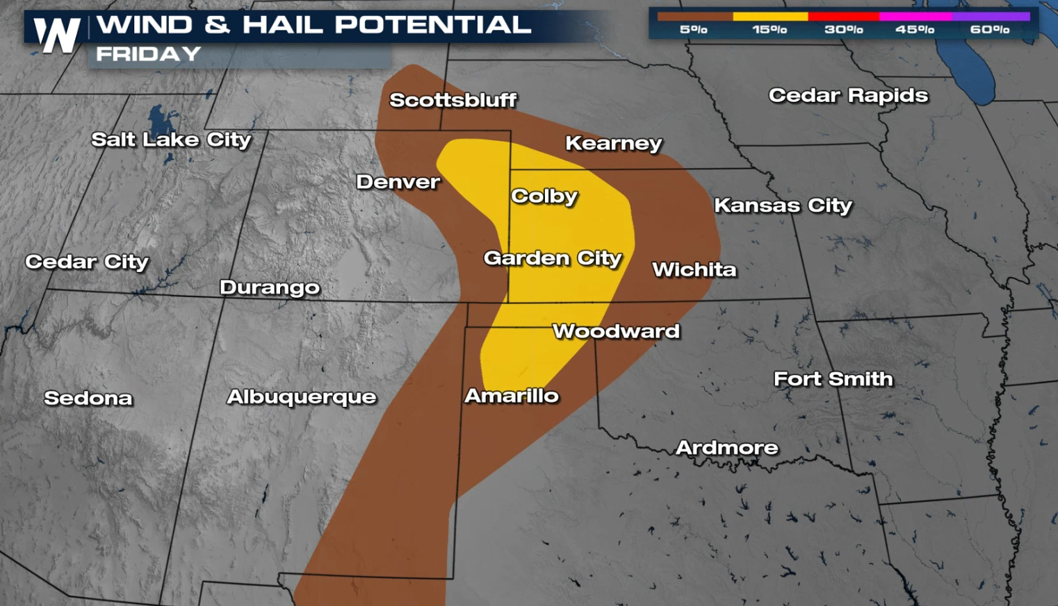
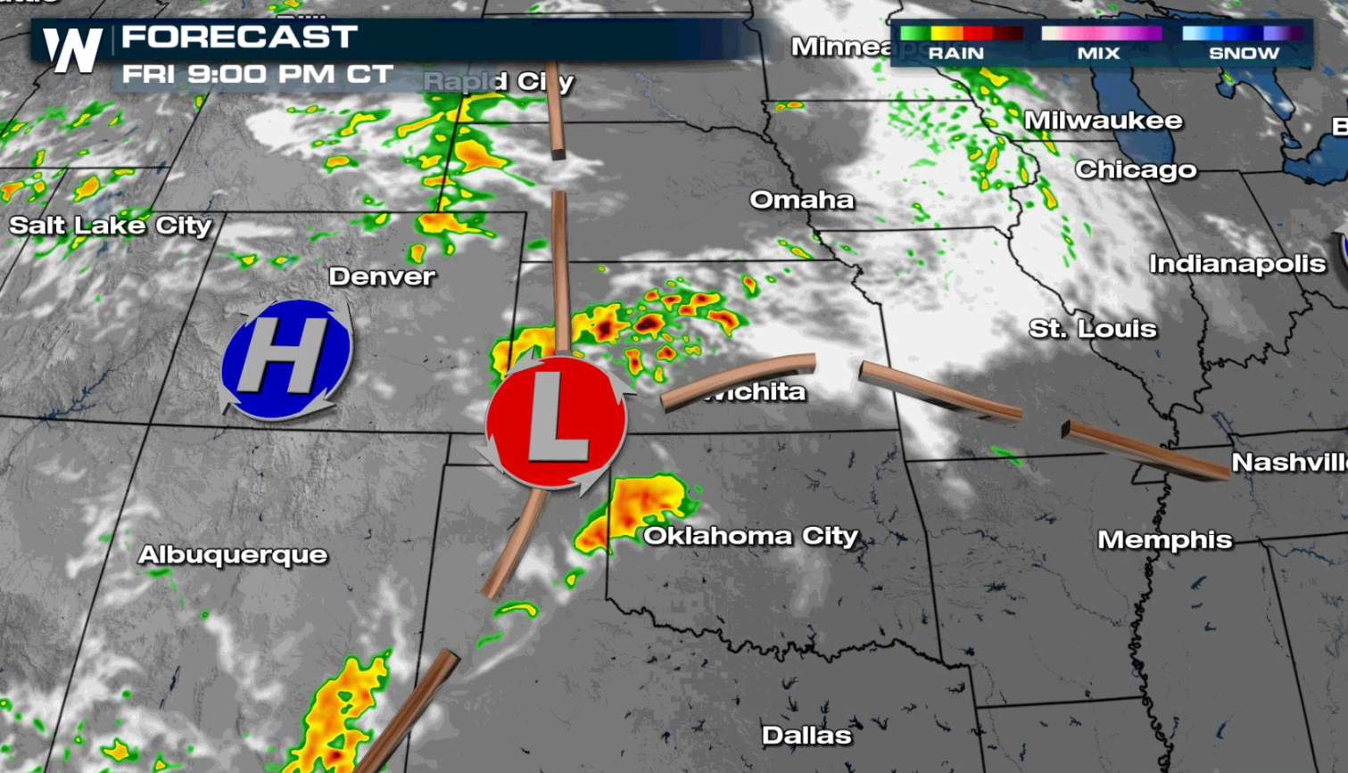
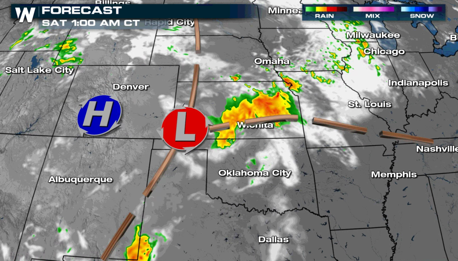
 The severe weather risk area expands today (Friday) from Wyoming and Nebraska southward to west Texas. There is a slight risk (level 2 on a scale of 1 to 5) in eastern Colorado and western Kansas into the Oklahoma and Texas Panhandles.
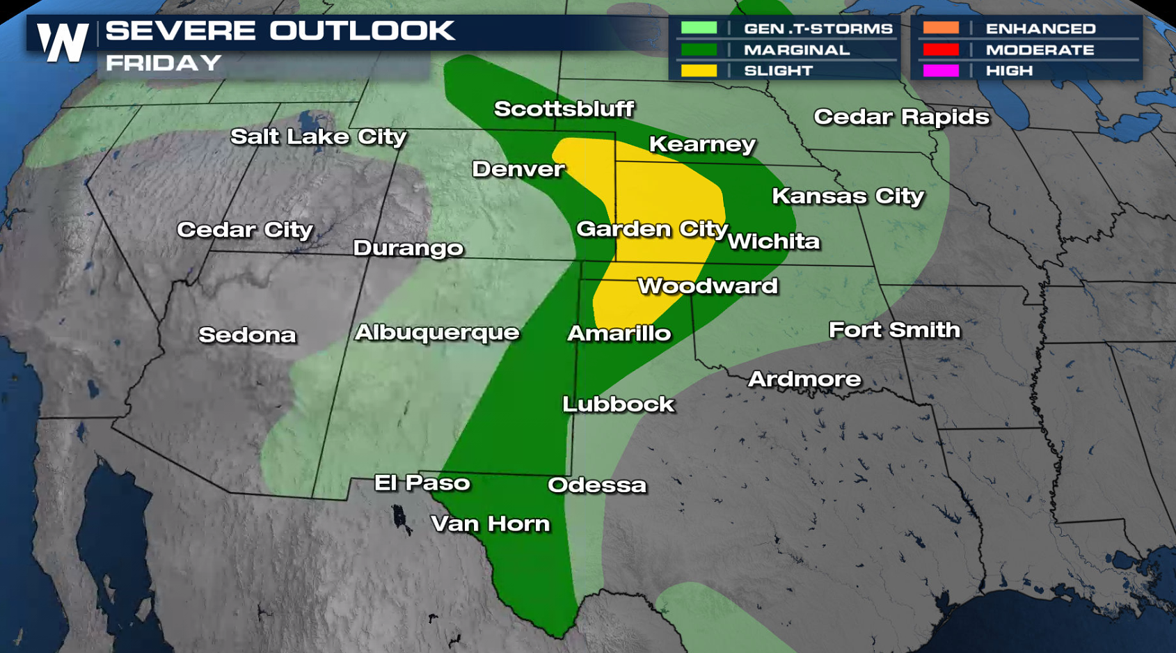
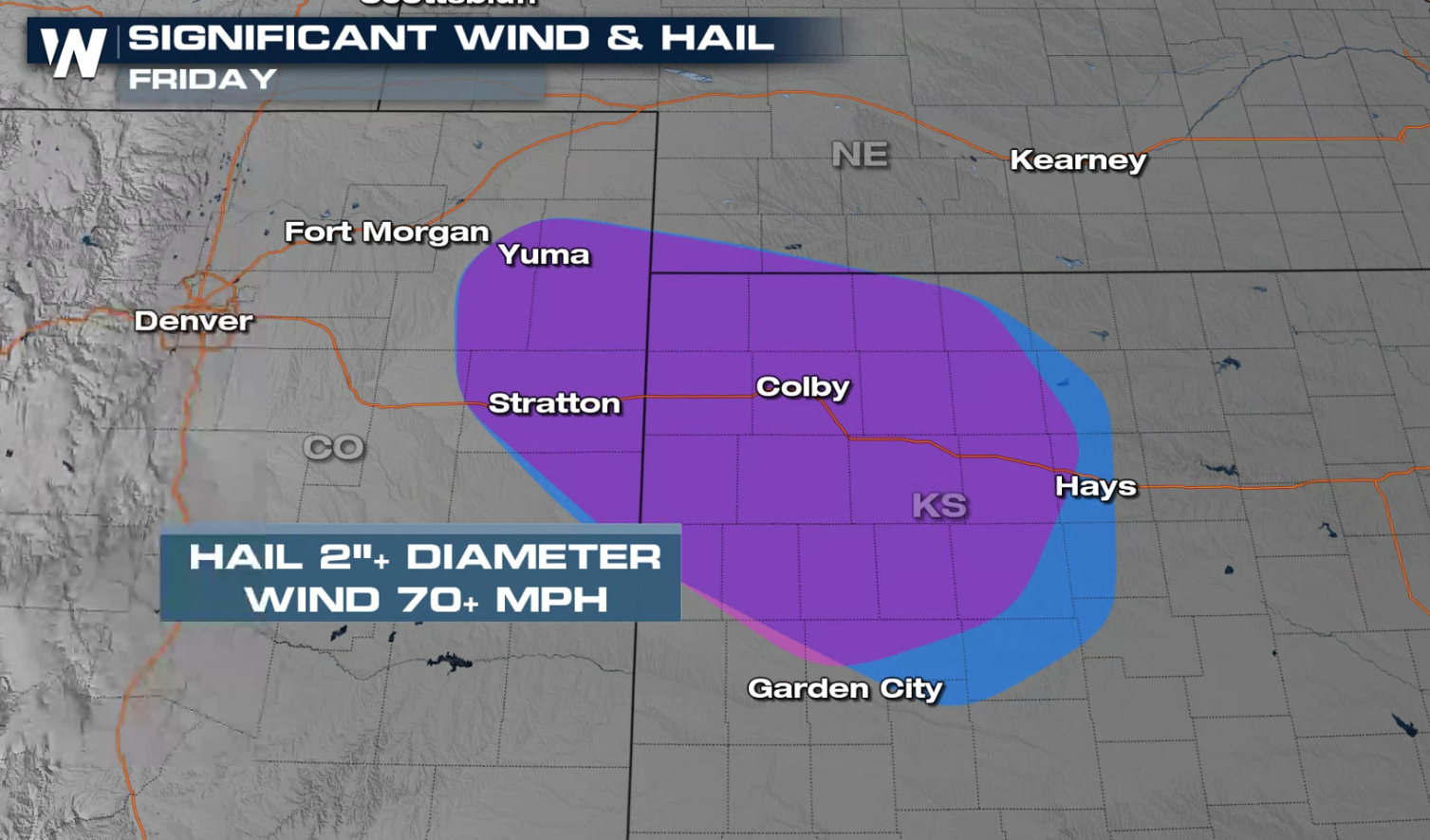
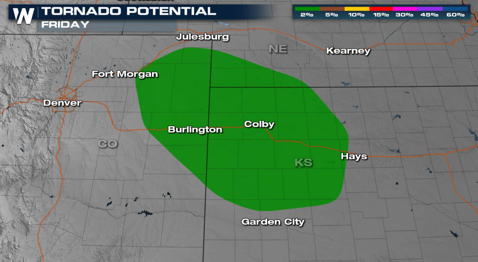 Large hail and strong wind gusts are the main concerns, especially in eastern Colorado and western Kansas. Isolated tornadoes may also develop.
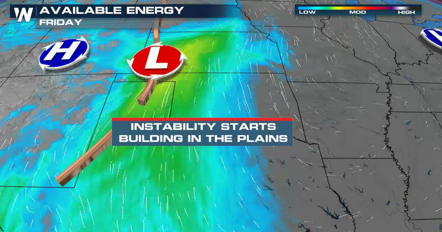
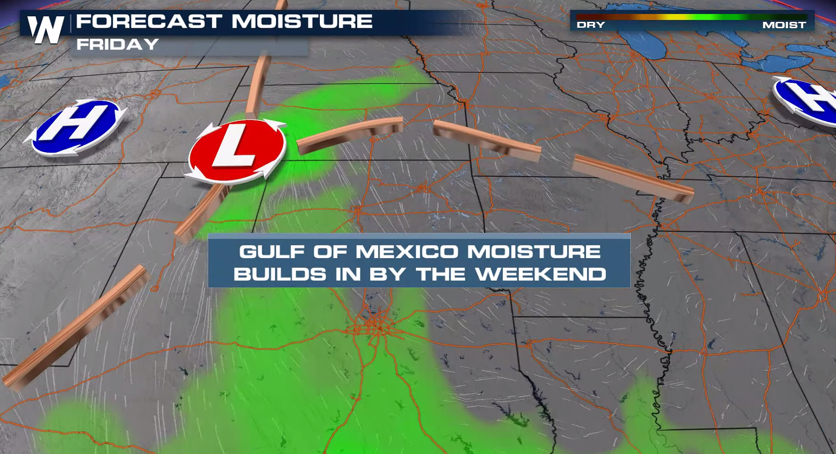
 A developing low pressure center and dryline will likely produce several thunderstorms. With increasing humidity and temperatures, instability will aiding to create storms with large hail, strong wind gusts and isolated tornadoes.
 Storms will fire over the higher terrain of Colorado and New Mexico, pushing east through the nighttime hours into Kansas as well as the panhandles of Oklahoma and Texas.
 WeatherNation will have updates on-air and online for the potential of severe thunderstorms. Check back for forecast updates and alerts.
The severe weather risk area expands today (Friday) from Wyoming and Nebraska southward to west Texas. There is a slight risk (level 2 on a scale of 1 to 5) in eastern Colorado and western Kansas into the Oklahoma and Texas Panhandles.
Large hail and strong wind gusts are the main concerns, especially in eastern Colorado and western Kansas. Isolated tornadoes may also develop.
A developing low pressure center and dryline will likely produce several thunderstorms. With increasing humidity and temperatures, instability will aiding to create storms with large hail, strong wind gusts and isolated tornadoes.
Storms will fire over the higher terrain of Colorado and New Mexico, pushing east through the nighttime hours into Kansas as well as the panhandles of Oklahoma and Texas.
WeatherNation will have updates on-air and online for the potential of severe thunderstorms. Check back for forecast updates and alerts.All Weather News
More
Severe Storm Threat Returns to the Midwest
After several tornadoes ripped through the Mi
31 Jul 2026 2:20 AM


After Reaching Category 5, Genevieve Weakens in the Pacific
PacificFausto is now a post-tropical cyclone.
31 Jul 2026 1:30 AM

Flooding Risk Increases as Heavy Rain Targets the Tri-State Area
Tuesday, heavy rainfall moved across the Nort
30 Jul 2026 12:25 AM

Severe Weather: Energy From the Midwest Now in the Southeast
UPPER MIDWEST - Through Monday, dangerous tor
29 Jul 2026 10:30 PM

Southeast Flood Risk Lingers Near Stalled Front
A stalled boundary over the Southeast will ke
25 Jul 2026 10:55 AM