Frigid Morning Ahead for the South and Southeast
Special Stories
21 Jan 2020 3:00 AM
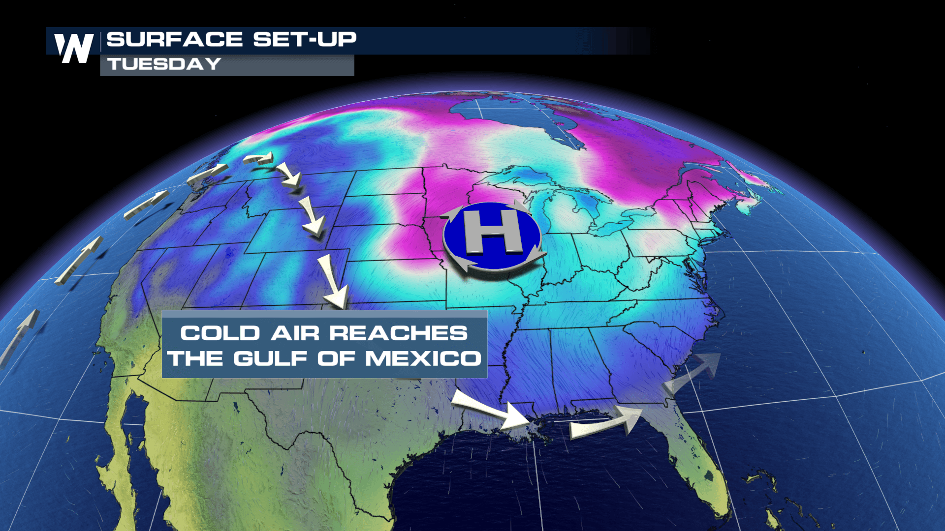
Clear skies will allow for some big drops in the temperatures Tuesday night across areas of the South and Southeast. Freeze alerts are in place for these areas with the risk of cold temperatures doing damage to temperature sensitive vegetation.
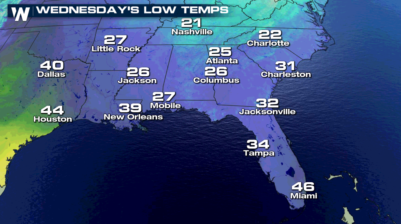
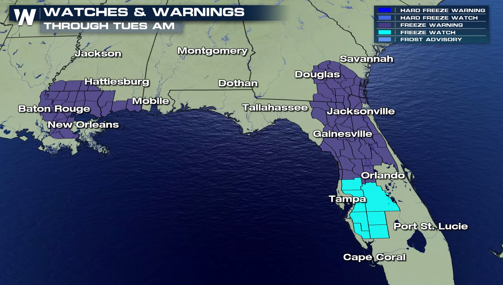 Areas under a freeze watch or warning will need be on alert for temperatures at 28° or below for several hours. Protect your pipes, pets and plants tonight. Another concern for Florida residents could be falling iguanas. Iguanas are cold-blooded reptiles and become immobile when temperatures reach a certain level. Under 50 degrees they become sluggish, and below 40 their blood-flow slows down. Occasionally, this causes them to fall out of trees. If you encounter a stunned iguana, don't touch it, it will likely thaw out on its own.
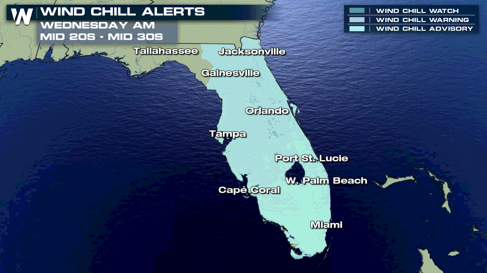
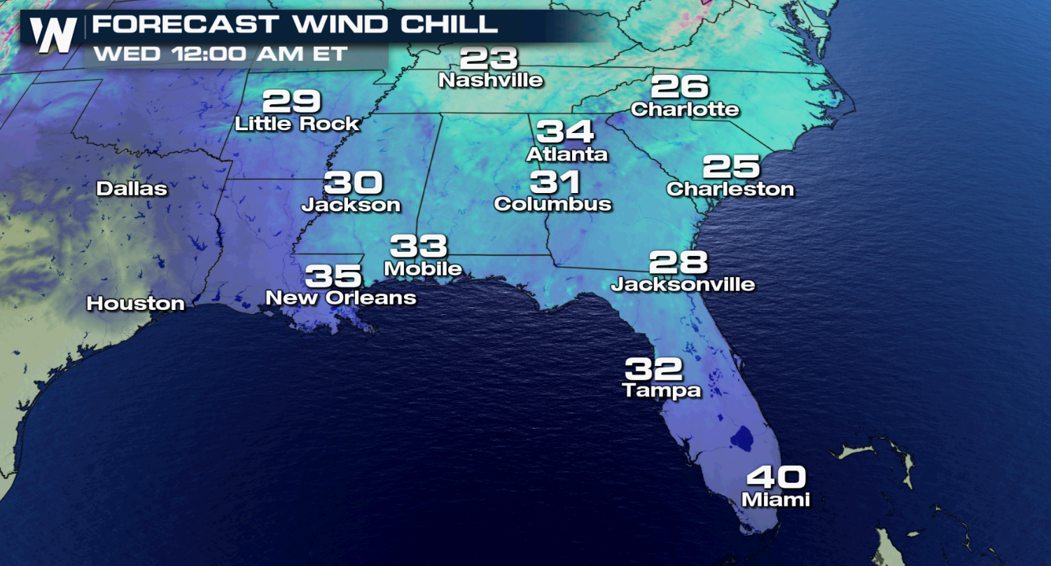
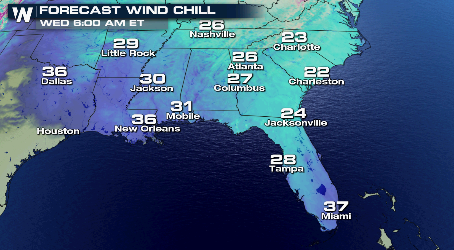
As the temperature tumbles, so will the wind chill. A 5 to 10 mph wind will drop wind chills into the 20s and mid 30s Tuesday night into Wednesday morning. Wind Chill Advisories are in effect across most of Florida.
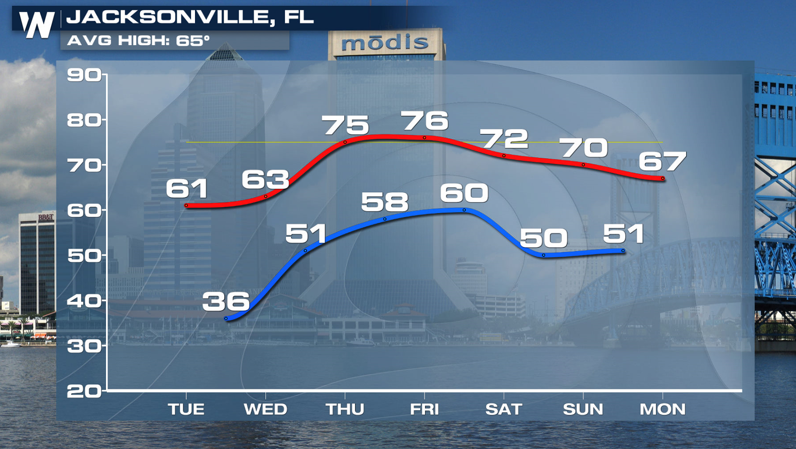
 Bundle up as you head out the door Wednesday morning! Thankfully the chilly conditions don't stick around too long. Temperatures bounce back to above-average in Jacksonville by the end of the week.
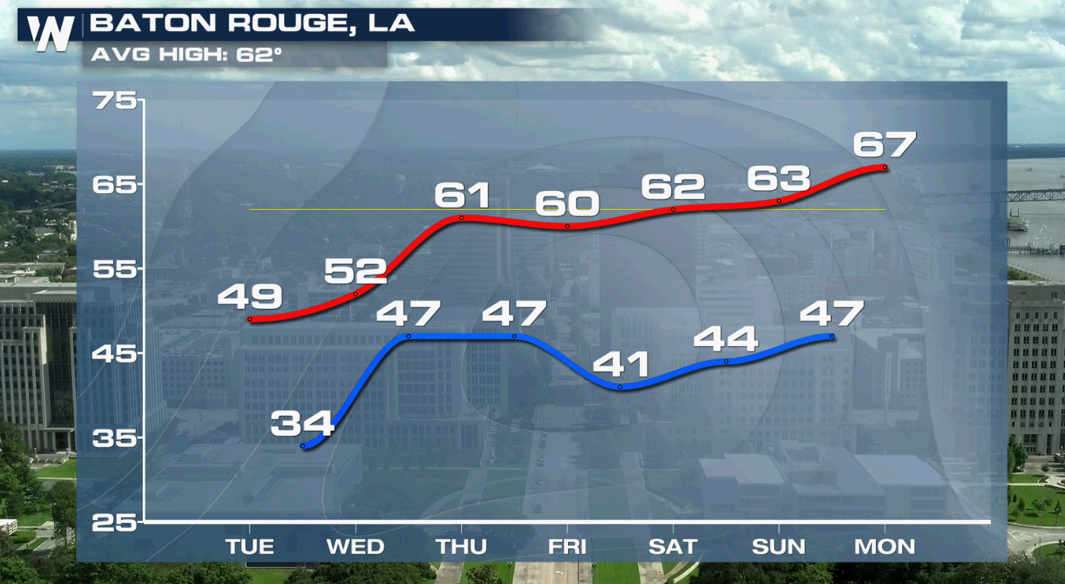
 Baton Rouge rebounds a bit as well, going from the low 50s to the low 60s in the next few days.
 Some areas of the southeast could see rain by the end of the week as well. Be sure to tune into WeatherNation for more forecast updates.
Areas under a freeze watch or warning will need be on alert for temperatures at 28° or below for several hours. Protect your pipes, pets and plants tonight. Another concern for Florida residents could be falling iguanas. Iguanas are cold-blooded reptiles and become immobile when temperatures reach a certain level. Under 50 degrees they become sluggish, and below 40 their blood-flow slows down. Occasionally, this causes them to fall out of trees. If you encounter a stunned iguana, don't touch it, it will likely thaw out on its own.
 Bundle up as you head out the door Wednesday morning! Thankfully the chilly conditions don't stick around too long. Temperatures bounce back to above-average in Jacksonville by the end of the week.
Baton Rouge rebounds a bit as well, going from the low 50s to the low 60s in the next few days.
Some areas of the southeast could see rain by the end of the week as well. Be sure to tune into WeatherNation for more forecast updates.
Bundle up as you head out the door Wednesday morning! Thankfully the chilly conditions don't stick around too long. Temperatures bounce back to above-average in Jacksonville by the end of the week.
Baton Rouge rebounds a bit as well, going from the low 50s to the low 60s in the next few days.
Some areas of the southeast could see rain by the end of the week as well. Be sure to tune into WeatherNation for more forecast updates.All Weather News
More
Wildfire Outbreak in the Pacific Northwest
SPOKANE, WA - On Saturday, August 1st, the Ol
2 Aug 2026 7:20 PM

More Storms for the East Through Monday
A low-pressure system that moved through the
2 Aug 2026 7:20 PM


After Reaching Category 5, Genevieve Weakens in the Pacific
PacificGenevieve formed on last Friday south
2 Aug 2026 6:25 PM

Flooding, Severe Storms Target the Midwest Again
After an active week of storms across the nor
1 Aug 2026 1:40 AM

Flooding Risk Increases as Heavy Rain Targets the Tri-State Area
Tuesday, heavy rainfall moved across the Nort
30 Jul 2026 12:25 AM

Severe Weather: Energy From the Midwest Now in the Southeast
UPPER MIDWEST - Through Monday, dangerous tor
29 Jul 2026 10:30 PM