Front Range and High Plains Severe Risk This Week
Special Stories
4 Aug 2020 1:00 PM
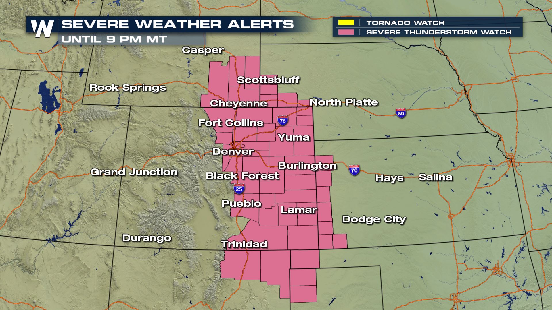
UPDATE: A severe thunderstorm watch has been issued for areas of CO, KS, NE, NM, OK/TX panhandle, and WY until 9 PM MT for scattered large hail up to 2", damaging wind gusts up to 70 mph, and an isolated tornado possible.
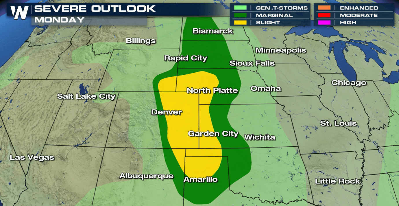
 A slow moving storm system moving out of the Northwest will bring a threat for severe thunderstorms the next couple days in the Front Range of the Rockies and High Plains. For today (Tuesday), there is a marginal risk for severe thunderstorms from Montana to New Mexico. This is level 1 on the Storm Prediction Center (SPC) scale where 1 is the lowest and 5 the highest. A slight risk (level 2 on the scale) has been posted from the Nebraska Panhandle to the Texas Panhandle.
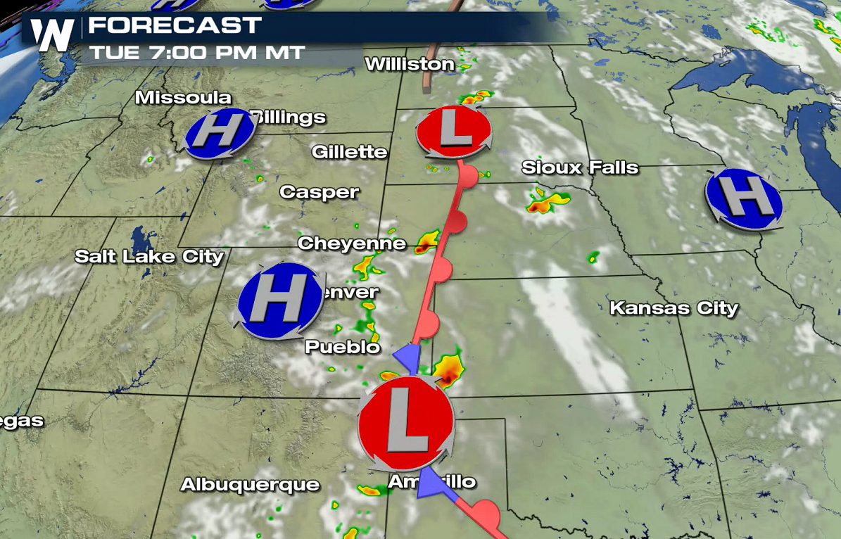
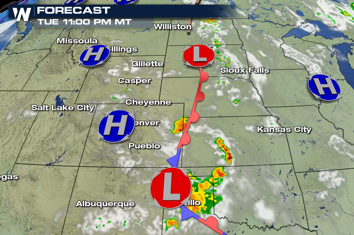
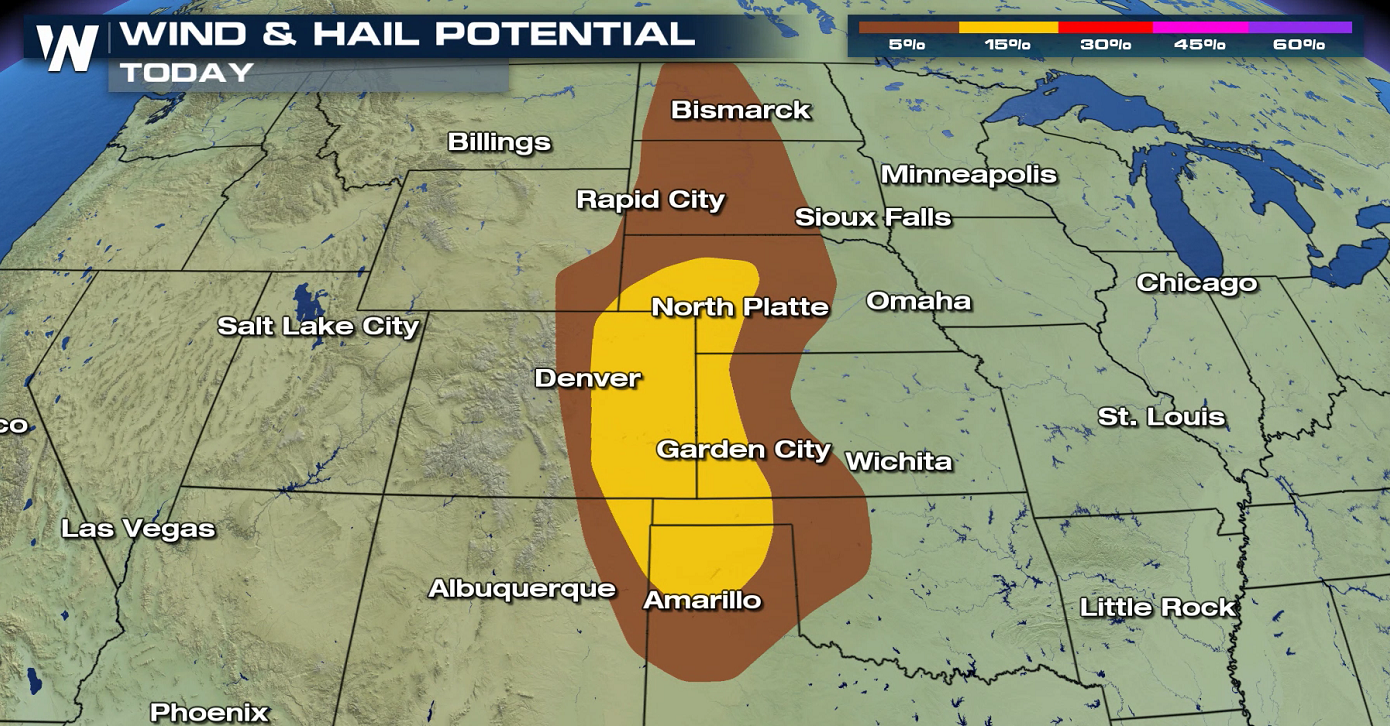 Surface energy is weak, with a stationary front throughout the High Plains and low pressure center near the Black Hills. There is enough upper-level energy and instability to create a few thunderstorms. Isolated storms may produce large hail and strong wind gusts in the afternoon and evening.
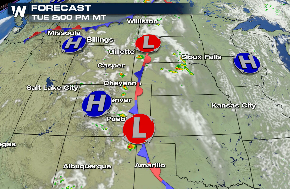
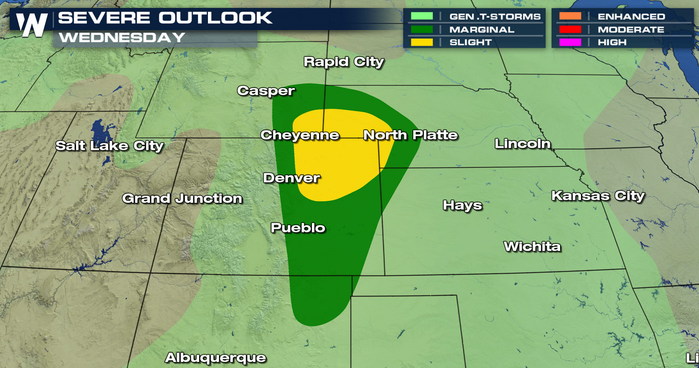
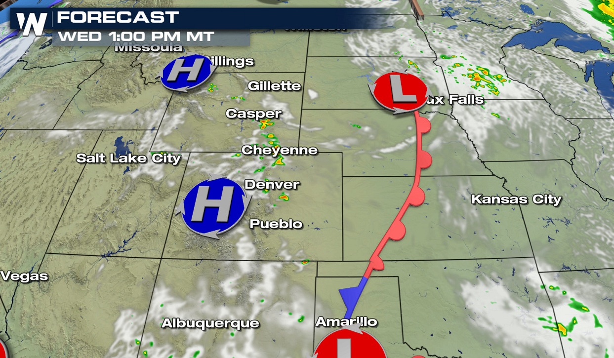
 As the system pushes slightly eastward on Wednesday, the risk area is focused from the Front Range of Wyoming into far northeastern New Mexico. There is a slight risk for severe thunderstorms (level 2 on the scale of 1 to 5) in the Front Range of Colorado and Wyoming into the Nebraska Panhandle.
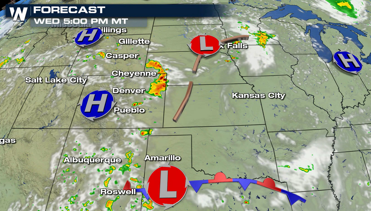
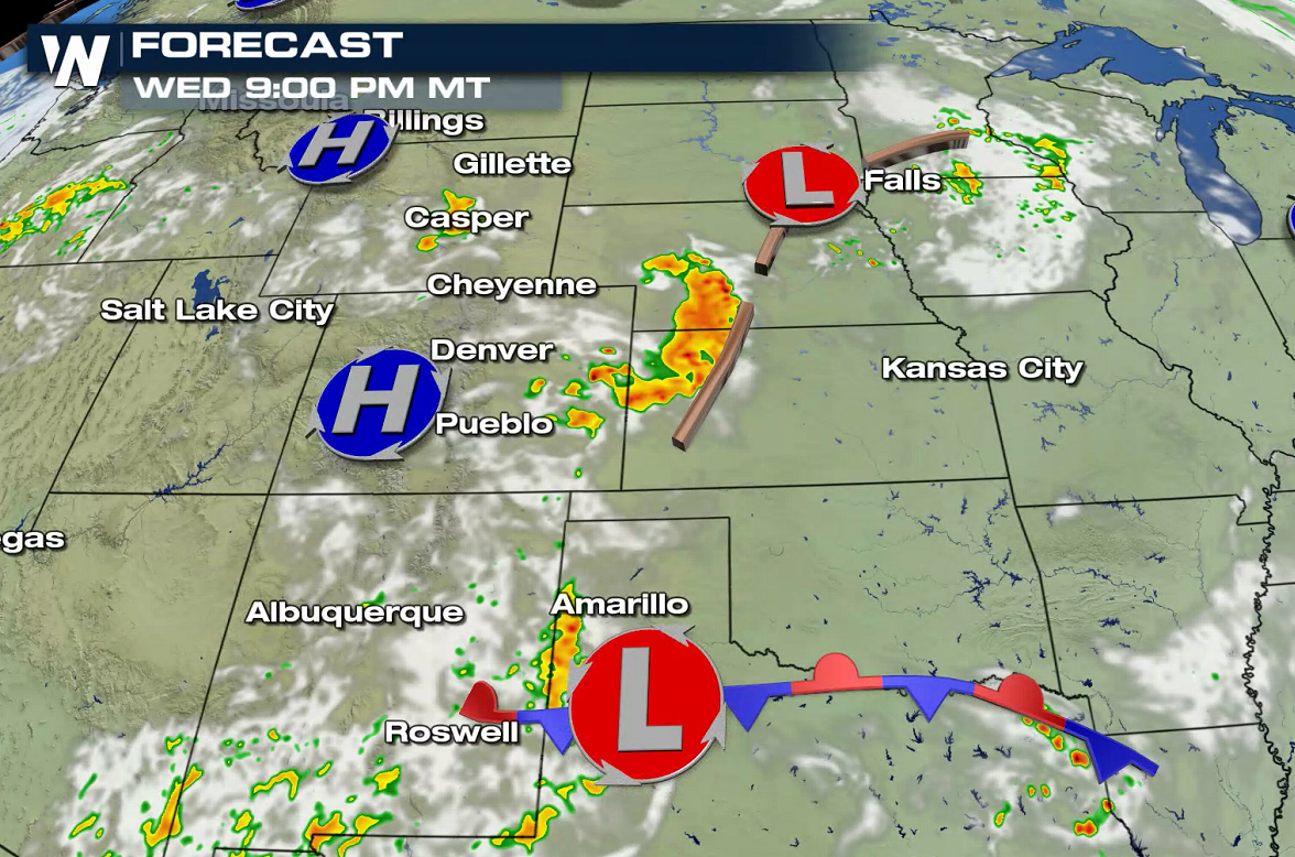
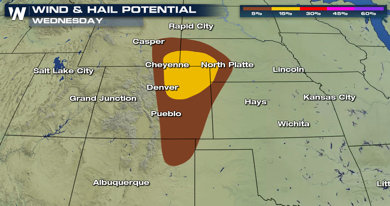 Once again, thunderstorms will develop as instability builds during the afternoon. Surface energy remains weak, but upper level support and wind energy should be strong enough to support a few severe thunderstorms in the late afternoon and early evening.
 WeatherNation will keep you up-to-date on the latest forecasts and severe weather alerts. Check back with us on-air and online for the latest information.
A slow moving storm system moving out of the Northwest will bring a threat for severe thunderstorms the next couple days in the Front Range of the Rockies and High Plains. For today (Tuesday), there is a marginal risk for severe thunderstorms from Montana to New Mexico. This is level 1 on the Storm Prediction Center (SPC) scale where 1 is the lowest and 5 the highest. A slight risk (level 2 on the scale) has been posted from the Nebraska Panhandle to the Texas Panhandle.
Surface energy is weak, with a stationary front throughout the High Plains and low pressure center near the Black Hills. There is enough upper-level energy and instability to create a few thunderstorms. Isolated storms may produce large hail and strong wind gusts in the afternoon and evening.
As the system pushes slightly eastward on Wednesday, the risk area is focused from the Front Range of Wyoming into far northeastern New Mexico. There is a slight risk for severe thunderstorms (level 2 on the scale of 1 to 5) in the Front Range of Colorado and Wyoming into the Nebraska Panhandle.
Once again, thunderstorms will develop as instability builds during the afternoon. Surface energy remains weak, but upper level support and wind energy should be strong enough to support a few severe thunderstorms in the late afternoon and early evening.
WeatherNation will keep you up-to-date on the latest forecasts and severe weather alerts. Check back with us on-air and online for the latest information.All Weather News
More
Severe Chances Return for the Midwest The Next Few Days
The upcoming stretch of hot temperatures will
25 Jul 2026 2:00 AM

Tropics: Fausto Heads to Hawaii; Genevieve Has Formed and Could Become a Major Hurricane
Atlantic BasinBertha has dissipated after mov
25 Jul 2026 1:50 AM

Southeast Flood Risk Lingers Near Stalled Front
A stalled boundary over the Southeast will ke
25 Jul 2026 1:50 AM

Weekend Heat For the Western and Central United States
Are you over the summer heat yet? Well, more
25 Jul 2026 1:40 AM

Hot & Smoky w/ a Chance of Lightning
Conditions have been really dry out west. We'
24 Jul 2026 11:15 AM

Another Round of Storms Targets the Northeast
Tuesday brought severe weather again across p
23 Jul 2026 1:15 AM

Another Round of Severe Weather for the Upper Midwest and Great Lakes
The upper-level low train continues to keep t
21 Jul 2026 1:45 AM