More Flooding Possible in the Southeast

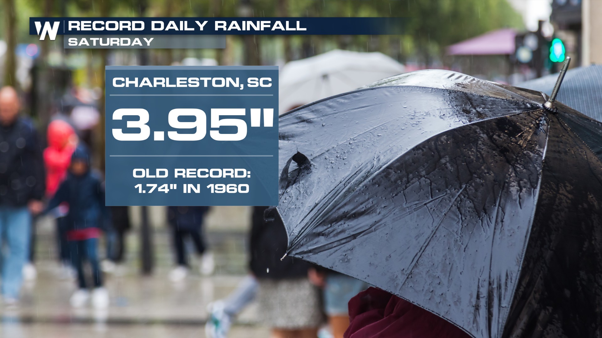
Another day and another record rainfall in South Carolina. This time it was for downtown Charleston! The heavy rain risk isn't going away, as there will be more heavy rain chances on Sunday for some of the same areas.
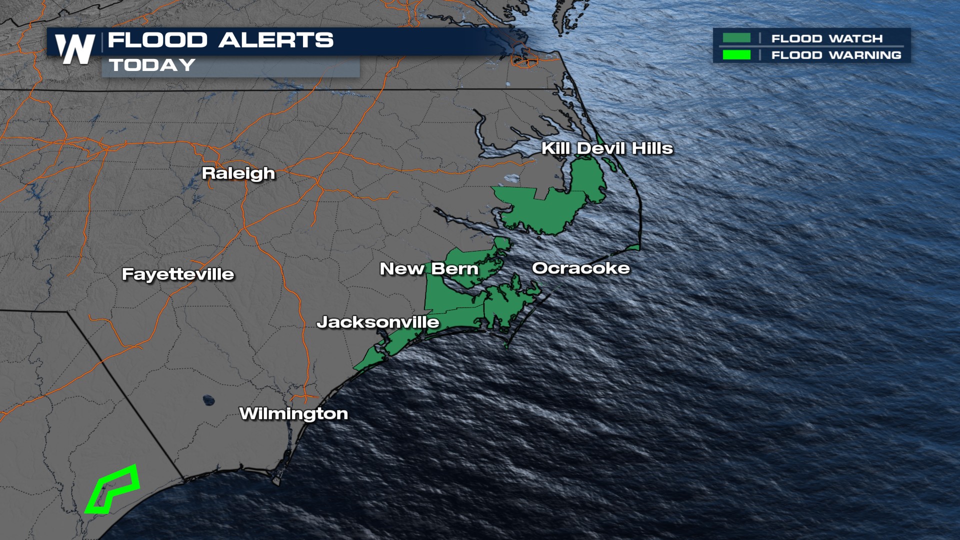
 Storms will stick around Sunday, with rainfall rates of 2–3 inches per hour possible in heavier, slower-moving systems. Some of the Outer Banks could pick up enough rain to create flooding thanks to a little enhancement from the low spinning off of the coast.
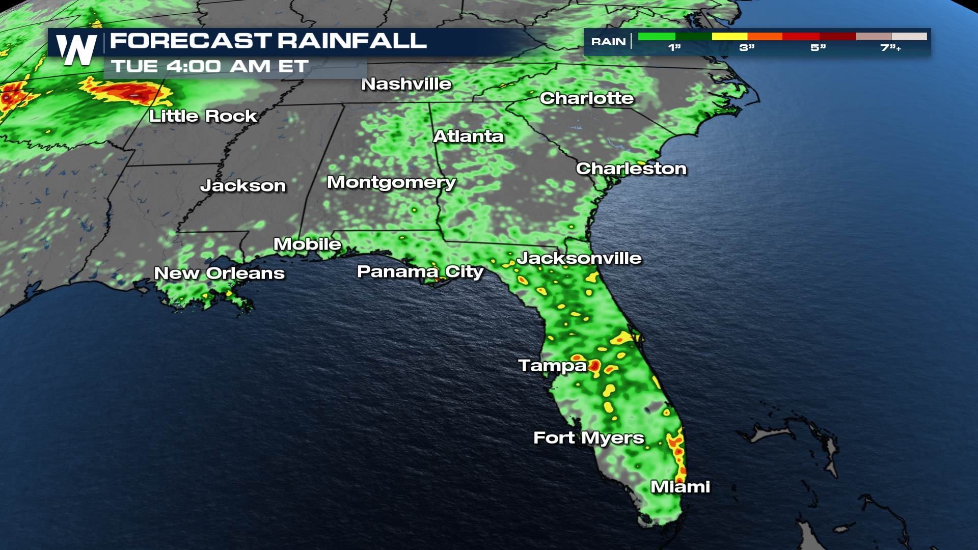
Showers and thunderstorms will stick around through the rest of the weekend, starting relatively early each morning. The front will slowly move farther south and bring heavy rainfall across Central Florida.
The beaches of the Atlantic Coast could see an additional 1-2 inches, with isolated higher amounts possible. Soils in this region are saturated from 1-3" of rainfall along the stationary front since Friday.
 Tune into the Eastern regional forecast :10 past the hour for more details.


