A Funnel Cloud in Idaho?? It Happened on Saturday.
Special Stories
7 Apr 2018 9:09 PM
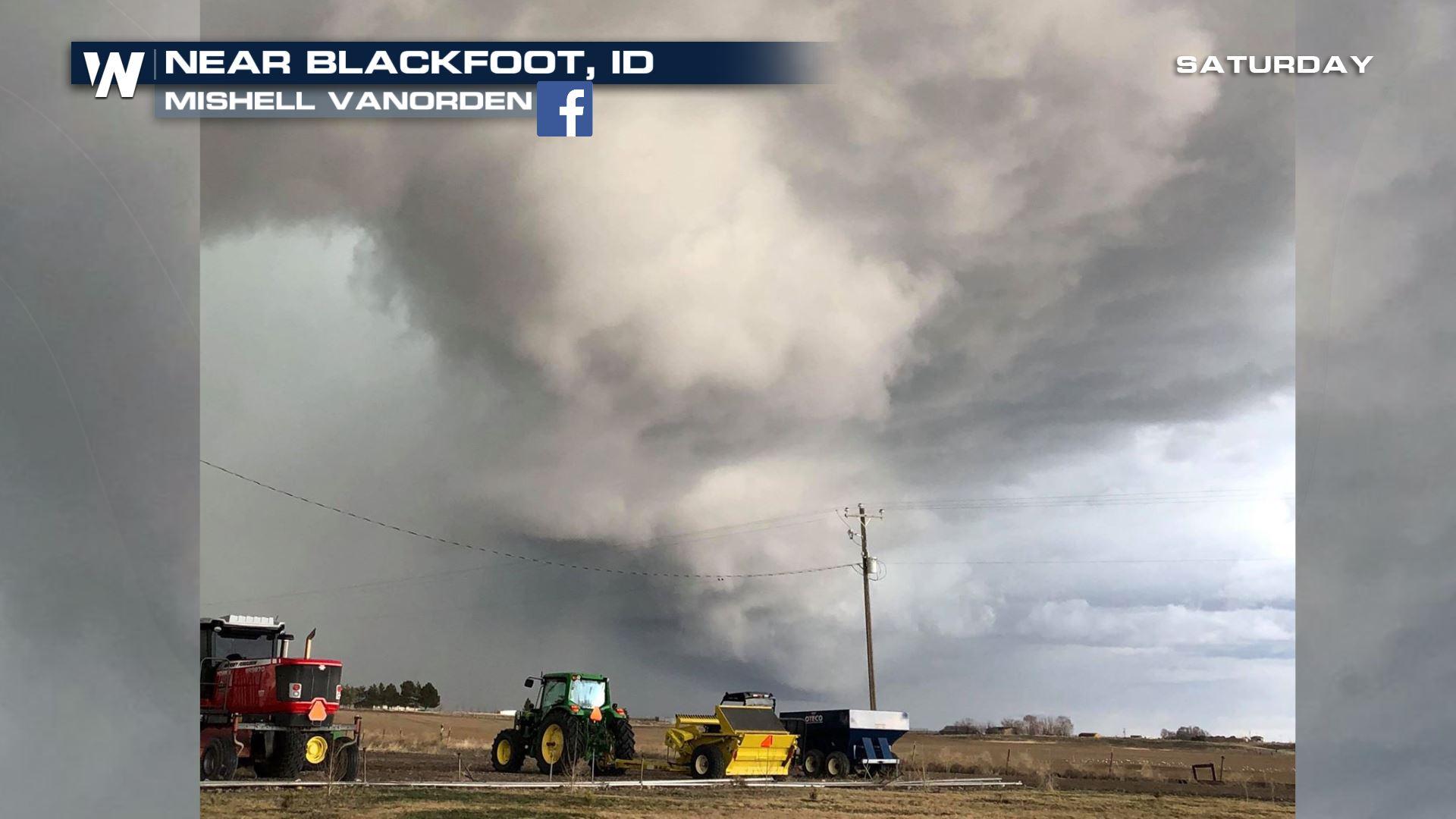
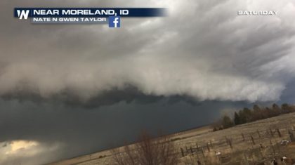
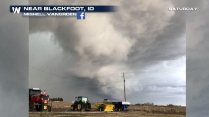
Idaho, while no stranger to rain, snow, and ice, is not familiar territory when it comes to tornadoes and supercell thunderstorms. The atmospheric dynamics do not usually favor severe weather in this part of the country. But on Saturday afternoon, things were very different. A cold front was slicing through unstable air, and all of the necessary ingredients, (moisture, lift, and wind shear), were in place to produce a funnel cloud, and possible tornado. It was an extremely rare event, and one that was captured on camera and video.
Check out some of the amazing images and video below:
 https://twitter.com/twitter/statuses/982801487876112389
There was also substantial hail. Some of the hail near Ammon, Idaho was near golf ball size. It was certainly large enough to do damage to cars, windows, and possibly roofs.
https://twitter.com/ffejeryc/status/982791461824376837
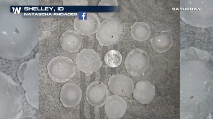
The hail in Shelley, Idaho was larger than a quarter, shown in the picture below. Quarter-sized hail, and larger, is considered damaging hail. They certainly had that in Shelley on Saturday afternoon.
https://twitter.com/twitter/statuses/982801487876112389
There was also substantial hail. Some of the hail near Ammon, Idaho was near golf ball size. It was certainly large enough to do damage to cars, windows, and possibly roofs.
https://twitter.com/ffejeryc/status/982791461824376837
The hail in Shelley, Idaho was larger than a quarter, shown in the picture below. Quarter-sized hail, and larger, is considered damaging hail. They certainly had that in Shelley on Saturday afternoon.
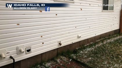
 And the winds were substantial too. Look at the damage on the siding of a home in Idaho Falls, ID. Flying debris became dangerous projectiles in the high winds of the storm.
 While there was certainly a funnel cloud, to be considered an official tornado, a touch-down with the ground must be confirmed by the National Weather Service. At the time of this article, the NWS Office in Pocatello has not issued an official storm report. So for now, we will term this event as a sighted funnel cloud, with possible tornado touch-down. It was truly a unique and rarely seen weather event in southern Idaho. Mother Nature always knows how to keep things interesting!
For WeatherNation: Meteorologist Matt Monroe
While there was certainly a funnel cloud, to be considered an official tornado, a touch-down with the ground must be confirmed by the National Weather Service. At the time of this article, the NWS Office in Pocatello has not issued an official storm report. So for now, we will term this event as a sighted funnel cloud, with possible tornado touch-down. It was truly a unique and rarely seen weather event in southern Idaho. Mother Nature always knows how to keep things interesting!
For WeatherNation: Meteorologist Matt Monroe
https://twitter.com/twitter/statuses/982801487876112389
There was also substantial hail. Some of the hail near Ammon, Idaho was near golf ball size. It was certainly large enough to do damage to cars, windows, and possibly roofs.
https://twitter.com/ffejeryc/status/982791461824376837
The hail in Shelley, Idaho was larger than a quarter, shown in the picture below. Quarter-sized hail, and larger, is considered damaging hail. They certainly had that in Shelley on Saturday afternoon.
And the winds were substantial too. Look at the damage on the siding of a home in Idaho Falls, ID. Flying debris became dangerous projectiles in the high winds of the storm.
While there was certainly a funnel cloud, to be considered an official tornado, a touch-down with the ground must be confirmed by the National Weather Service. At the time of this article, the NWS Office in Pocatello has not issued an official storm report. So for now, we will term this event as a sighted funnel cloud, with possible tornado touch-down. It was truly a unique and rarely seen weather event in southern Idaho. Mother Nature always knows how to keep things interesting!
For WeatherNation: Meteorologist Matt MonroeAll Weather News
More
Wildfire Outbreak in the Pacific Northwest
SPOKANE, WA - On Saturday, August 1st, the Ol
3 Aug 2026 1:55 AM

More Storms for the East Through Monday
A low-pressure system that moved through the
3 Aug 2026 1:50 AM


After Reaching Category 5, Genevieve Weakens in the Pacific
PacificGenevieve formed last Friday south of
3 Aug 2026 12:30 AM

Flooding, Severe Storms Target the Midwest Again
After an active week of storms across the nor
1 Aug 2026 1:40 AM

Flooding Risk Increases as Heavy Rain Targets the Tri-State Area
Tuesday, heavy rainfall moved across the Nort
30 Jul 2026 12:25 AM

Severe Weather: Energy From the Midwest Now in the Southeast
UPPER MIDWEST - Through Monday, dangerous tor
29 Jul 2026 10:30 PM