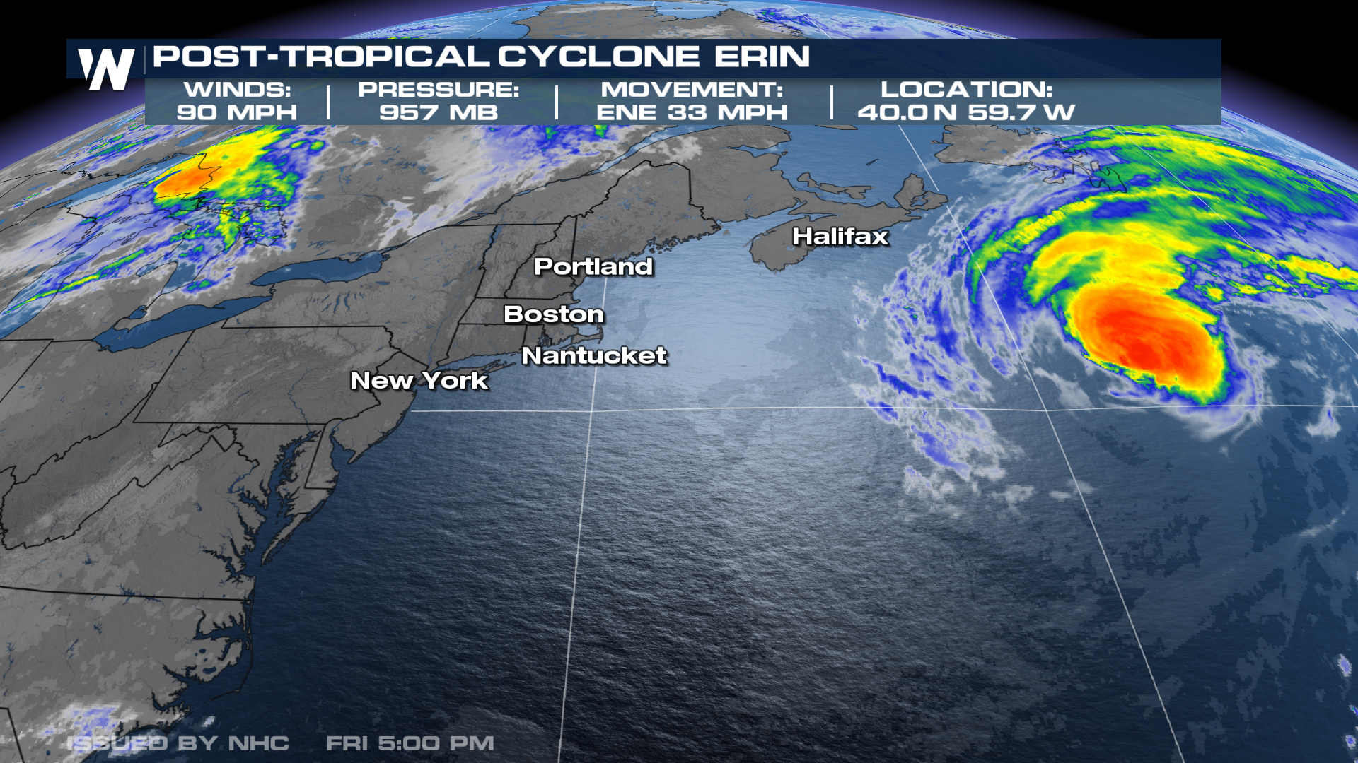
Erin Becomes A Post-Tropical Cyclone

Hurricane Erin was the first major Hurricane of the 2025 Atlantic Hurricane season, and even though Erin did not make direct landfall in the U.S., impacts were still felt across the eastern seaboard. Hurricane Erin once had a wind field that spanned over 500 miles, and the size of Erin previously made it rank among the top 10% of the largest Atlantic hurricanes ever recorded. With the latest update, the National Hurricane Center has deemed Erin to be post-tropical.
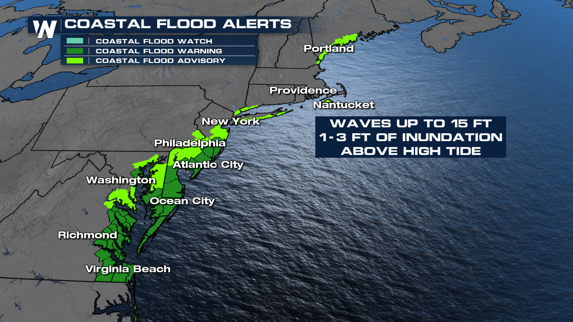
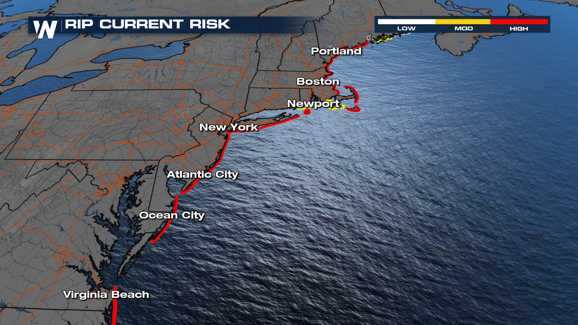
Coastal flooding remains an issue. Despite staying offshore, the storm’s effects have rippled up and down the East Coast of the United States, prompting emergency responses from North Carolina to Massachusetts. Larger waves will continue for the Northeast, with life-threatening rip currents. Flooded highways will still be one of the biggest concerns moving forward, especially as high tide approaches. Alerts for coastal flooding have been extended up the Atlantic Seaboard up to the Maine coast.
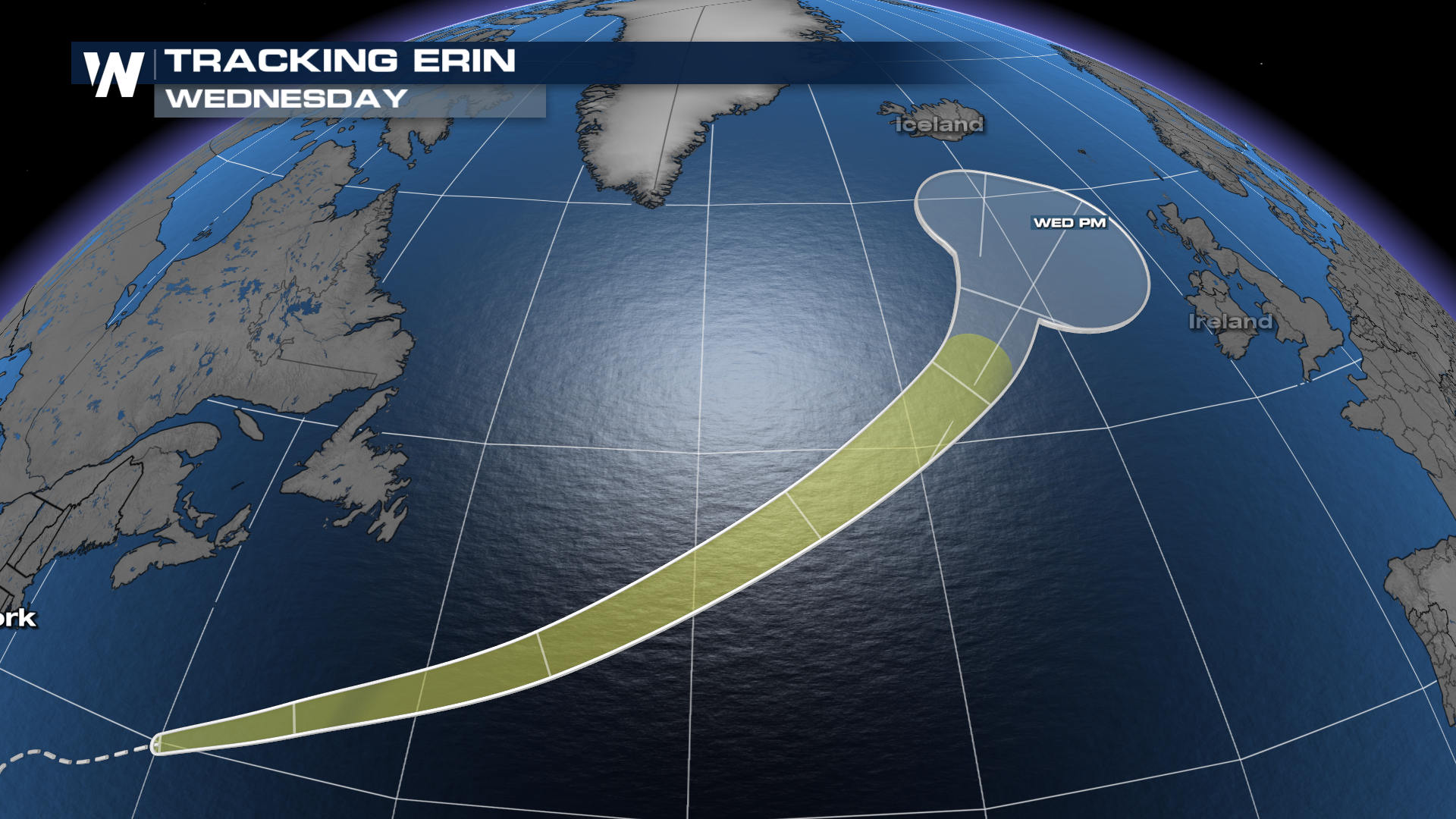
Erin will continue to weaken and move away from land. It is interesting to note that Erin may retain some of its strength as it approaches Iceland, Ireland, and the British Isles.
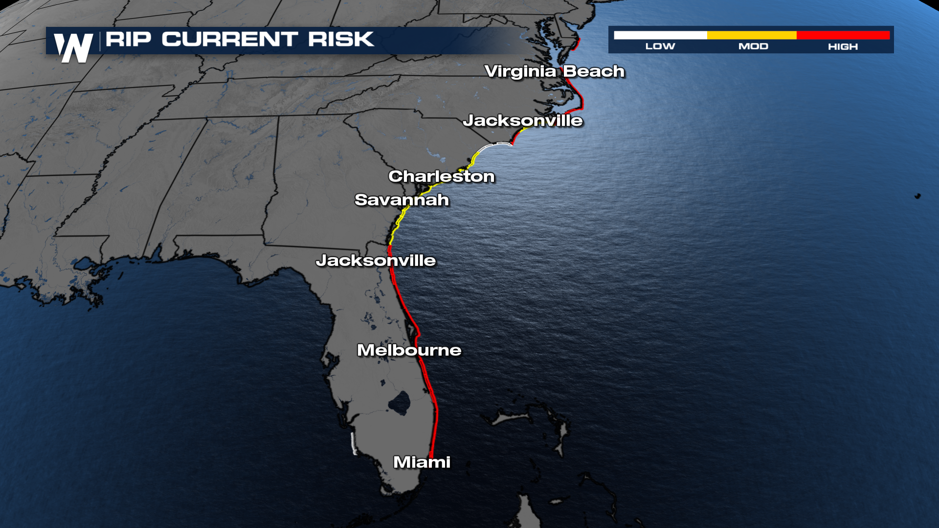
Venturing into the water as a beachgoer will remain dangerous along the East Coast. So far, numerous rip current rescues have been reported, just in the Tar Heel State alone.
Stick with WeatherNation TV for the latest.
RELATED ARTICLE: CSU, NOAA UPDATE Atlantic Hurricane Season Forecast


