CSU, NOAA UPDATE Atlantic Hurricane Season Forecast

Thursday, NOAA issued an update to their outlook for the 2025 Atlantic hurricane season. Although their numbers have adjusted down slightly, their predictions continue to foresee an above average season. This comes on the heels of Colorado State University releasing its final forecast for the 2025 Atlantic hurricane season Wednesday. The forecast team at CSU, led by meteorologist Dr. Phil Klotzbach, kept their predictions the same as July. For August, they are stuck with 16 named storms overall, with eight of those predicted to be hurricanes, and three major hurricanes.
It is important to note that both the NOAA and CSU forecasts include the four name storms that have already formed in the Atlantic (Andrea, Barry, Chantal and Dexter). Climatologically, around August 10 the rate at which storms form and grow accelerates quickly through the peak of the season around September 11.
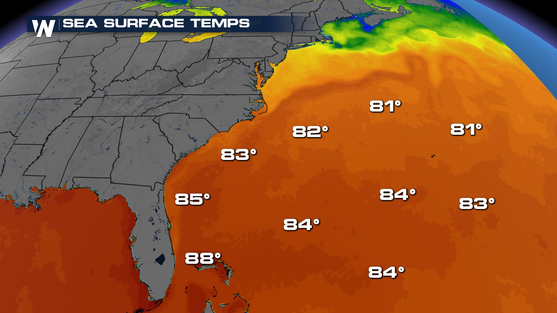
The reason why the forecast has not changed much, or has gone down slightly since the April, is the uncertainty across the tropics. While sea surface temperatures in both the Atlantic and Pacific are still warm, and this tends to support storm formation, upper-level winds over the Caribbean have been unusually hostile during June and July. This atmospheric setup typically suppresses hurricane development in the Atlantic basin.
“Many of the factors we identified ahead of the season are still at play, and conditions are largely tracking along with our May predictions,” said Matt Rosencrans, lead hurricane season forecaster with NOAA’s National Centers for Environmental Prediction, part of the National Weather Service.
RELATED ARTICLE: Atlantic Waking Up, Eastern Pacific Staying Active
The driving factor behind the above-average forecast remains the exceptionally warm waters across the eastern and central Atlantic Basin. Combined with a neutral El Niño-Southern Oscillation (ENSO), a state that neither strongly inhibits nor enhances storm activity, these conditions could still favor a more active season.
Yet, forecasters are closely watching high levels of wind shear in the Caribbean, a phenomenon involving shifts in wind direction and speed with height. This shear is known to disrupt storm development.
CSU also warns that the U.S. coastline faces an above-average risk of at least one major hurricane making landfall this season, a reminder that even in uncertain years, coastal residents should remain vigilant.
"No two storms are alike. Every storm presents unique, life-threatening hazards that can impact people in both coastal and inland communities. Have a plan in place, and know the actions you should take before, during and after the wide range of hazards that the hurricane season can bring.” said NOAA’s National Weather Service Director Ken Graham.
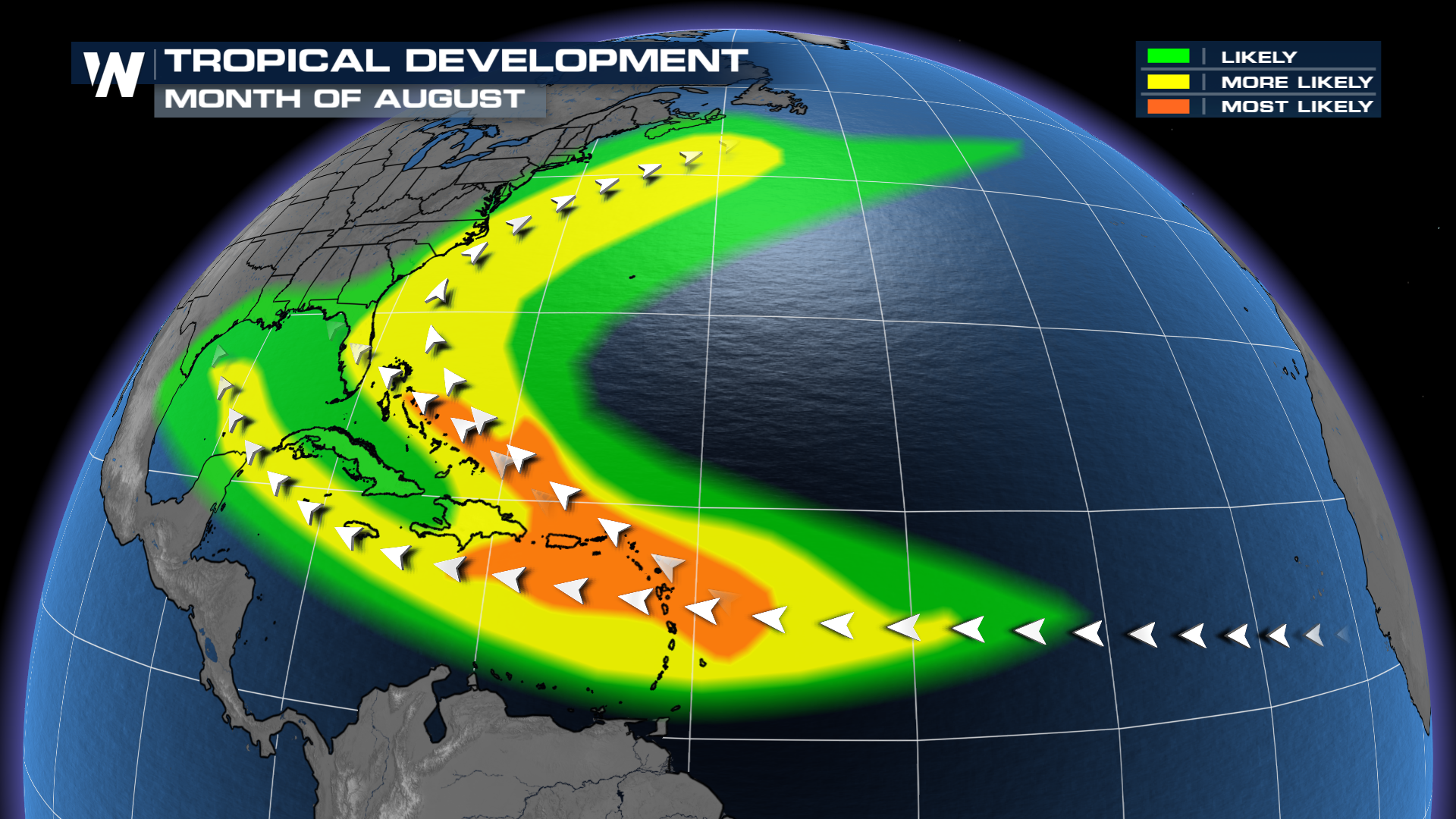
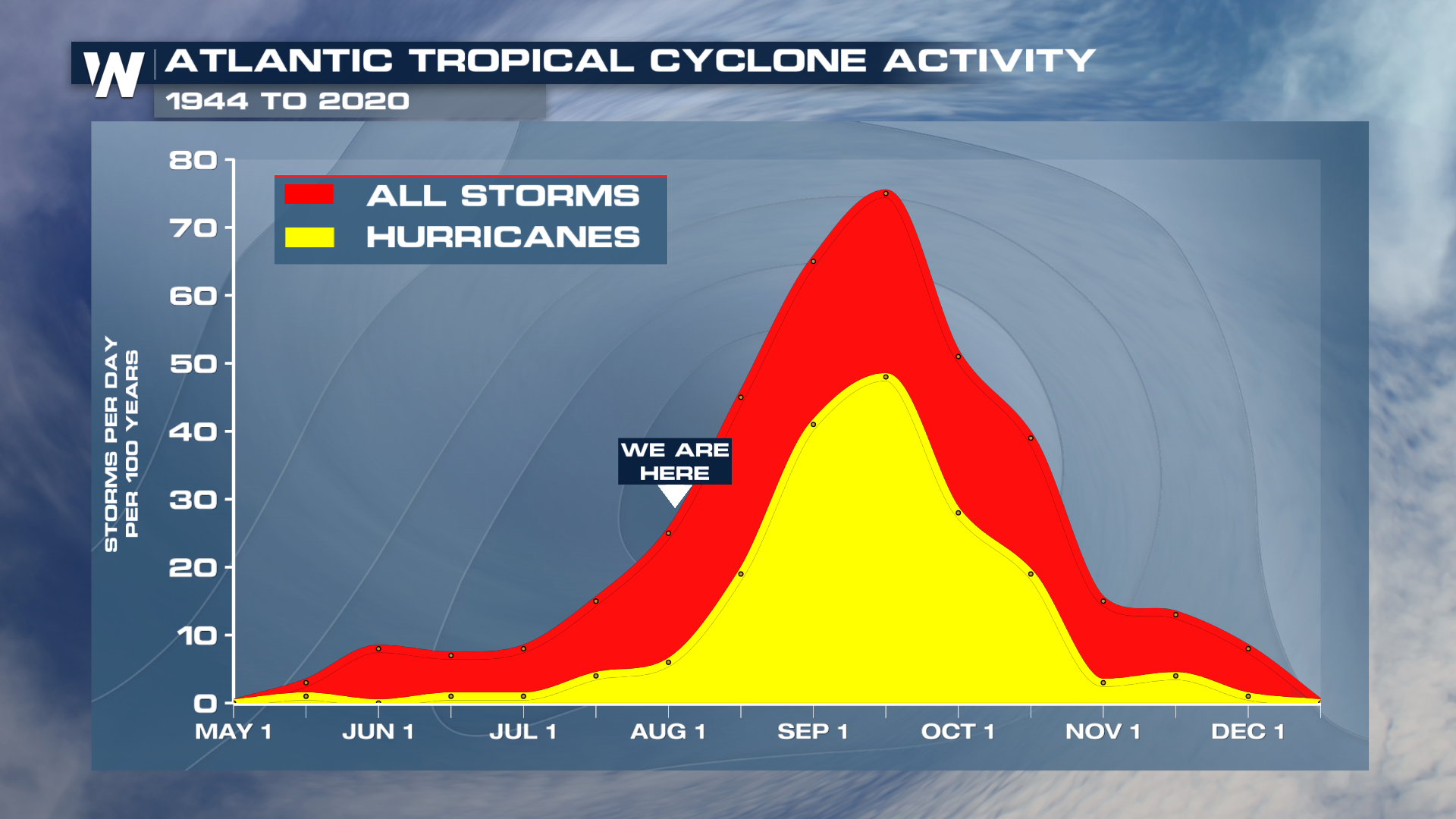 With the arrival of August, the Atlantic hurricane season is entering its most active stretch, which typically peaks around September 10. The pattern is starting to get more active in the Atlantic. Tropical Storm Dexter is still making waves (literally) in the Atlantic, and there are two additional areas to watch in the central Atlantic and off the Southeast coast.
The Atlantic hurricane season officially runs through November 30, leaving several more months of potential activity ahead. Tune into WeatherNation for the latest Tropical updates.


