Getaway Forecast

Special Stories
26 Mar 2019 11:37 AM
FORECAST
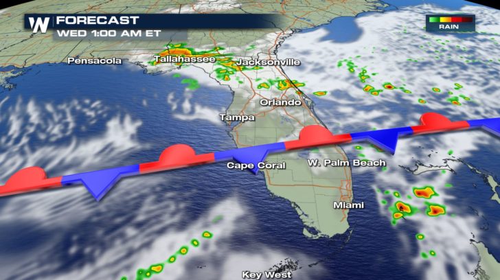
 The getaway forecast is looking a little wet over the next couple of days. Isolated showers will start to pop up as we head into the evening hours.
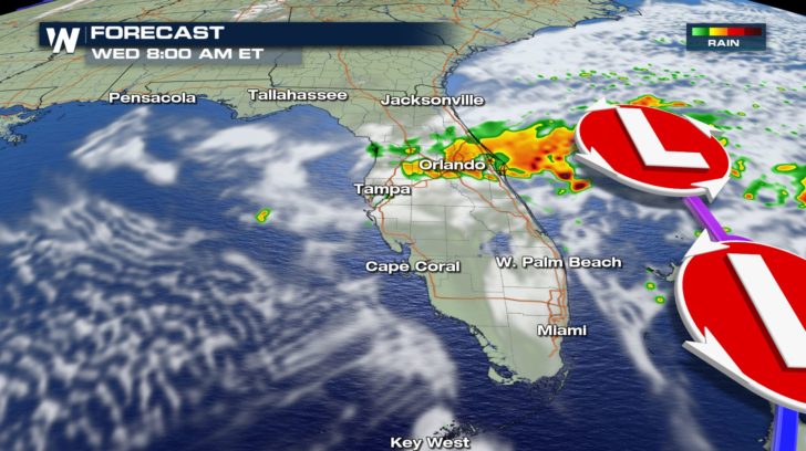
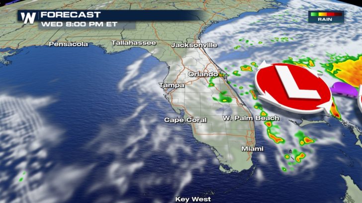
By Wednesday morning, a band of heavy rain accompanied by thunderstorms will move into the panhandle of Florida and slowly track towards the south. Expect these showers to linger all throughout the day.
By Thursday, it looks to be a lot better with rain and clouds clearing up.
TEMPERATURE FORECAST
The getaway forecast is looking a little wet over the next couple of days. Isolated showers will start to pop up as we head into the evening hours.
By Wednesday morning, a band of heavy rain accompanied by thunderstorms will move into the panhandle of Florida and slowly track towards the south. Expect these showers to linger all throughout the day.
By Thursday, it looks to be a lot better with rain and clouds clearing up.
TEMPERATURE FORECAST
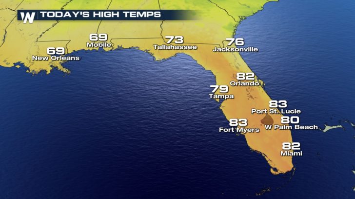
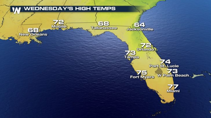
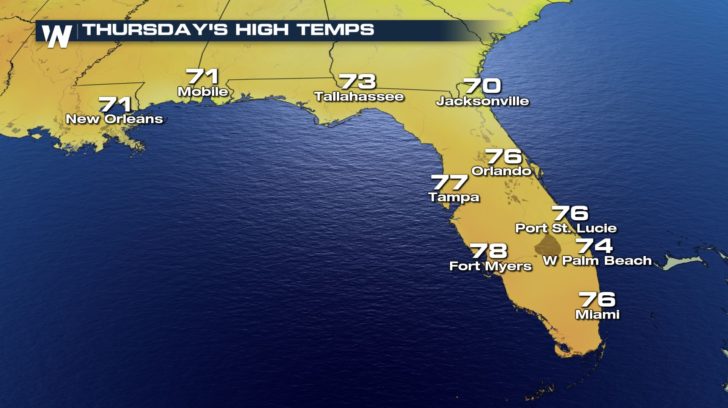 Temperatures today will be quite pleasant, but once the front passes, temperatures will cool off into the 60s and 70s for the middle of the work week.
By Friday, we should see temperatures start to warm back up.
Temperatures today will be quite pleasant, but once the front passes, temperatures will cool off into the 60s and 70s for the middle of the work week.
By Friday, we should see temperatures start to warm back up.
The getaway forecast is looking a little wet over the next couple of days. Isolated showers will start to pop up as we head into the evening hours.
By Wednesday morning, a band of heavy rain accompanied by thunderstorms will move into the panhandle of Florida and slowly track towards the south. Expect these showers to linger all throughout the day.
By Thursday, it looks to be a lot better with rain and clouds clearing up.
TEMPERATURE FORECAST
Temperatures today will be quite pleasant, but once the front passes, temperatures will cool off into the 60s and 70s for the middle of the work week.
By Friday, we should see temperatures start to warm back up.All Weather News
More
Wildfire Outbreak in the Pacific Northwest
Conditions have been incredibly dry out west.
2 Aug 2026 1:30 PM

After Reaching Category 5, Genevieve Weakens in the Pacific
PacificGenevieve formed on last Friday south
2 Aug 2026 1:25 PM

More Storms for the East Sunday and Monday
A low-pressure system crashing through the Mi
2 Aug 2026 1:25 PM


Flooding, Severe Storms Target the Midwest Again
After an active week of storms across the nor
1 Aug 2026 1:40 AM

Flooding Risk Increases as Heavy Rain Targets the Tri-State Area
Tuesday, heavy rainfall moved across the Nort
30 Jul 2026 12:25 AM

Severe Weather: Energy From the Midwest Now in the Southeast
UPPER MIDWEST - Through Monday, dangerous tor
29 Jul 2026 10:30 PM