Mississippi Tornado Caught on Camera

GAUTIER, MS - Earlier Sunday morning, tornado warnings swept through the Gulf Coast, and this person was caught in the debris of the tornado in Mississippi. The severe threat continues through tonight across the Gulf Coast as this frontal boundary keeps moving through.
According to the National Weather Service in New Orleans, a survey team will be heading out on Monday morning to survey the damage that Sunday morning's storms brought. The NWS has also encouraged anyone in the region to send over their reports to help with their surveys as well.
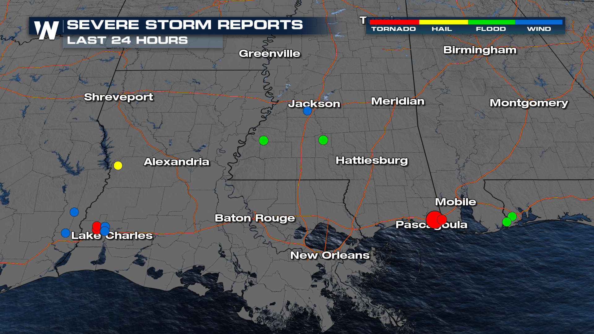 Most of the storms from Sunday sat along a warm front and remained as supercells. Through the overnight hours, storms are expected to cluster together, lessening the tornado threat but maintaining the wind, hail, and heavy rain threat into Florida.
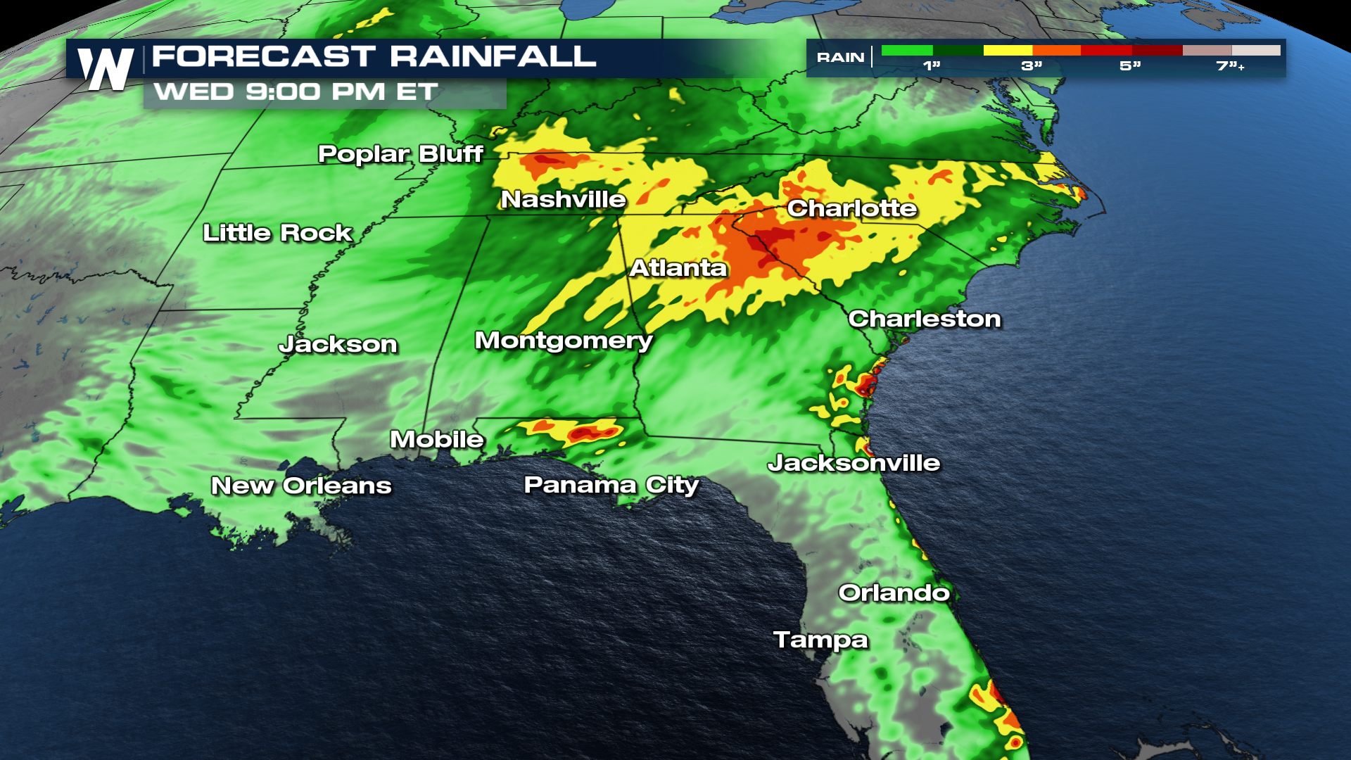
Heavy rain is also going to be a concern along the system, and with another batch of rain moving in by late Tuesday, the flood threat will continue into the work week as well.
 For more details on how this rain may influence your forecast temperatures, be sure to join us at :10 past the hour, where we detail your east regional forecast.


