Heavy rain in the Southeast this weekend; severe storms possible in Florida

Top Stories
6 Feb 2021 6:00 AM
A low pressure system emerging out of the western Gulf of Mexico will skirt the Gulf Coast this weekend, bringing rounds of heavy rain to the I-10 and I-20 corridors across the Southeast. While it won't be raining at all times for the entire weekend, periods of heavy rain will make for a soggy stretch the next few days.
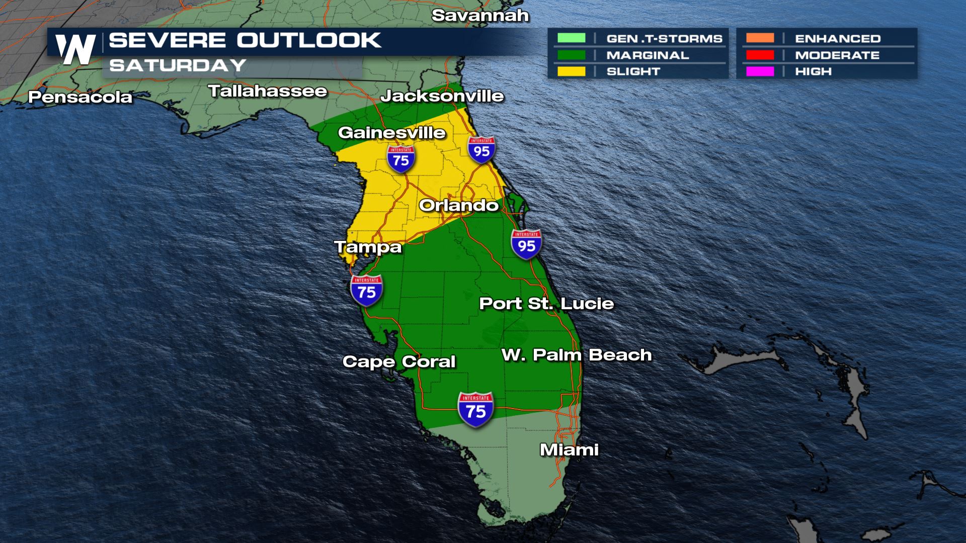
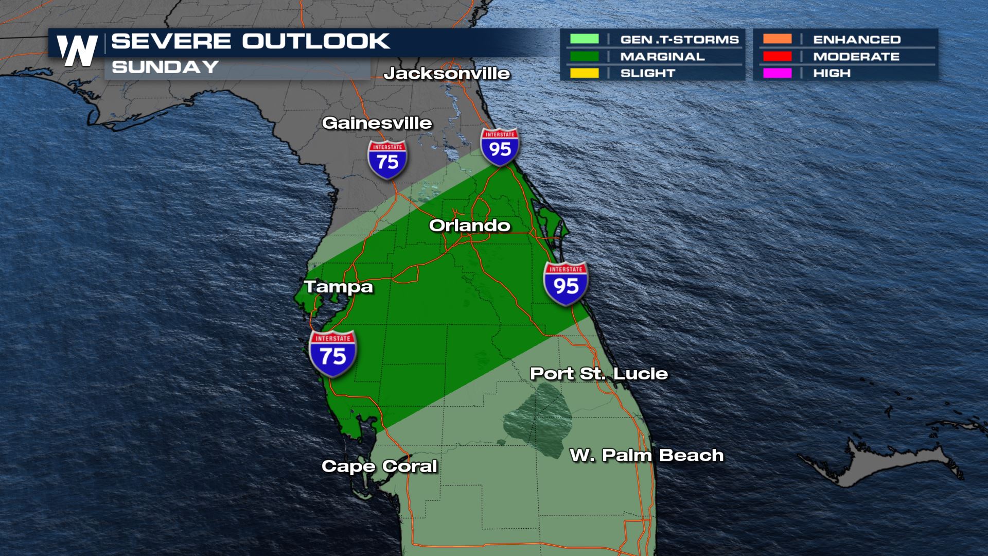
Scattered severe thunderstorms are possible across Florida this afternoon. The severe weather risk is a Slight for areas in yellow (Level 2 out of 5) while the rest of Florida is in a Marginal (Level 1 out of 5). Storms with winds of 60 mph are possible and there is the chance for a brief, weak spin-up tornado as well. The severe weather risk will be highest through 5 pm E.T. for Gainesville, Tampa and Orlando before shifting to the south overnight to the I-75 corridor.
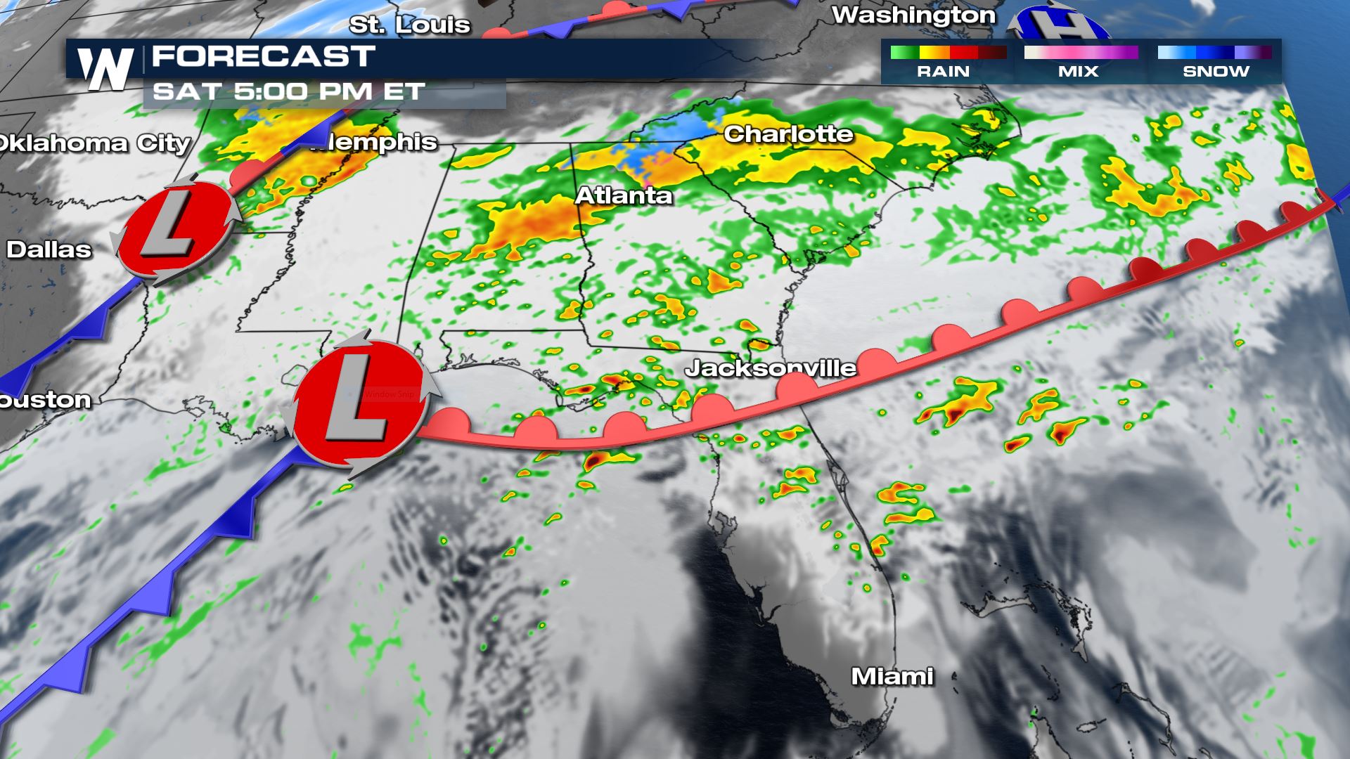
 By Saturday afternoon the low will be approaching the coast, sending heavy rain into north Alabama, Georgia, Tennessee and South Carolina. Strong thunderstorms will have the chance to move onshore in Florida and could have gusty winds or a brief spin-up tornado. Meanwhile some cold air draining in from the northern U.S. may result in rain changing over to snow in higher terrain areas of Georgia, North Carolina and Alabama. A cold, heavy rain will be the dominant precipitation type across the region.
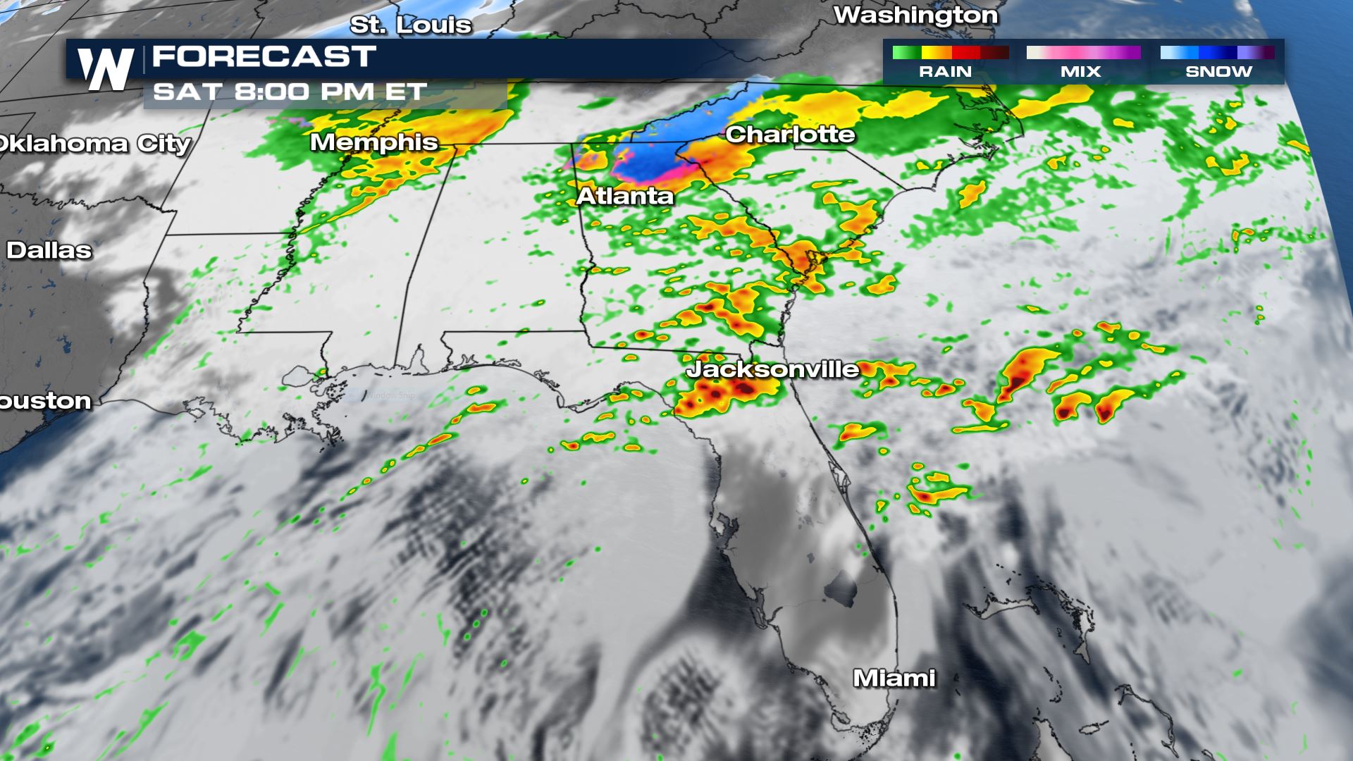
 The low pressure system will move into the panhandle of Florida Saturday evening as the warm front moves inland into south Georgia. Heavy rain will continue into Georgia and South Carolina. A few severe thunderstorms may persist in north central Florida in the evening. Gusty straight line winds of 60 mph and a brief tornado are the main threats.
 The low keeps moving northeast Saturday night into Sunday. Rain continues east of I-95 in North and South Carolina in the late evening before moving offshore after midnight. A few scattered showers and thunderstorms are likely across south Georgia and Florida right along the cold front. Isolated strong thunderstorms are possible into central Florida as well with gusty winds the most likely threat.
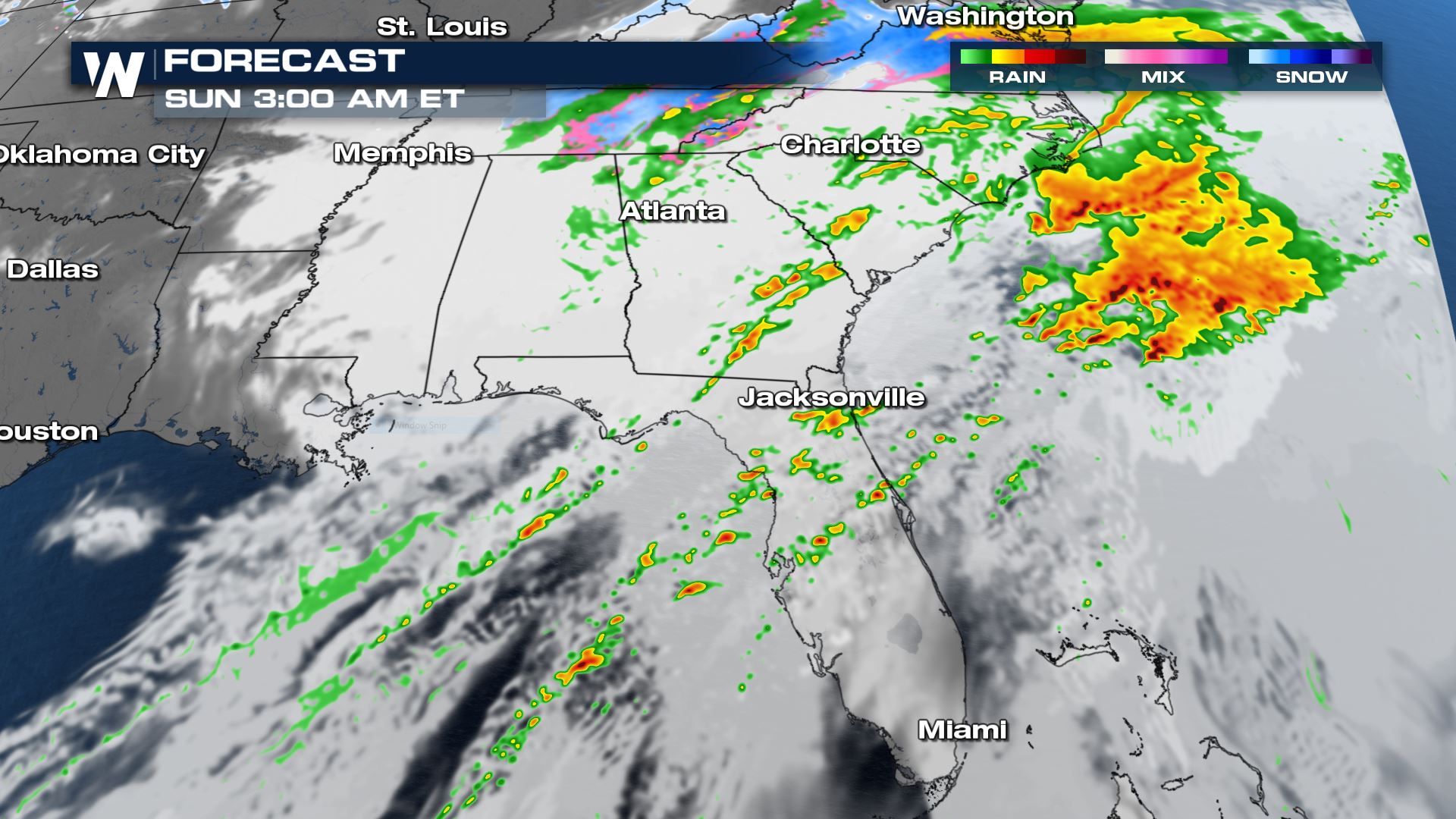 Heavy rain moves offshore by sunrise Sunday. Isolated thunderstorms are likely to be ongoing across central Florida and some could be severe. Gusty winds and a brief weak spin-up tornado can't be ruled out with the strongest storms.
 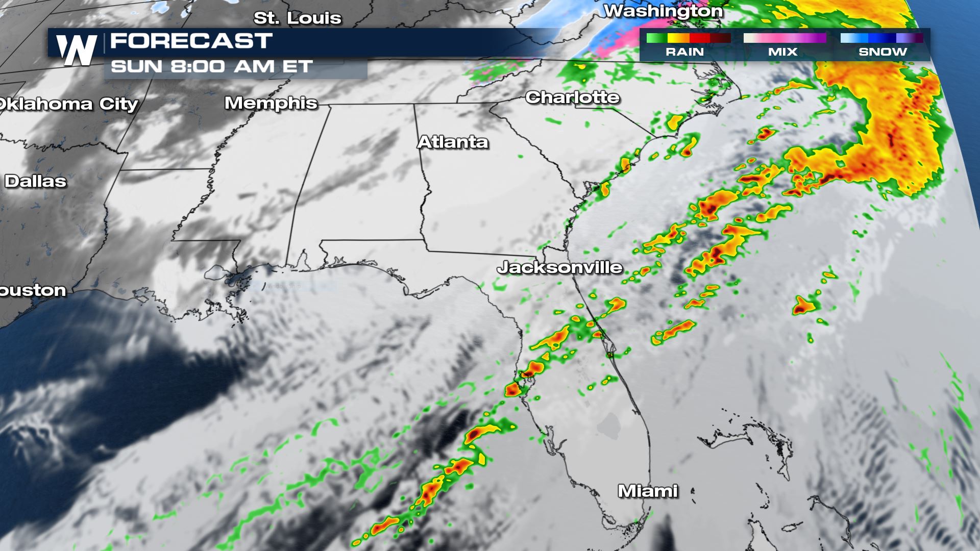 The severe weather risk is a marginal (Level 1 out of 5) for Sunday but a few rotating thunderstorms can't be ruled out.
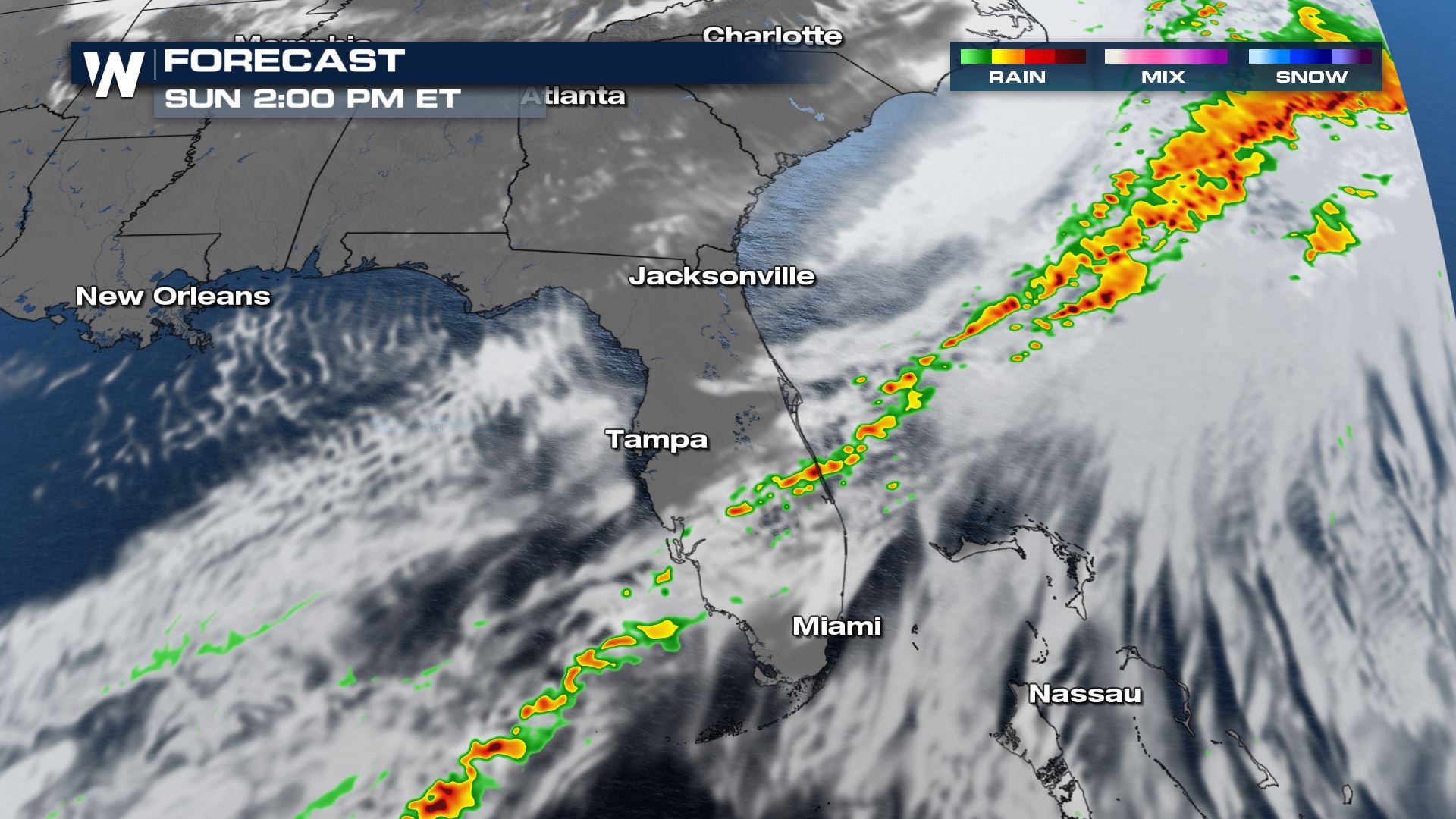
 The front will sweep through Florida through the rest of the morning with rain and thunderstorms along the boundary. By early afternoon the rain will be coming to an end in central Florida. Good news for The Big Game--the forecast will be clear with temperatures in the upper 60s for kickoff, falling into the low 60s by the end of the game.
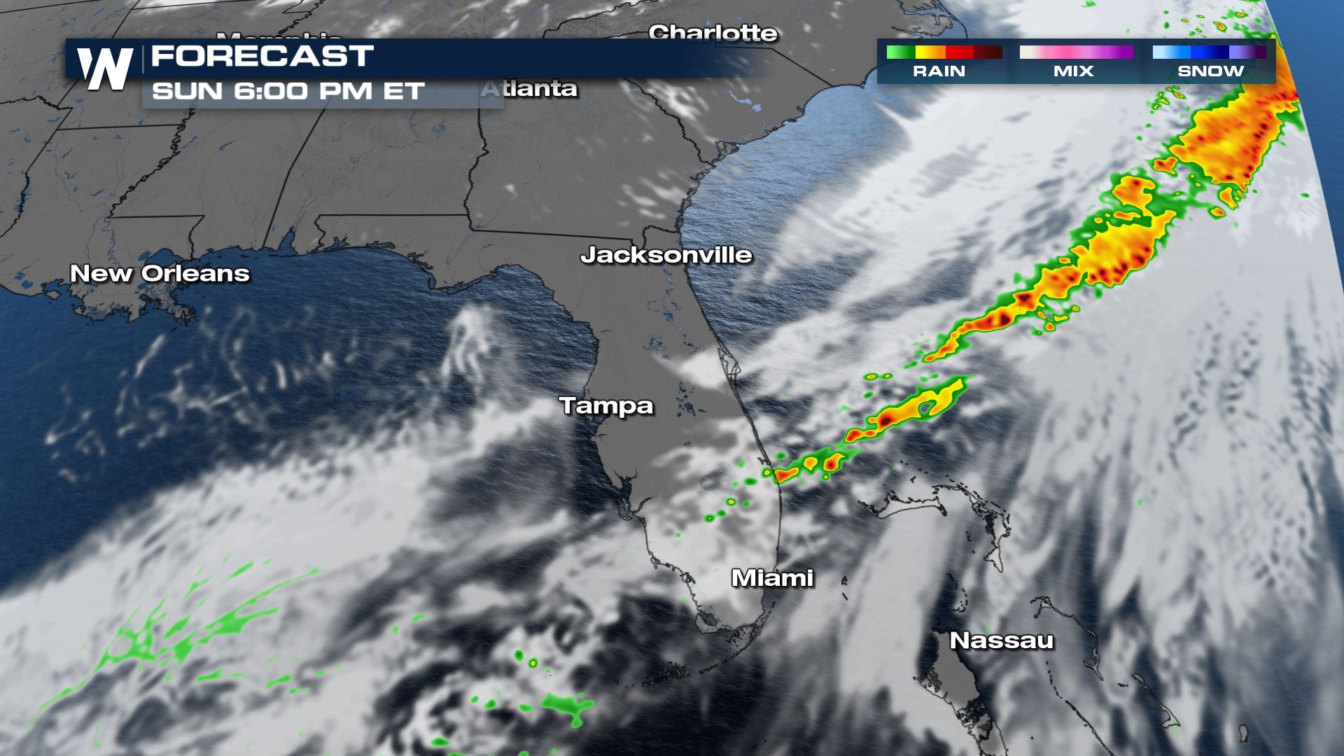
 Rain and thunderstorms will continue to move south into the evening as the front sags toward the Florida Keys. The severe weather threat will decrease into the evening.
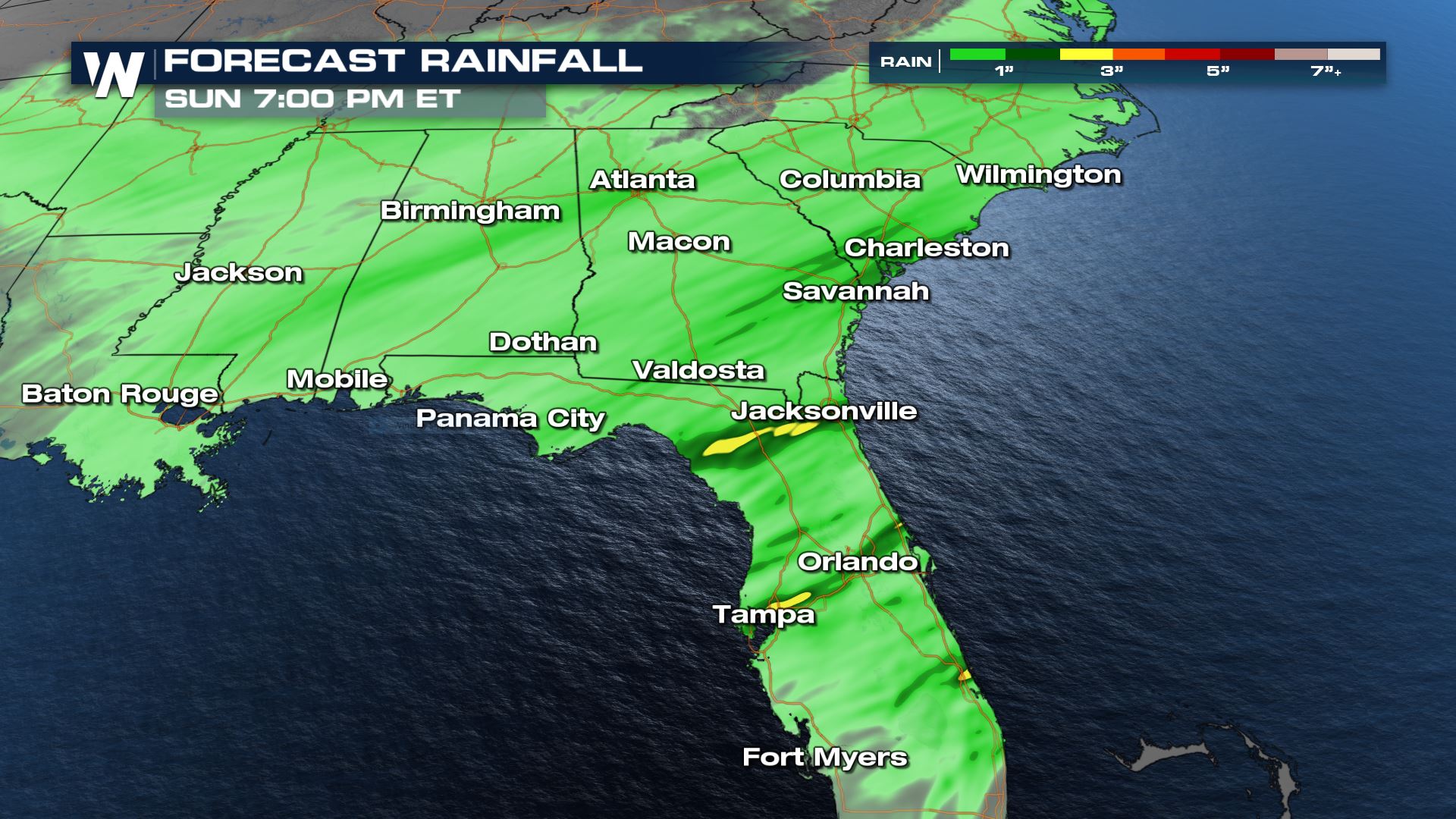
 Rain totals will be around an inch for most spots, but there will be pockets of 2" of rain possible where multiple bands train over the same areas. In snorth Florida where the low pressure and warm front track inland, higher rain totals approaching 3" are possible through Sunday evening. This could lead to brief ponding on the roads especially in places that tend to flood easily.
 The overall weather pattern through the middle of February features higher than average precipitation chances for the Gulf Coast and Southeast.
This is one of our top weather headlines on WeatherNation. Stay tuned on PlutoTV or any of our digital platforms for the latest on this system and our other top weather stories.
The overall weather pattern through the middle of February features higher than average precipitation chances for the Gulf Coast and Southeast.
This is one of our top weather headlines on WeatherNation. Stay tuned on PlutoTV or any of our digital platforms for the latest on this system and our other top weather stories.
By Saturday afternoon the low will be approaching the coast, sending heavy rain into north Alabama, Georgia, Tennessee and South Carolina. Strong thunderstorms will have the chance to move onshore in Florida and could have gusty winds or a brief spin-up tornado. Meanwhile some cold air draining in from the northern U.S. may result in rain changing over to snow in higher terrain areas of Georgia, North Carolina and Alabama. A cold, heavy rain will be the dominant precipitation type across the region.
The low pressure system will move into the panhandle of Florida Saturday evening as the warm front moves inland into south Georgia. Heavy rain will continue into Georgia and South Carolina. A few severe thunderstorms may persist in north central Florida in the evening. Gusty straight line winds of 60 mph and a brief tornado are the main threats.
The low keeps moving northeast Saturday night into Sunday. Rain continues east of I-95 in North and South Carolina in the late evening before moving offshore after midnight. A few scattered showers and thunderstorms are likely across south Georgia and Florida right along the cold front. Isolated strong thunderstorms are possible into central Florida as well with gusty winds the most likely threat.
Heavy rain moves offshore by sunrise Sunday. Isolated thunderstorms are likely to be ongoing across central Florida and some could be severe. Gusty winds and a brief weak spin-up tornado can't be ruled out with the strongest storms.
The severe weather risk is a marginal (Level 1 out of 5) for Sunday but a few rotating thunderstorms can't be ruled out.
The front will sweep through Florida through the rest of the morning with rain and thunderstorms along the boundary. By early afternoon the rain will be coming to an end in central Florida. Good news for The Big Game--the forecast will be clear with temperatures in the upper 60s for kickoff, falling into the low 60s by the end of the game.
Rain and thunderstorms will continue to move south into the evening as the front sags toward the Florida Keys. The severe weather threat will decrease into the evening.
Rain totals will be around an inch for most spots, but there will be pockets of 2" of rain possible where multiple bands train over the same areas. In snorth Florida where the low pressure and warm front track inland, higher rain totals approaching 3" are possible through Sunday evening. This could lead to brief ponding on the roads especially in places that tend to flood easily.
The overall weather pattern through the middle of February features higher than average precipitation chances for the Gulf Coast and Southeast.
This is one of our top weather headlines on WeatherNation. Stay tuned on PlutoTV or any of our digital platforms for the latest on this system and our other top weather stories.All Weather News
More
East Gears Up for Stormy, Wet Weekend
A low pressure system crashing through the Mi
1 Aug 2026 11:35 AM


Flooding, Severe Storms Target the Midwest Again
After an active week of storms across the nor
1 Aug 2026 1:40 AM


After Reaching Category 5, Genevieve Weakens in the Pacific
PacificFausto is now a post-tropical cyclone.
31 Jul 2026 1:30 AM

Flooding Risk Increases as Heavy Rain Targets the Tri-State Area
Tuesday, heavy rainfall moved across the Nort
30 Jul 2026 12:25 AM

Severe Weather: Energy From the Midwest Now in the Southeast
UPPER MIDWEST - Through Monday, dangerous tor
29 Jul 2026 10:30 PM