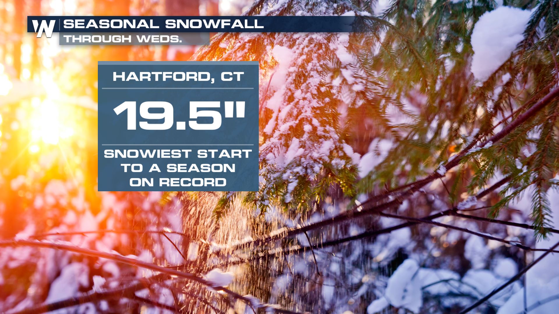
Hartford, Connecticut Off to its Snowiest Start to a Winter Season on Record

Top Stories
11 Dec 2019 8:49 PM
Hartford, Connecticut is off to its snowiest start to a winter season on record.
After 3.0 inches of snow on Wednesday morning, Hartford's official weather observation site at Bradley International Airport has now recorded 19.5 inches of snow so far this season. That's the most snow Hartford has seen through December 11th, and nearly five times above the season-to-date average snowfall of 4.0 inches.
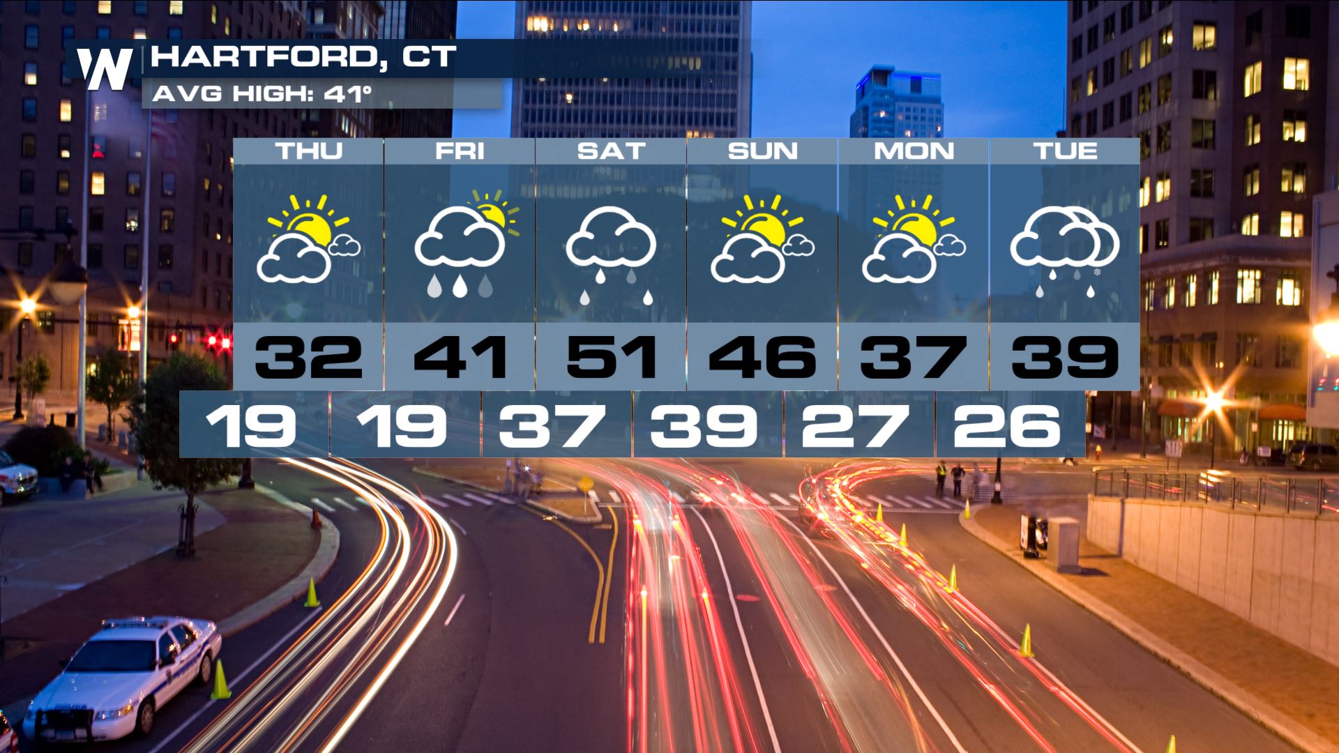
 While no snow is in the immediate forecast, an unsettled Friday night and Saturday is in store for much of Connecticut, including Hartford. An inch or two of rain is possible in Hartford, mainly on Saturday. Coupled with high temperatures in the 50s, rapid snowmelt and heavy rain could combine to create some flooding in the region on Saturday.
While no snow is in the immediate forecast, an unsettled Friday night and Saturday is in store for much of Connecticut, including Hartford. An inch or two of rain is possible in Hartford, mainly on Saturday. Coupled with high temperatures in the 50s, rapid snowmelt and heavy rain could combine to create some flooding in the region on Saturday.
All Weather News
More
Fire Weather Continues This Weekend
Conditions have been really dry out west. We'
26 Jul 2026 10:40 AM

Heat Wave Grips Central, Western U.S.
Are you over the summer heat yet? The heat al
26 Jul 2026 10:35 AM

Tropics: Fausto Heads to Hawaii; Genevieve Will Become a Major Hurricane
Atlantic BasinBertha has dissipated after mov
26 Jul 2026 10:35 AM

Severe Storms Target the Midwest This Weekend
Extreme heat will be a big story this week ac
26 Jul 2026 10:30 AM

Southeast Flood Risk Lingers Near Stalled Front
A stalled boundary over the Southeast will ke
25 Jul 2026 10:55 AM

Another Round of Storms Targets the Northeast
Tuesday brought severe weather again across p
23 Jul 2026 1:15 AM

Another Round of Severe Weather for the Upper Midwest and Great Lakes
The upper-level low train continues to keep t
21 Jul 2026 1:45 AM