Heat-seeking Citizen Scientists Focus on D.C., Baltimore for Mapping Mission
Heat-seeking Citizen Scientists Focus on D.C., Baltimore for Mapping Mission -- From NOAA
A corps of volunteers are setting out this week with an important task in front of them: Collect real-time data about the hottest places in Baltimore and Washington, D.C. It's part of a NOAA-funded project to map places where people are most at risk during extreme heat waves.
Using specially designed thermal sensors mounted on their own cars, these citizen scientists are driving prescribed routes through each city recording temperatures, time and location second by second.
Then, scientists from Portland State University and the Science Museum of Virginia will transform this data into detailed maps of both cities’ urban heat islands — areas that trap heat and can run 10 to 20 degrees hotter than in other areas of the city. The campaign started earlier this summer.
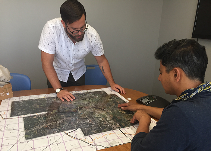
[Jeremy Hoffman, a climate and earth scientist at the Science Museum of Virginia, left, and Vivek Shandas, a professor of urban studies and planning at Portland State University, design the routes that citizen scientists will later take to collect heat data for mapping Richmond's heat islands last summer. (Photo courtesy of Jeremy Hoffman. With permission.)]
“By measuring temperatures in tens of thousands of locations throughout a city, we can map what areas are hottest, and the reason behind those patterns,” explained Vivek Shandas, a professor at Portland State University and co-leader of the project. “It’s a very simple system that any city can use to describe the urban heat island effect, which can help to inform planning strategies to cool the city, especially in areas where the most vulnerable populations live.”
To relieve extreme heat: First, locate the hot spots
Keeping cities cooler can involve a number of actions such as:
-
Opening more public air-conditioned spaces.
-
Removing or whitewashing large areas of black asphalt or roof surfaces.
-
Adding more trees for shade.
-
Requiring developers to vary the heights of new buildings to increase natural airflow through hot neighborhoods.
The city of Richmond, Virginia, knows this first-hand: This week’s heat-island mapping builds on a similar pilot project last summer led by Shandas and Jeremy Hoffman of the Science Museum of Virginia and supported by a NOAA educational grant.
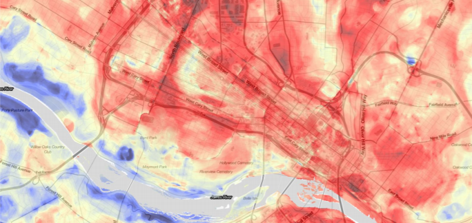
[Map from Richmond, VA, urban heat island study last summer. Red shows hotter areas and blue shows cooler areas. From NOAA]
“We’re already using this data on two different scales,” Hoffman said. "Richmond is incorporating it into citywide planning and, at the local level, a community nonprofit recently built a large awning to shade public seating in one of hottest neighborhoods.”
What’s next
Research findings from the Washington, D.C., and Baltimore mapping project will be published in a peer-reviewed science journal, and the data will be shared freely with city officials and interested members of the public. NOAA and its partners hope to eventually develop an off-the shelf, ready-made template for other cities to affordably conduct their own urban heat-island maps.
Edited for WeatherNation by Meteorologist Mace Michaels


