Heavy Rain Continues in the East
Special Stories
3 Aug 2018 9:19 AM
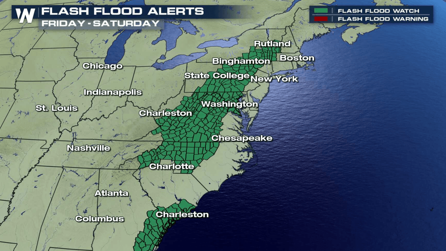
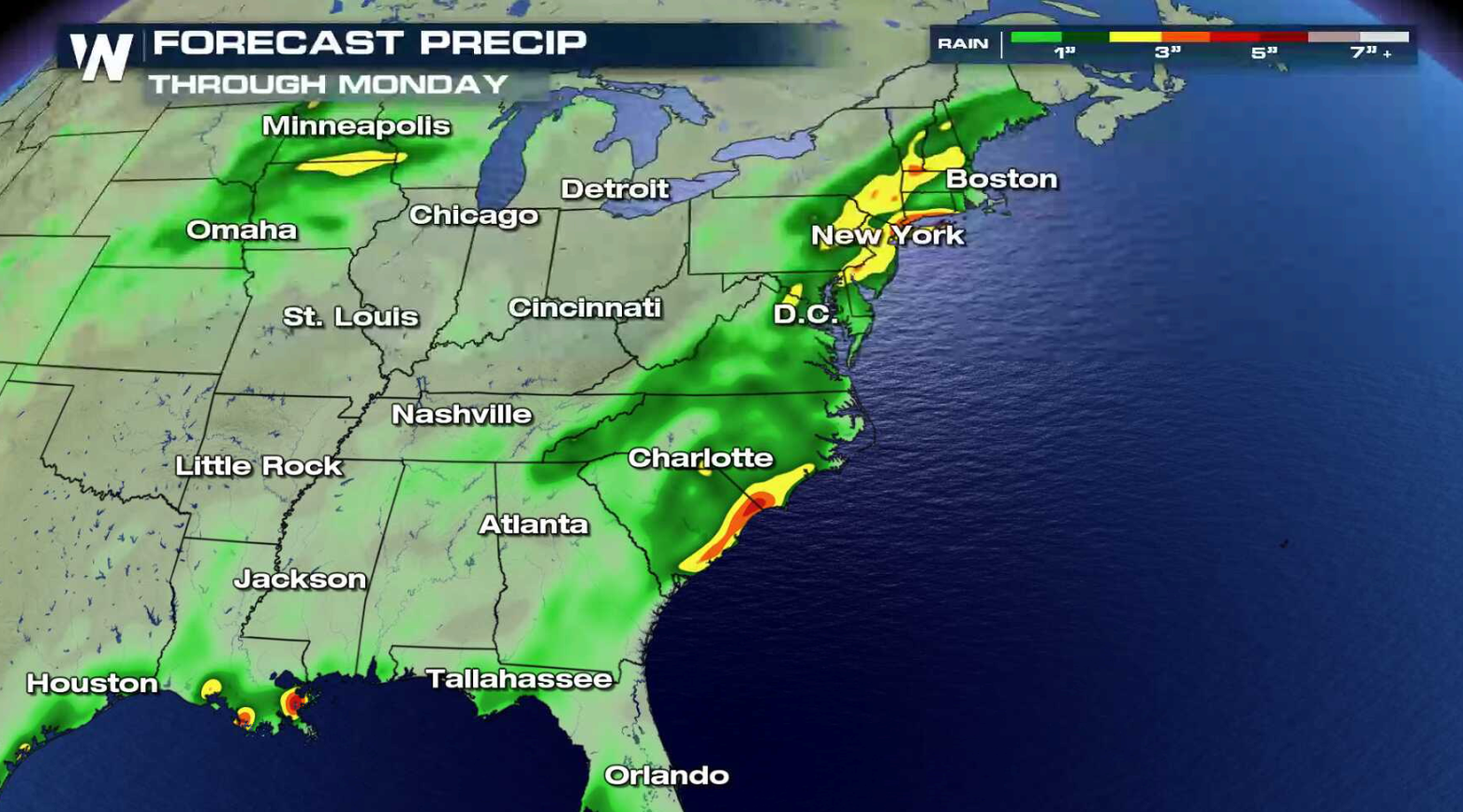
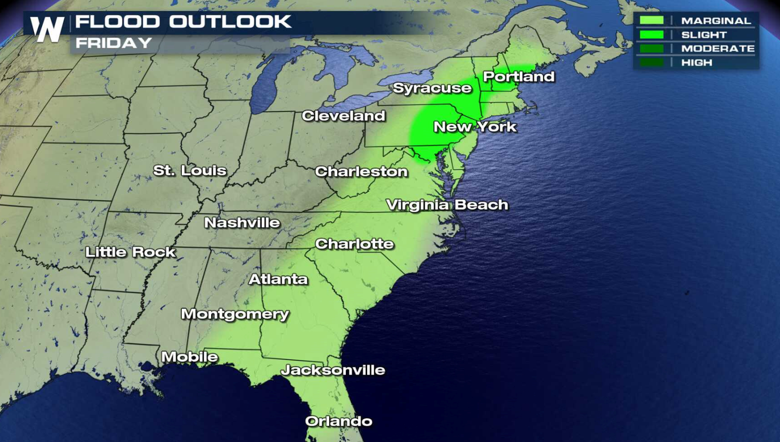
Flash Flood Watches continue from New England to the Southeast as the threat for heavy rain continues today (Friday). A few areas could see more than 5" of rain into this weekend, which may lead to flooding.
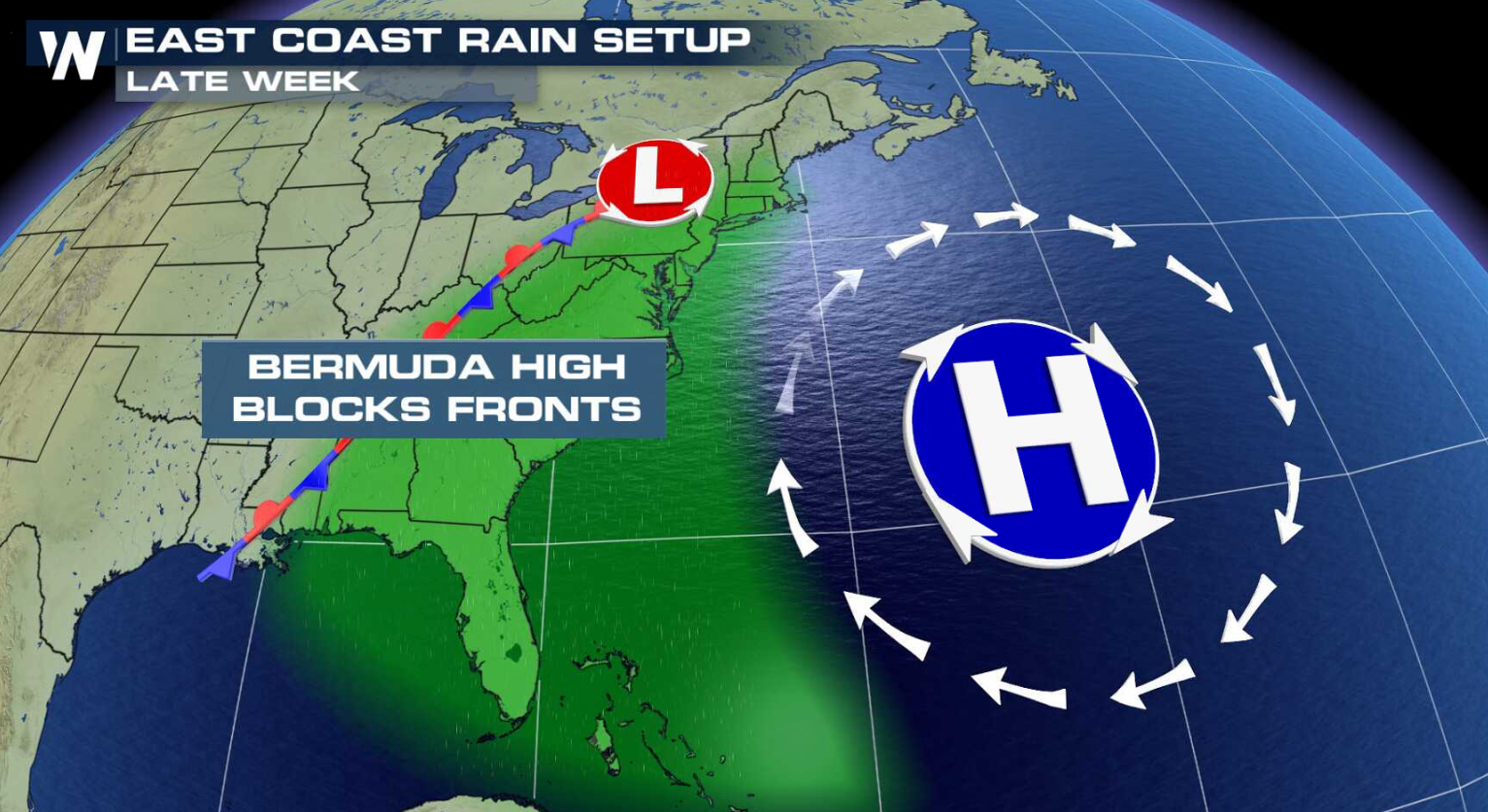
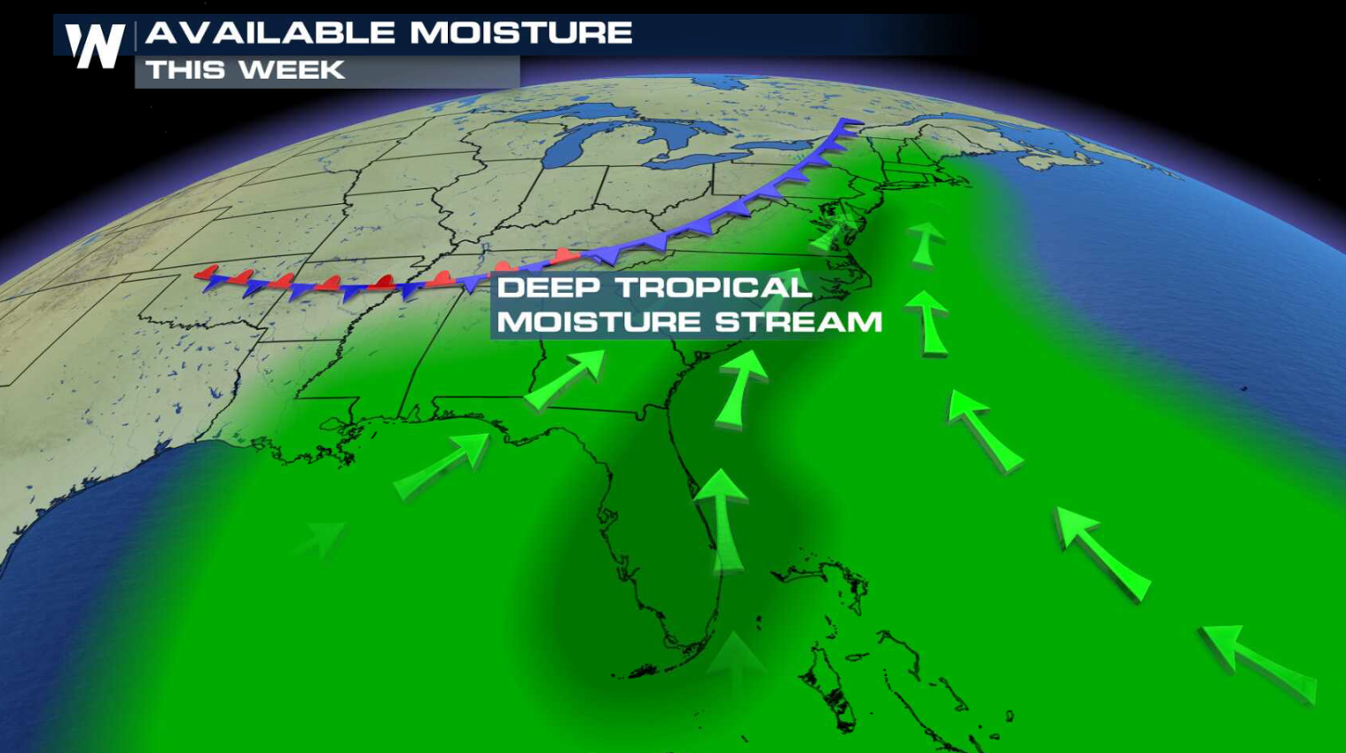
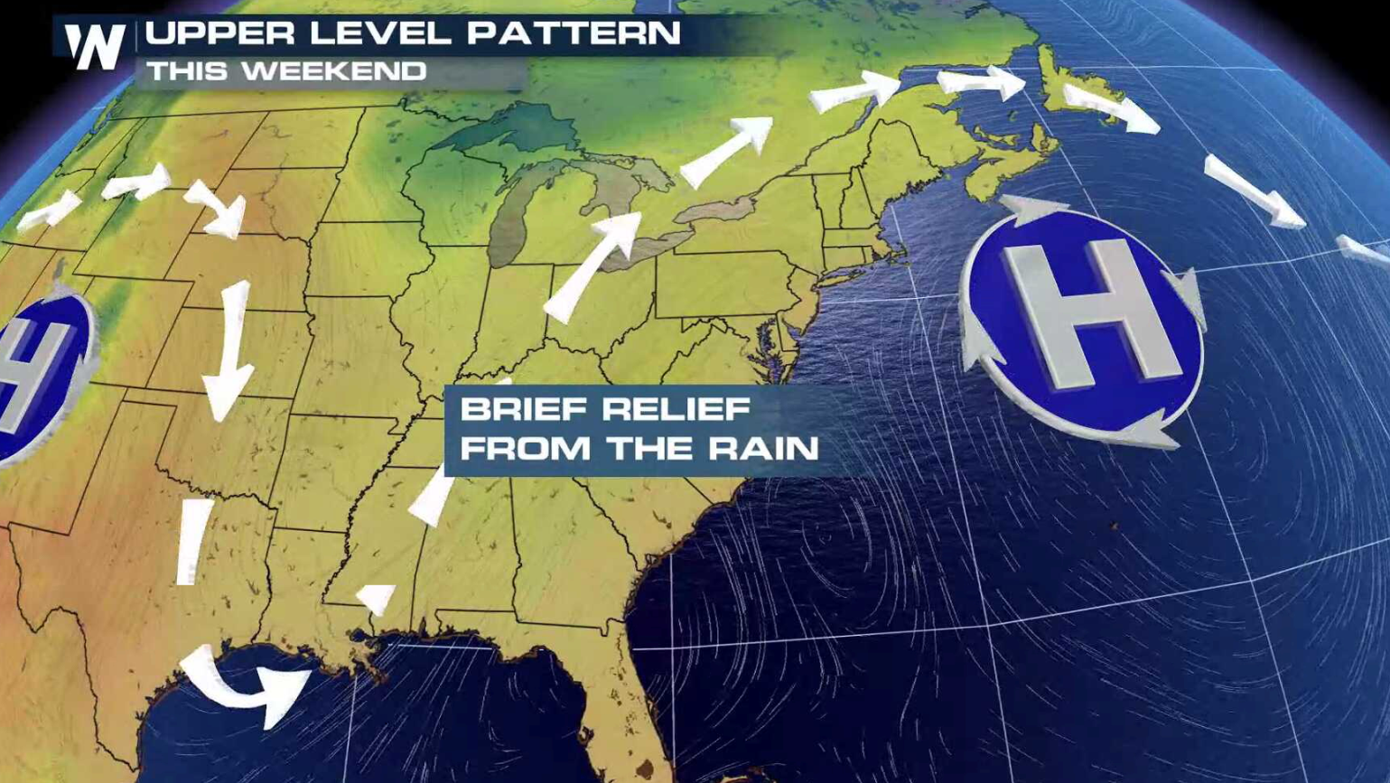
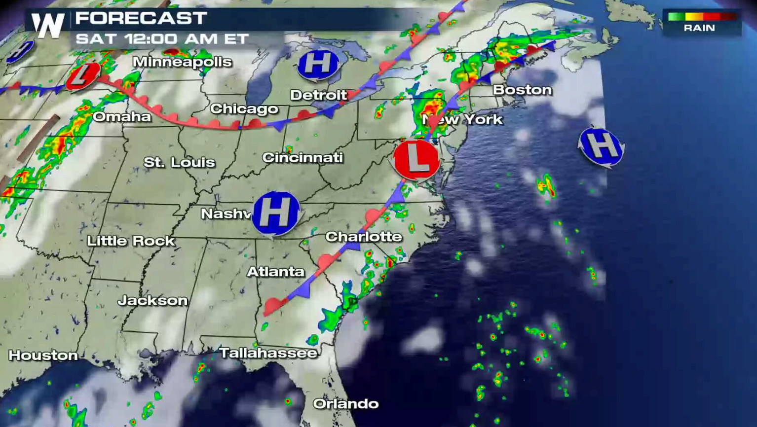
 A strong area of high pressure in the eastern Atlantic Ocean continues to funnel a rich feed of moisture into the atmosphere from the Gulf of Mexico. The high humidity streams northward along a stalled front, producing rounds of heavy rain. Later this weekend, the high will begin to shift, diminishing the flooding threat.
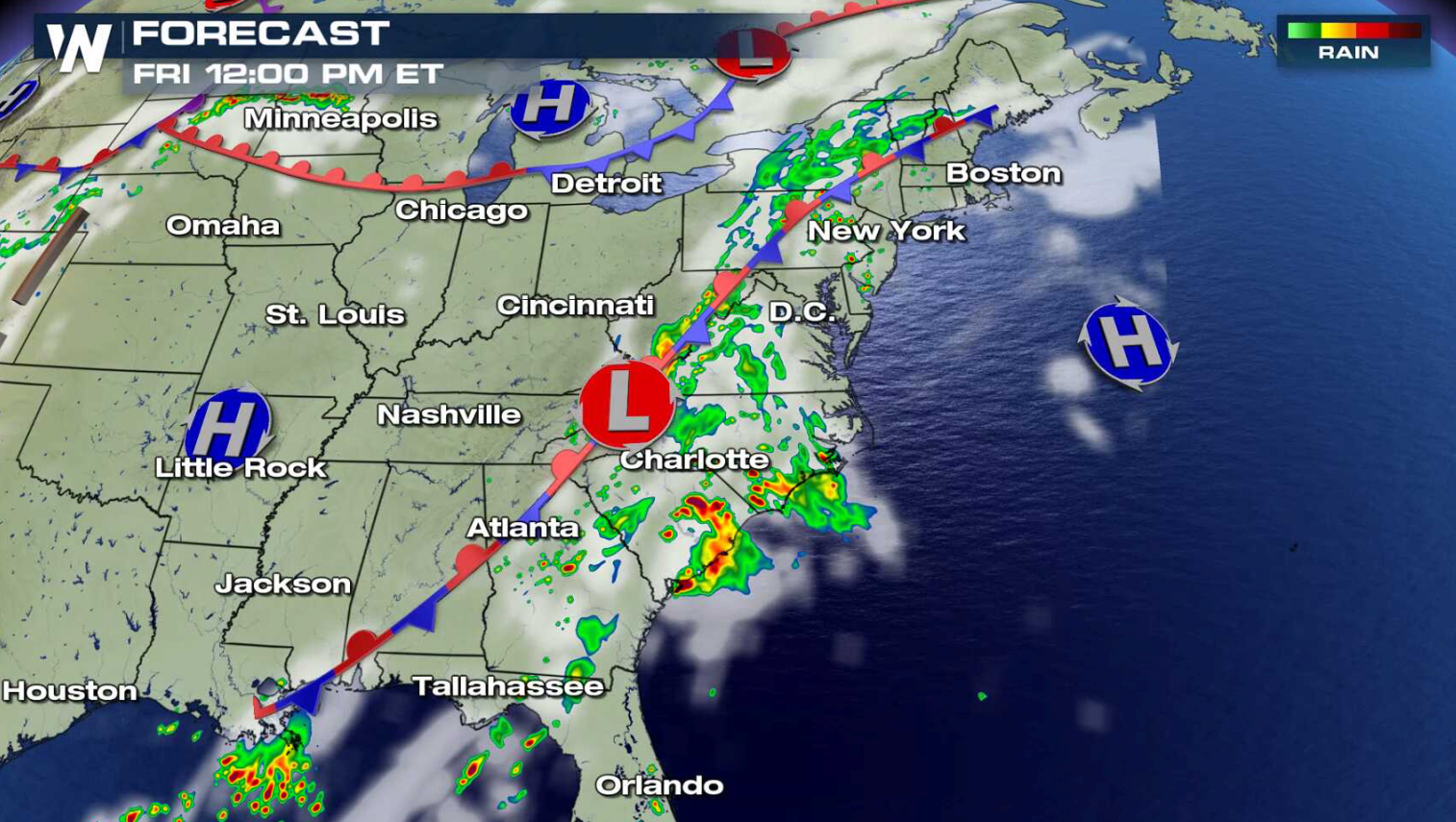
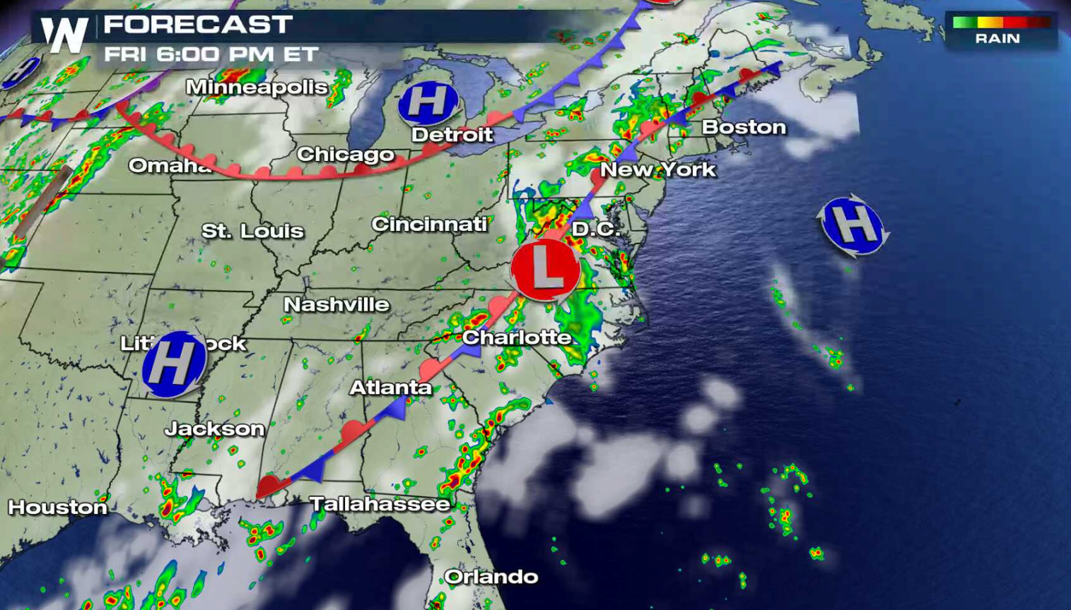
 The front barely moves throughout the day, as a low pressure center shifts from the Mid Atlantic to the Northeast. This will be the focus for a more organized area of storms with the potential for flooding rains. Storms are still possible anywhere along the front and with over saturated soils, flooding is a concern.
 For WeatherNation: Meteorologist Mace Michaels
A strong area of high pressure in the eastern Atlantic Ocean continues to funnel a rich feed of moisture into the atmosphere from the Gulf of Mexico. The high humidity streams northward along a stalled front, producing rounds of heavy rain. Later this weekend, the high will begin to shift, diminishing the flooding threat.
The front barely moves throughout the day, as a low pressure center shifts from the Mid Atlantic to the Northeast. This will be the focus for a more organized area of storms with the potential for flooding rains. Storms are still possible anywhere along the front and with over saturated soils, flooding is a concern.
For WeatherNation: Meteorologist Mace MichaelsAll Weather News
More

Flooding Risk Increases as Heavy Rain Targets the Tri-State Area
Tuesday, heavy rainfall moved across the nort
29 Jul 2026 10:30 PM

Severe Weather: Energy From the Midwest Now in the Southeast
UPPER MIDWEST - Through Monday, dangerous tor
29 Jul 2026 5:30 PM

Tropics: Fausto Heads towards Hawaii; Genevieve a Major Hurricane
PacificTropical Depression Fausto continues t
29 Jul 2026 10:15 AM


Southeast Flood Risk Lingers Near Stalled Front
A stalled boundary over the Southeast will ke
25 Jul 2026 10:55 AM

Another Round of Storms Targets the Northeast
Tuesday brought severe weather again across p
23 Jul 2026 1:15 AM