Heavy Rain Expected Next week into the Plains
Special Stories
18 May 2019 8:37 PM
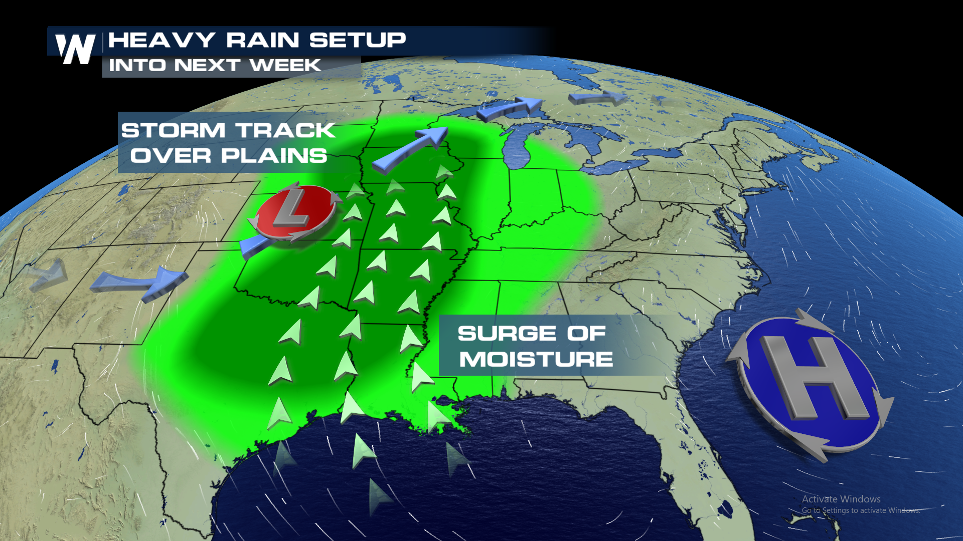
Wet weather will remain in the forecast through the central plains into mid next week, as another round of moisture surges in from the Gulf of Mexico. An area of low pressure will drop on the lee side of the Rockies, combining with an upper level ridge of high pressure off shore of the southeast. These two features will funnel in a southeast flow into portions of next week. This will result in a moist airmass over the area and possibly create flooding issues.
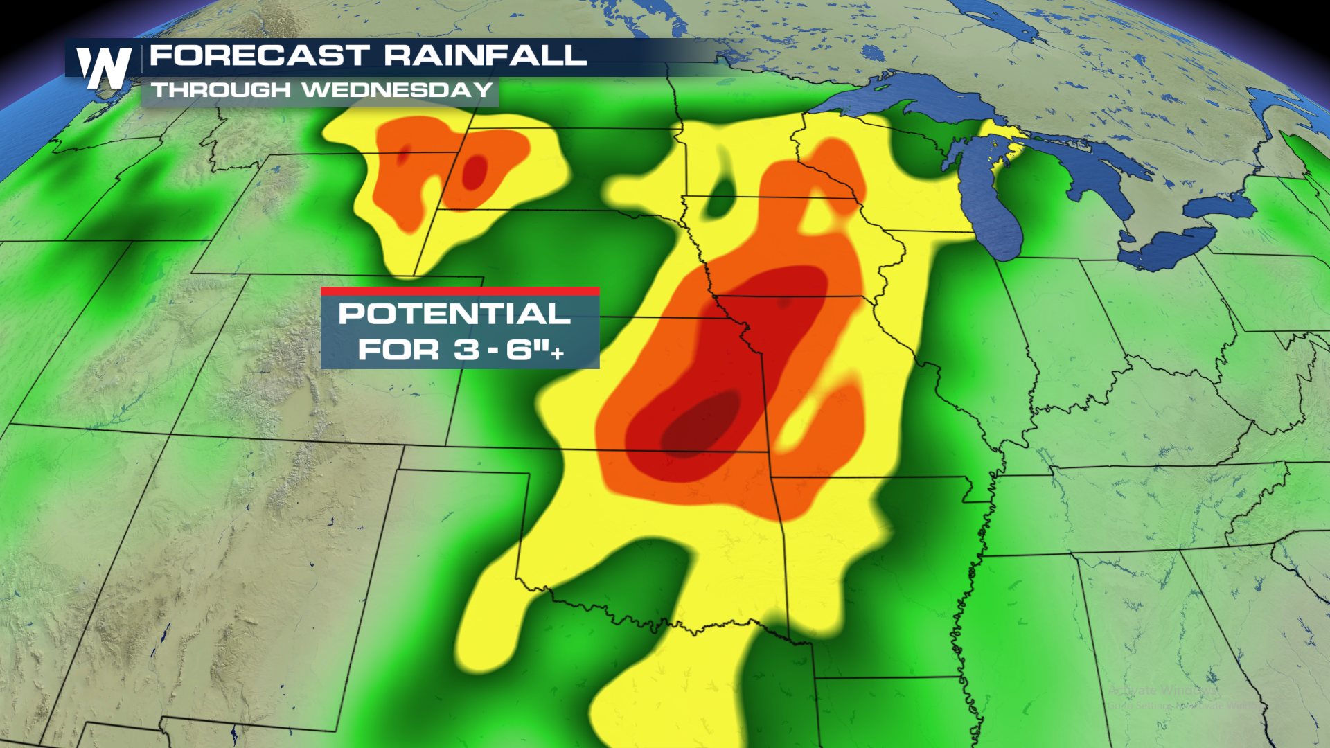
 Anticipated rainfall amounts may exceed 6" in hardest hit areas. These amounts will accumulate from Monday through Wednesday evening.
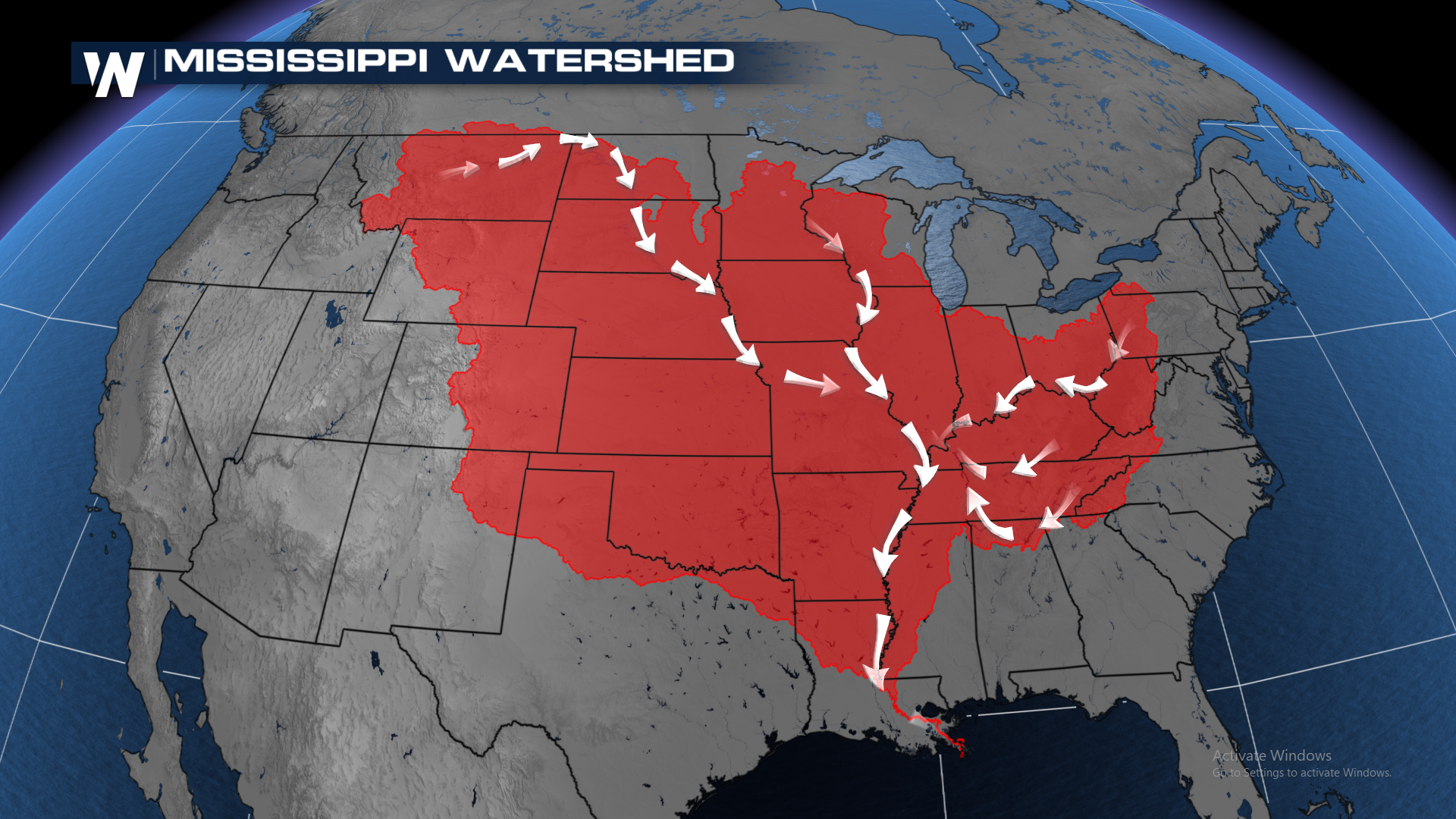
 Most rainfall will eventually drain into the Mississippi River. Here is the watershed imagery of the river.
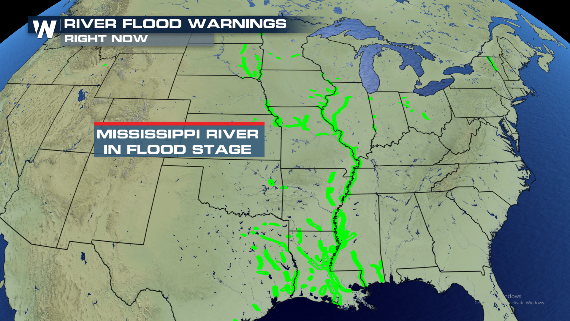
 Unfortunately, the bulk of the Mississippi River is already dealing with flood concerns. The rainfall into next week will only exacerbate the flooding worries along the areas of the Mississippi. Please take caution if working or playing around the river banks over the next few days.
 For WeatherNation, I'm Meteorologist Greg Rule
 Anticipated rainfall amounts may exceed 6" in hardest hit areas. These amounts will accumulate from Monday through Wednesday evening.
 Most rainfall will eventually drain into the Mississippi River. Here is the watershed imagery of the river.
 Unfortunately, the bulk of the Mississippi River is already dealing with flood concerns. The rainfall into next week will only exacerbate the flooding worries along the areas of the Mississippi. Please take caution if working or playing around the river banks over the next few days.
 For WeatherNation, I'm Meteorologist Greg Rule
All Weather News
More