Continued Heavy Rain for the Southeast Wednesday
Top Stories
16 Oct 2019 4:20 AM
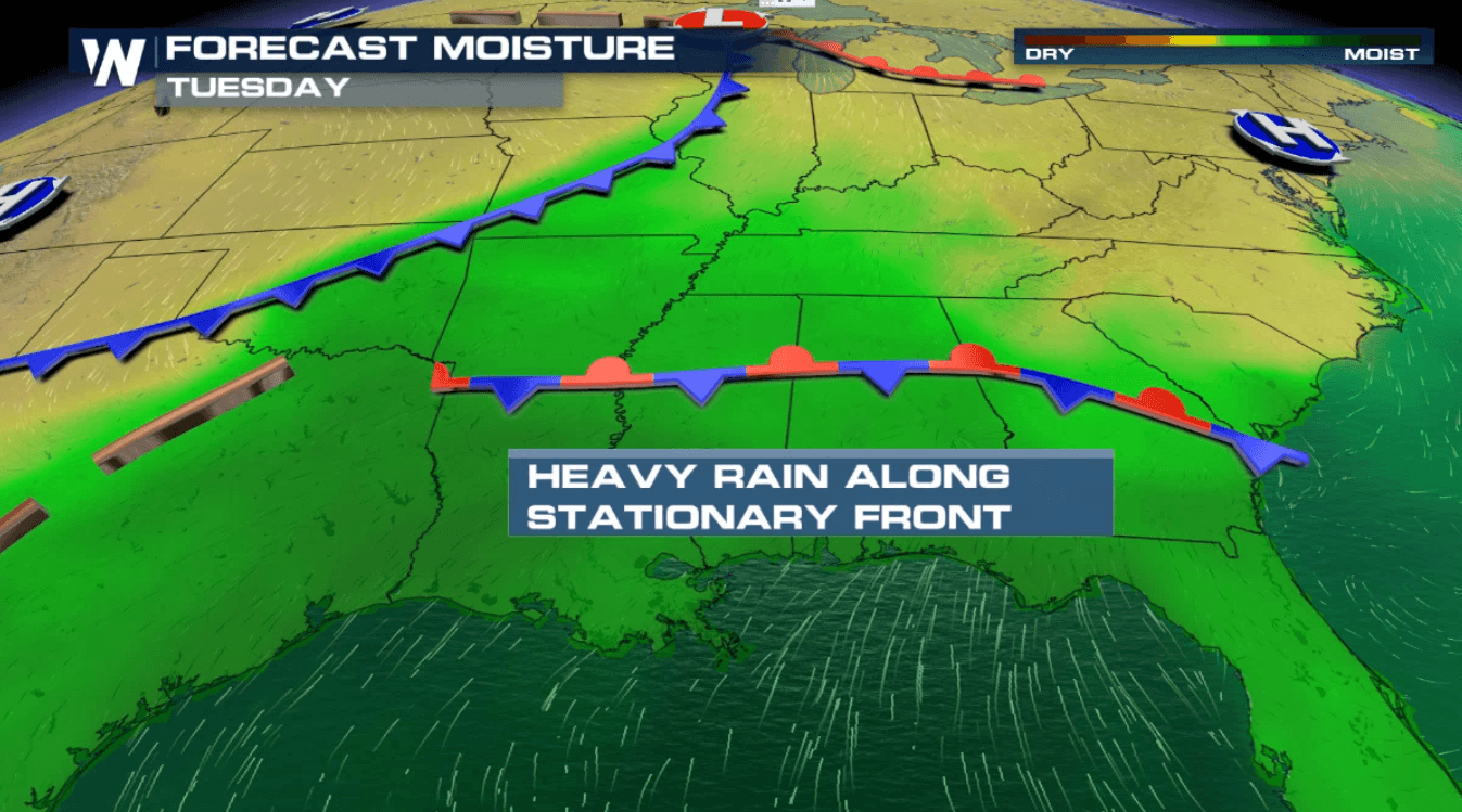
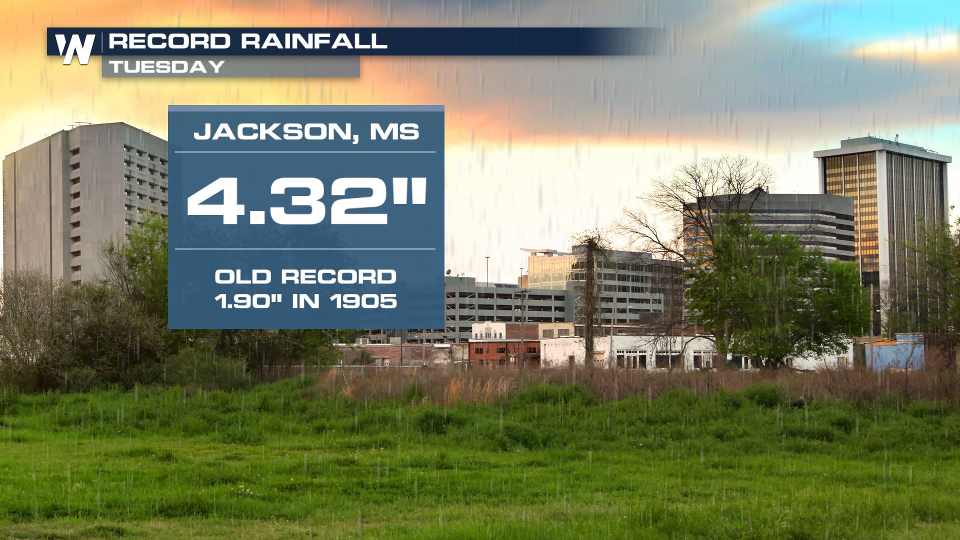
A stationary front draped over the Southeast will continue to bring showers and thunderstorms over the next few days. Locally heavy rainfall will be possible across areas of the deep south and we've already seen record-setting daily rain in parts of Mississippi.
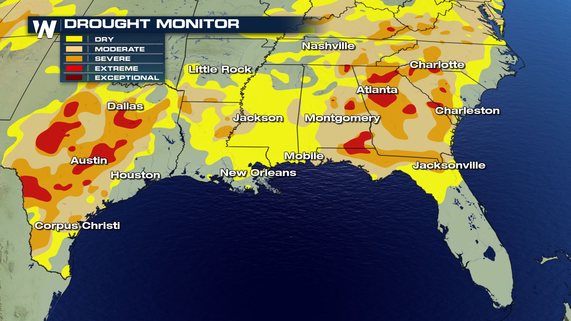
While there is a potential for flooding and flash flooding across Southeast, it's also a good thing to help with the current drought. You can read more on the drought at this link.
Rainfall Reports
Thunderstorms have already been producing heavy rainfall in portions of the South and Southeast. Some areas have seen more than 2-3" of rain in a short amount of time.
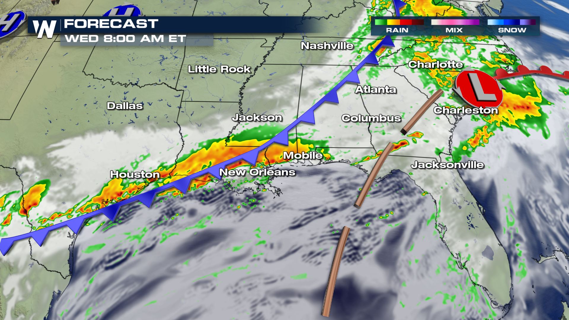
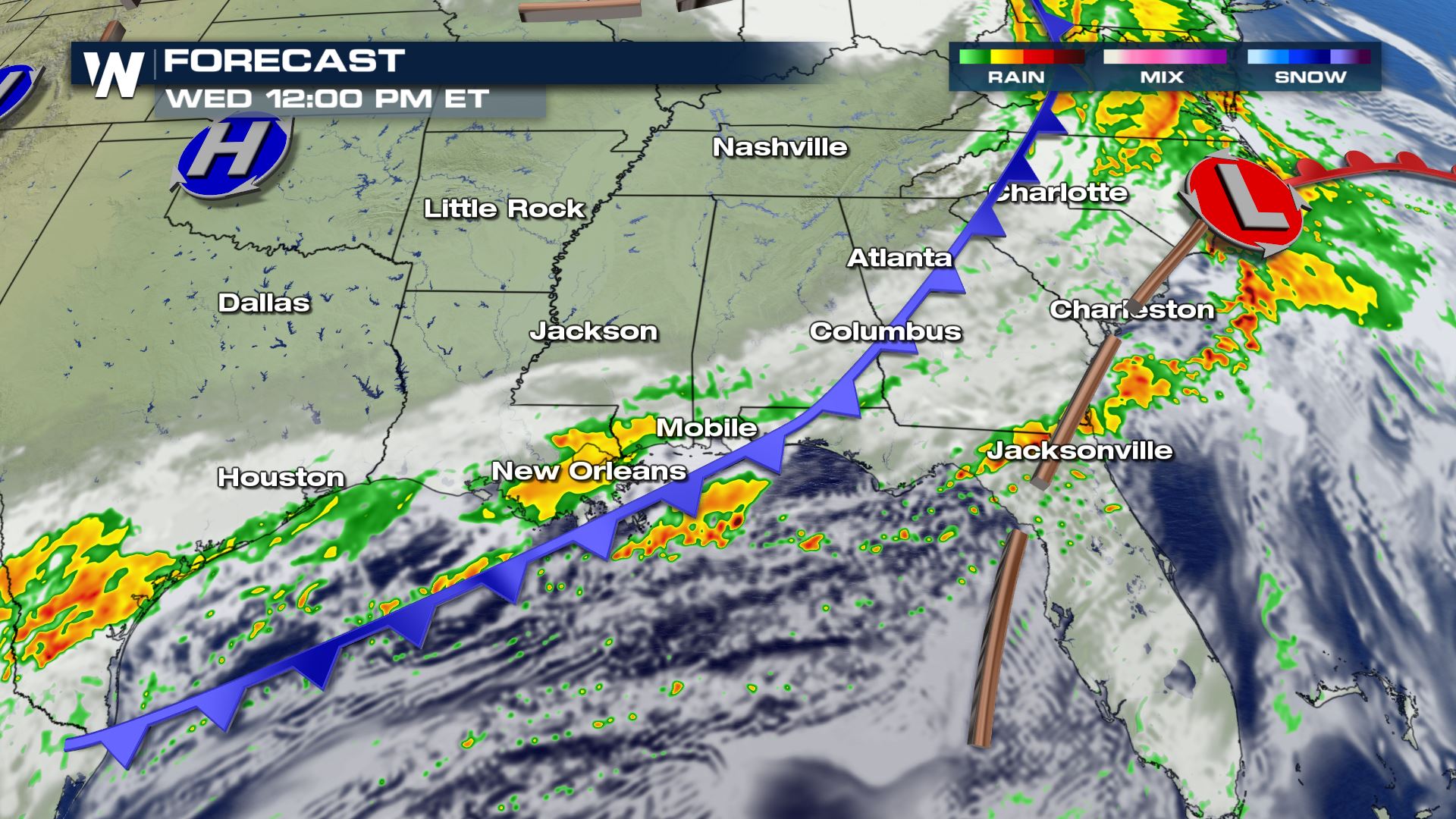
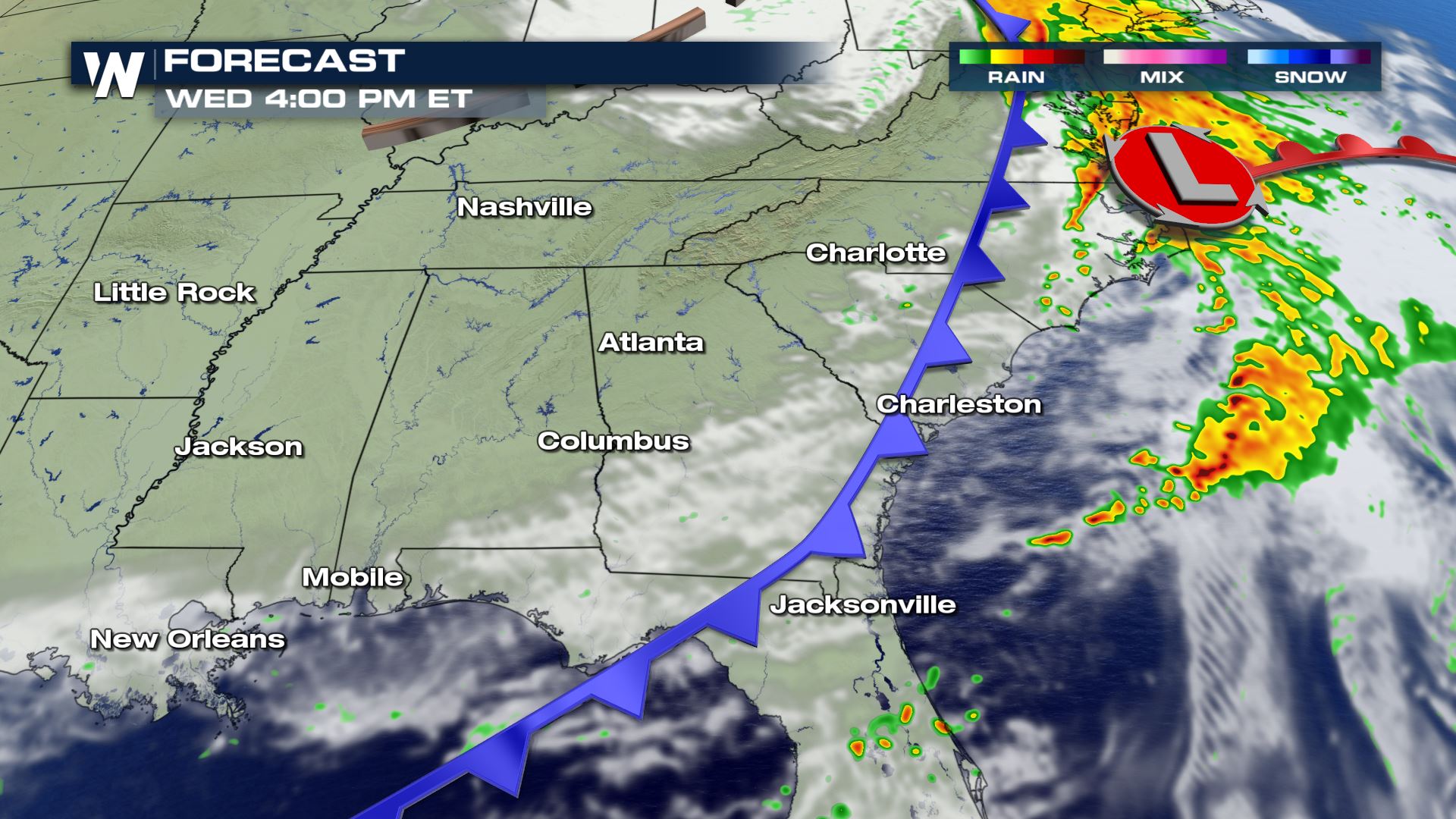 A cold front sweeping into the region from the west will produce more storms into Wednesday, tapering off by later in the evening for most of the region.
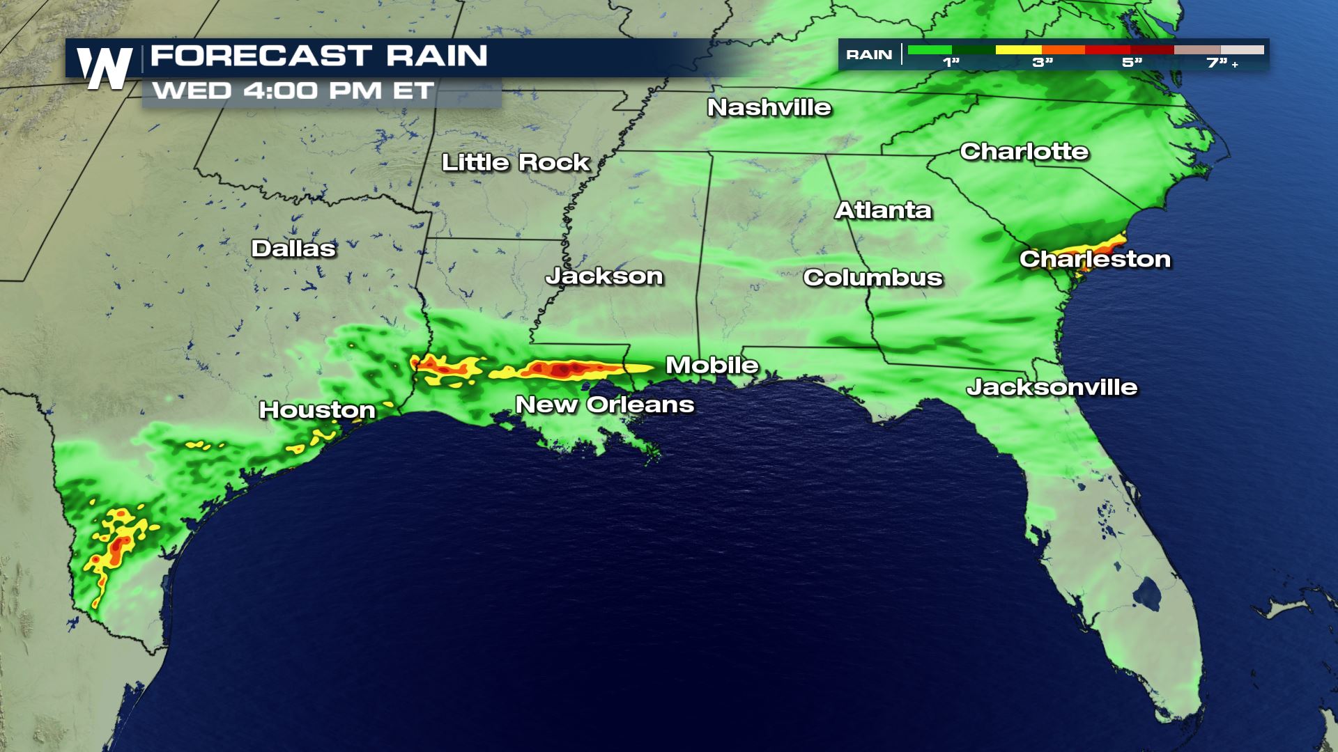 From northern Louisiana to South Carolina, heavy rain will be possible through tonight. Our forecast model is showing some places seeing more than 5" of rainfall. You will want to be on alert for flooding in these areas with the heavy rain risk.
WeatherNation will have more updates all day on this heavy rain risk.
From northern Louisiana to South Carolina, heavy rain will be possible through tonight. Our forecast model is showing some places seeing more than 5" of rainfall. You will want to be on alert for flooding in these areas with the heavy rain risk.
WeatherNation will have more updates all day on this heavy rain risk.
Drought Monitor
Rainfall Reports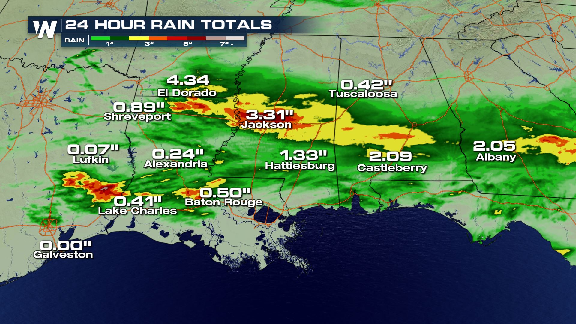
Thunderstorms have already been producing heavy rainfall in portions of the South and Southeast. Some areas have seen more than 2-3" of rain in a short amount of time.
Forecast
A cold front sweeping into the region from the west will produce more storms into Wednesday, tapering off by later in the evening for most of the region.
Rainfall Potential
From northern Louisiana to South Carolina, heavy rain will be possible through tonight. Our forecast model is showing some places seeing more than 5" of rainfall. You will want to be on alert for flooding in these areas with the heavy rain risk.
WeatherNation will have more updates all day on this heavy rain risk.All Weather News
More
Tropics: Fausto Heads towards Hawaii; Genevieve Cat 4 Hurricane
PacificHurricane Fausto continues to track we
27 Jul 2026 11:00 PM

Severe Storms Target the Midwest to the Northeast
UPPER MIDWEST - Dangerous tornadoes have alre
27 Jul 2026 10:20 PM


Southeast Flood Risk Lingers Near Stalled Front
A stalled boundary over the Southeast will ke
25 Jul 2026 10:55 AM

Another Round of Storms Targets the Northeast
Tuesday brought severe weather again across p
23 Jul 2026 1:15 AM

Another Round of Severe Weather for the Upper Midwest and Great Lakes
The upper-level low train continues to keep t
21 Jul 2026 1:45 AM