Heavy Rain and Severe Storms Possible in Florida Today, Arklatex Friday
Special Stories
10 Apr 2018 10:20 AM
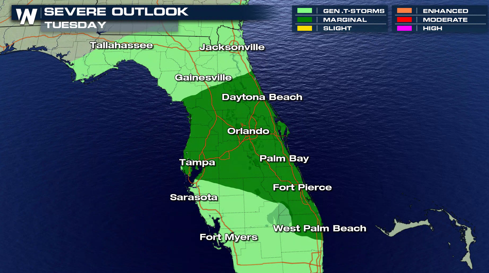
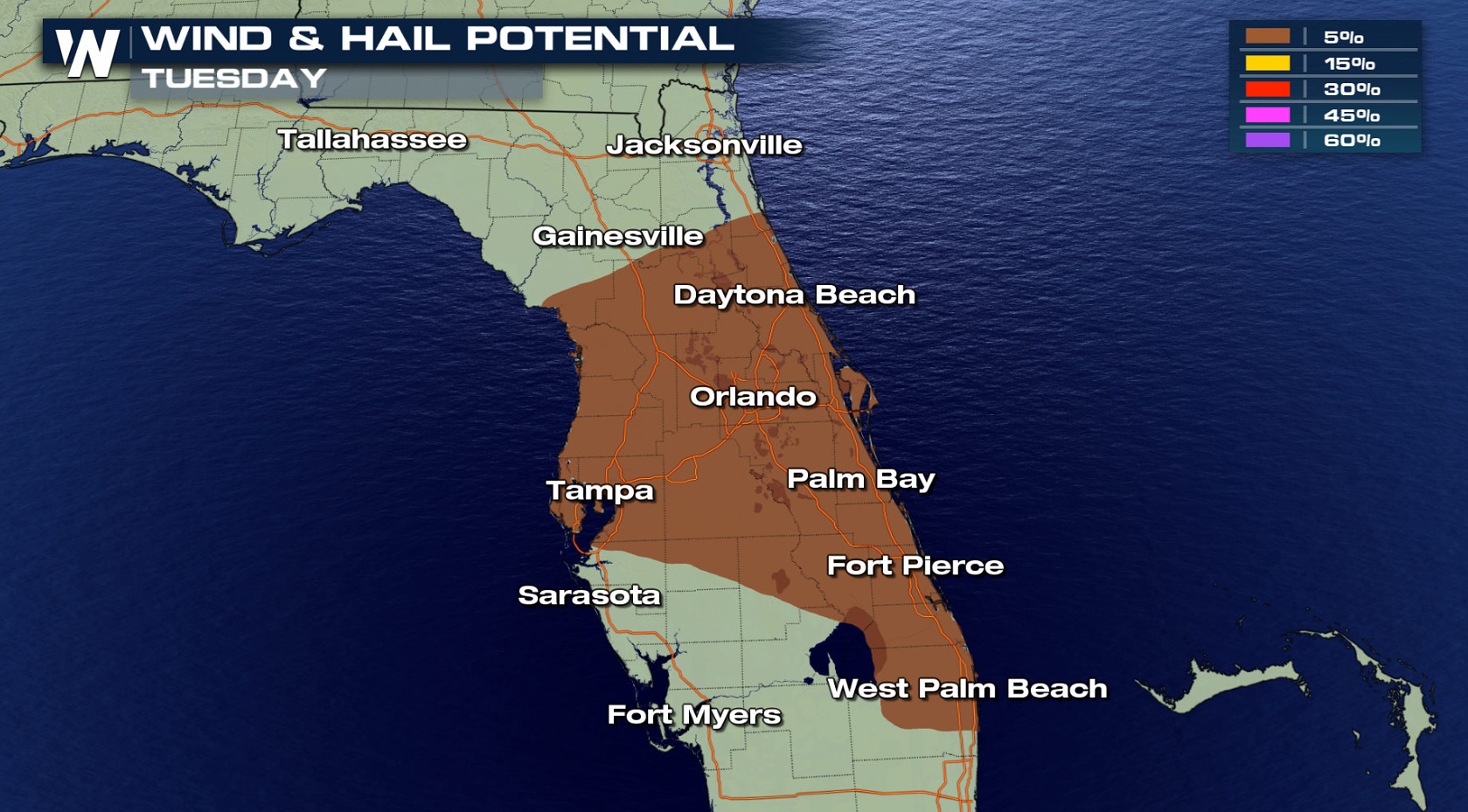
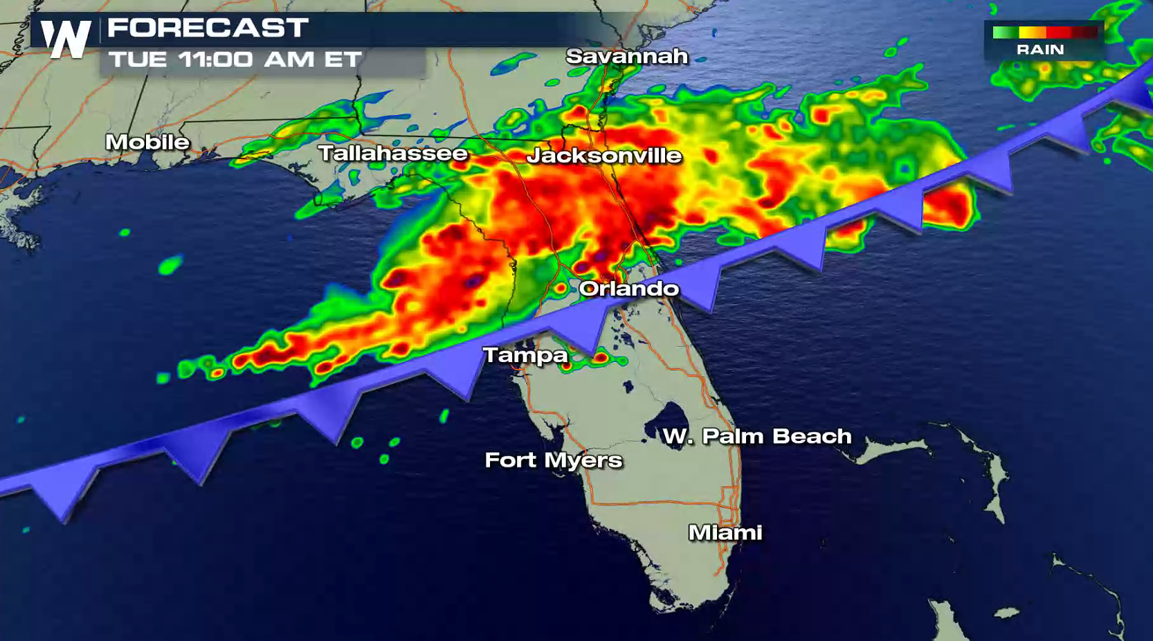
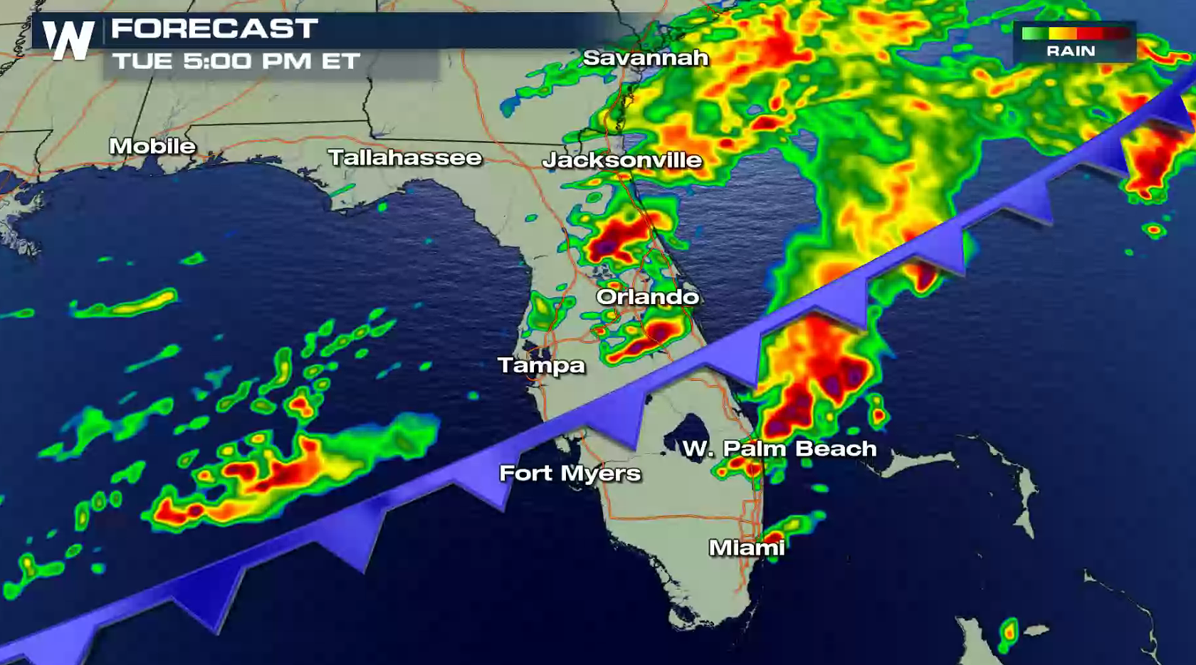
A cold front pushing through Florida will produce rounds of showers and thunderstorms throughout the day. Some storms will produce flooding rain and may become severe with strong winds and large hail. A marginal risk has been issued from the Storm Prediction Center for central and eastern Florida.
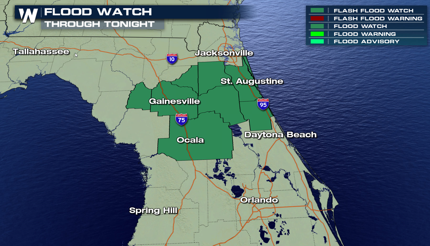
 A Flood Watch has been issued through tonight from the Green Swamp area to the First Coast. Heavier storms into this evening may produce rain totals of three or more inches.
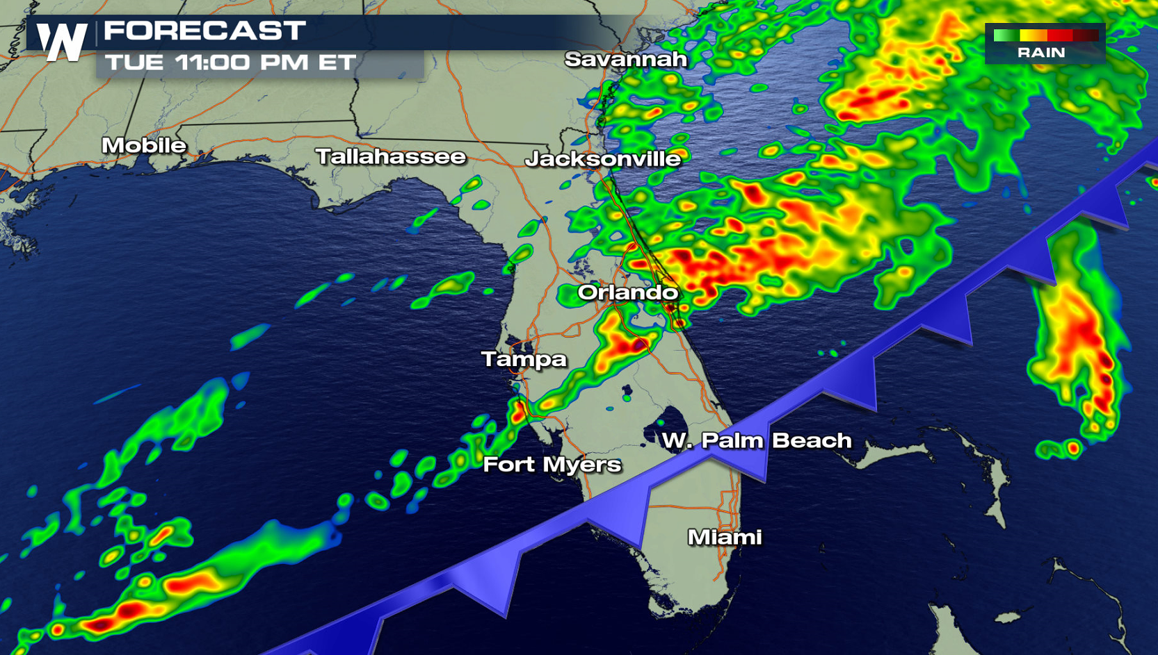
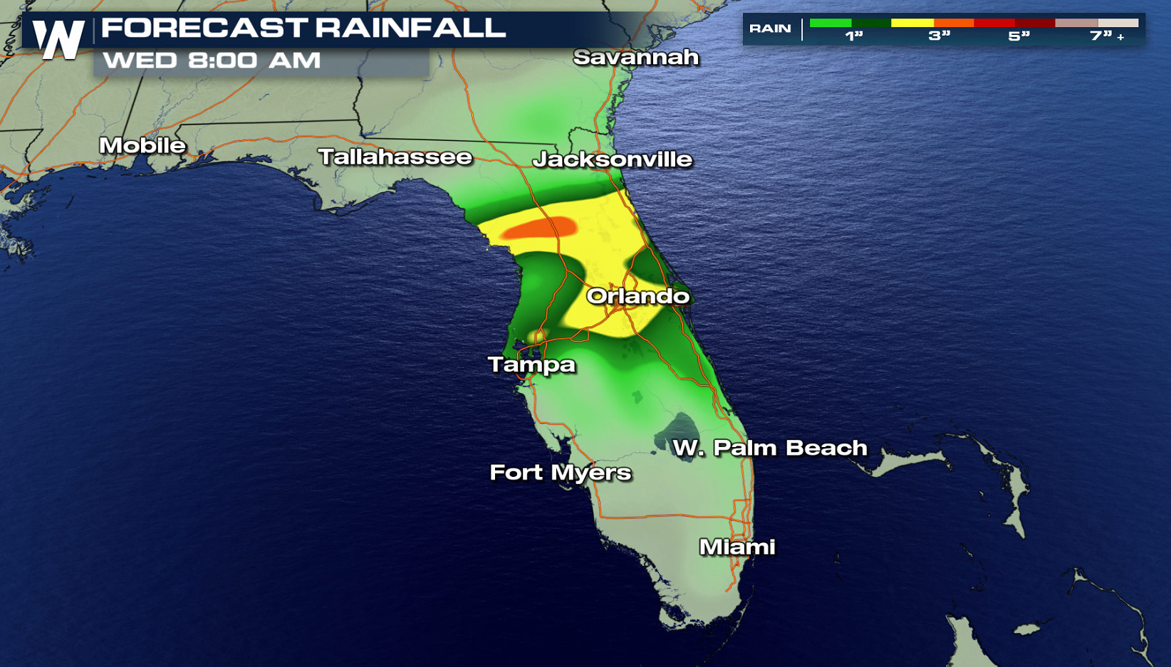 Thunderstorms through the midday hours will be most likely found along and north of the I-4 corridor. As the front slides to the south and an east coast sea breeze forms, storms will form into the Space Coast and I-95 corridor. Rain will continue into the overnight hours, but storms will weaken below severe limits.
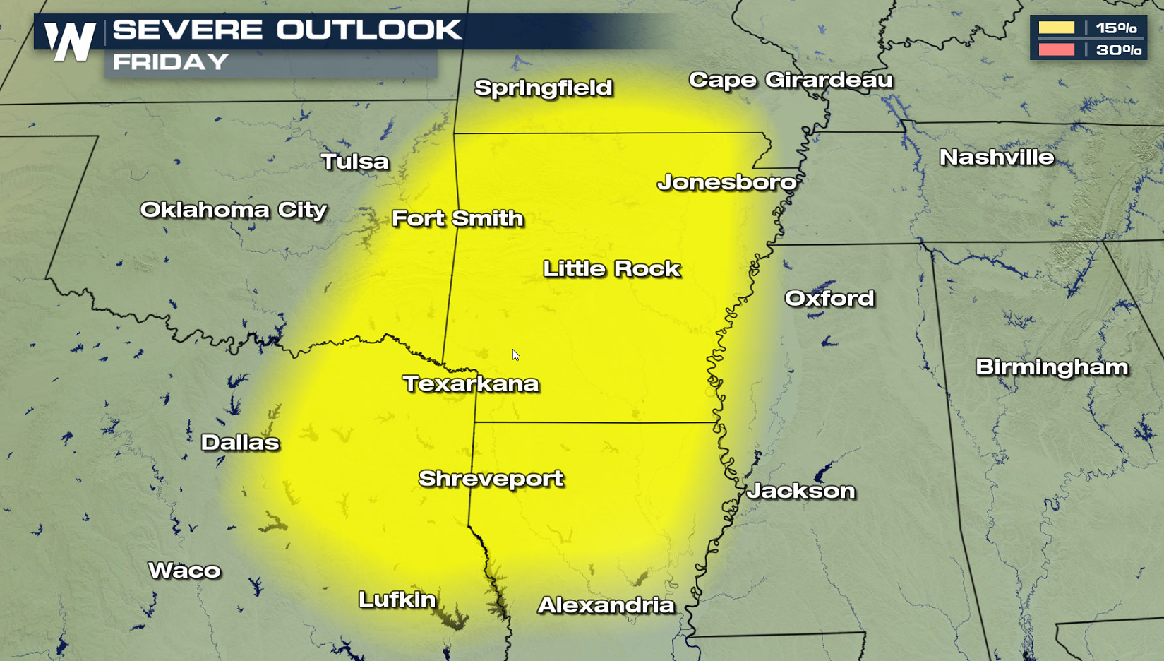
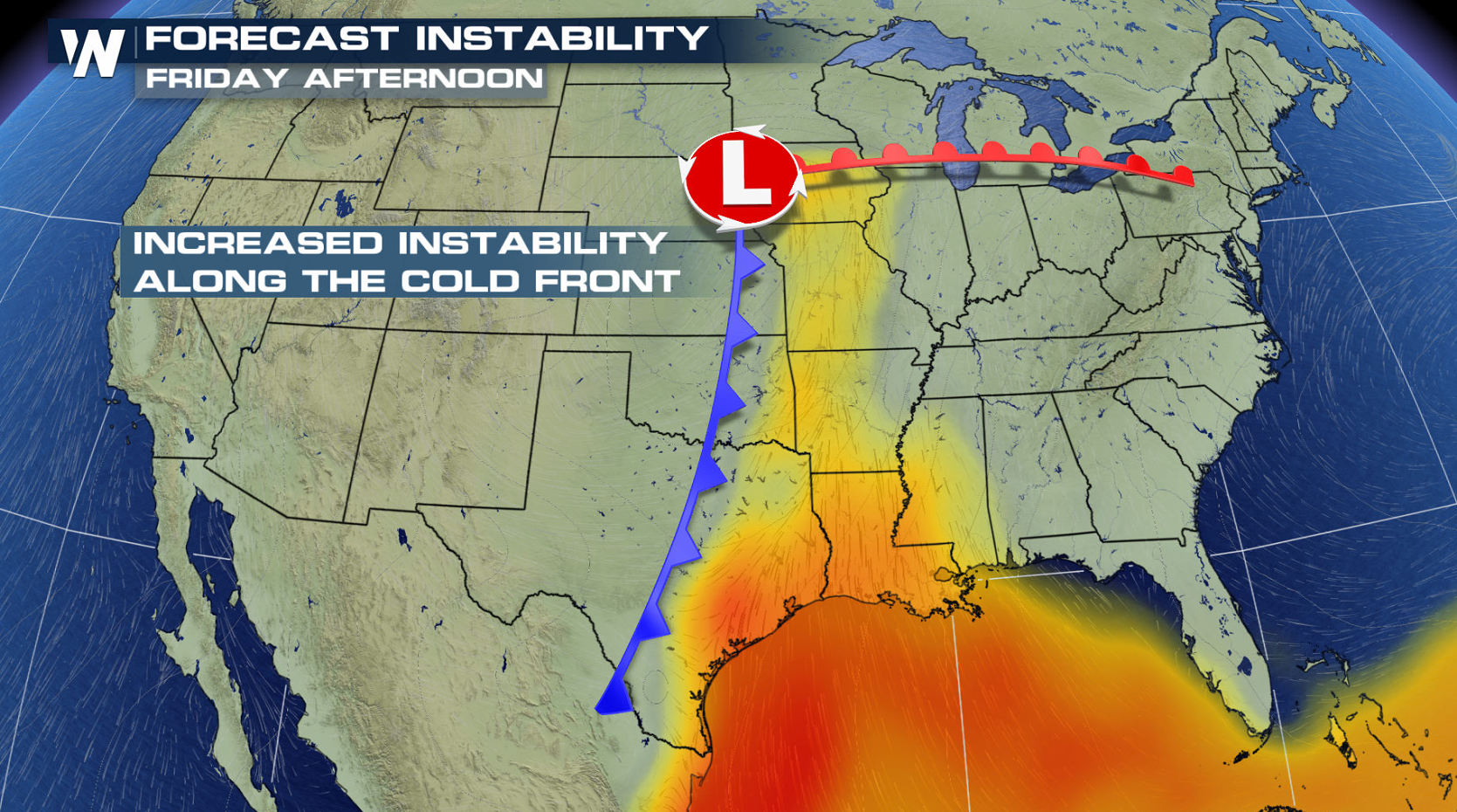
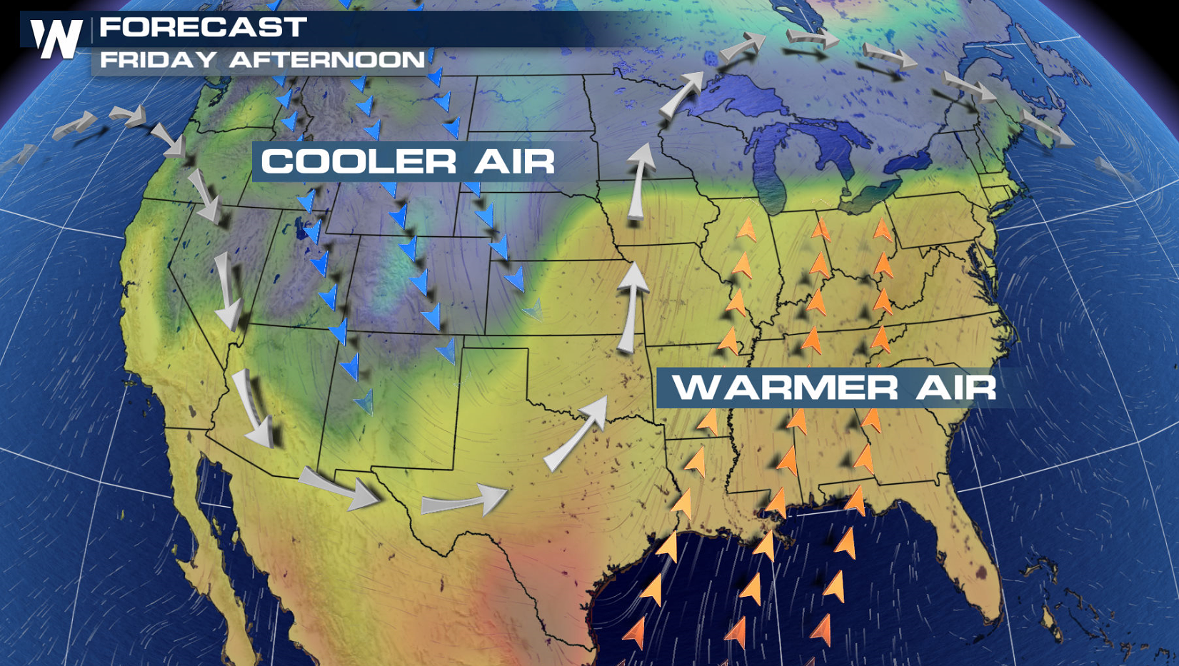
 On Friday, another area of severe storms will likely form around the Arklatex region. A sharp cold front will sweep up higher humidity and warmer temperatures from the Gulf of Mexico. Strong Jet Stream energy will help to fuel storms in the late afternoon and early evening.
 For WeatherNation: Meteorologist Mace Michaels

 A Flood Watch has been issued through tonight from the Green Swamp area to the First Coast. Heavier storms into this evening may produce rain totals of three or more inches.

 Thunderstorms through the midday hours will be most likely found along and north of the I-4 corridor. As the front slides to the south and an east coast sea breeze forms, storms will form into the Space Coast and I-95 corridor. Rain will continue into the overnight hours, but storms will weaken below severe limits.


 On Friday, another area of severe storms will likely form around the Arklatex region. A sharp cold front will sweep up higher humidity and warmer temperatures from the Gulf of Mexico. Strong Jet Stream energy will help to fuel storms in the late afternoon and early evening.


 For WeatherNation: Meteorologist Mace Michaels
All Weather News
More