Foot of Rain in the Deep South, More Ahead
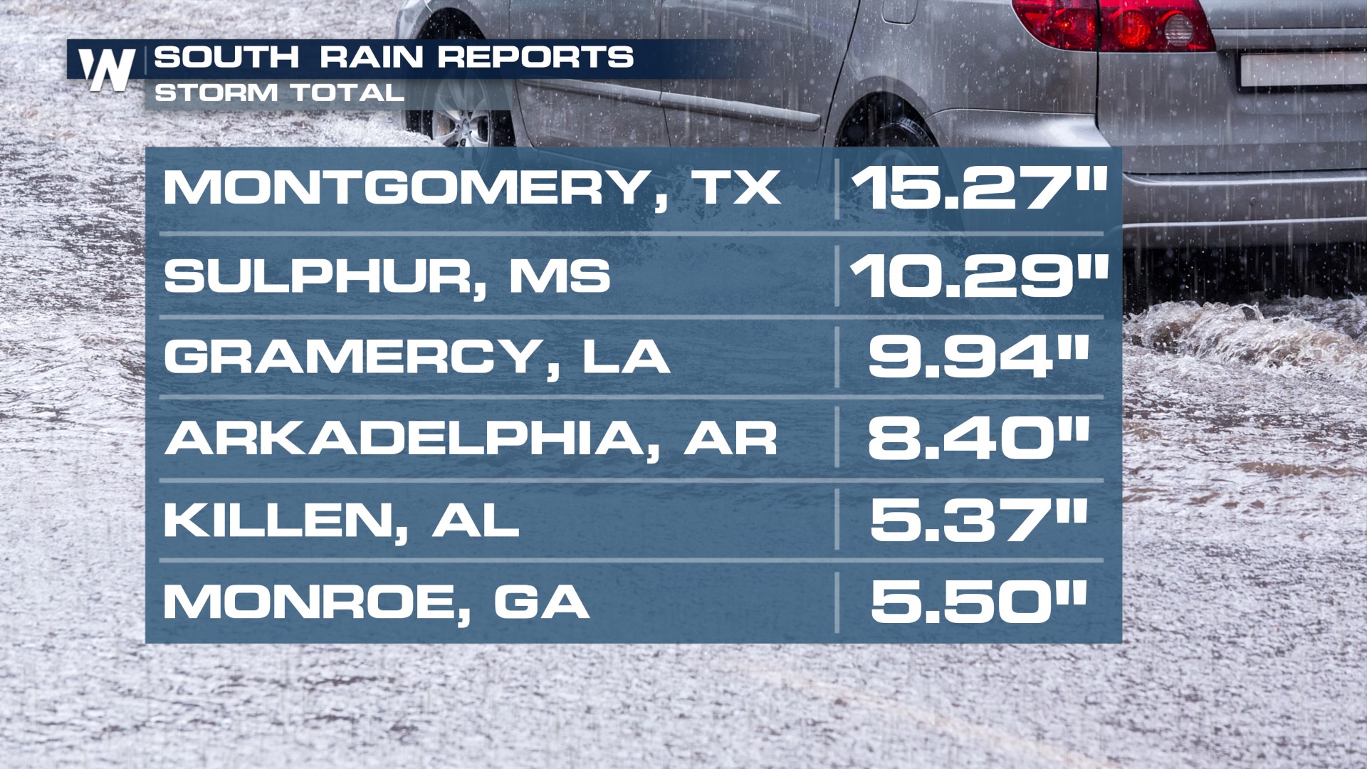
Several storm systems continue to tap into warm and moist air from the Gulf of Mexico, creating intense rainfall that's led to widespread flooding across the South this week. Rainfall topping a foot has led to rivers swelling in SE Texas and Louisiana, where major and moderate flood stages have been reached for several areas. Thankfully, after rain on Saturday, these areas will get a break Sunday through most of next week.
 Rainfall totals across the South & Southeast have topped 7" in many locations. A flash flood emergency was issued for St. Tammany Parish north of New Orleans on Wednesday due to 6" of rain in less than 24 hours causing widespread flooding.
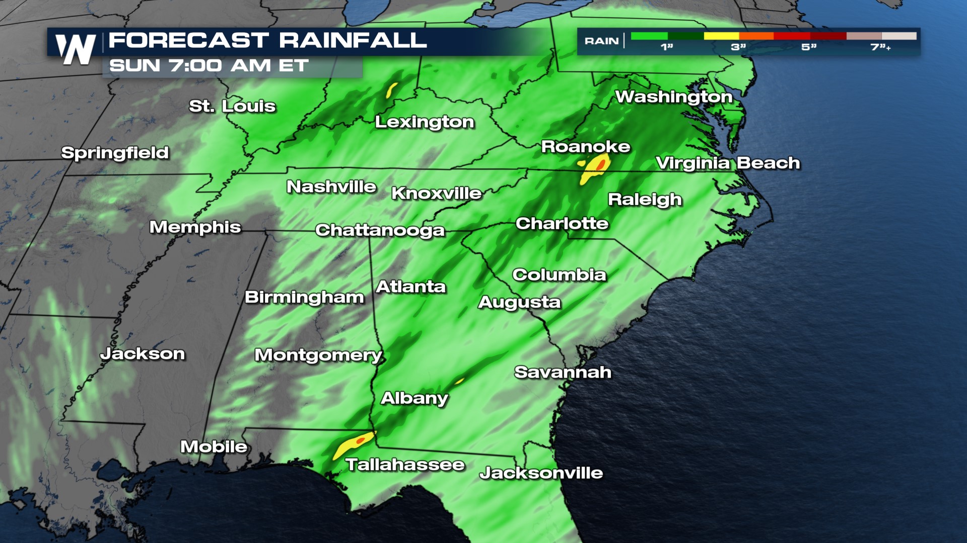
Flood Alerts continue through Sunday morning and totals in the range of 1-3" will be possible for much of Alabama, northern Mississippi, and Tennessee through Sunday. There is the potential for isolated 4-6" of rain is possible along I-65.
 Multiple rounds of rainfall and thunderstorms will continue through the end of the week and into the weekend as this system moves towards the east. Storms will be active during the overnight hours, so please be sure to have multiple ways to get alerts during the night.