Widespread Rain Continues for Central U.S.

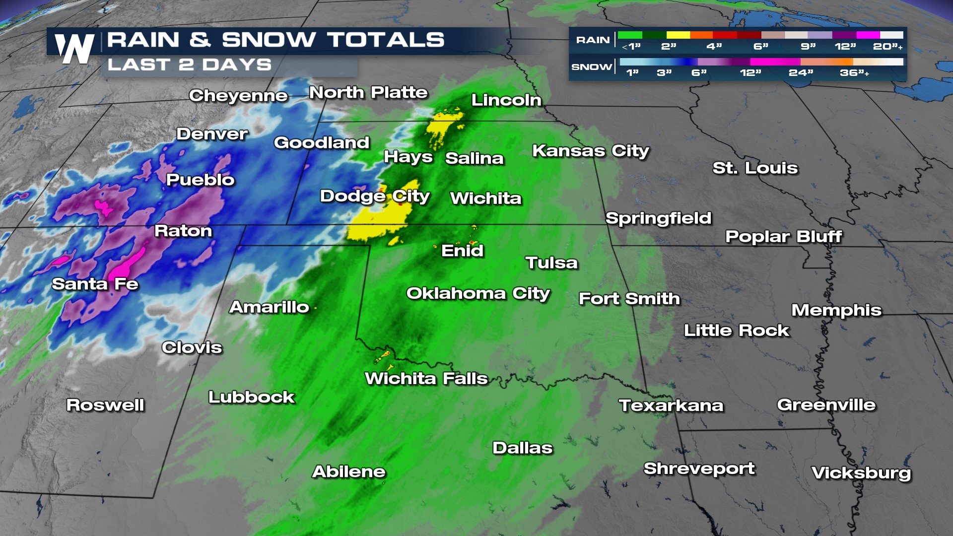
An upper-level low moving out of the Southwest into the Plains generated heavy snow through Colorado and New Mexico, and heavy rain for parts of the Plains. Snow totals of 10-17" fell in the mountains of Colorado and New Mexico, with 1-2" of rain from western Texas through Kansas! As this low finally gets caught back up in the jet stream, the rain will push into the rest of the Deep South Saturday.
 The heaviest rainfall shifts to the ArkLaTex late Friday through Saturday, giving needed-rainfall to areas of Louisiana and the Mississippi River Basin. In cities such as Shreveport, Texarkana, and Tyler, we could see 1-2" of rain and isolated pockets of flooding.
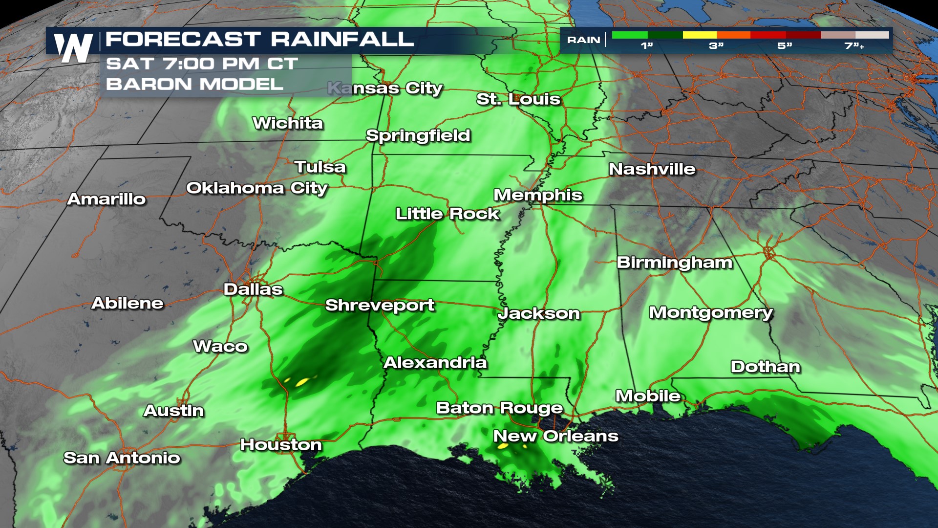 The rain that falls across the region is much-needed rain, as drought conditions gripping many in the South. However, with the rain falling at rapid rates and over the same regions, it will cause some concern for flooding. The Storm Prediction Center [SPC] has also highlighted the region as a "general thunderstorm risk" Friday and Saturday as this system moves through, but temperatures are too cool to support severe storms.
After this system exits, warmer weather and sunshine returns heading into the weekend!


