Heavy Rain Threat Targets Florida Through Midweek
Special Stories
18 Apr 2021 3:10 AM
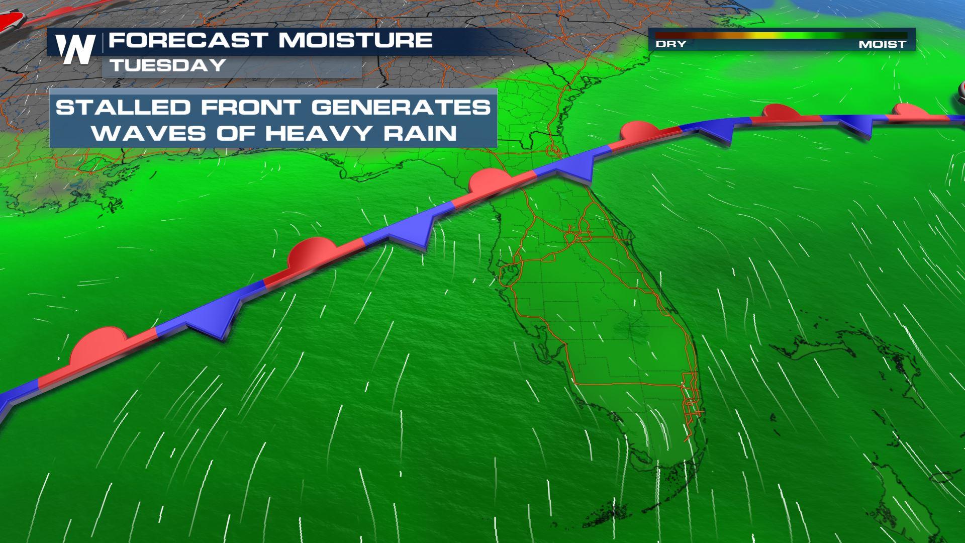
Heavy showers and thunderstorms are expected to linger along a frontal boundary through the first half of the upcoming week. That frontal boundary has brought several days of heavy rain and severe storms to portions of the Gulf Coast already, but now will shift slightly south into Central and Northern Florida.
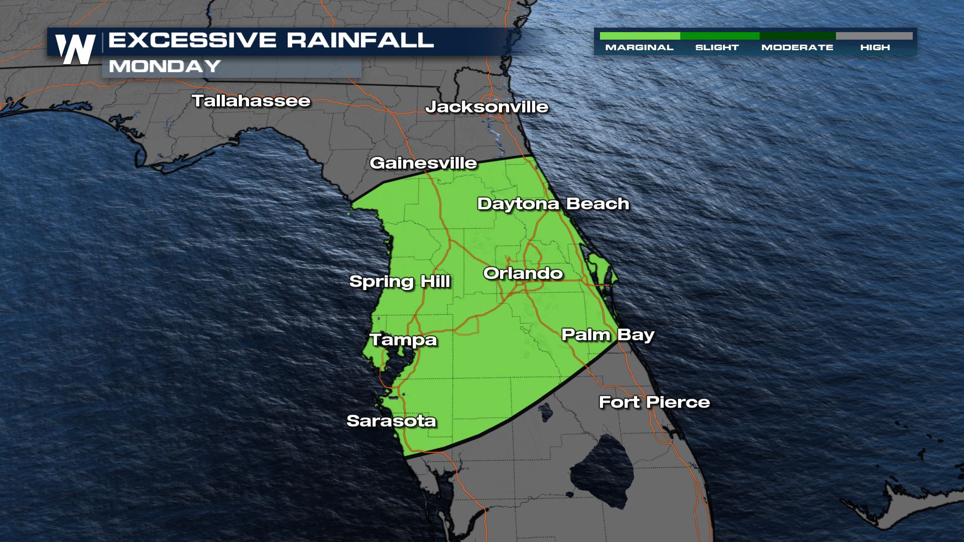
Excessive rainfall outlooks have been issued for Sunday and Monday. This locations will see the potential for isolated flash flooding to develop.
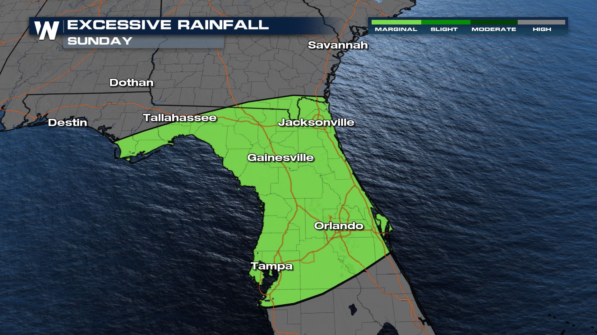
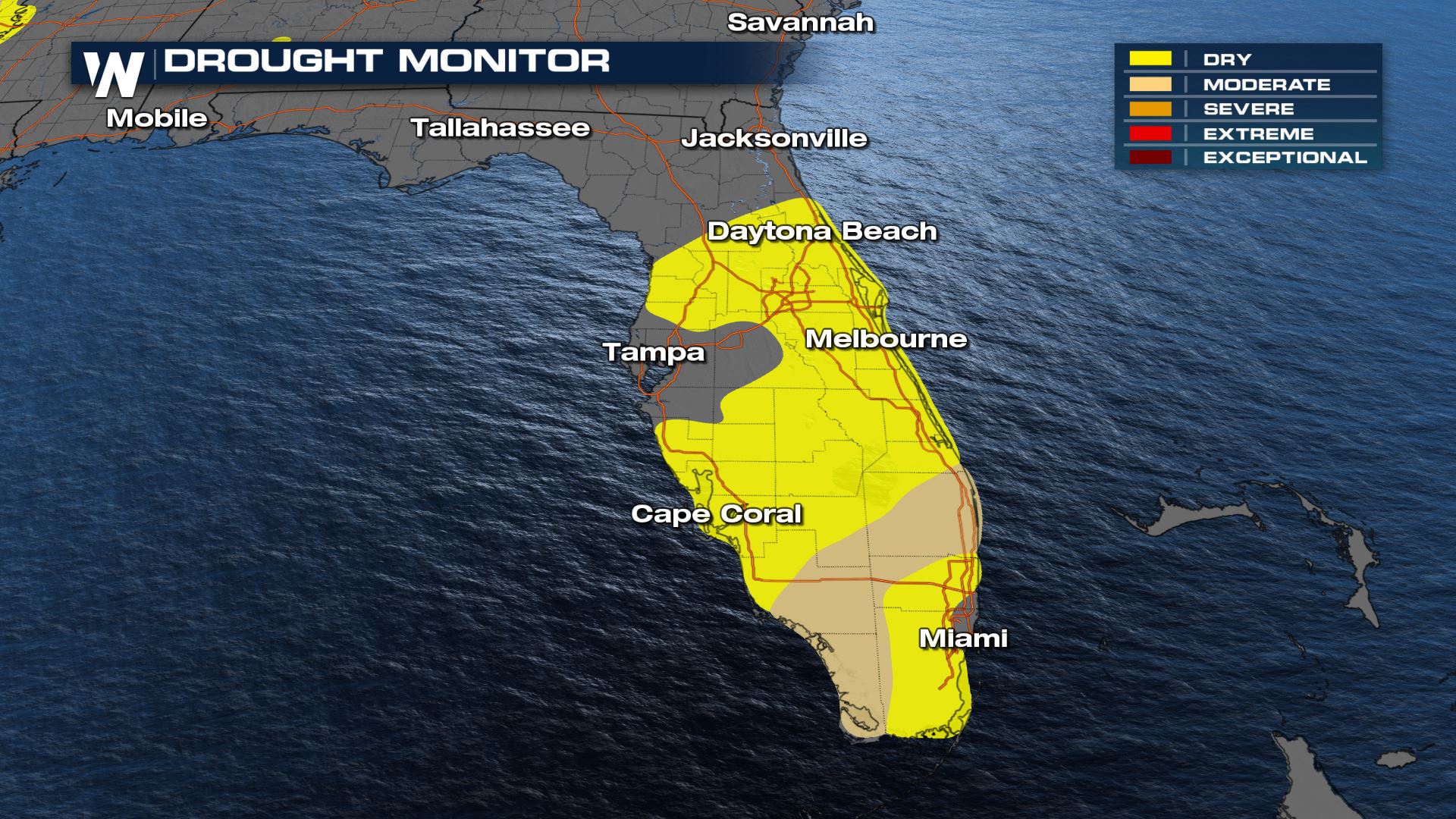
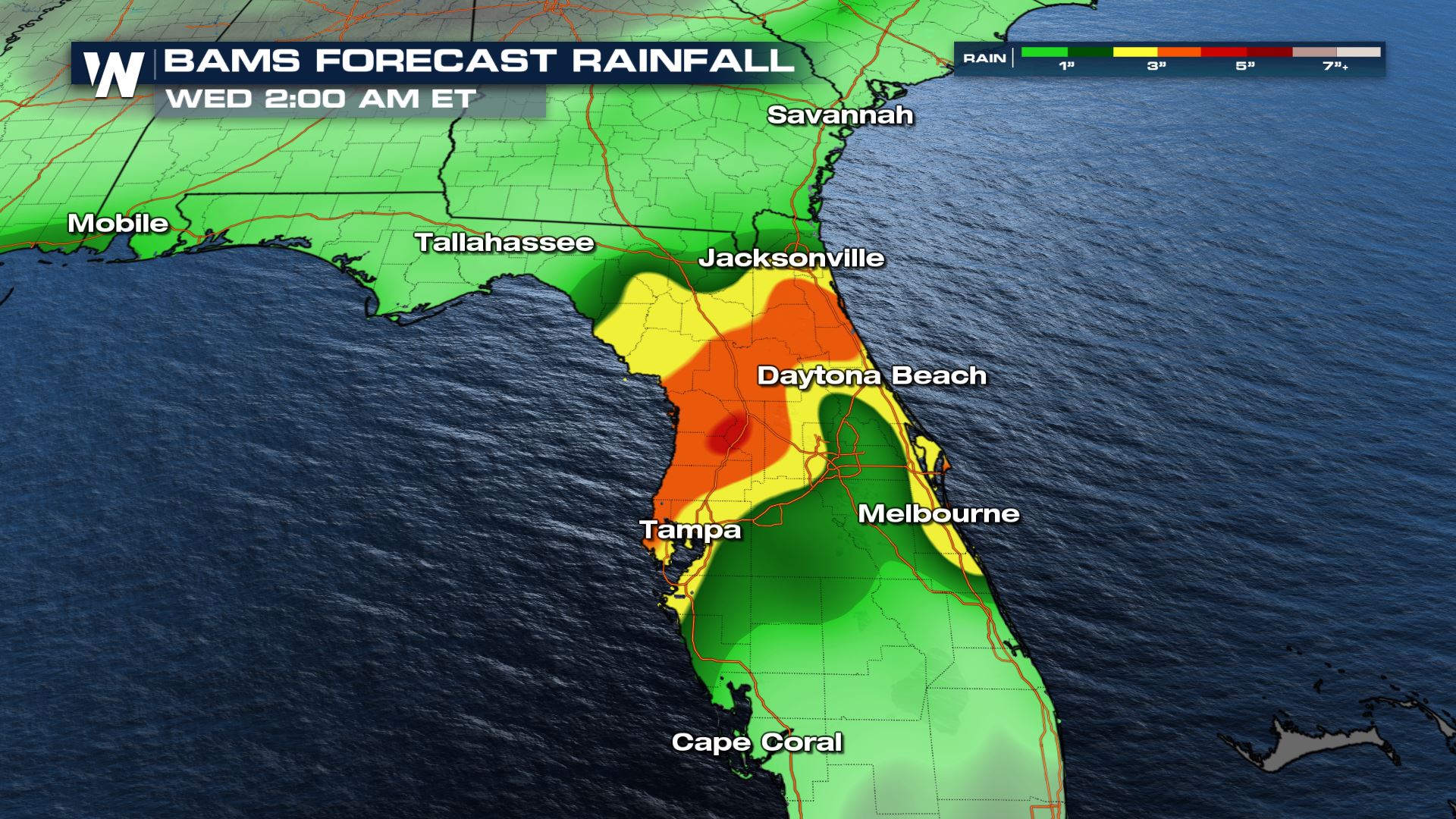 Rain totals between 4-6 inches are possible for some locations, especially between the I-10 and I-4 corridors. Some of these locations could use the rain though. The late winter and early spring are typically Florida's driest portion of the year, with wildfires possible at times. Some locations are considered dry or even in moderate drought.
 Stay with WeatherNation for updates on air and online.
Forecast
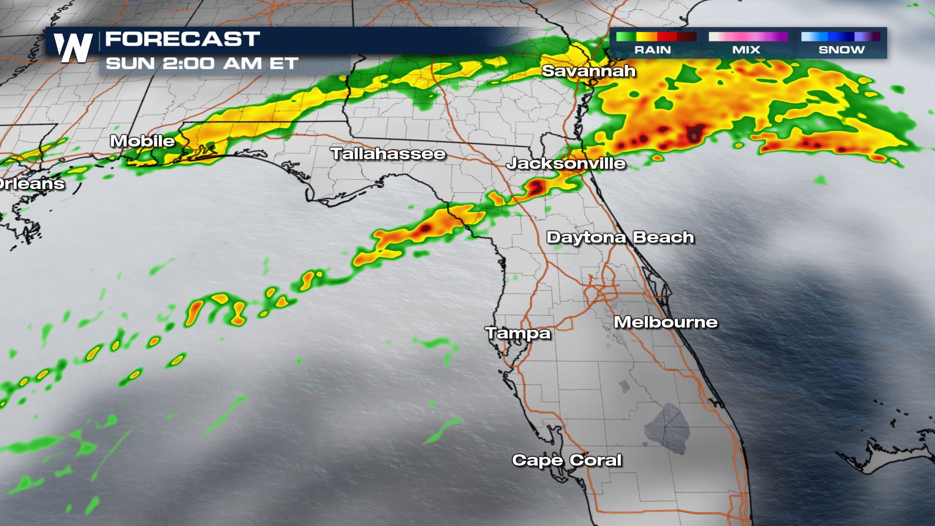
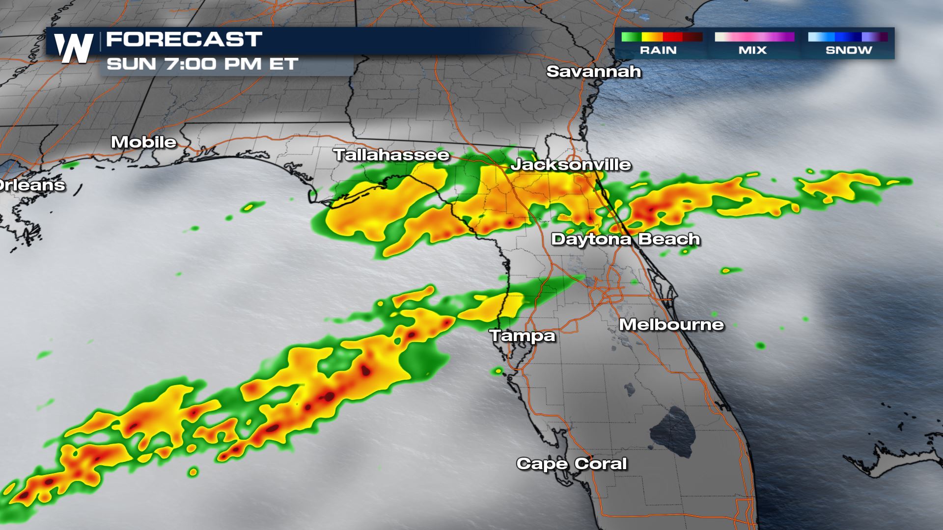
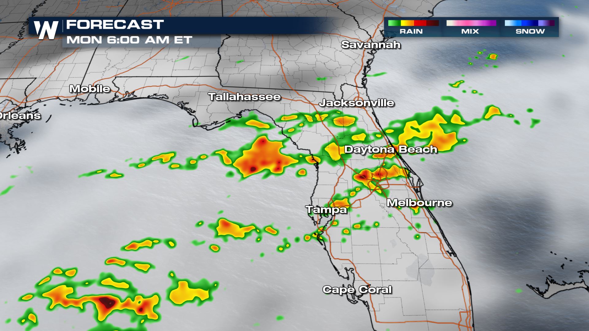
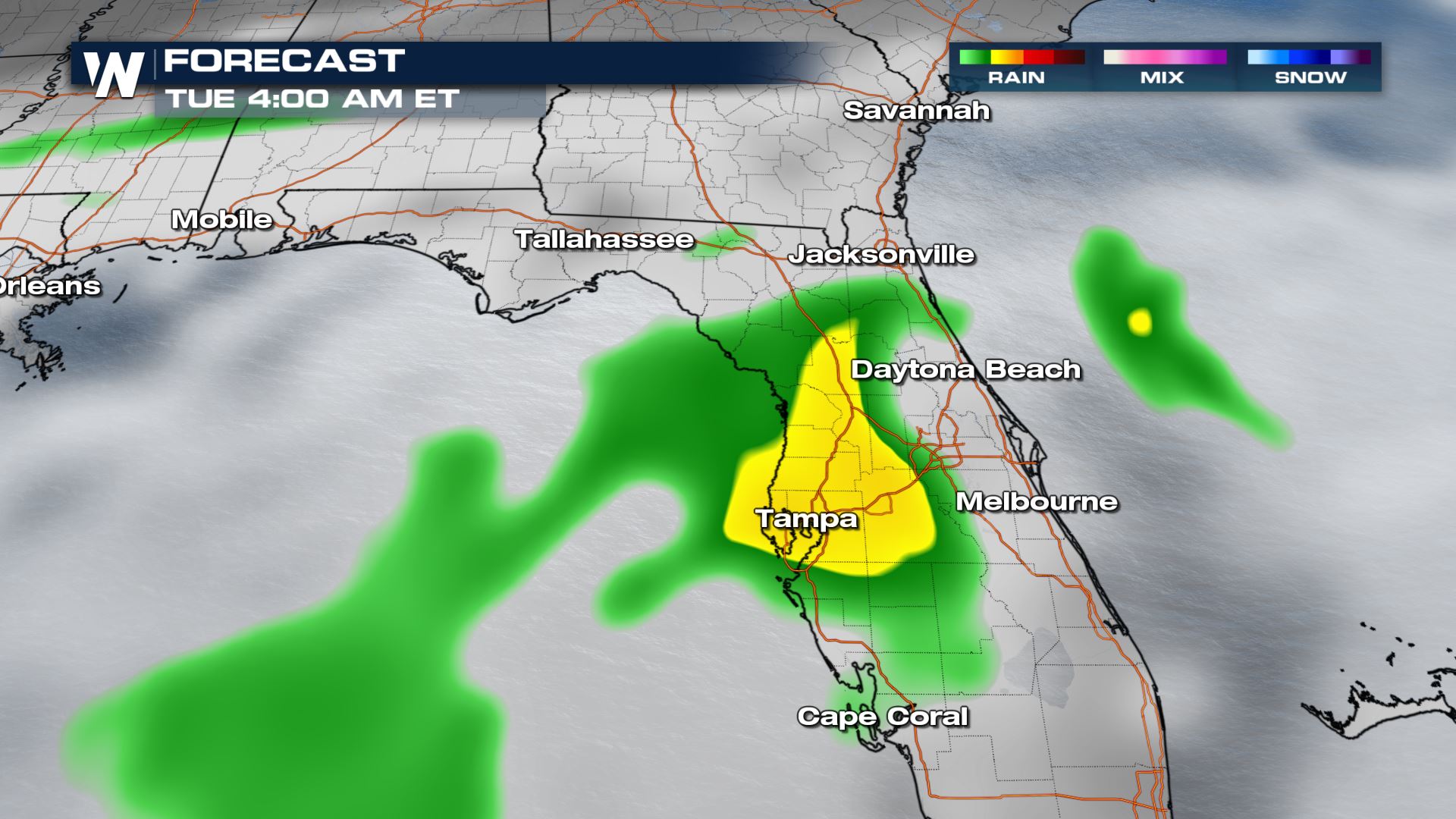
Multiple waves of showers and thunderstorms are expected today through Tuesday night. Areas that are hit with multiple thunderstorms will be at a greater risk of flash flooding.
Rain totals between 4-6 inches are possible for some locations, especially between the I-10 and I-4 corridors. Some of these locations could use the rain though. The late winter and early spring are typically Florida's driest portion of the year, with wildfires possible at times. Some locations are considered dry or even in moderate drought.
Stay with WeatherNation for updates on air and online.All Weather News
More
More Storms for the East Through Monday
A low-pressure system that moved through the
2 Aug 2026 10:40 PM

Wildfire Outbreak in the Pacific Northwest
SPOKANE, WA - On Saturday, August 1st, the Ol
2 Aug 2026 10:35 PM


After Reaching Category 5, Genevieve Weakens in the Pacific
PacificGenevieve formed on last Friday south
2 Aug 2026 6:25 PM

Flooding, Severe Storms Target the Midwest Again
After an active week of storms across the nor
1 Aug 2026 1:40 AM

Flooding Risk Increases as Heavy Rain Targets the Tri-State Area
Tuesday, heavy rainfall moved across the Nort
30 Jul 2026 12:25 AM

Severe Weather: Energy From the Midwest Now in the Southeast
UPPER MIDWEST - Through Monday, dangerous tor
29 Jul 2026 10:30 PM