Heavy Lake Effect Snow for the Great Lakes
Top Stories
28 Feb 2020 8:30 AM
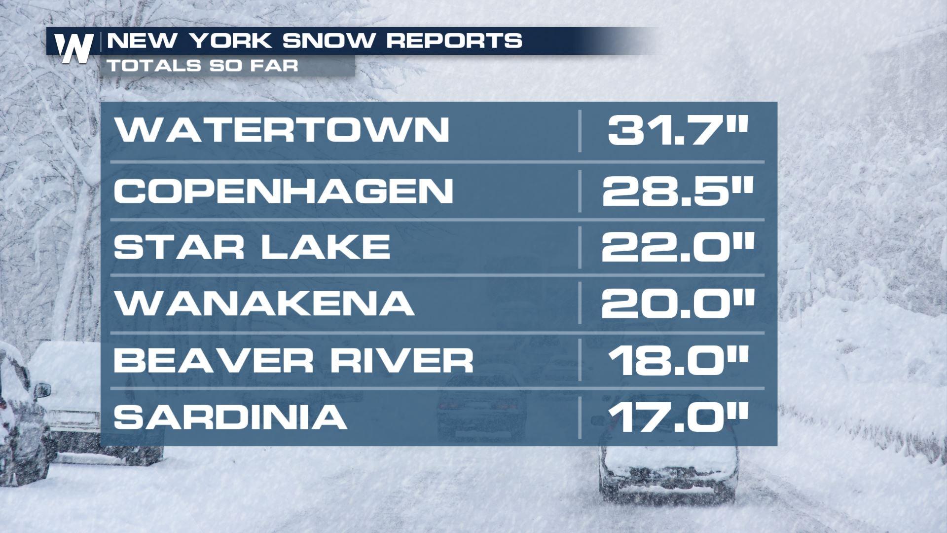
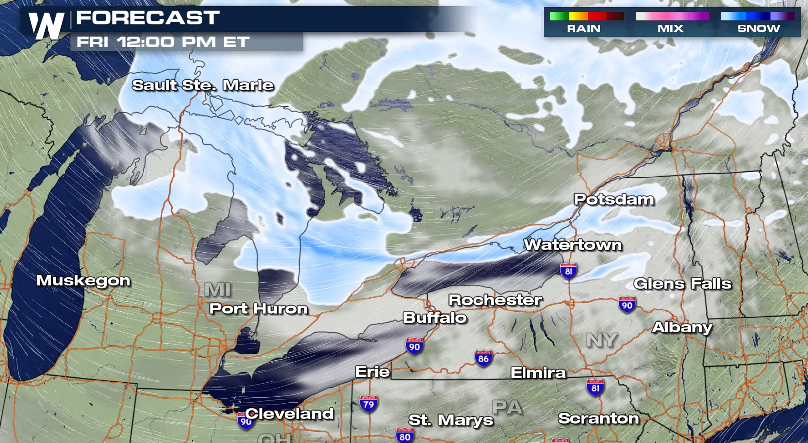
A strong low pressure center has moved through the Northeast into Ontario, circulating cold air across the Great Lakes. This has lead to heavy lake effect snow, with some areas seeing already over a foot of accumulations. Strong wind gusts greater than 40 mph are creating significant blowing and drifting snow.
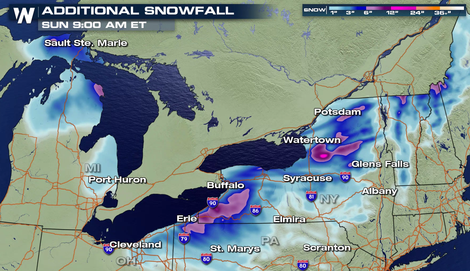
 The lake effect snow will continue into early Saturday, with heaviest snowfall near Lake Erie and Lake Ontario in New York. Additional snowfall will likely be measured in feet instead of inches.
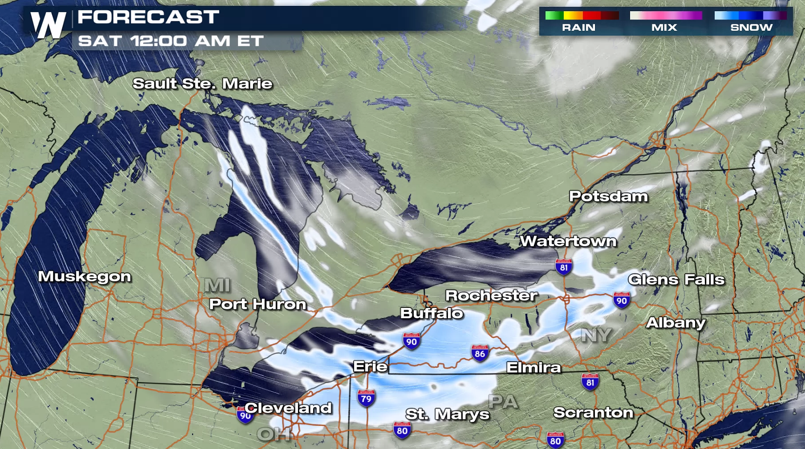
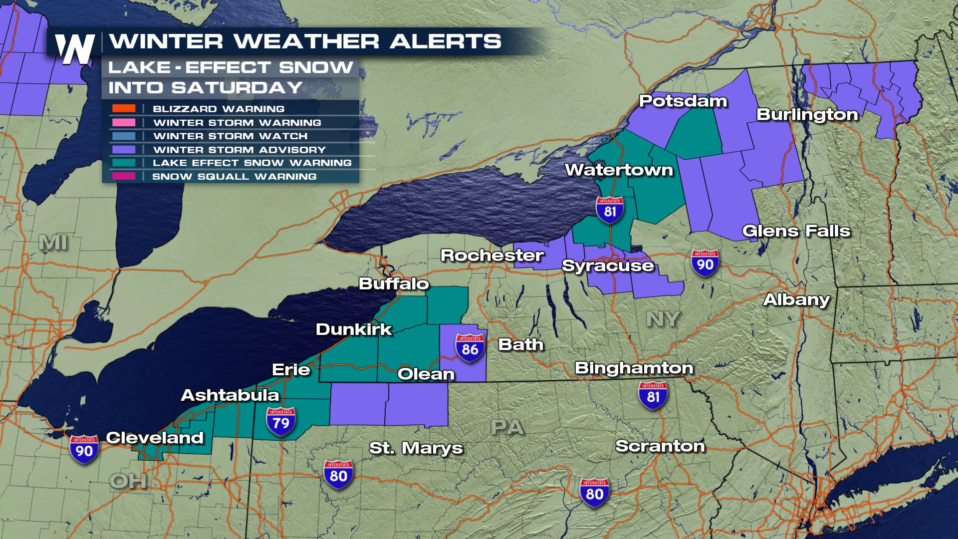
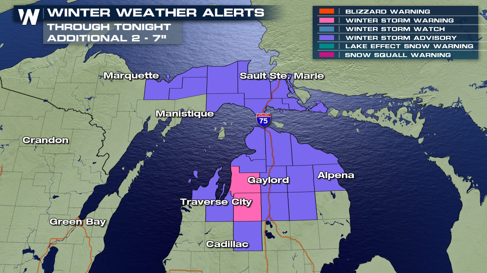
 The intense northwest winds on the backside of this system will continue to bring significant lake-effect snow to from Lake Superior to Lake Ontario. As the atmosphere starts to warm Saturday and the wind begins to shift, lake effect snow bands will diminish.
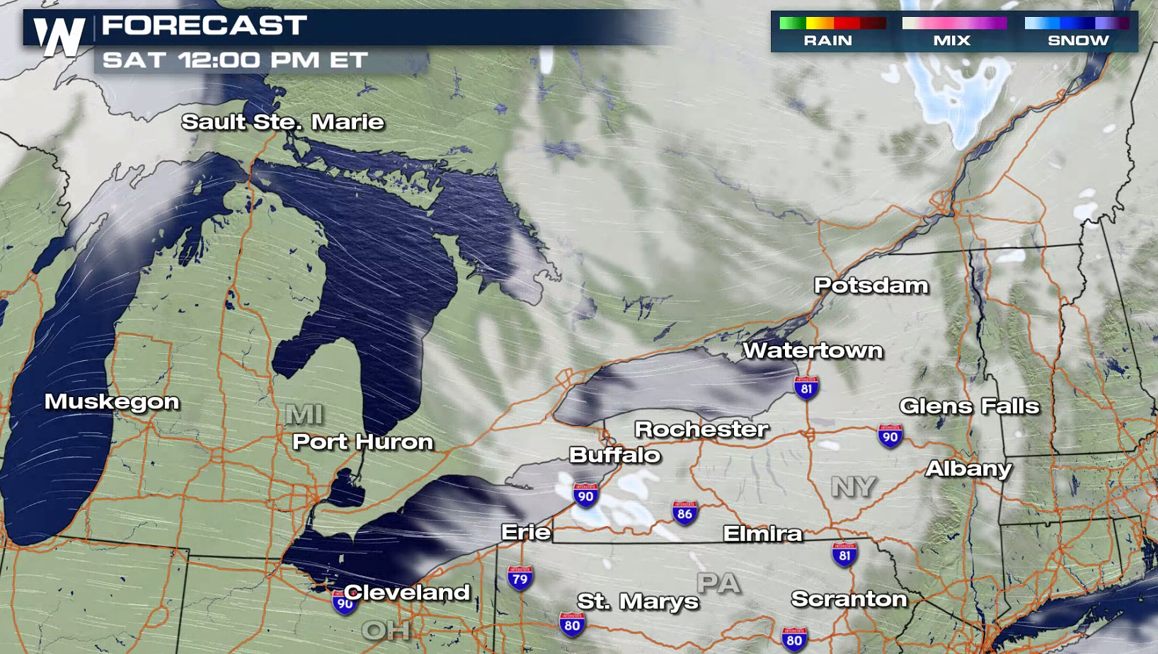
 WeatherNation will keep you updated on-air and online with the latest forecast.
The lake effect snow will continue into early Saturday, with heaviest snowfall near Lake Erie and Lake Ontario in New York. Additional snowfall will likely be measured in feet instead of inches.
The intense northwest winds on the backside of this system will continue to bring significant lake-effect snow to from Lake Superior to Lake Ontario. As the atmosphere starts to warm Saturday and the wind begins to shift, lake effect snow bands will diminish.
WeatherNation will keep you updated on-air and online with the latest forecast.All Weather News
More
Next Big Push of Moisture in the Northwest
A series of atmospheric rivers has been respo
6 Nov 2025 2:10 AM

Windy and Stormy Weather For The Northeast
NORTHEAST - The Storm Prediction Center has m
6 Nov 2025 2:10 AM

First Snow Forecast of the Season for the Northern Plains
NORTHERN PLAINS - As we head into the end of
6 Nov 2025 2:05 AM

Mid-South Eyeing Severe Threat Friday
This is an interesting setup that's been piqu
6 Nov 2025 2:00 AM

Record Heat This Week, Before Arctic Blast
Another round of records was set today across
6 Nov 2025 1:50 AM

King Tides Return to Start the Month
Coastal areas will be dealing with intrusions
5 Nov 2025 11:35 AM

How Big Did the Hail Get in Texas Saturday?
Powerful storms swept through the Lone Star S
2 Nov 2025 10:25 PM