Heavy Snow Likely from the High Plains to the Great Lakes
Special Stories
2 Apr 2018 3:55 PM
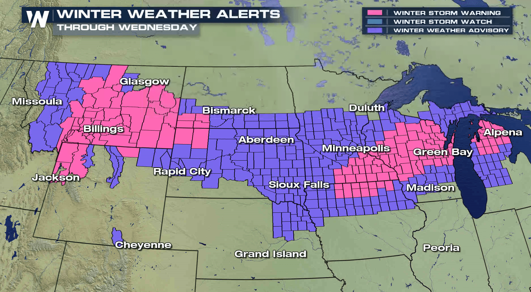
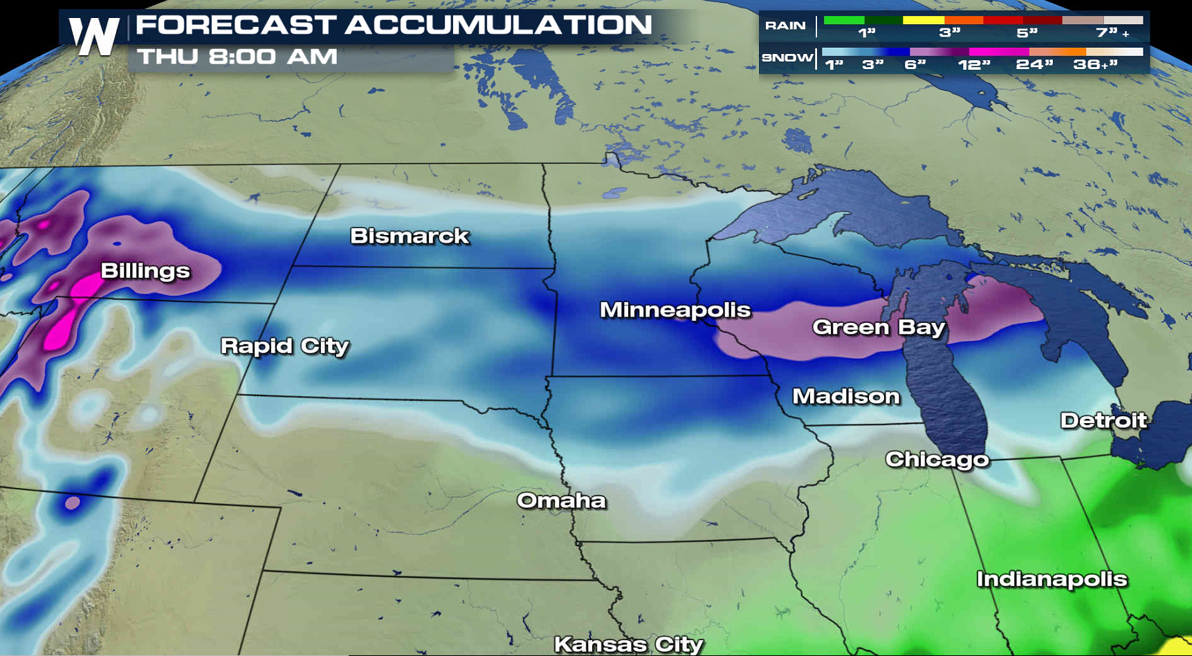
The calendar may say April, but the weather is behaving more like winter with heavy snowfall accumulations and cold temperatures. A foot of snow may fall across portions of the Northern Plains and western Great Lakes. Winter Storm Warnings stretch from Montana to Michigan.
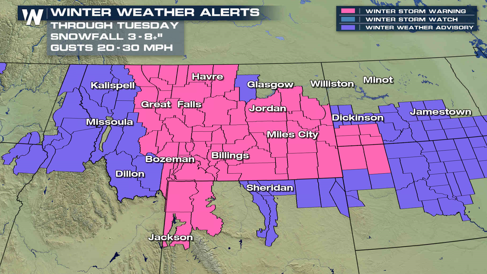
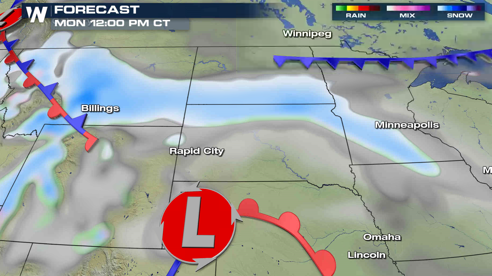
 A wave of snow will continue to push from Montana to Minnesota into this evening. This will bring the first round of accumulations and slow down travelers.
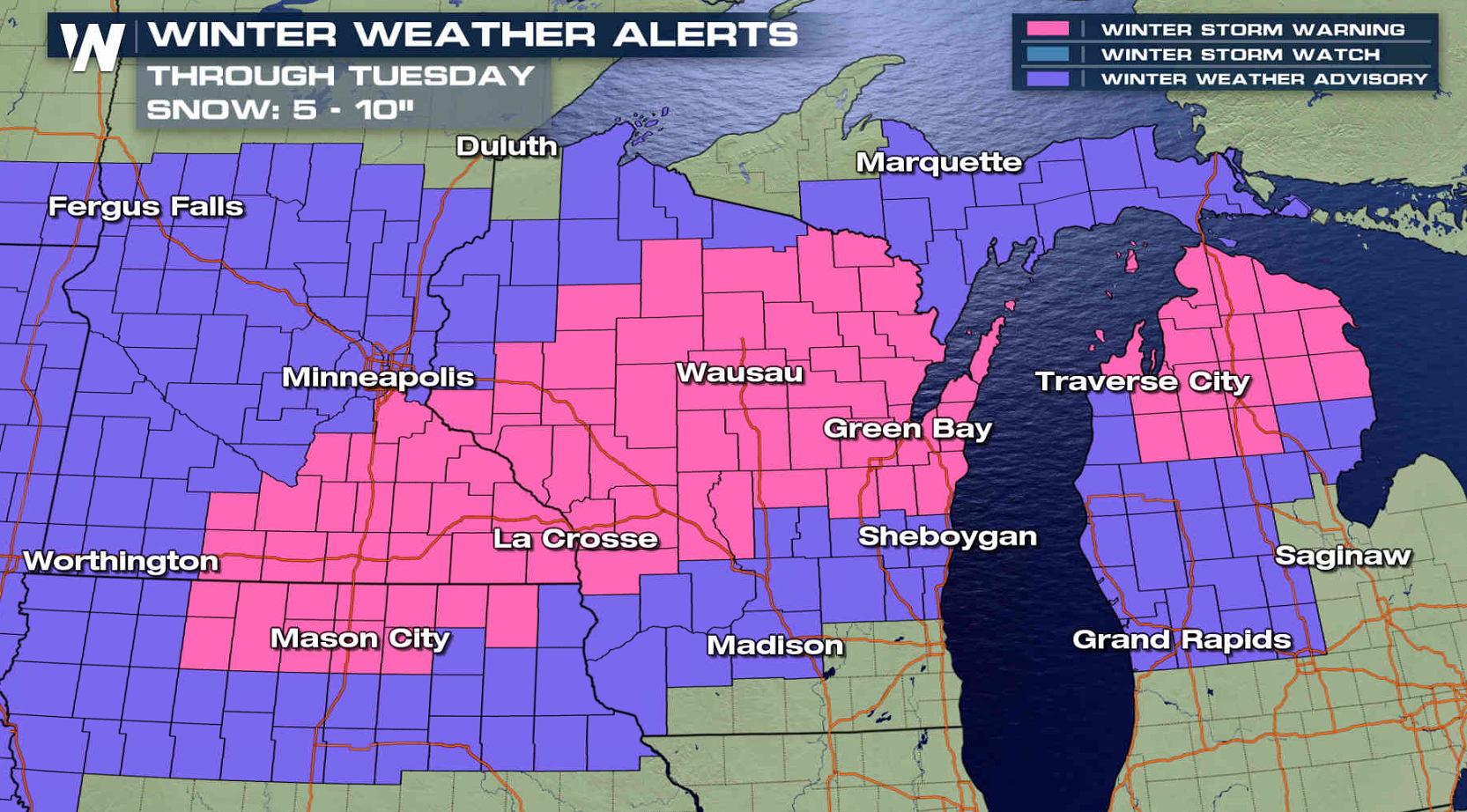
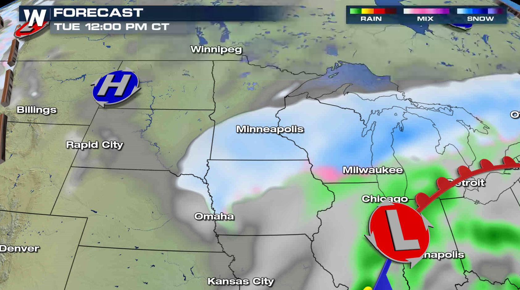
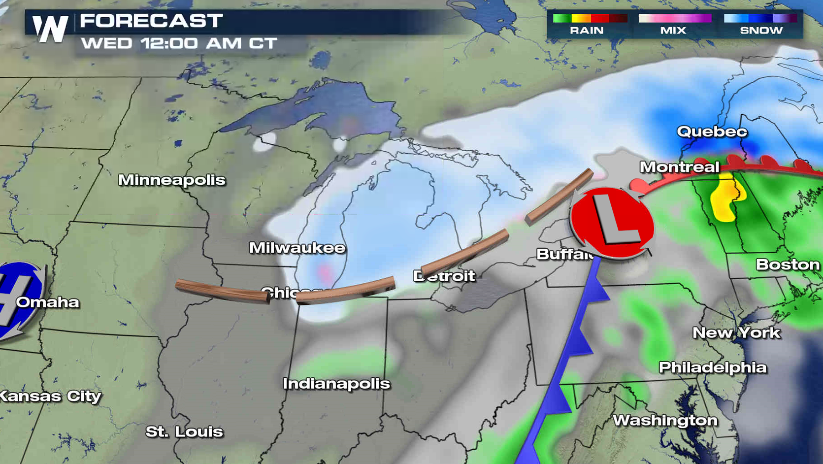
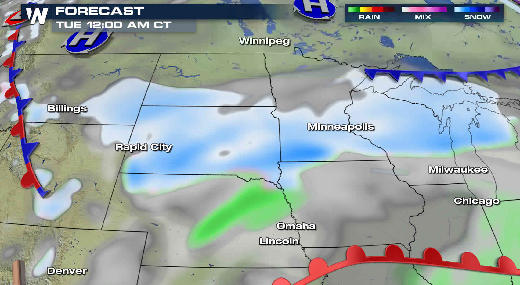 The main low pressure center will approach the region Tuesday into Wednesday spreading snow from Iowa to Michigan. Heavy snow and gusty winds will create low visibility and blowing snow. The system will exit the region Wednesday night.
 For WeatherNation: Meteorologist Mace Michaels
A wave of snow will continue to push from Montana to Minnesota into this evening. This will bring the first round of accumulations and slow down travelers.
The main low pressure center will approach the region Tuesday into Wednesday spreading snow from Iowa to Michigan. Heavy snow and gusty winds will create low visibility and blowing snow. The system will exit the region Wednesday night.
For WeatherNation: Meteorologist Mace MichaelsAll Weather News
More
Wildfire Outbreak in the Pacific Northwest
SPOKANE, WA - On Saturday, August 1st, the Ol
3 Aug 2026 1:55 AM

More Storms for the East Through Monday
A low-pressure system that moved through the
3 Aug 2026 1:50 AM


After Reaching Category 5, Genevieve Weakens in the Pacific
PacificGenevieve formed last Friday south of
3 Aug 2026 12:30 AM

Flooding, Severe Storms Target the Midwest Again
After an active week of storms across the nor
1 Aug 2026 1:40 AM

Flooding Risk Increases as Heavy Rain Targets the Tri-State Area
Tuesday, heavy rainfall moved across the Nort
30 Jul 2026 12:25 AM

Severe Weather: Energy From the Midwest Now in the Southeast
UPPER MIDWEST - Through Monday, dangerous tor
29 Jul 2026 10:30 PM