Severe Weather Risks in the Plains Continue Through Saturday
Top Stories
15 Aug 2019 8:43 AM
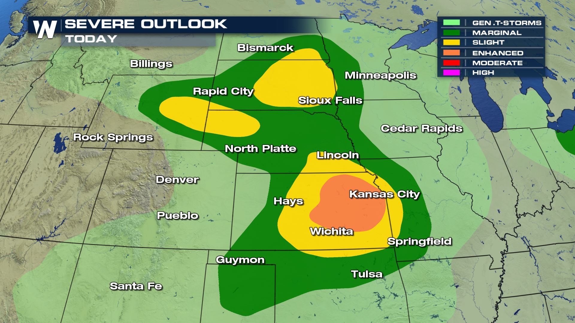
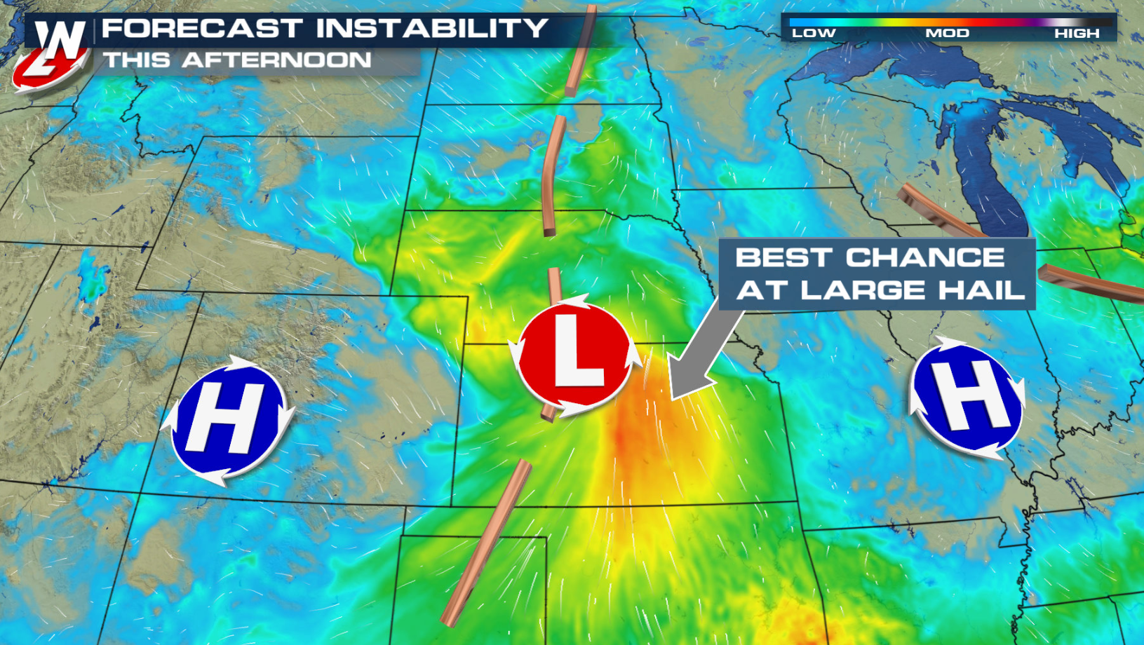
An active severe weather pattern continues in the Plains into this weekend. There is a risk for severe thunderstorms in the High Plains and Front Range today. The best chances for storms to develop will likely be in central Kansas where an Enhanced Risk of severe weather has been issued. There is a Slight Risk in Wyoming, South Dakota, Nebraska, and Kansas.
WHAT DOES AN SPC OUTLOOK MEAN?
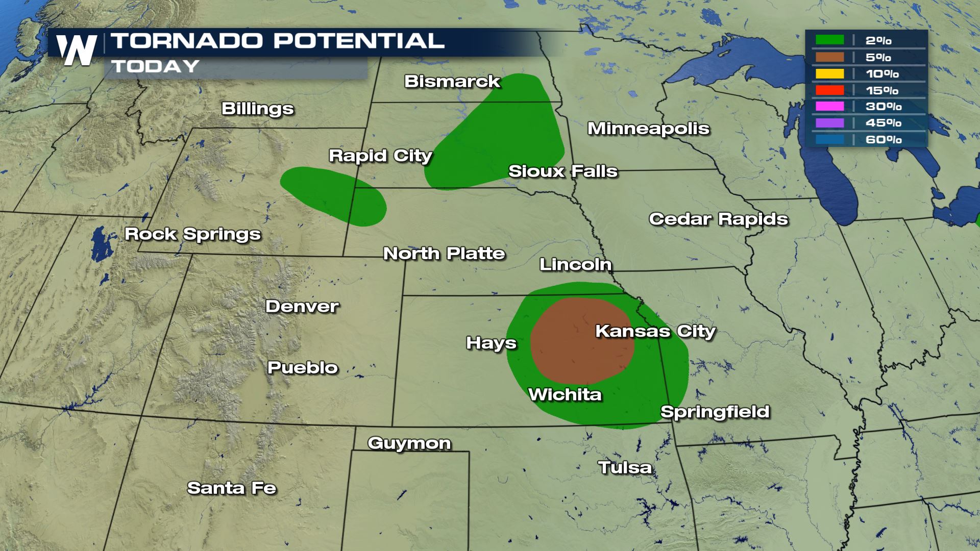
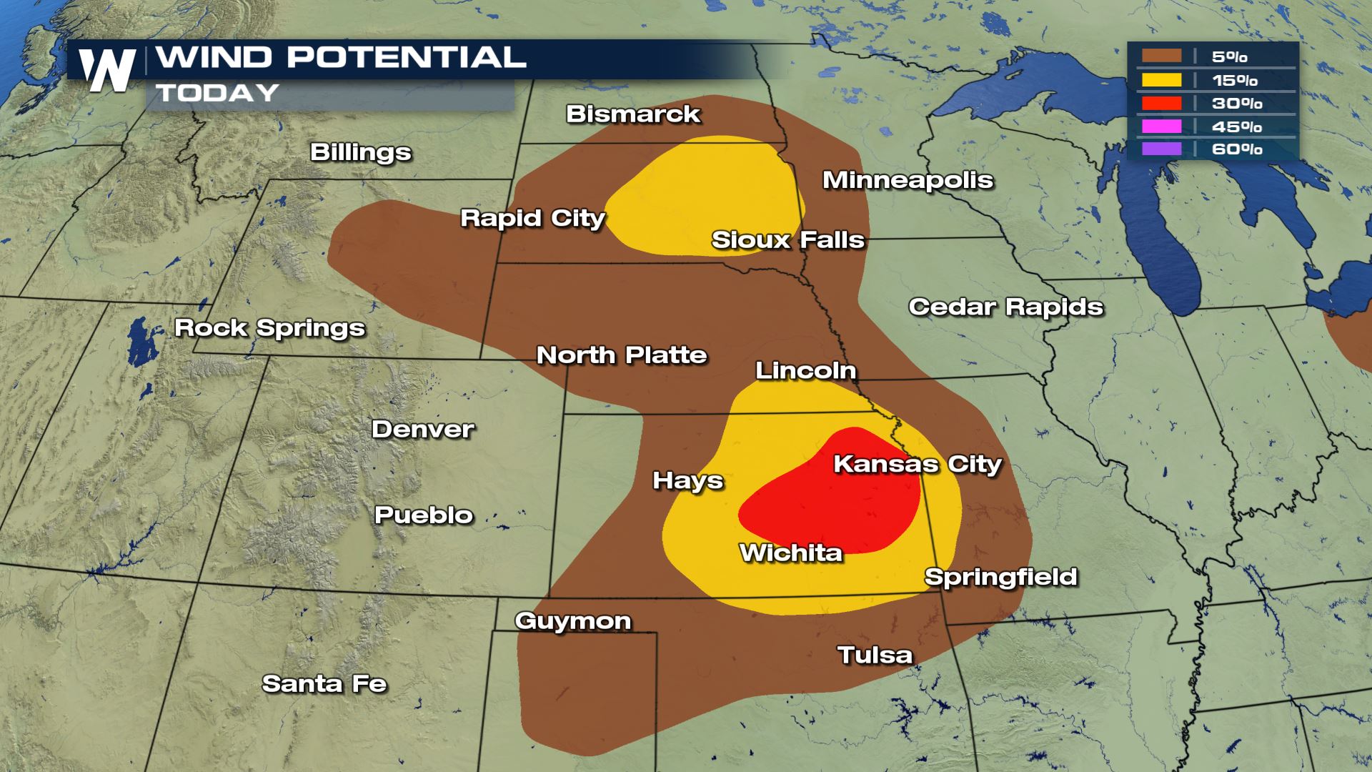
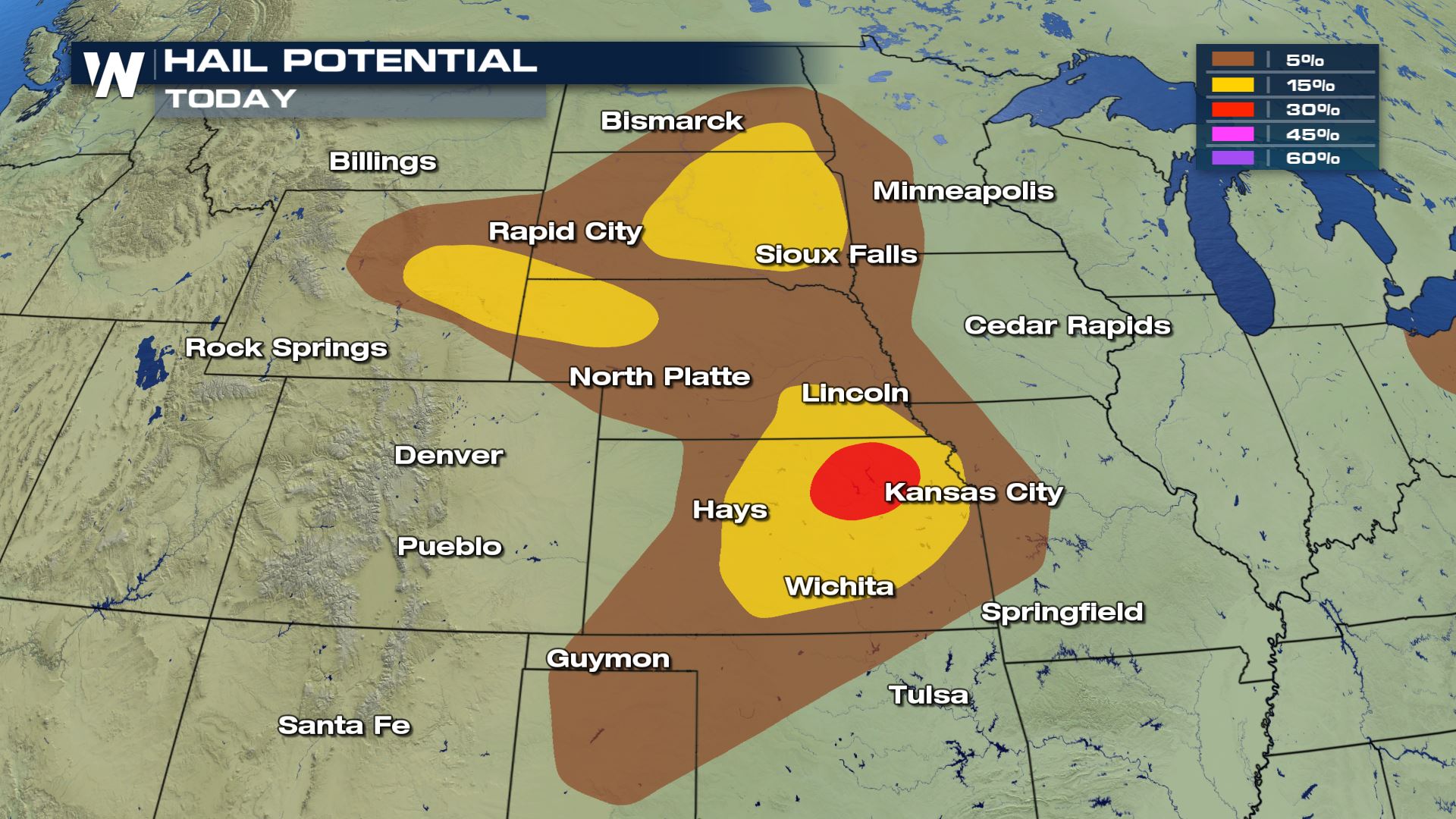
 Isolated tornadoes and large hail will be the biggest threats with any storms that develop in the afternoon and evening. Plus, damaging winds over 58 mph will likely accompany the storms today, too.
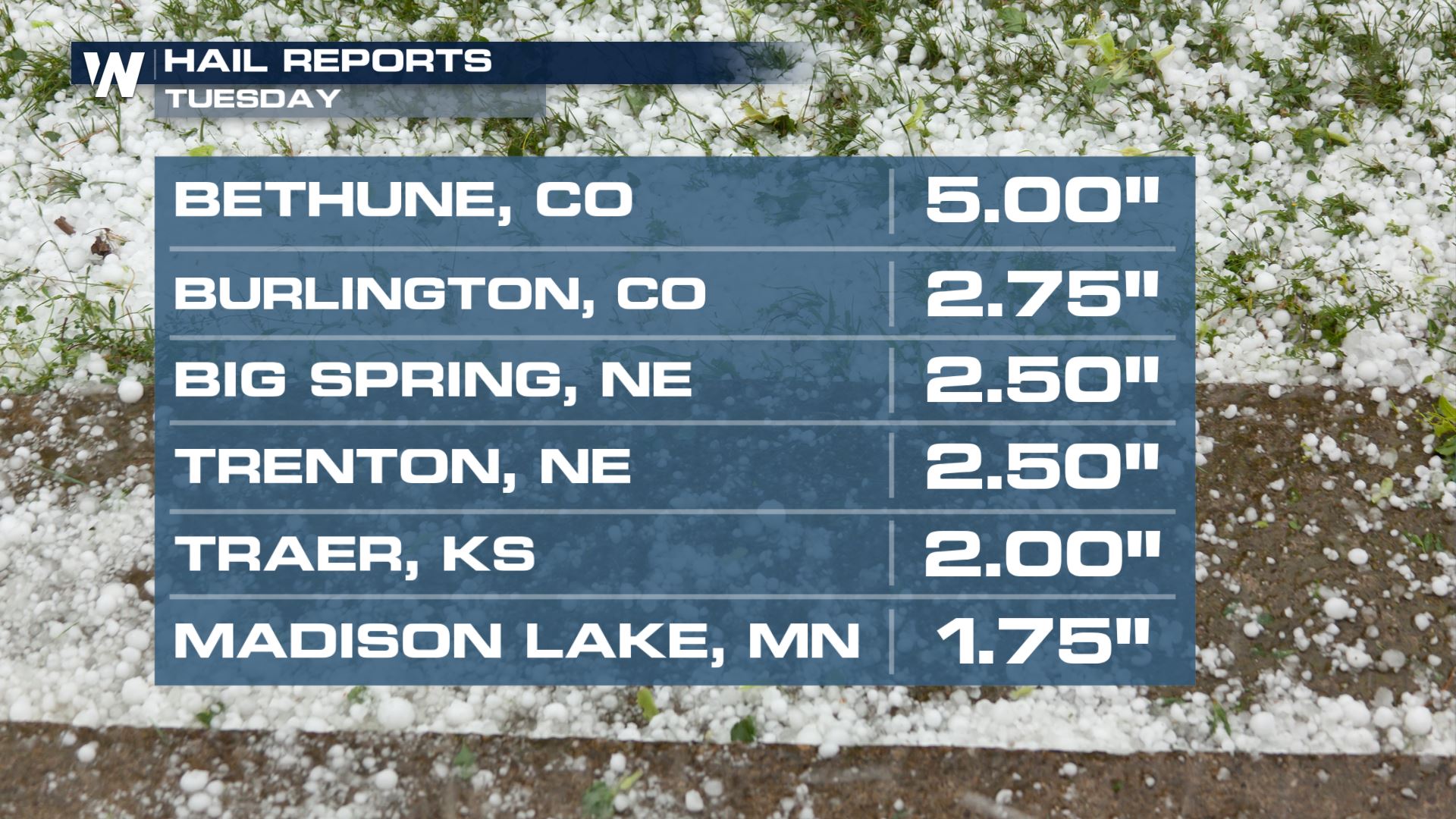
 Speaking of large hail, check out the size of the hail that fell in this area on Tuesday. Five inch diameter hail was reported in Bethune, CO!
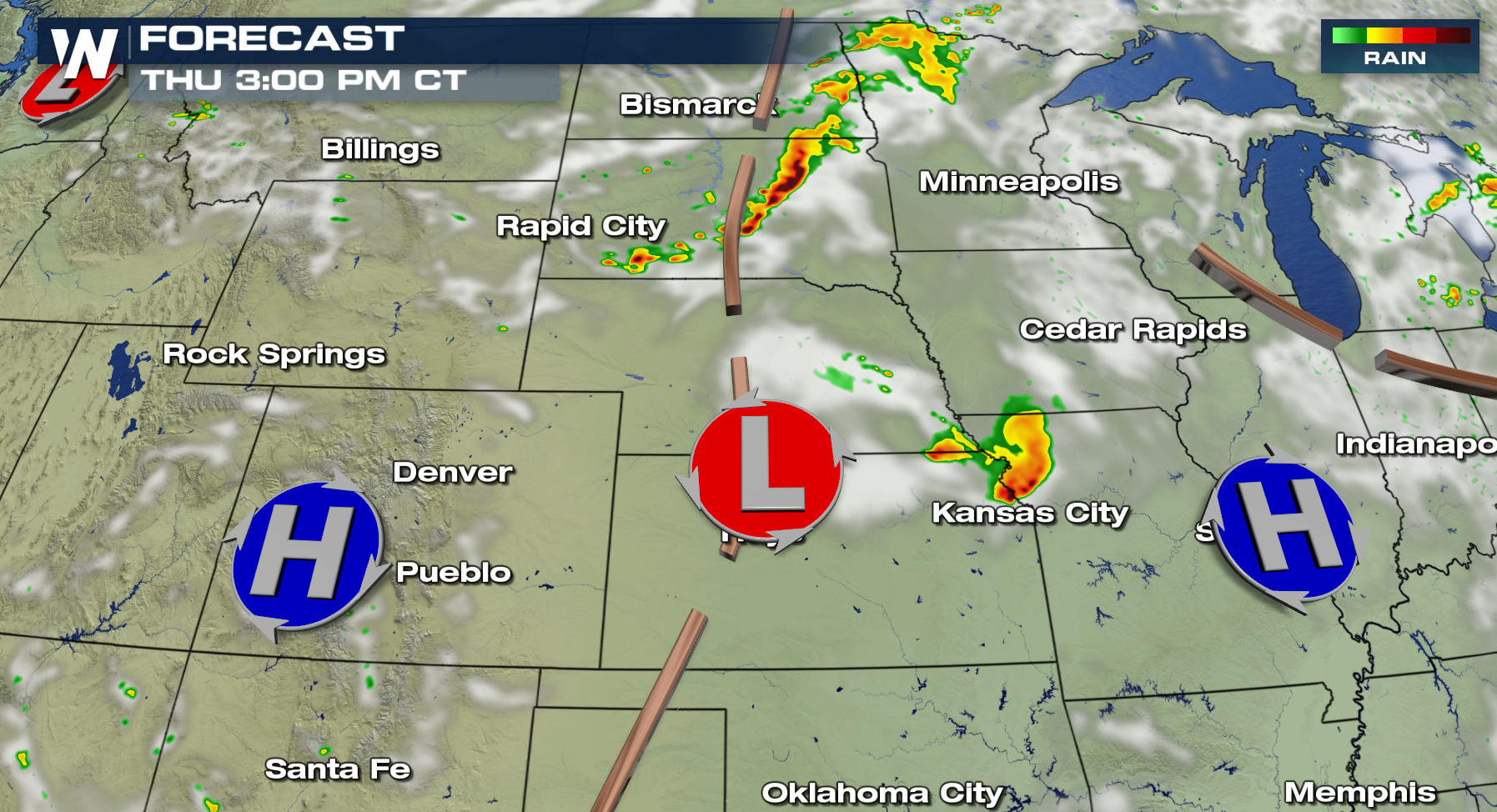
 Storms will begin to bubble up early this afternoon. The threat for the strongest storms will roll around this evening.
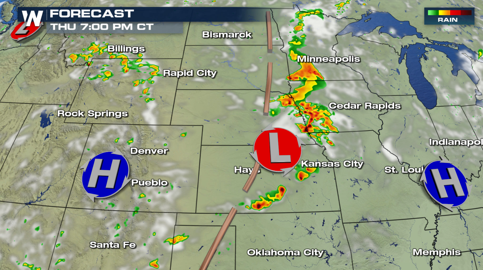
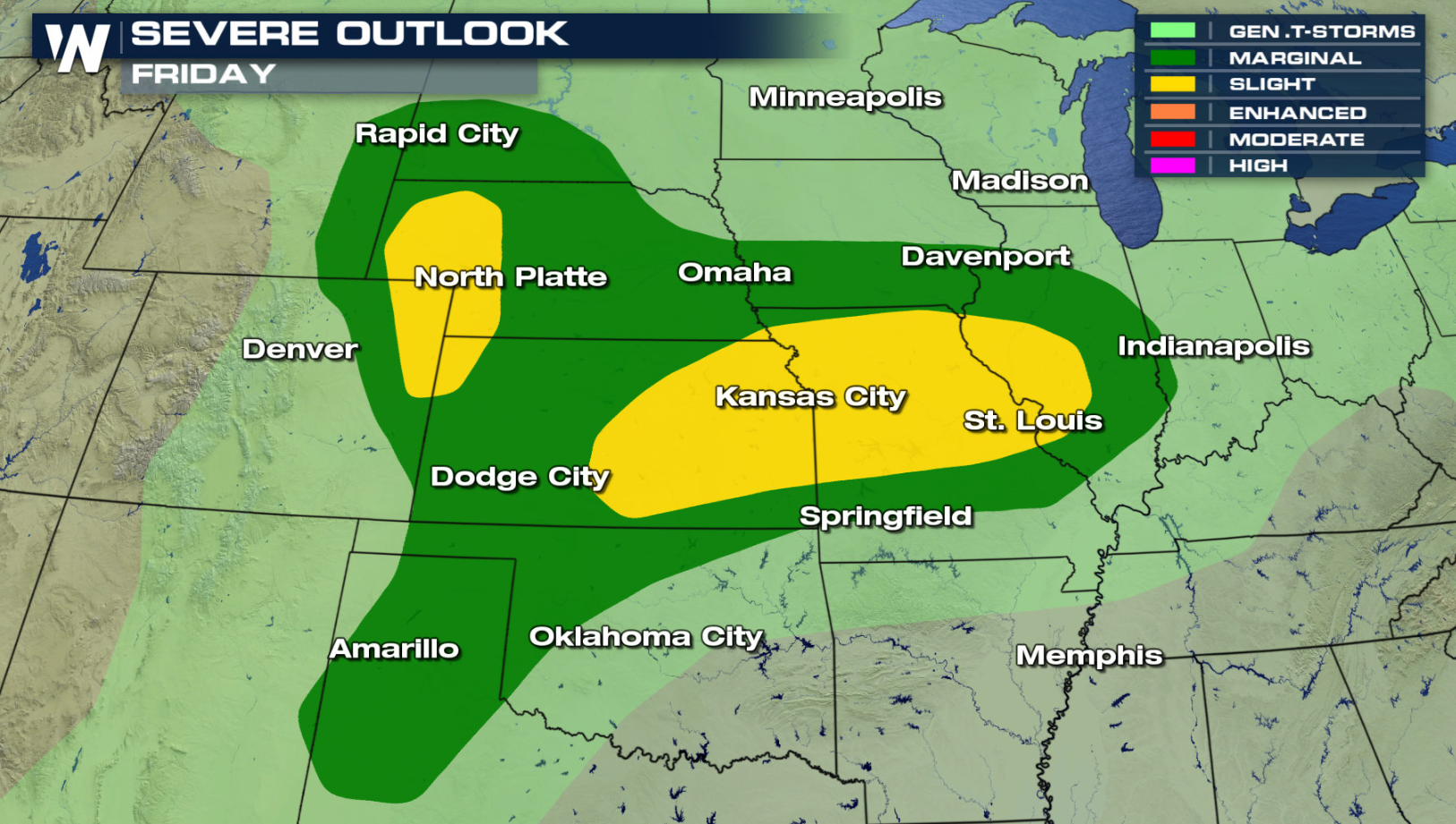
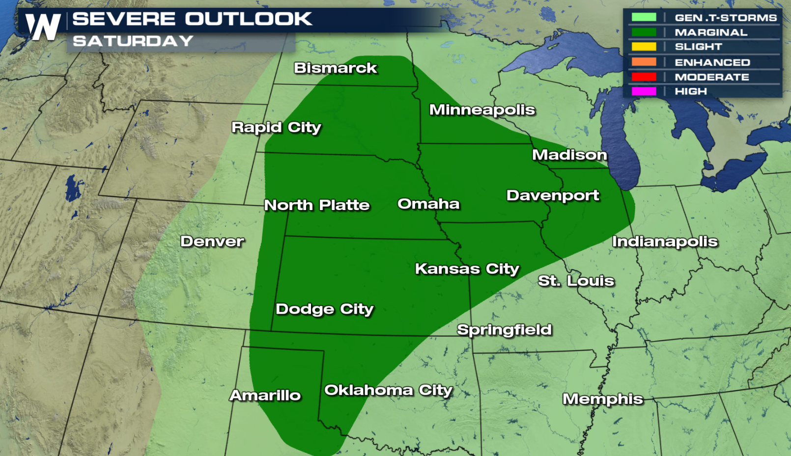
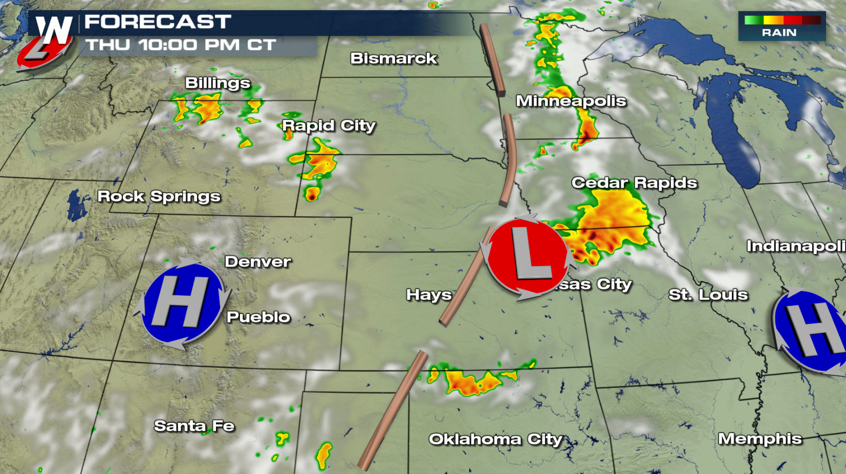 With a slow moving trough and a developing low pressure center, the risk for severe storms will continue in similar areas of the Front Range and Plains for Friday and Saturday.
 For WeatherNation: Meteorologist Mace Michaels
 Isolated tornadoes and large hail will be the biggest threats with any storms that develop in the afternoon and evening. Plus, damaging winds over 58 mph will likely accompany the storms today, too.


 Speaking of large hail, check out the size of the hail that fell in this area on Tuesday. Five inch diameter hail was reported in Bethune, CO!
 Storms will begin to bubble up early this afternoon. The threat for the strongest storms will roll around this evening.


 With a slow moving trough and a developing low pressure center, the risk for severe storms will continue in similar areas of the Front Range and Plains for Friday and Saturday.

 For WeatherNation: Meteorologist Mace Michaels
All Weather News
More