High-Resolution Models Accurate Forecast of Rare Southeast Winter Storm
Special Stories
20 Jun 2018 7:51 AM
From NOAA
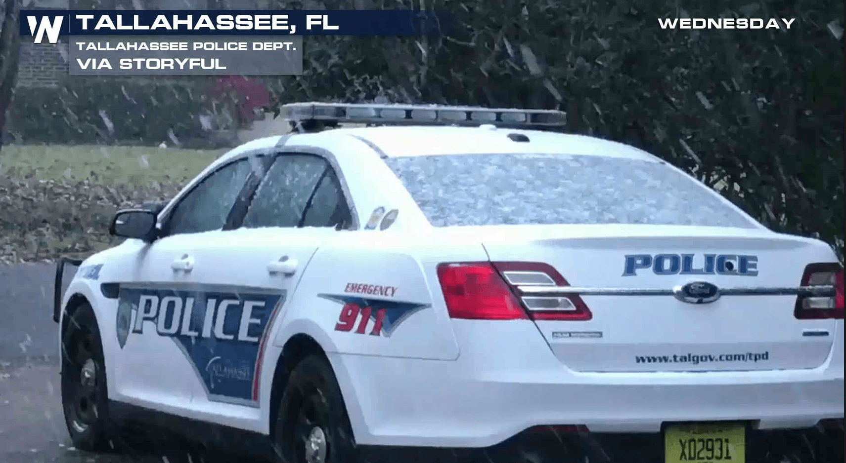
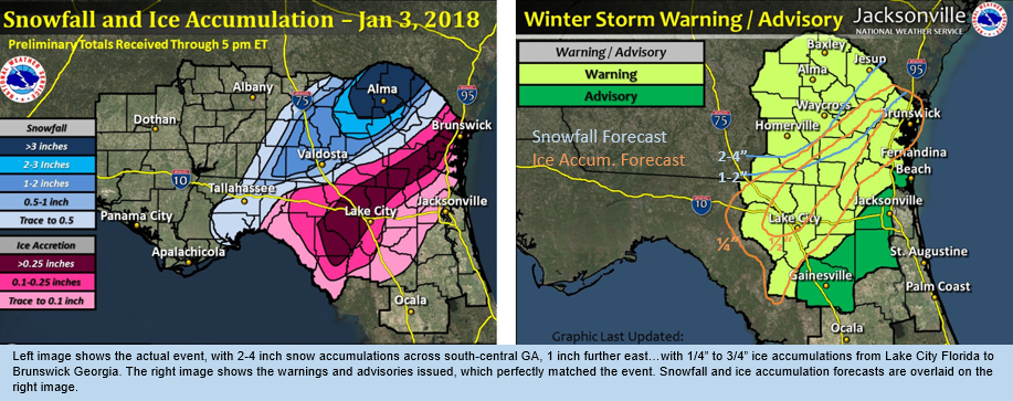
Back at the beginning of the year on January 3, 2018, a significant winter storm struck northeast Florida and southeast Georgia, an event that occurs once every 25-50 years. The last winter storm event like this one occurred in 1989. A challenging forecast faced the staff of the National Weather Service in Jacksonville, as some of the weather forecast models were indicating a significant snow and ice event to occur. As this hasn’t happened in 30 years, there was no knowledge on forecast model accuracy or bias in predicting such a rare event in Florida. In the past, models were notoriously bad in forecasting shallow-cold-air events. The storm later became a classic Nor'easter, moving up the Atlantic Ocean.
https://twitter.com/NWSTallahassee/status/948938101317079040
While the global models had problems predicting the event, higher-resolution forecast models accurately predicted precipitation type and type-changeover. Despite the known NAM (North American Mesoscale Forecast System) bias of over-predicting precipitation in cold air (it consistently showed 8-12 inches of snow in southeast Georgia), its precipitation type forecasts were accurate. As the event drew closer, the HRRR (High-Resolution Rapid Refresh) forecast both precipitation type and amount.
This supported accurate winter storm watches/warnings, and decisions not to include Jacksonville and Gainesville in them, despite the fear of past model handling of shallow, cold air. The challenge to forecasters was whether or not to believe the higher-res model forecasts of such a rare event, particularly one coming out of the Gulf of Mexico, a warm air source that makes winter storm events so rare.
 The accurate watches/warnings issued in advance, and DSS webinars for nearly 100 partners that focused as much on impact as weather, supported efforts to keep people off the roads. During state calls, Florida Highway Patrol officials noted the lack of accidents and injuries/fatalities on icy roads, despite the wintry precipitation falling.
As observed by SOO Pete Wolf, “the improvements in higher-resolution modeling were key to accurately warn of a high-impact event that probably would have been missed 10-15 years ago.”
Edited for WeatherNation by Meteorologist Mace Michaels
The accurate watches/warnings issued in advance, and DSS webinars for nearly 100 partners that focused as much on impact as weather, supported efforts to keep people off the roads. During state calls, Florida Highway Patrol officials noted the lack of accidents and injuries/fatalities on icy roads, despite the wintry precipitation falling.
As observed by SOO Pete Wolf, “the improvements in higher-resolution modeling were key to accurately warn of a high-impact event that probably would have been missed 10-15 years ago.”
Edited for WeatherNation by Meteorologist Mace MichaelsAll Weather News
More
NHC Monitoring Front in the Southeast Ahead of 4th of July
Tropical downpours for a long holiday weekend
3 Jul 2025 9:25 PM

Flossie is No More, Eastern Pacific Remains Active
Post Tropical FlossieThe National Hurricane C
3 Jul 2025 9:15 PM

Near Seasonal Temperatures for Many Come July 4th!
AAA is expecting over 70 million travelers to
3 Jul 2025 9:05 PM


Severe Storms in the Midwest Could Dampen Holiday Plans
NORTHERN PLAINS - A frontal system is expecte
3 Jul 2025 8:00 PM

Northwest Heat Met With Thunderstorm Risk
NORTHWEST - Today, portions of Montana are un
3 Jul 2025 12:00 AM

Severe Weather Threat Continues in the Midwest
It has been an active, severe season across t
30 Jun 2025 9:00 PM