Huge Hail Hits Arkansas and Oklahoma
Special Stories
10 Mar 2018 6:31 PM
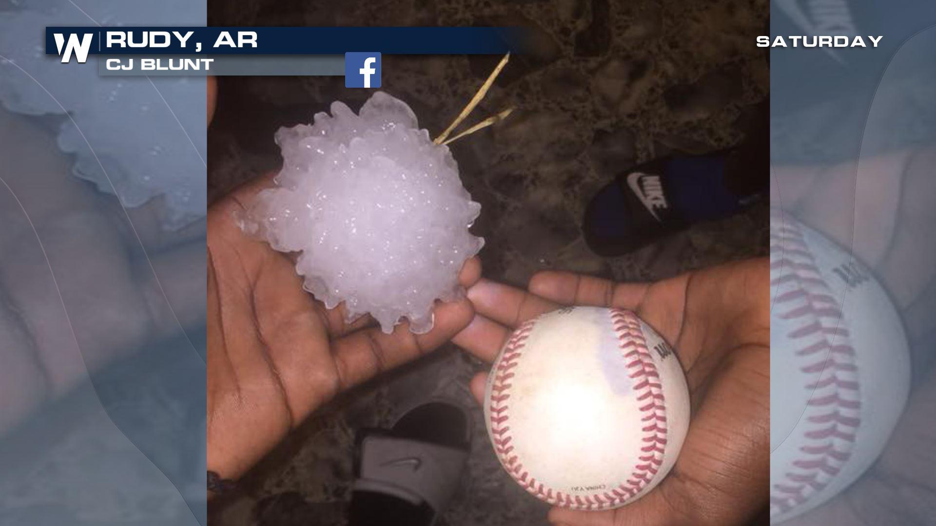
Hail up to the size of hen eggs fell from the sky Saturday afternoon and evening across parts of Oklahoma and Arkansas. Take a look at some of the pictures coming in so far.
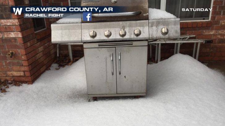
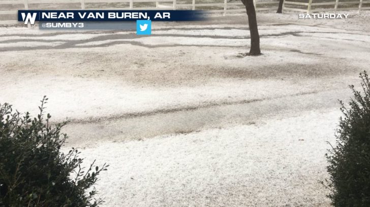 The first picture is courtesy Rachel Fight via Facebook and second picture courtesy Sunby3 via Twitter.
https://twitter.com/GarofaloWX/status/972672712882573313
Hail reached up to the size of two inches thick near Charleston, Arkansas and just shy of two inches in Muldrow, Oklahoma.
The first picture is courtesy Rachel Fight via Facebook and second picture courtesy Sunby3 via Twitter.
https://twitter.com/GarofaloWX/status/972672712882573313
Hail reached up to the size of two inches thick near Charleston, Arkansas and just shy of two inches in Muldrow, Oklahoma.
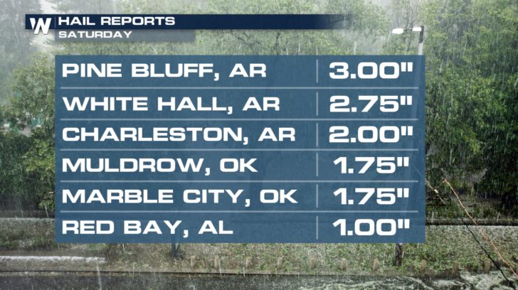 Most of these big hail reports came from a handful of storms that continued to produce the stones throughout their path.
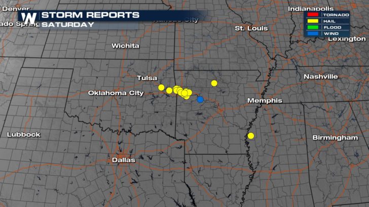 Hail reports seen via yellow dots Saturday evening.
https://twitter.com/WeatherNation/status/972631038793936896
What caused the big hail? Robust updrafts. There was strong vertical motion within Saturday's storms, meaning the air was rising really fast upwards into the sky. This can happen from warm, moist air near the ground rising quickly through cooler/drier air above it. Or it can also happen via a triggering mechanism such as a cold front or warm front. As this air rose quickly, small ice chunks began to form. When the ice chunks became too heavy for the wind to keep pushing it up, it fell from the sky and resulted in the images above.
Hail reports seen via yellow dots Saturday evening.
https://twitter.com/WeatherNation/status/972631038793936896
What caused the big hail? Robust updrafts. There was strong vertical motion within Saturday's storms, meaning the air was rising really fast upwards into the sky. This can happen from warm, moist air near the ground rising quickly through cooler/drier air above it. Or it can also happen via a triggering mechanism such as a cold front or warm front. As this air rose quickly, small ice chunks began to form. When the ice chunks became too heavy for the wind to keep pushing it up, it fell from the sky and resulted in the images above.
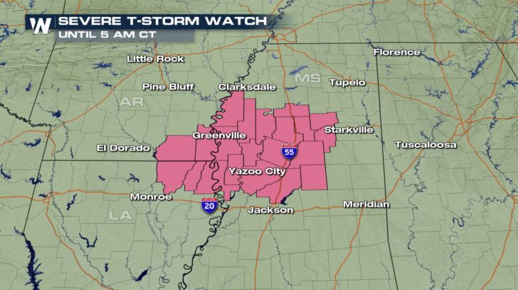 The potential for more severe weather continues through Saturday night and into Sunday morning. In fact, the rest of Sunday and Monday could feature additional severe weather. We have written more extensively about that topic here, just click/tap to here to read more.
For WeatherNation, Meteorologist Steve Glazier
The potential for more severe weather continues through Saturday night and into Sunday morning. In fact, the rest of Sunday and Monday could feature additional severe weather. We have written more extensively about that topic here, just click/tap to here to read more.
For WeatherNation, Meteorologist Steve Glazier
The first picture is courtesy Rachel Fight via Facebook and second picture courtesy Sunby3 via Twitter.
https://twitter.com/GarofaloWX/status/972672712882573313
Hail reached up to the size of two inches thick near Charleston, Arkansas and just shy of two inches in Muldrow, Oklahoma.
Most of these big hail reports came from a handful of storms that continued to produce the stones throughout their path.
Hail reports seen via yellow dots Saturday evening.
https://twitter.com/WeatherNation/status/972631038793936896
What caused the big hail? Robust updrafts. There was strong vertical motion within Saturday's storms, meaning the air was rising really fast upwards into the sky. This can happen from warm, moist air near the ground rising quickly through cooler/drier air above it. Or it can also happen via a triggering mechanism such as a cold front or warm front. As this air rose quickly, small ice chunks began to form. When the ice chunks became too heavy for the wind to keep pushing it up, it fell from the sky and resulted in the images above.
The potential for more severe weather continues through Saturday night and into Sunday morning. In fact, the rest of Sunday and Monday could feature additional severe weather. We have written more extensively about that topic here, just click/tap to here to read more.
For WeatherNation, Meteorologist Steve GlazierAll Weather News
More


More Storms for the East Through Monday
A low-pressure system that moved through the
3 Aug 2026 1:50 AM

After Reaching Category 5, Genevieve Weakens in the Pacific
PacificGenevieve formed last Friday south of
3 Aug 2026 12:30 AM

Flooding, Severe Storms Target the Midwest Again
After an active week of storms across the nor
1 Aug 2026 1:40 AM

Flooding Risk Increases as Heavy Rain Targets the Tri-State Area
Tuesday, heavy rainfall moved across the Nort
30 Jul 2026 12:25 AM

Severe Weather: Energy From the Midwest Now in the Southeast
UPPER MIDWEST - Through Monday, dangerous tor
29 Jul 2026 10:30 PM