Hurricane Barry Aerial Damage Imagery
Special Stories
24 Jul 2019 1:45 AM
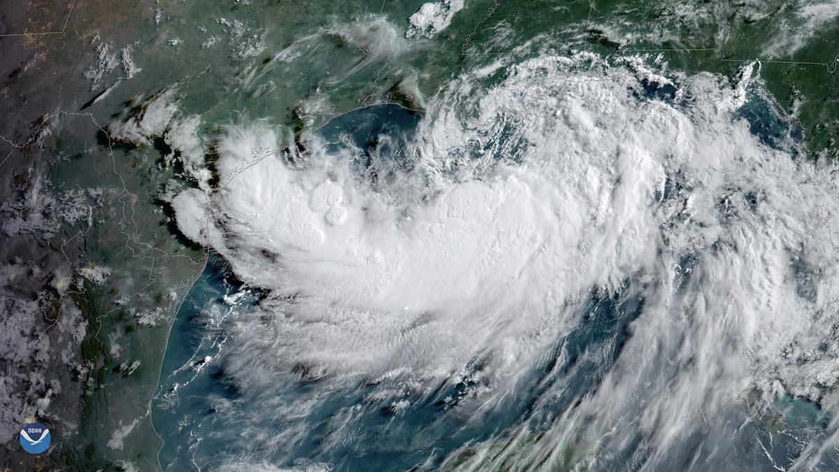
[Tropical Storm Barry, seen here by GOES East on July 12, 2019, at 9 a.m. ET, strengthens over the warm waters of the northern Gulf of Mexico prior to reaching hurricane strength.]
[NOAA] From July 16-19, 2019, the National Geodetic Survey (NGS) collected aerial damage assessment images in the aftermath of Hurricane Barry. Imagery was collected in specific areas identified by NOAA in coordination with FEMA and other state and federal partners. Collected images are available to view online via the NGS aerial imagery viewer.
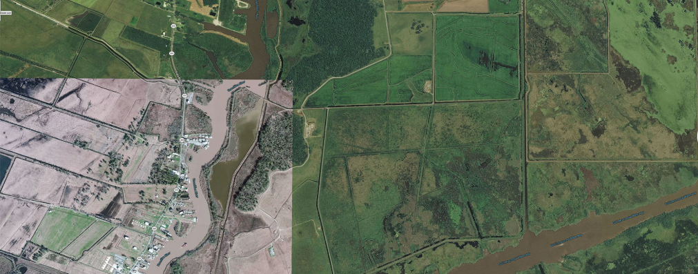
 [Before imagery (top) and after (bottom, July 16th) of flooding north of Intracoastal City, Louisiana]
NOAA's aerial imagery aids safe navigation and captures damage to coastal areas caused by a storm. Aerial imagery is a crucial tool to determine the extent of the damage inflicted by flooding, and to compare baseline coastal areas to assess the damage to major ports and waterways, coastlines, critical infrastructure, and coastal communities. This imagery provides a cost-effective way to better understand the damage sustained to both property and the environment.
Edited for WeatherNation by Meteorologist Mace Michaels
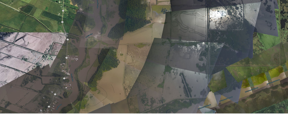
[Before imagery (top) and after (bottom, July 16th) of flooding north of Intracoastal City, Louisiana]
NOAA's aerial imagery aids safe navigation and captures damage to coastal areas caused by a storm. Aerial imagery is a crucial tool to determine the extent of the damage inflicted by flooding, and to compare baseline coastal areas to assess the damage to major ports and waterways, coastlines, critical infrastructure, and coastal communities. This imagery provides a cost-effective way to better understand the damage sustained to both property and the environment.
Edited for WeatherNation by Meteorologist Mace Michaels
[Before imagery (top) and after (bottom, July 16th) of flooding north of Intracoastal City, Louisiana]
NOAA's aerial imagery aids safe navigation and captures damage to coastal areas caused by a storm. Aerial imagery is a crucial tool to determine the extent of the damage inflicted by flooding, and to compare baseline coastal areas to assess the damage to major ports and waterways, coastlines, critical infrastructure, and coastal communities. This imagery provides a cost-effective way to better understand the damage sustained to both property and the environment.
Edited for WeatherNation by Meteorologist Mace MichaelsAll Weather News
More
Where Rain Could Dampen Holiday Travel Plans
AAA is expecting over 70 million travelers to
2 Jul 2025 2:35 AM

Western Heat Continues With Some Relief
A large dome of hot, high pressure remains ac
2 Jul 2025 2:00 AM

Severe Storms For the East Coast Through Tuesday
A cold front moving through a moist airmass h
2 Jul 2025 1:00 AM


NHC Monitoring Front in the Southeast Ahead of 4th of July
SOUTHEAST - A frontal boundary moving through
1 Jul 2025 10:35 PM

Severe Weather Threat Continues in the Midwest
It has been an active, severe season across t
30 Jun 2025 9:00 PM