Hurricane Dorian Before and After Damage Assessment Imagery
Special Stories
9 Sep 2019 3:16 AM
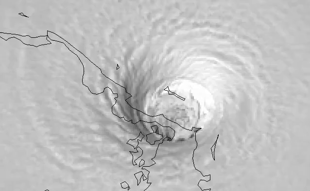
[GOES Visible satellite image of Hurricane Dorian first landfall in the Abaco Islands of the Bahamas. From NOAA]
[NOAA] Last week, the National Geodetic Survey (NGS) began collecting U.S. aerial damage assessment images for Hurricane Dorian. Imagery is being collected in specific areas identified by NOAA in coordination with FEMA and other state and federal partners. Collected images are available to view online via the NGS aerial imagery viewer.
https://twitter.com/iceyefi/status/1168618527751888898
NOAA's aerial imagery aids safe navigation and captures damage to coastal areas caused by a storm. Aerial imagery is a crucial tool to determine the extent of the damage inflicted by flooding, and to compare baseline coastal areas to assess the damage to major ports and waterways, coastlines, critical infrastructure, and coastal communities. This imagery provides a cost-effective way to better understand the damage sustained to both property and the environment.
https://twitter.com/iceyefi/status/1169331326132084736
The team of NOAA aviators and sensor operators are capturing the images using specialized remote-sensing cameras aboard NOAA Office of Marine and Aviation Operations' King Air aircraft flying above the area at an altitude between 500 and 1500 meters (about 1,600 to 5,000 feet).
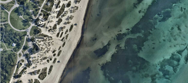
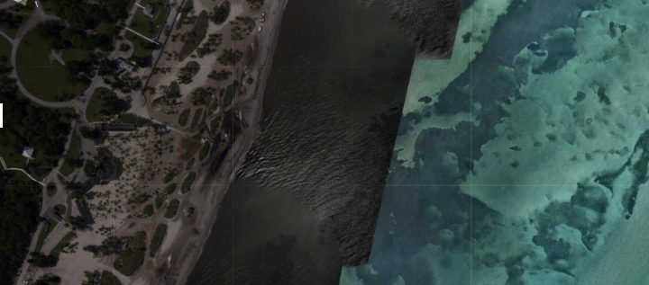 [Key Biscayne, Florida. Top image is before Hurricane Dorian, provided by Mapbox, Digital Globe, and OpenStreetMap. Bottom image is after Dorian landfall, from NOAA's National Geodetic Survey]
September 5, 2019: Fort Lauderdale, Florida to just south of Savannah, Georgia.
[Key Biscayne, Florida. Top image is before Hurricane Dorian, provided by Mapbox, Digital Globe, and OpenStreetMap. Bottom image is after Dorian landfall, from NOAA's National Geodetic Survey]
September 5, 2019: Fort Lauderdale, Florida to just south of Savannah, Georgia.
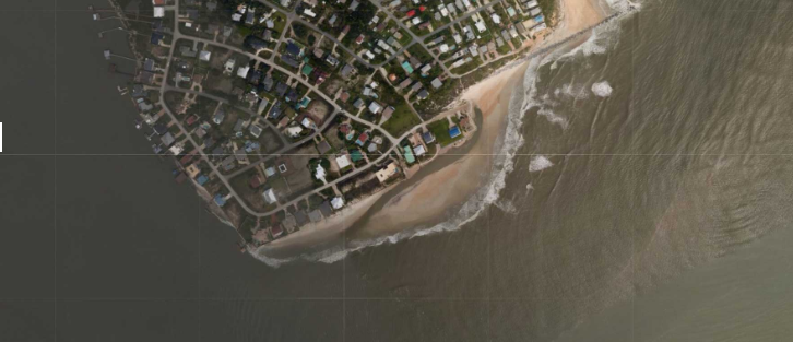 [St. Augustine, Florida. Top image is before Hurricane Dorian, provided by Mapbox, Digital Globe, and OpenStreetMap. Bottom image is after Dorian landfall, from NOAA's National Geodetic Survey]
September 6, 2019: Coastal and inland areas near Savannah, Georgia and Beaufort, South Carolina; coastal and inland areas from Edisto Beach, South Carolina to Bald Head Island, North Carolina
[St. Augustine, Florida. Top image is before Hurricane Dorian, provided by Mapbox, Digital Globe, and OpenStreetMap. Bottom image is after Dorian landfall, from NOAA's National Geodetic Survey]
September 6, 2019: Coastal and inland areas near Savannah, Georgia and Beaufort, South Carolina; coastal and inland areas from Edisto Beach, South Carolina to Bald Head Island, North Carolina
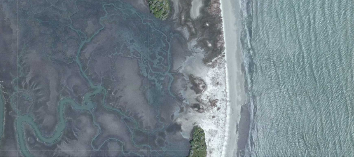
 [North of Brunswick, Georgia. Top image is before Hurricane Dorian, provided by Mapbox, Digital Globe, and OpenStreetMap. Bottom image is after Dorian landfall, from NOAA's National Geodetic Survey]
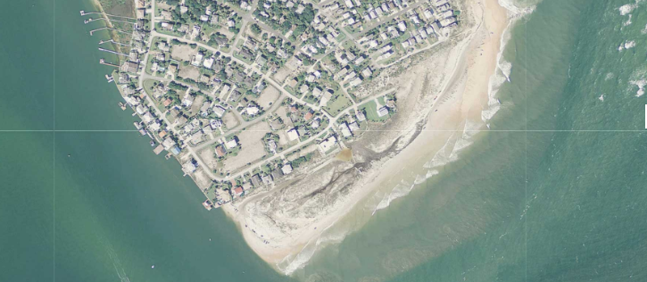
September 7, 2019: Bald Head Island, North Carolina to Norfolk, Virginia
[North of Brunswick, Georgia. Top image is before Hurricane Dorian, provided by Mapbox, Digital Globe, and OpenStreetMap. Bottom image is after Dorian landfall, from NOAA's National Geodetic Survey]
September 7, 2019: Bald Head Island, North Carolina to Norfolk, Virginia
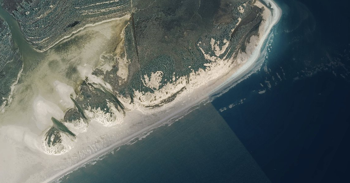
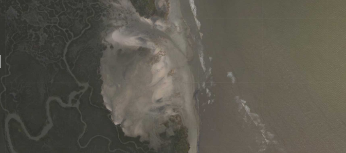
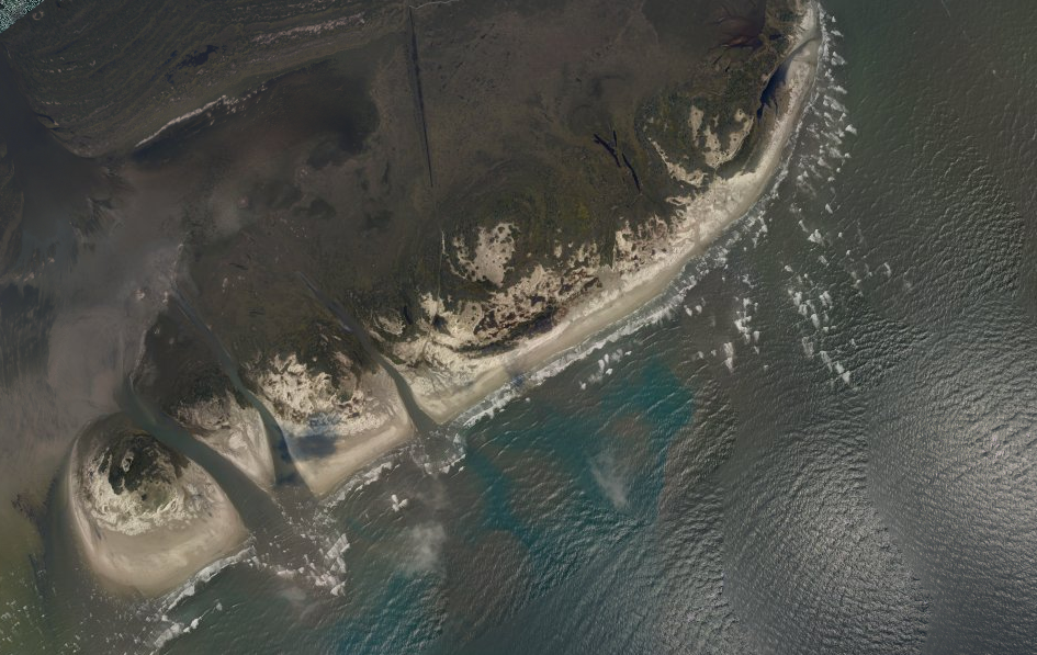 [Outer Banks of North Carolina. Top image is before Hurricane Dorian, provided by Mapbox, Digital Globe, and OpenStreetMap. Bottom image is after Dorian landfall, from NOAA's National Geodetic Survey]
Edited for WeatherNation by Meteorologist Mace Michaels
[Outer Banks of North Carolina. Top image is before Hurricane Dorian, provided by Mapbox, Digital Globe, and OpenStreetMap. Bottom image is after Dorian landfall, from NOAA's National Geodetic Survey]
Edited for WeatherNation by Meteorologist Mace Michaels
Available Imagery
View NOAA Emergency Response Imagery collected on the following days: September 4, 2019: North Key Largo, Florida, to Hollywood, Florida.
[Key Biscayne, Florida. Top image is before Hurricane Dorian, provided by Mapbox, Digital Globe, and OpenStreetMap. Bottom image is after Dorian landfall, from NOAA's National Geodetic Survey]
September 5, 2019: Fort Lauderdale, Florida to just south of Savannah, Georgia.
[St. Augustine, Florida. Top image is before Hurricane Dorian, provided by Mapbox, Digital Globe, and OpenStreetMap. Bottom image is after Dorian landfall, from NOAA's National Geodetic Survey]
September 6, 2019: Coastal and inland areas near Savannah, Georgia and Beaufort, South Carolina; coastal and inland areas from Edisto Beach, South Carolina to Bald Head Island, North Carolina
[North of Brunswick, Georgia. Top image is before Hurricane Dorian, provided by Mapbox, Digital Globe, and OpenStreetMap. Bottom image is after Dorian landfall, from NOAA's National Geodetic Survey]
September 7, 2019: Bald Head Island, North Carolina to Norfolk, Virginia
[Outer Banks of North Carolina. Top image is before Hurricane Dorian, provided by Mapbox, Digital Globe, and OpenStreetMap. Bottom image is after Dorian landfall, from NOAA's National Geodetic Survey]
Edited for WeatherNation by Meteorologist Mace MichaelsAll Weather News
More


More Storms for the East Sunday and Monday
A low-pressure system crashing through the Mi
2 Aug 2026 2:20 AM

After Reaching Category 5, Genevieve Weakens in the Pacific
PacificGenevieve formed on last Friday south
2 Aug 2026 1:30 AM

Flooding, Severe Storms Target the Midwest Again
After an active week of storms across the nor
1 Aug 2026 1:40 AM

Flooding Risk Increases as Heavy Rain Targets the Tri-State Area
Tuesday, heavy rainfall moved across the Nort
30 Jul 2026 12:25 AM

Severe Weather: Energy From the Midwest Now in the Southeast
UPPER MIDWEST - Through Monday, dangerous tor
29 Jul 2026 10:30 PM