Ice Spreads from the South to Northeast
Special Stories
7 Feb 2018 11:27 AM
A potent storm started to take shape on Tuesday. On the northern side of the low pressure system, temperatures were hovering right around freezing. This meant freezing rain started making roads dangerously slick.
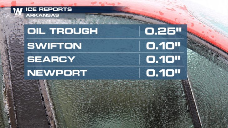
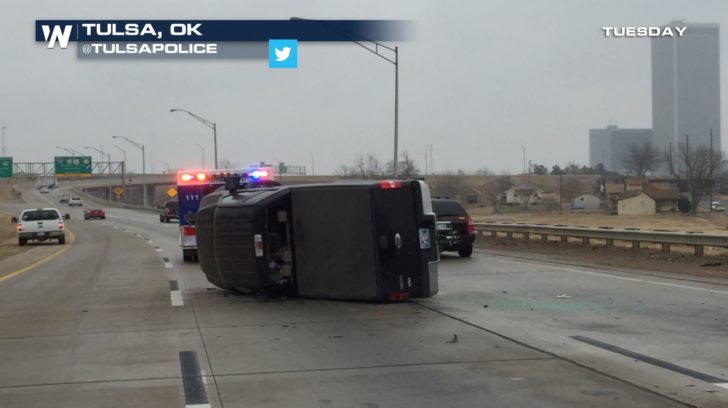 Ice covered roadways and surfaces across Oklahoma and Texas during Tuesday afternoon and evening. Some locations saw ice accumulations of as much as a quarter of an inch.
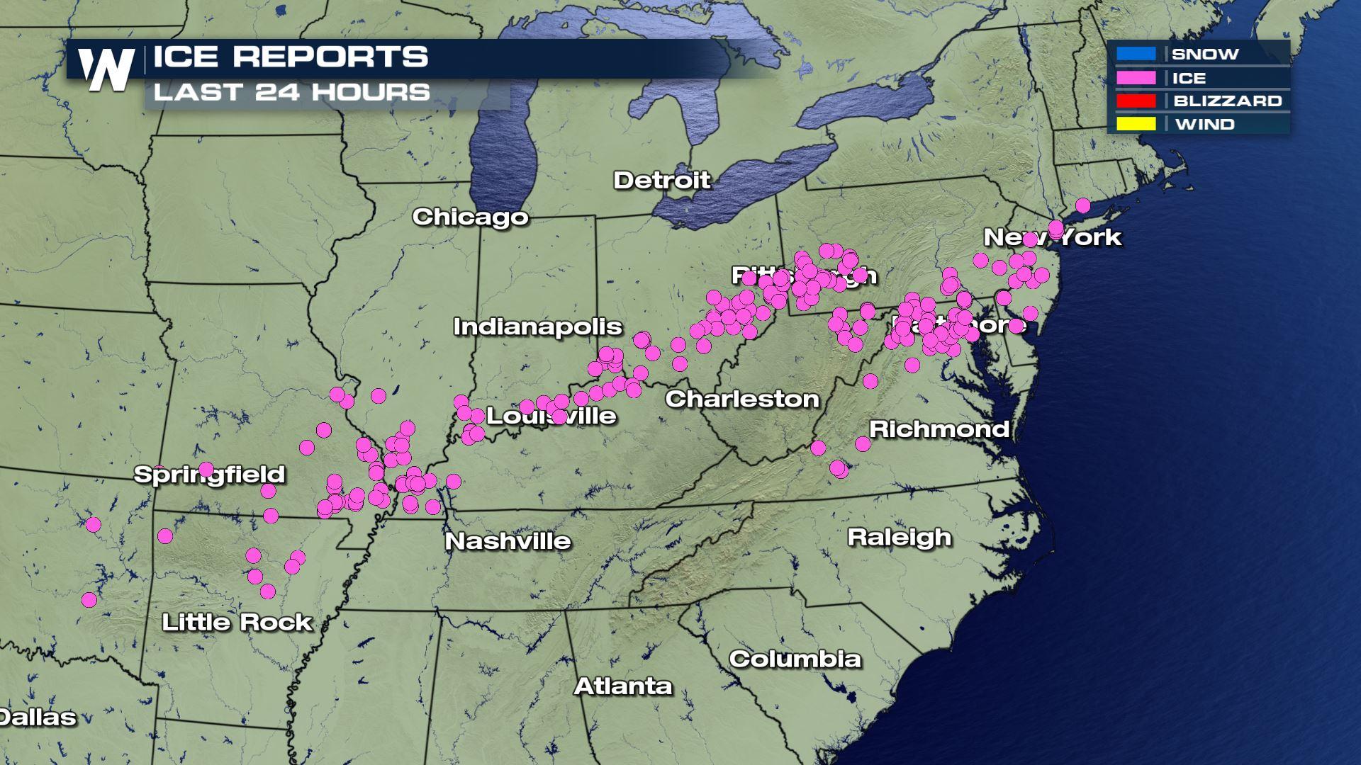
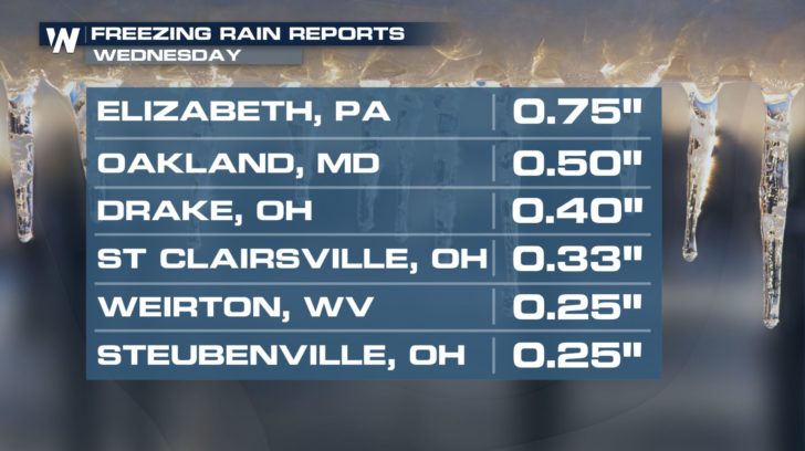
 The freezing rain continued all the way from Oklahoma to Connecticut causing many issues on the roads and causing power outages. Some areas of Ohio, Maryland, and Pennsylvania were put under a Snow Emergency for Wednesday due to the dangerous road conditions from the ice and the snow.
https://twitter.com/NWS_BaltWash/status/961204114591019008
Some places like Elizabeth, PA saw 3/4th of an inch of ice accumulating on surfaces.
The freezing rain continued all the way from Oklahoma to Connecticut causing many issues on the roads and causing power outages. Some areas of Ohio, Maryland, and Pennsylvania were put under a Snow Emergency for Wednesday due to the dangerous road conditions from the ice and the snow.
https://twitter.com/NWS_BaltWash/status/961204114591019008
Some places like Elizabeth, PA saw 3/4th of an inch of ice accumulating on surfaces.
 https://twitter.com/WHSVFPeyton/status/961274389529550849
For WeatherNation, Meteorologist Kate Mantych
https://twitter.com/WHSVFPeyton/status/961274389529550849
For WeatherNation, Meteorologist Kate Mantych
Ice covered roadways and surfaces across Oklahoma and Texas during Tuesday afternoon and evening. Some locations saw ice accumulations of as much as a quarter of an inch.
The freezing rain continued all the way from Oklahoma to Connecticut causing many issues on the roads and causing power outages. Some areas of Ohio, Maryland, and Pennsylvania were put under a Snow Emergency for Wednesday due to the dangerous road conditions from the ice and the snow.
https://twitter.com/NWS_BaltWash/status/961204114591019008
Some places like Elizabeth, PA saw 3/4th of an inch of ice accumulating on surfaces.
https://twitter.com/WHSVFPeyton/status/961274389529550849
For WeatherNation, Meteorologist Kate MantychAll Weather News
More
Strong July Trough Shakes Up Temperatures
"Enough of this heat, already" - everybodyIn
14 Jul 2025 8:00 PM

Flash Flooding Threat Continues in Texas
It has been 10 days since the devastating flo
14 Jul 2025 7:05 PM

Invest 93L Develops Off Florida Coast, CSU Updates Seasonal Forecast
Invest 93L has developed off the Florida coas
14 Jul 2025 7:00 PM

Flooding Concern Growing in the Northeast
Storms rumbling through the northeast on Sund
14 Jul 2025 6:55 PM

Dangerous Heat Impacting the Western U.S.
High pressure is moving off the California co
14 Jul 2025 6:10 PM

Heavy Rain, Flooding Threat Returns to Florida
Keep the rain boots handy in Florida - heavy
13 Jul 2025 12:50 PM

Severe Storm Risk Pushes into the Great Lakes, Ohio Valley
Friday was another busy day with severe weath
12 Jul 2025 8:00 PM