Improving Hurricane Forecasts with Gulfstream Hurricane Hunter Data

Special Stories
3 Apr 2019 3:11 AM
[Gulfstream IV-SP Hurricane Hunter aircraft. From NOAA]
[NOAA] During each hurricane season, NOAA’s Gulfstream-IV (G-IV) Hurricane Hunter aircraft measures wind, temperature, humidity, and pressure in and around hurricanes threatening the United States. An instrument called the dropwindsonde is released from the G-IV to collect the data as it falls to the ocean surface. The plane currently flies where observations from the dropwindsondes will make the best forecasts of where the hurricanes will go (what we call “track forecasts”). The methods to find the right places are more than 20 years old using old computer weather models and methods to put the data into the model. Observing System Simulation Experiments (OSSEs) are used to look at new ways to find where the G-IV should release dropwindsondes to improve forecasts.
In an OSSE, a realistic model of a hurricane (called a “hurricane nature run”) is created. Dropwindsonde measurements are created in the nature run just like they are taken in the real atmosphere. The data is put into the computer forecast models to see how much it improves the forecasts. In a new study published in the AMS Journal, the Hurricane Research and Forecasting (HWRF) model was used to see the forecast in the nature run, just like it is used to forecast hurricanes during hurricane season. Results were compared from data taken at different distances from the center of the hurricane. The impact on forecasts of how strong the storm will be, called intensity forecasts, was also studied.
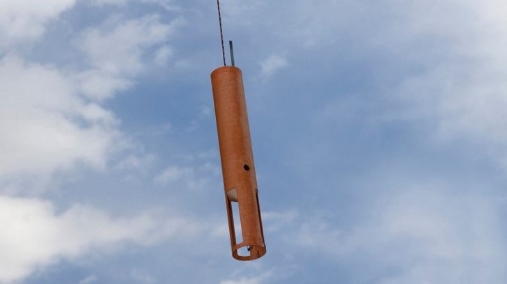 [A dropwindsonde. Credit: NCAR]
Important Conclusions from the study:
1. Dropwindsonde data improve both track and intensity forecasts.
2. There is a preferred region for hurricane data at a distance from the hurricane’s center that depends on the size of the hurricane. Gathering these observations in a large area around large hurricanes and in a small area around small hurricanes showed the most impact.
3. Dropwindsonde data closest to the hurricane improved track forecasts the most.
Edited for WeatherNation by Meteorologist Mace Michaels
[A dropwindsonde. Credit: NCAR]
Important Conclusions from the study:
1. Dropwindsonde data improve both track and intensity forecasts.
2. There is a preferred region for hurricane data at a distance from the hurricane’s center that depends on the size of the hurricane. Gathering these observations in a large area around large hurricanes and in a small area around small hurricanes showed the most impact.
3. Dropwindsonde data closest to the hurricane improved track forecasts the most.
Edited for WeatherNation by Meteorologist Mace MichaelsAll Weather News
More


More Storms for the East Sunday and Monday
A low-pressure system crashing through the Mi
2 Aug 2026 2:20 AM

After Reaching Category 5, Genevieve Weakens in the Pacific
PacificGenevieve formed on last Friday south
2 Aug 2026 1:30 AM

Flooding, Severe Storms Target the Midwest Again
After an active week of storms across the nor
1 Aug 2026 1:40 AM

Flooding Risk Increases as Heavy Rain Targets the Tri-State Area
Tuesday, heavy rainfall moved across the Nort
30 Jul 2026 12:25 AM

Severe Weather: Energy From the Midwest Now in the Southeast
UPPER MIDWEST - Through Monday, dangerous tor
29 Jul 2026 10:30 PM