Isaias Recap
Special Stories
5 Aug 2020 8:00 PM
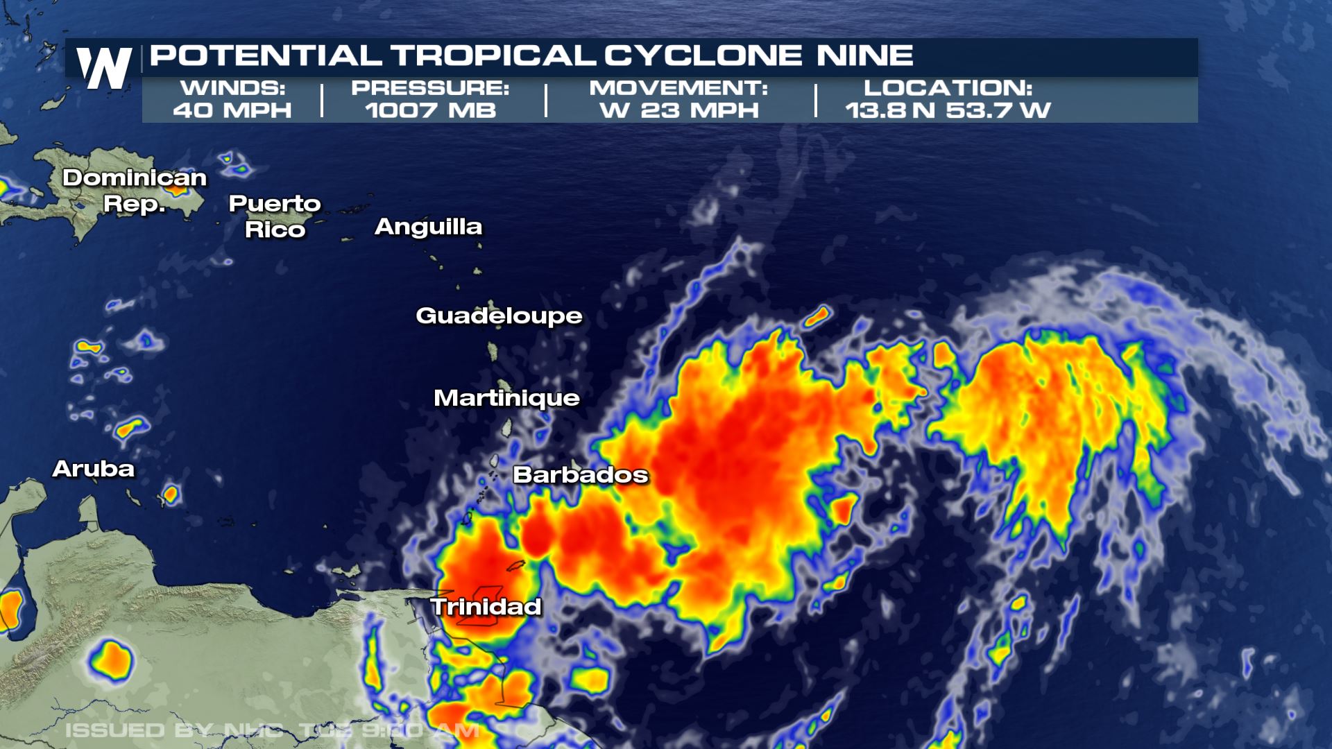
Isaias began developing over a week ago as an unorganized cluster of storms in the eastern Caribbean, strengthening to a Category 1 Hurricane with max sustained winds of 85 mph by the time it made landfall in the United States.
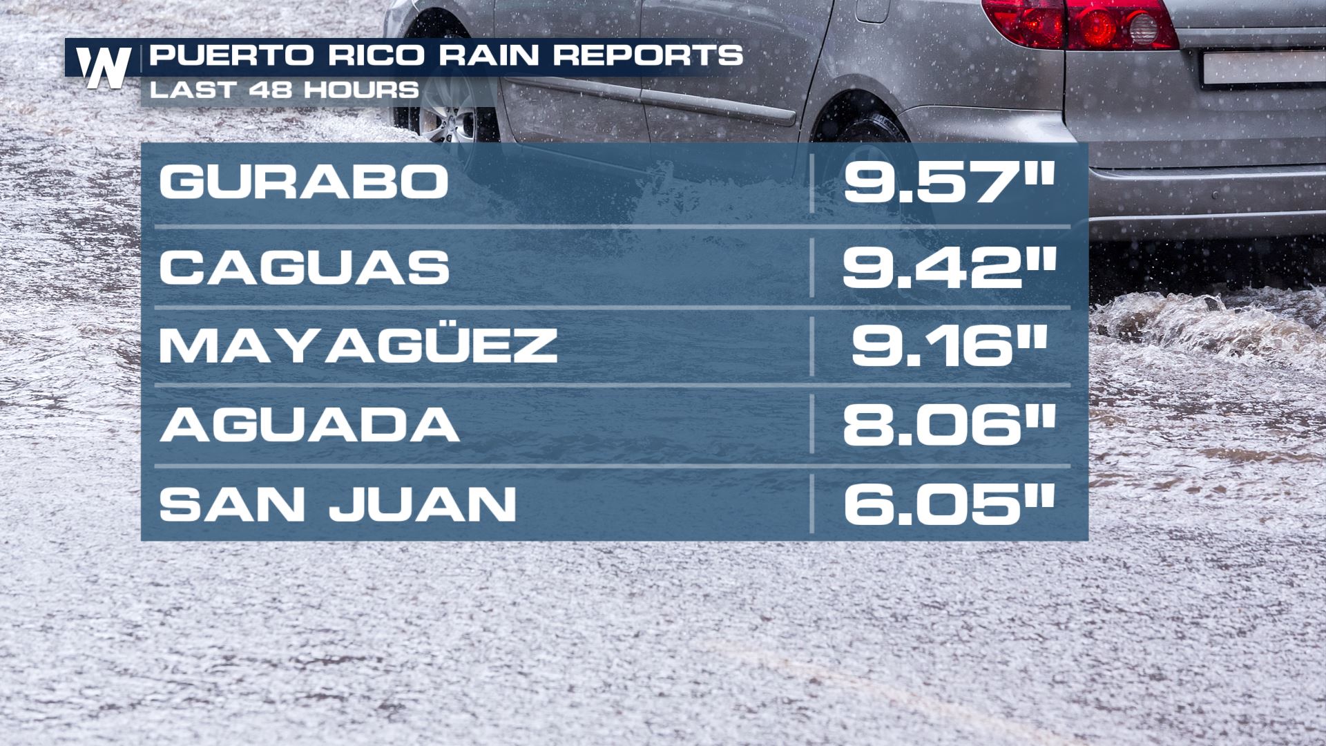
 After passing over the Lesser Antilles, the system strengthen to a Tropical Storm and impacted Puerto Rico by dumping between 6" -10" of rain. Debris flows and devastating flooding took over the island as the slow moving system passed.
https://twitter.com/WeatherNation/status/1288957215907479553
https://twitter.com/WeatherNation/status/1289161636381679616
After passing over the Lesser Antilles, the system strengthen to a Tropical Storm and impacted Puerto Rico by dumping between 6" -10" of rain. Debris flows and devastating flooding took over the island as the slow moving system passed.
https://twitter.com/WeatherNation/status/1288957215907479553
https://twitter.com/WeatherNation/status/1289161636381679616
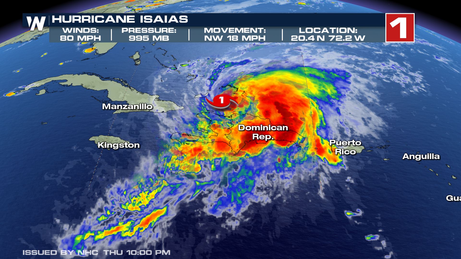
 As the system moved over Hispaniola, it strengthened to Category 1 Hurricane on July 31st, while moving toward The Bahamas.
 https://twitter.com/WeatherNation/status/1289319210963935232
Hurricane Isaias held it's strength as it moved through the southern islands of the Bahamas and Turks and Caicos. Eventually making a landfall over Andros Island in the northwestern region of the Bahamas.
https://twitter.com/WeatherNation/status/1289659669028524032
This interaction brought the storm strength down, slightly, to a tropical storm as it started to approach the southern parts of Florida.
https://twitter.com/WeatherNation/status/1289319210963935232
Hurricane Isaias held it's strength as it moved through the southern islands of the Bahamas and Turks and Caicos. Eventually making a landfall over Andros Island in the northwestern region of the Bahamas.
https://twitter.com/WeatherNation/status/1289659669028524032
This interaction brought the storm strength down, slightly, to a tropical storm as it started to approach the southern parts of Florida.
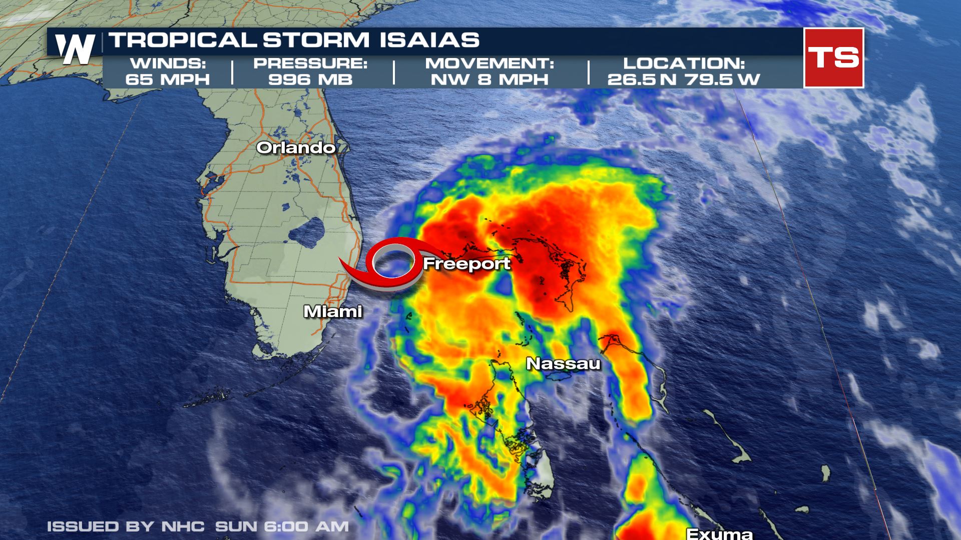 The impacts throughout Florida included gusty wind along the beach and outer bands bringing off and on downpours. The storm's center was just far enough of coast the major impacts remained over the open water.
https://twitter.com/WeatherNation/status/1289887253573984257
The storm was able to churn in the open water and this allowed it to strengthen. Outer rain bans impacted southern Georgia and South Carolina by early on Aug. 3rd.
The impacts throughout Florida included gusty wind along the beach and outer bands bringing off and on downpours. The storm's center was just far enough of coast the major impacts remained over the open water.
https://twitter.com/WeatherNation/status/1289887253573984257
The storm was able to churn in the open water and this allowed it to strengthen. Outer rain bans impacted southern Georgia and South Carolina by early on Aug. 3rd.
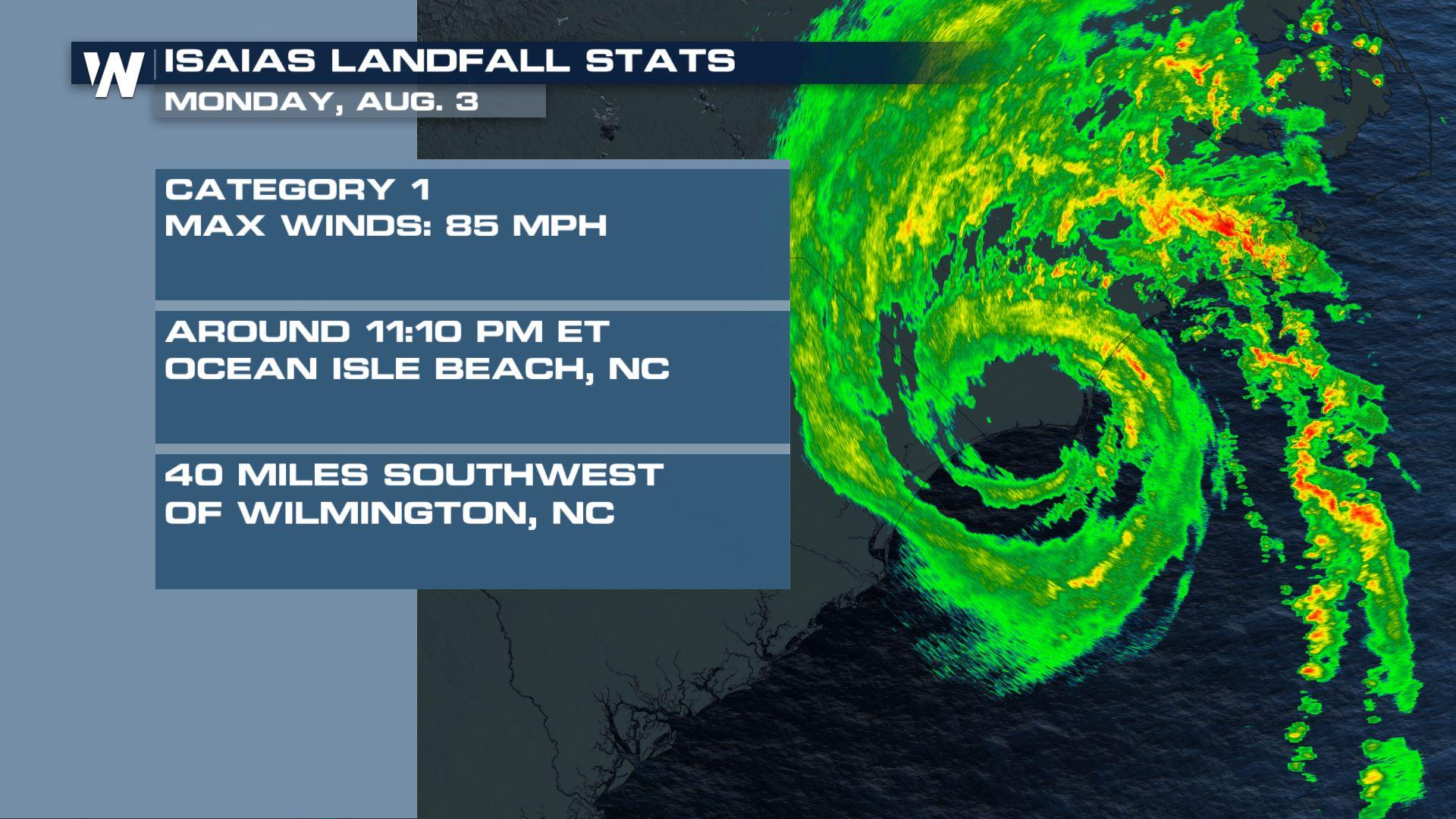
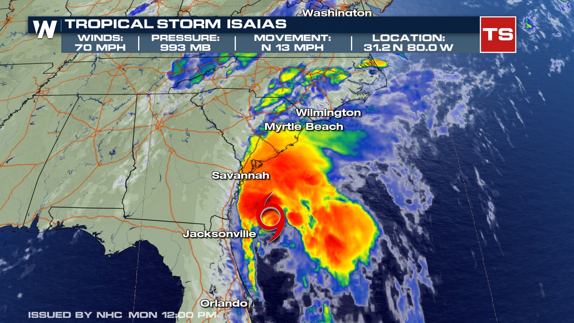 The storm strengthened back to a Category 1 Hurricane with max sustained wind of 85 mph as it made landfall over Ocean Isle Beach, NC at 11:10 p.m. ET Monday, Aug. 3rd.
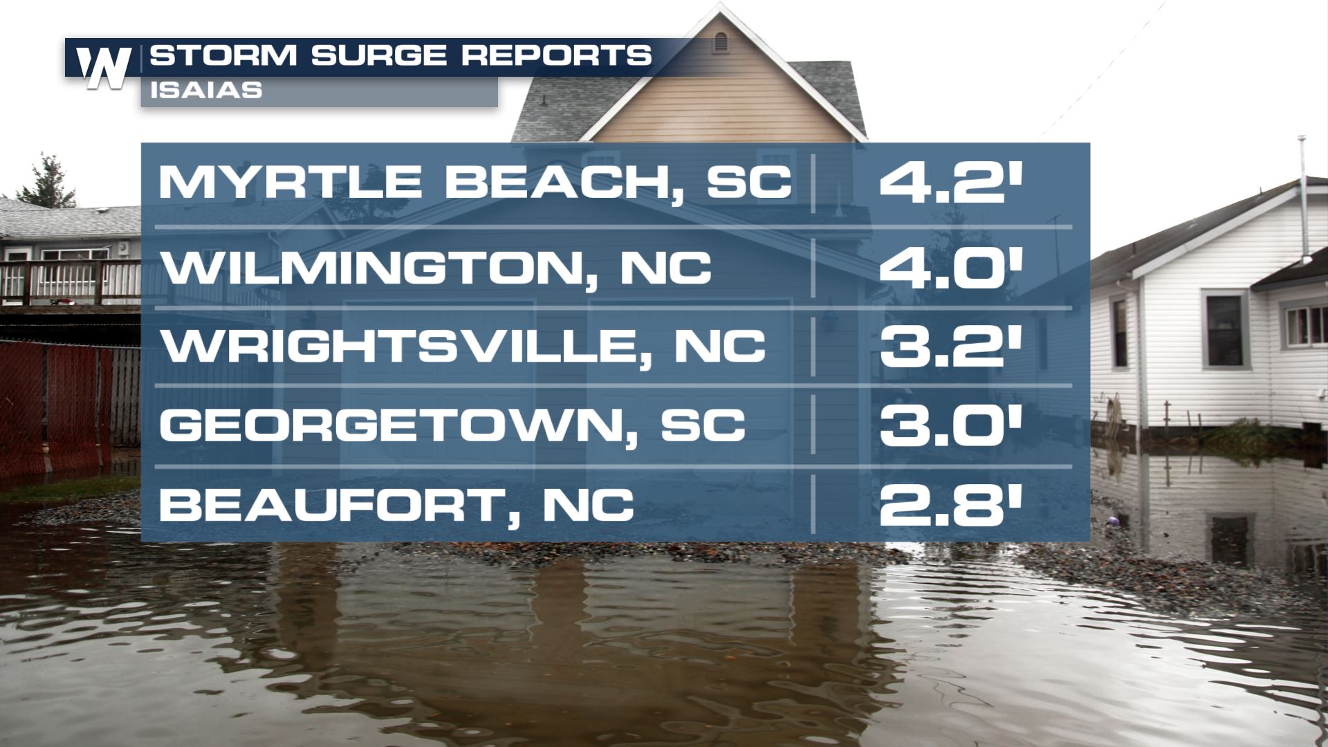
 Storm surge along the Carolinas' Coast ranged anywhere from 2 to 4+ feet on top of several inches of rain inundating coastal communities with water.
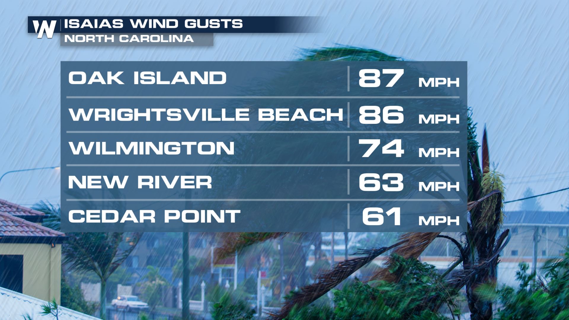
 Wind from this storm was gusting even stronger than 85 mph at times through North Carolina. Oak Island, NC was hit with a gust of 87 mph on top of the storm surge and rain.
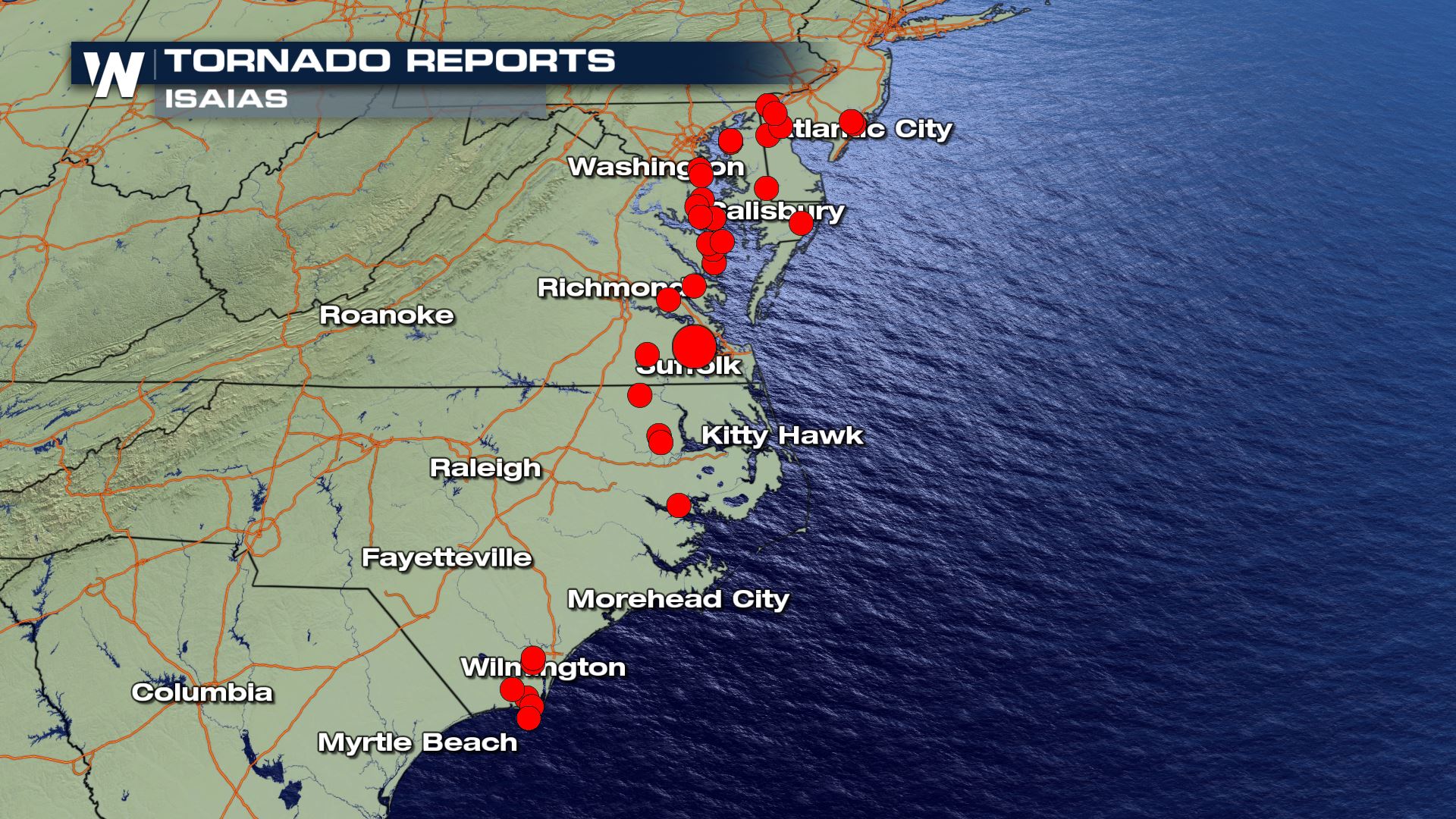
 As Isaias' wind weakened to a sustained 70 mph its speed picked up and impacts were felt all the way up to Canada. Tornadoes were numerous in the outer bands as the storm moved along the coast. Many water spouts moved onshore while inland tornadoes were strong and long lasting. The red dots indicate the reported sightings and damage from the tornadoes.
 https://twitter.com/WeatherNation/status/1290844979527446528
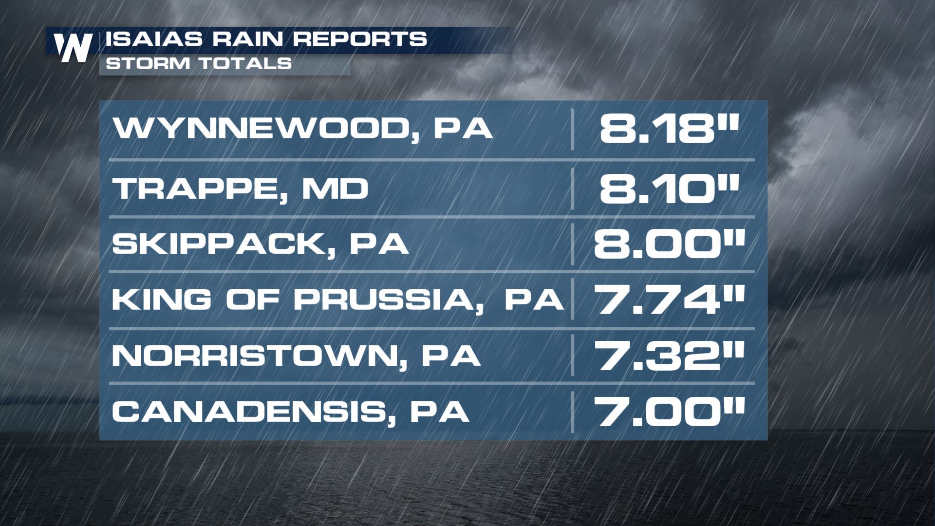
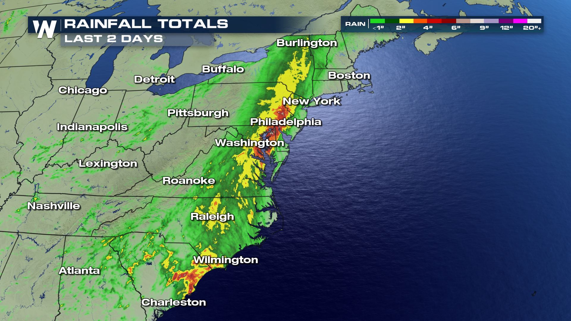
As the storm continued farther north, the tornado risk started to weaken but the flooding risk ramped-up. Over 8" of rain fell in parts of New England leading in imminent flooding concerns.
https://twitter.com/WeatherNation/status/1290844979527446528
As the storm continued farther north, the tornado risk started to weaken but the flooding risk ramped-up. Over 8" of rain fell in parts of New England leading in imminent flooding concerns.
 https://twitter.com/WeatherNation/status/1290814779158913024
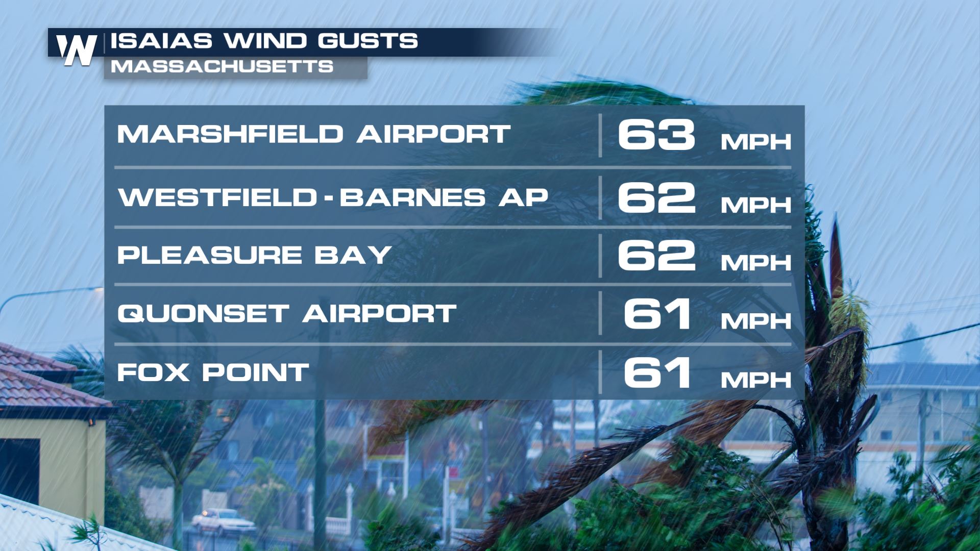
 The wind remained gusty which lead to many trees coming down under the weak ground from the rain thus leaving millions without power Tuesday Aug. 4th and Wednesday Aug. 5th.
 Clean up efforts are underway from millions as the tropical system is gone and quieter conditions return.
https://twitter.com/WeatherNation/status/1290777030691258369
We were with you before, during and after the storm and strive to keep you aware and safe.
Clean up efforts are underway from millions as the tropical system is gone and quieter conditions return.
https://twitter.com/WeatherNation/status/1290777030691258369
We were with you before, during and after the storm and strive to keep you aware and safe.
After passing over the Lesser Antilles, the system strengthen to a Tropical Storm and impacted Puerto Rico by dumping between 6" -10" of rain. Debris flows and devastating flooding took over the island as the slow moving system passed.
https://twitter.com/WeatherNation/status/1288957215907479553
https://twitter.com/WeatherNation/status/1289161636381679616
As the system moved over Hispaniola, it strengthened to Category 1 Hurricane on July 31st, while moving toward The Bahamas.
https://twitter.com/WeatherNation/status/1289319210963935232
Hurricane Isaias held it's strength as it moved through the southern islands of the Bahamas and Turks and Caicos. Eventually making a landfall over Andros Island in the northwestern region of the Bahamas.
https://twitter.com/WeatherNation/status/1289659669028524032
This interaction brought the storm strength down, slightly, to a tropical storm as it started to approach the southern parts of Florida.
The impacts throughout Florida included gusty wind along the beach and outer bands bringing off and on downpours. The storm's center was just far enough of coast the major impacts remained over the open water.
https://twitter.com/WeatherNation/status/1289887253573984257
The storm was able to churn in the open water and this allowed it to strengthen. Outer rain bans impacted southern Georgia and South Carolina by early on Aug. 3rd.
The storm strengthened back to a Category 1 Hurricane with max sustained wind of 85 mph as it made landfall over Ocean Isle Beach, NC at 11:10 p.m. ET Monday, Aug. 3rd.
Storm surge along the Carolinas' Coast ranged anywhere from 2 to 4+ feet on top of several inches of rain inundating coastal communities with water.
Wind from this storm was gusting even stronger than 85 mph at times through North Carolina. Oak Island, NC was hit with a gust of 87 mph on top of the storm surge and rain.
As Isaias' wind weakened to a sustained 70 mph its speed picked up and impacts were felt all the way up to Canada. Tornadoes were numerous in the outer bands as the storm moved along the coast. Many water spouts moved onshore while inland tornadoes were strong and long lasting. The red dots indicate the reported sightings and damage from the tornadoes.
https://twitter.com/WeatherNation/status/1290844979527446528
As the storm continued farther north, the tornado risk started to weaken but the flooding risk ramped-up. Over 8" of rain fell in parts of New England leading in imminent flooding concerns.
https://twitter.com/WeatherNation/status/1290814779158913024
The wind remained gusty which lead to many trees coming down under the weak ground from the rain thus leaving millions without power Tuesday Aug. 4th and Wednesday Aug. 5th.
Clean up efforts are underway from millions as the tropical system is gone and quieter conditions return.
https://twitter.com/WeatherNation/status/1290777030691258369
We were with you before, during and after the storm and strive to keep you aware and safe.All Weather News
More
East Gears Up for Stormy, Wet Weekend
A low pressure system crashing through the Mi
1 Aug 2026 11:35 AM


Flooding, Severe Storms Target the Midwest Again
After an active week of storms across the nor
1 Aug 2026 1:40 AM


After Reaching Category 5, Genevieve Weakens in the Pacific
PacificFausto is now a post-tropical cyclone.
31 Jul 2026 1:30 AM

Flooding Risk Increases as Heavy Rain Targets the Tri-State Area
Tuesday, heavy rainfall moved across the Nort
30 Jul 2026 12:25 AM

Severe Weather: Energy From the Midwest Now in the Southeast
UPPER MIDWEST - Through Monday, dangerous tor
29 Jul 2026 10:30 PM