Isolated Severe Risk Returns Wednesday
Top Stories
15 Jan 2020 4:31 AM
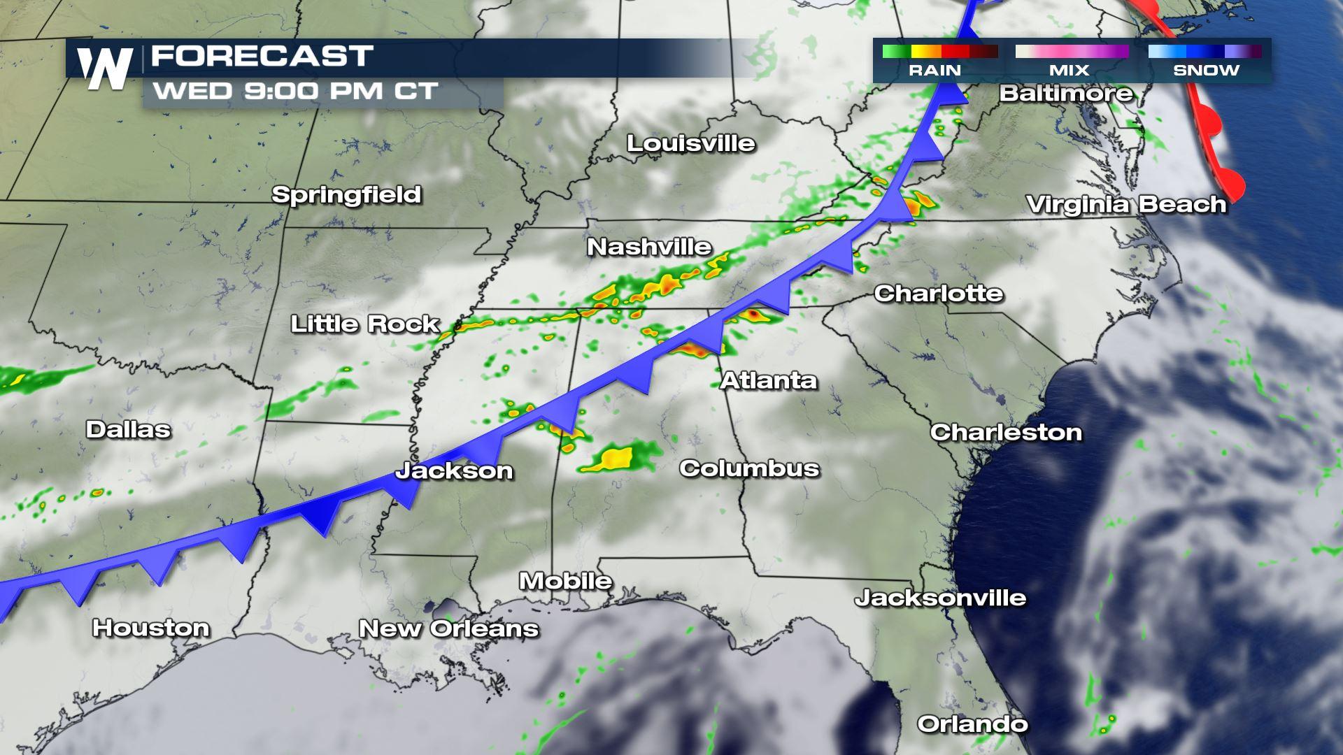
The stationary front that brought the severe and heavy rain to the Southeast will be moving into the Atlantic today, but another cold front pushing south will bring some isolated severe storm chances to areas of the the Mississippi Valley, Tennessee Valley and southern Appalachians. Here is the latest on today's severe forecast.
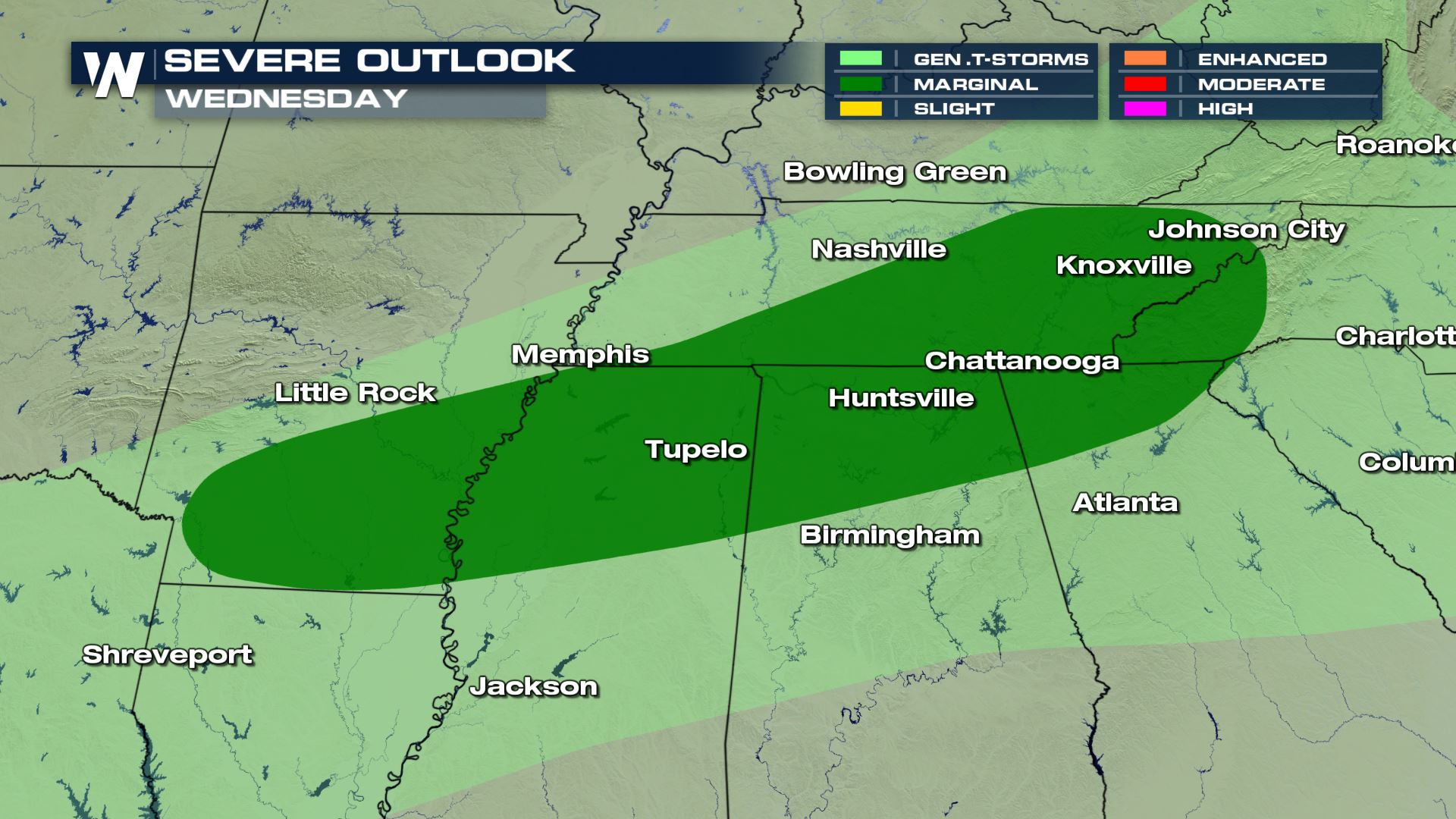 Compared to Tuesday the severe risk will shift more north into areas of Tennessee and North Carolina. Areas down along the Gulf Coast will be getting a break from the active weather pattern this afternoon and evening. It's a Marginal risk meaning only an isolated severe chance, but it is still something you will want to be prepared for in these areas.
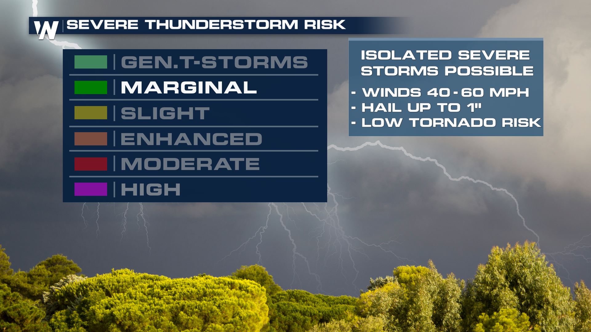
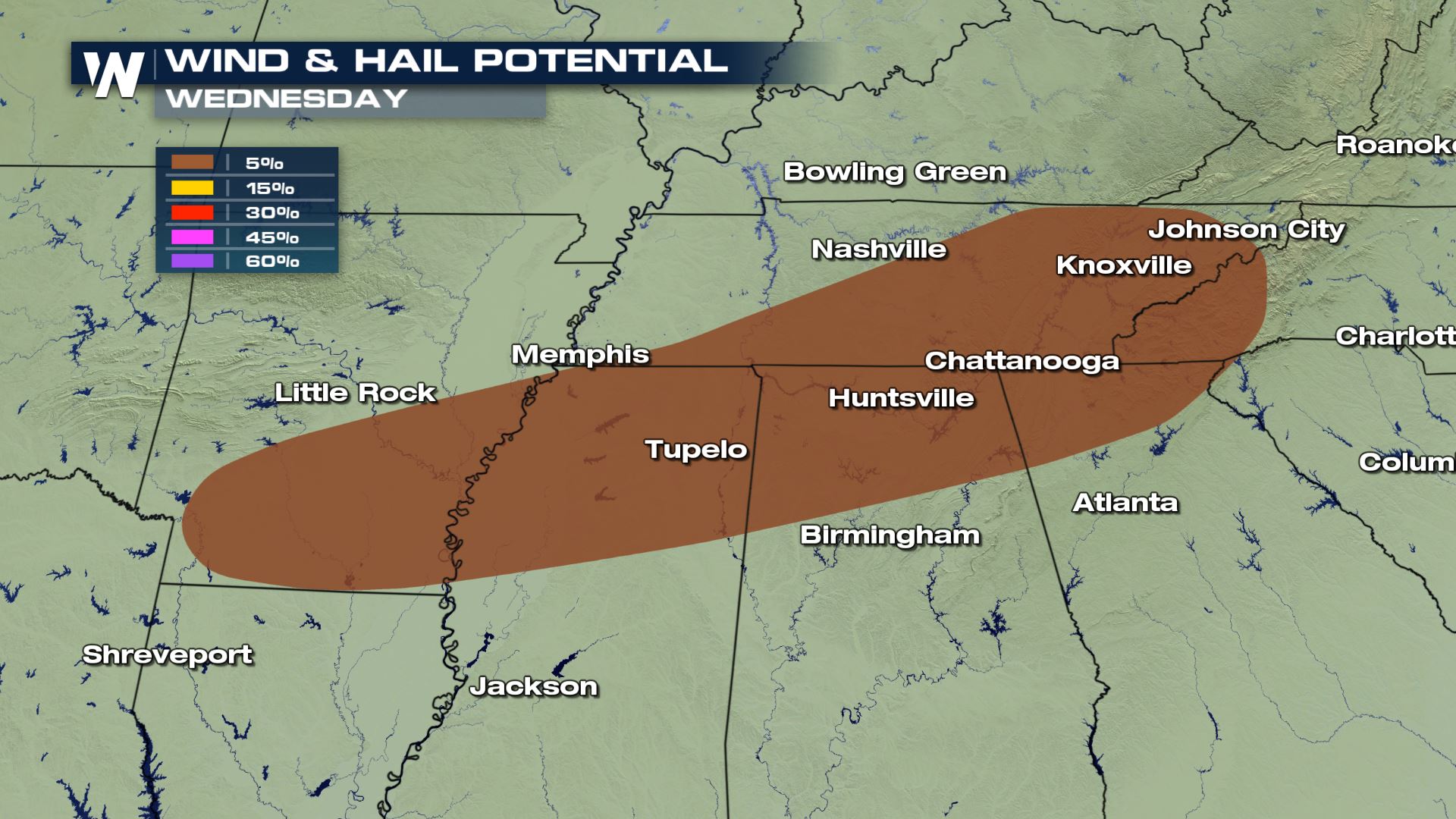 The main severe weather threat will be large hail and damaging wind gusts. The tornado risk will be low, but when it comes to severe storms you can never 100% rule out a tornado.
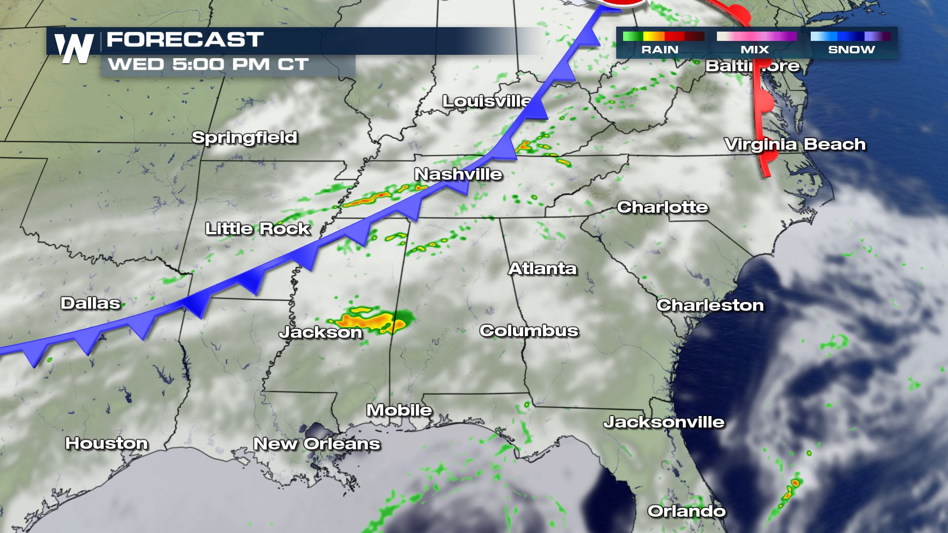
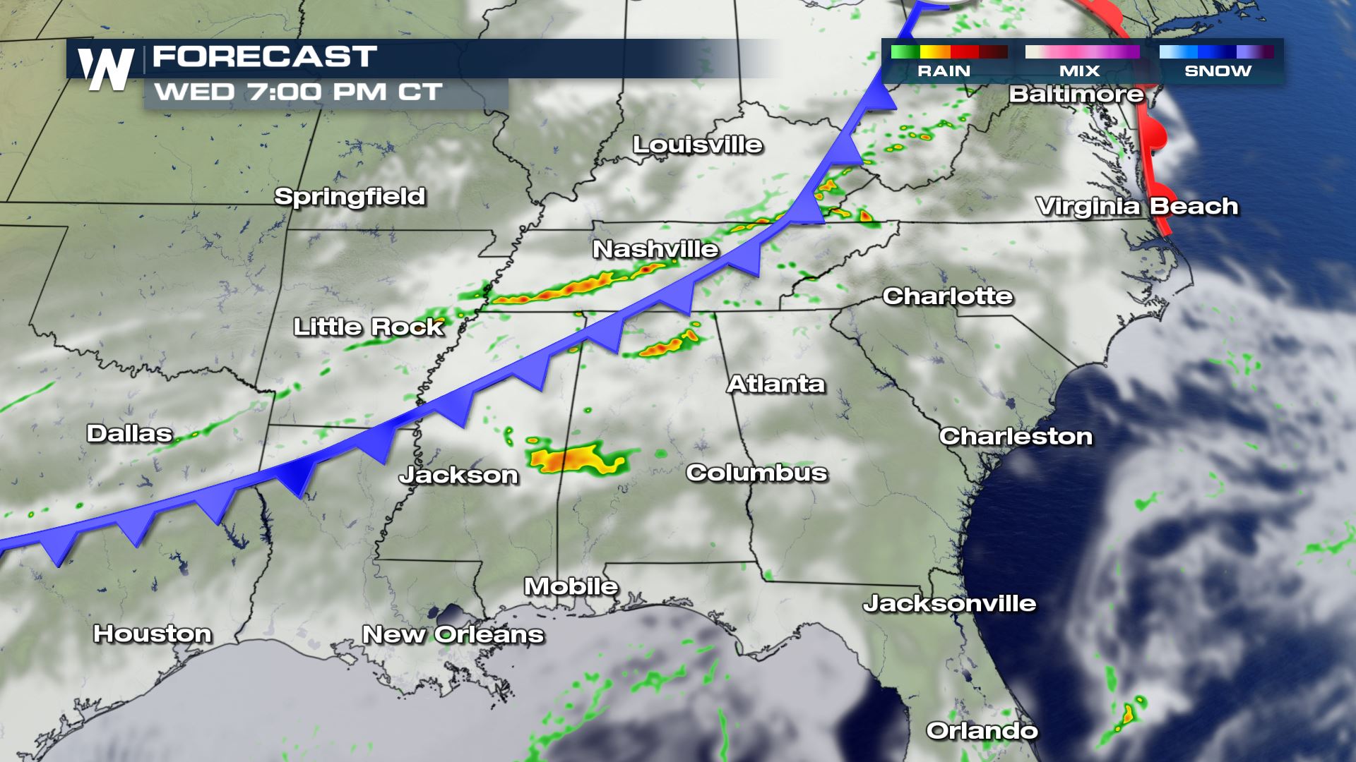

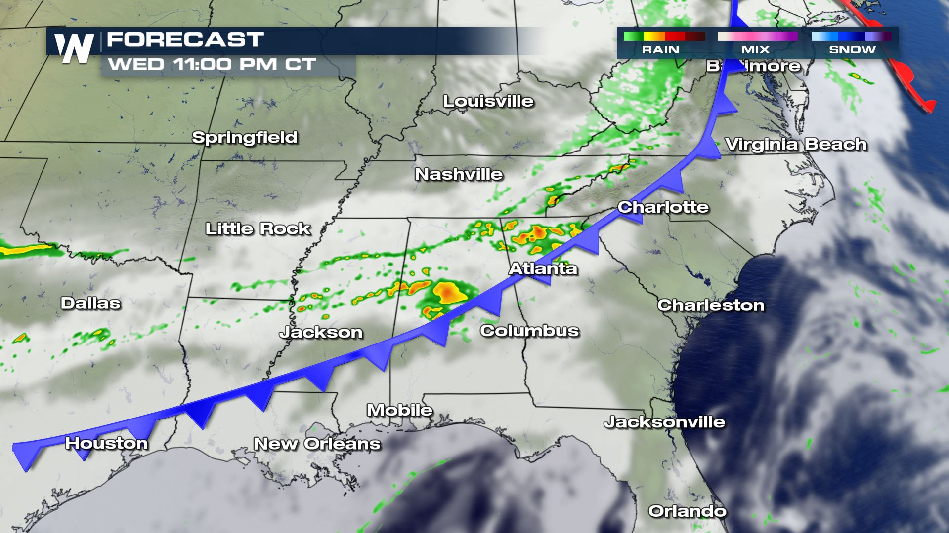 The timing for today's strong storms will be during the late afternoon and early evening. Some strong storms could last past midnight and into early Thursday morning. You will want to make sure you have a way to receive weather alerts into the early morning hours.
Keep checking with WeatherNation for more updates on today's severe risk.
The timing for today's strong storms will be during the late afternoon and early evening. Some strong storms could last past midnight and into early Thursday morning. You will want to make sure you have a way to receive weather alerts into the early morning hours.
Keep checking with WeatherNation for more updates on today's severe risk.
Severe Outlook
Compared to Tuesday the severe risk will shift more north into areas of Tennessee and North Carolina. Areas down along the Gulf Coast will be getting a break from the active weather pattern this afternoon and evening. It's a Marginal risk meaning only an isolated severe chance, but it is still something you will want to be prepared for in these areas.
Severe Risks
The main severe weather threat will be large hail and damaging wind gusts. The tornado risk will be low, but when it comes to severe storms you can never 100% rule out a tornado.
Forecast
The timing for today's strong storms will be during the late afternoon and early evening. Some strong storms could last past midnight and into early Thursday morning. You will want to make sure you have a way to receive weather alerts into the early morning hours.
Keep checking with WeatherNation for more updates on today's severe risk.
All Weather News
More
Severe Storms Target the Midwest to the Northeast
UPPER MIDWEST - Dangerous tornadoes have alre
28 Jul 2026 1:45 AM

Tropics: Fausto Heads towards Hawaii; Genevieve Cat 4 Hurricane
PacificHurricane Fausto continues to track we
28 Jul 2026 1:45 AM


Southeast Flood Risk Lingers Near Stalled Front
A stalled boundary over the Southeast will ke
25 Jul 2026 10:55 AM

Another Round of Storms Targets the Northeast
Tuesday brought severe weather again across p
23 Jul 2026 1:15 AM

Another Round of Severe Weather for the Upper Midwest and Great Lakes
The upper-level low train continues to keep t
21 Jul 2026 1:45 AM