Isolated Severe Storms for Texas Sunday
Top Stories
15 Mar 2020 4:55 AM
A disturbance moving out of the Gulf of California will bring an increasing chance for showers and storms in western Texas and southeast New Mexico Sunday. Some storms could be severe with large hail, damaging winds and isolated tornadoes. Here is the latest severe weather forecast.
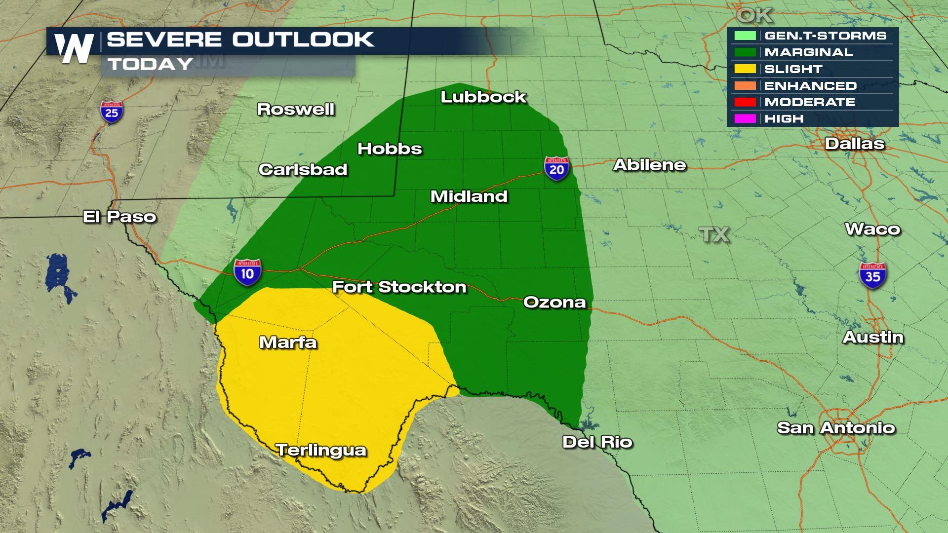
 Today's risk of severe weather will be confined to western Texas and southeast New Mexico. Numerous storms will develop over northern Mexico and then move into the Lone Start State.
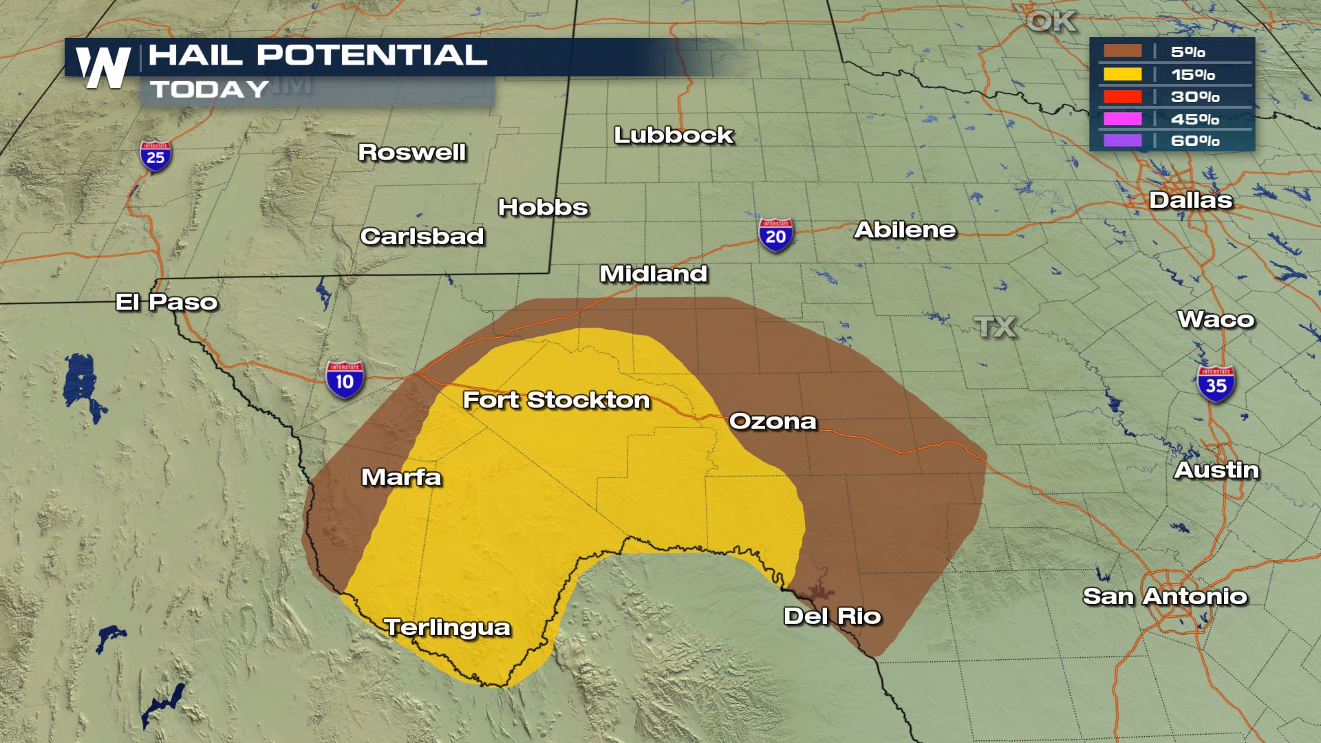
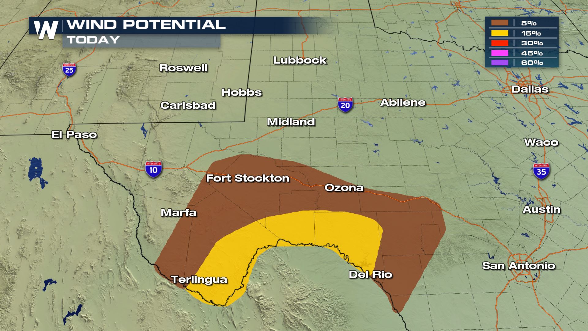
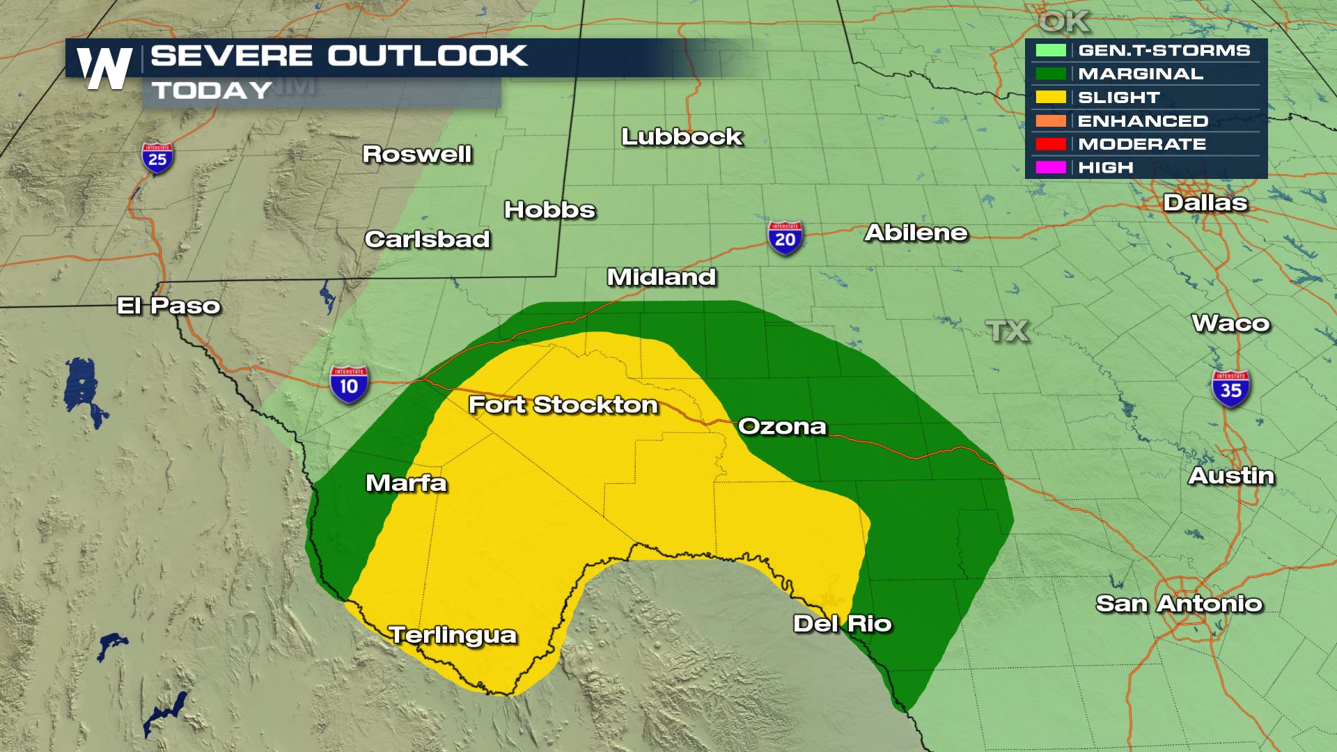
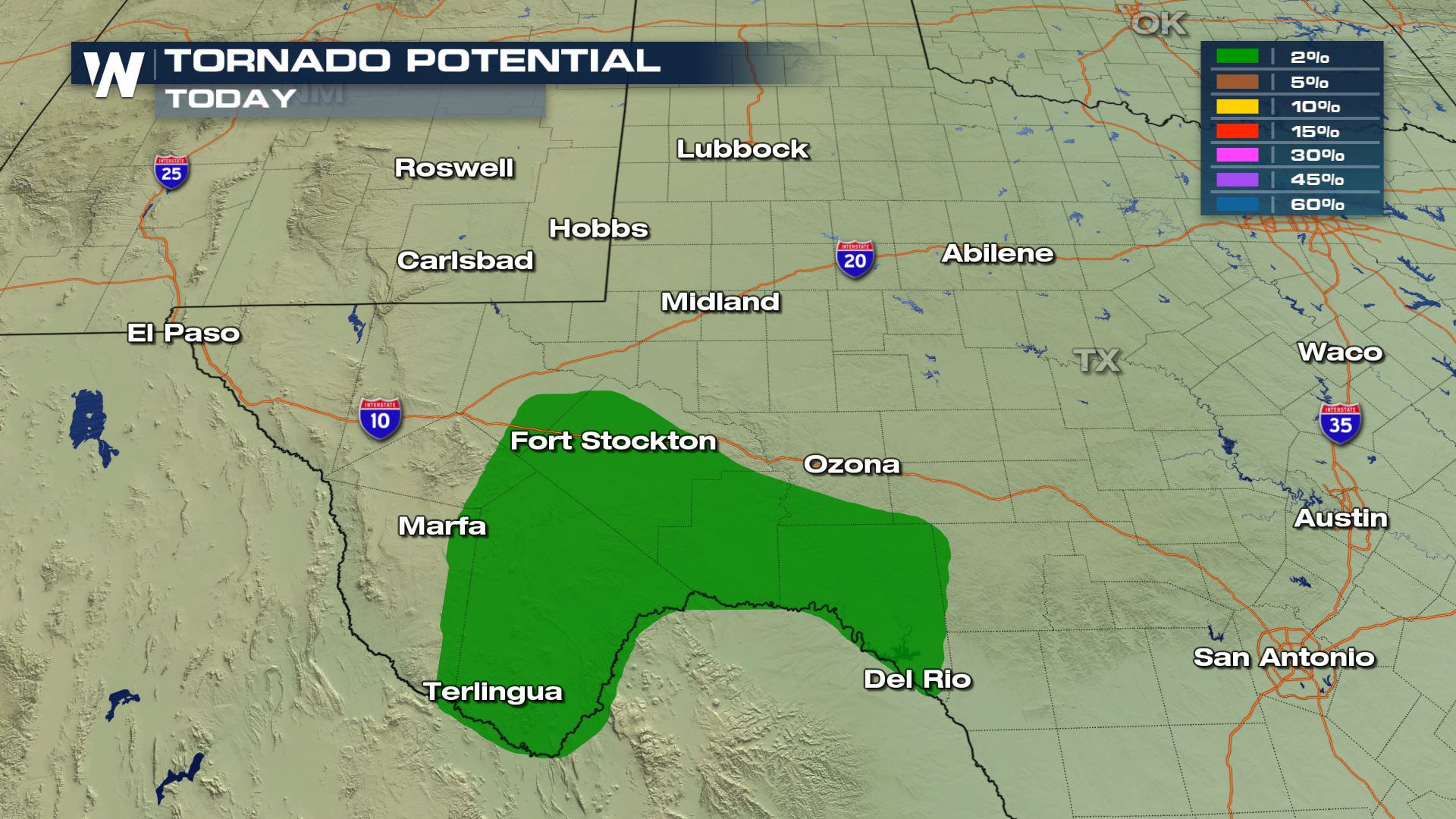 All modes of severe weather are in the forecast with the highest risk being the large hail. A lot of the storms will be over rural areas, but nonetheless you will want to be weather aware with today's set-up.
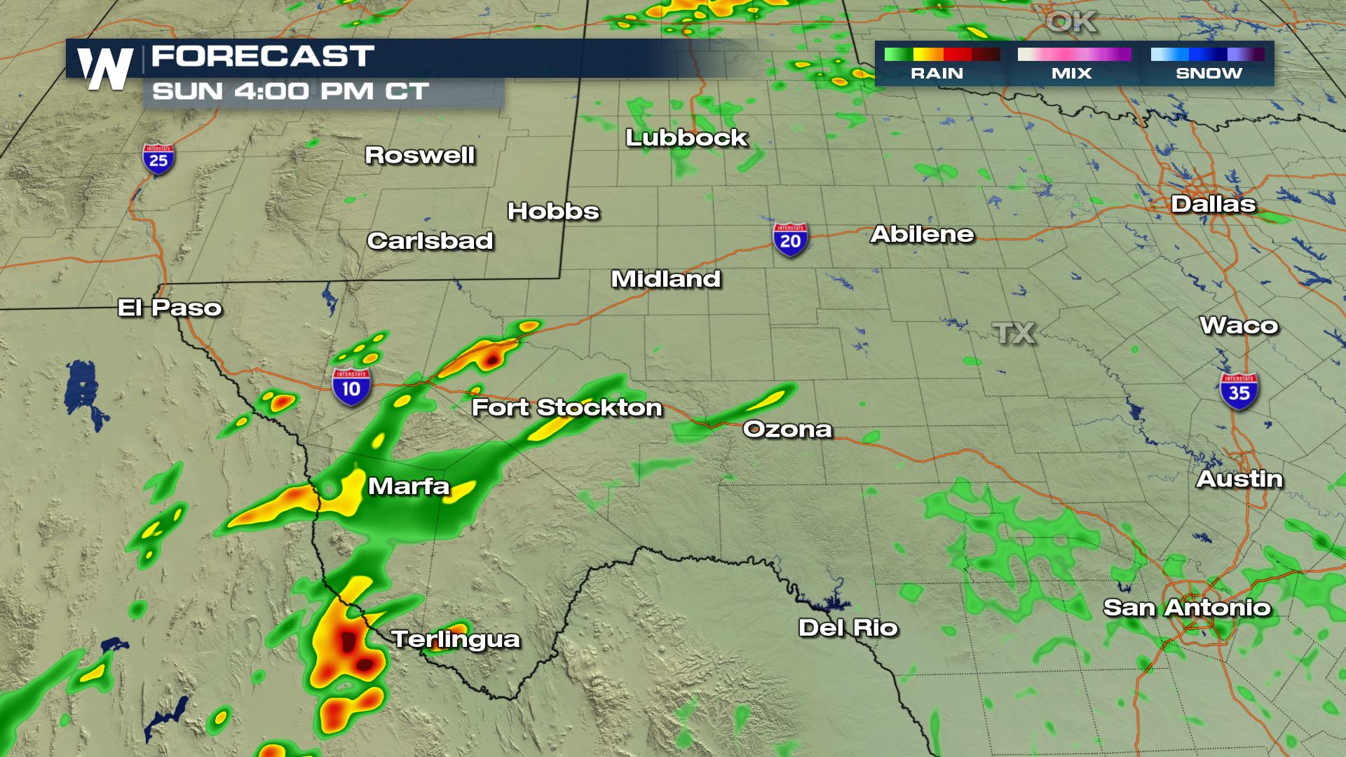
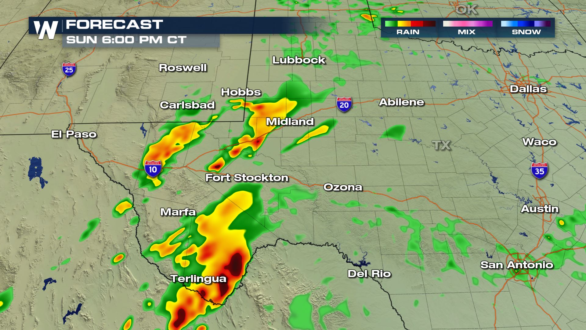
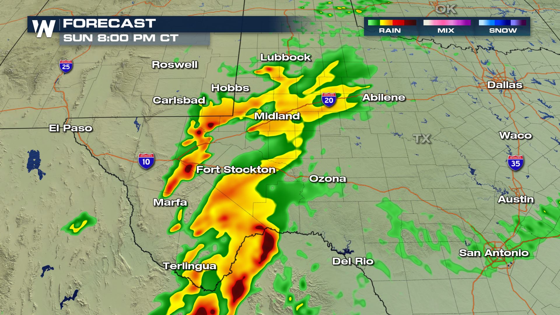 The storms will be firing over northern Mexico and then move into western Texas for the afternoon and evening. During the peak heating hours this afternoon is when the highest risk of severe weather will arrive.
Keep checking with WeatherNation for the very latest on today's severe weather.
The storms will be firing over northern Mexico and then move into western Texas for the afternoon and evening. During the peak heating hours this afternoon is when the highest risk of severe weather will arrive.
Keep checking with WeatherNation for the very latest on today's severe weather.
Severe Outlook
Today's risk of severe weather will be confined to western Texas and southeast New Mexico. Numerous storms will develop over northern Mexico and then move into the Lone Start State.
Severe Risks
All modes of severe weather are in the forecast with the highest risk being the large hail. A lot of the storms will be over rural areas, but nonetheless you will want to be weather aware with today's set-up.
Forecast
The storms will be firing over northern Mexico and then move into western Texas for the afternoon and evening. During the peak heating hours this afternoon is when the highest risk of severe weather will arrive.
Keep checking with WeatherNation for the very latest on today's severe weather.All Weather News
More
Hurricane Flossie Continues to Weaken
Hurricane FlossieThe National Hurricane Cente
3 Jul 2025 2:50 AM

NHC Monitoring Front in the Southeast Ahead of 4th of July
Later this week, a frontal boundary is expect
3 Jul 2025 1:00 AM

Northern Plains to Upper Midwest Severe Storms Threaten Holiday Travel
NORTHERN PLAINS - A frontal system is expecte
3 Jul 2025 1:00 AM


Northwest Heat Met With Thunderstorm Risk
NORTHWEST - Today, portions of Montana are un
3 Jul 2025 12:00 AM

Near Seasonal Temperatures for Many Come July 4th!
AAA is expecting over 70 million travelers to
2 Jul 2025 6:40 PM

Severe Weather Threat Continues in the Midwest
It has been an active, severe season across t
30 Jun 2025 9:00 PM