Isolated Severe Storms in the Northeast
Top Stories
14 Jul 2021 3:40 PM
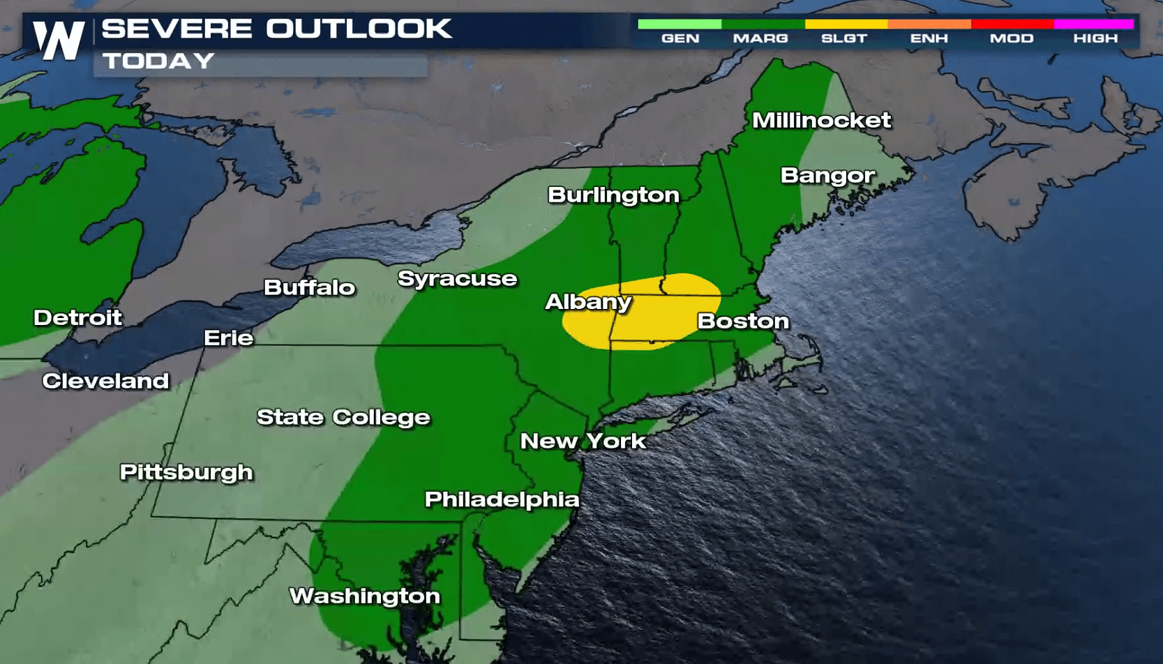
A weak front in the Northeast will keep a chance of severe storms in the forecast today (Wednesday). There is a slight risk for severe storms (yellow, level 2 on a scale of 2 to 5) centered near the Berkshire Mountains in western Massachusetts. There is a marginal threat for severe thunderstorms (green, level 1) from northern New England to Chesapeake Bay.
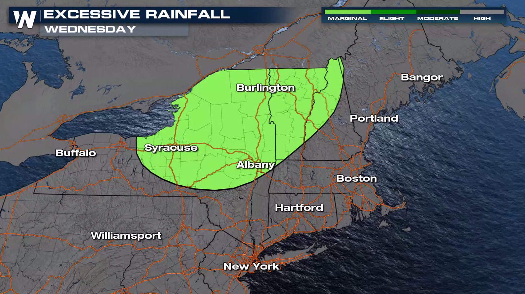
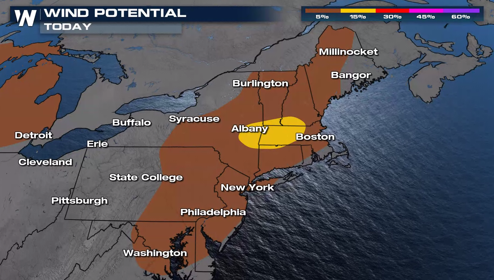 Strong downdraft winds are the main threats at this time but small hail and heavy rain could lead to localized flooding concerns. Some areas could see a couple of inches of rainfall on already saturated soils.
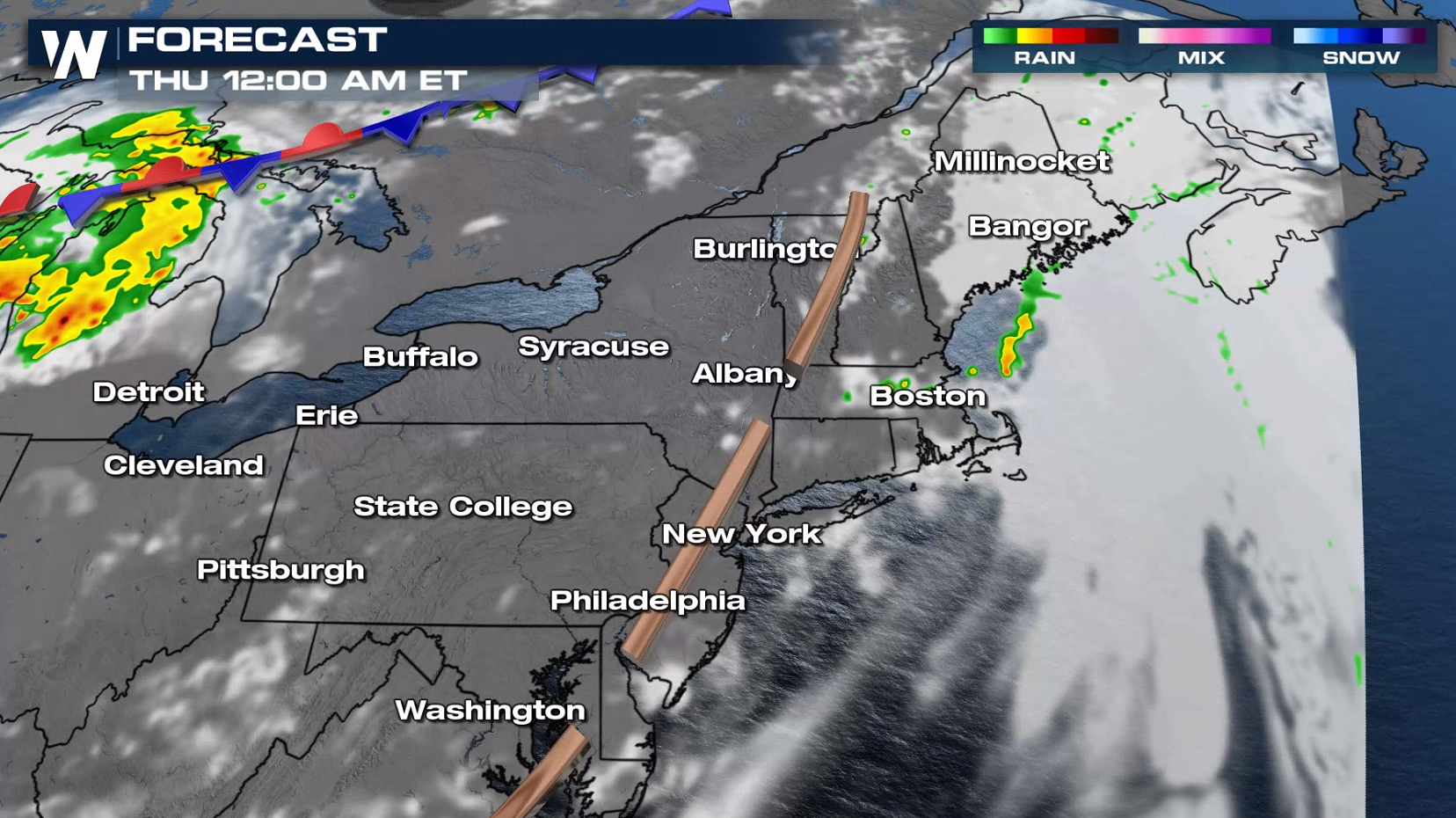
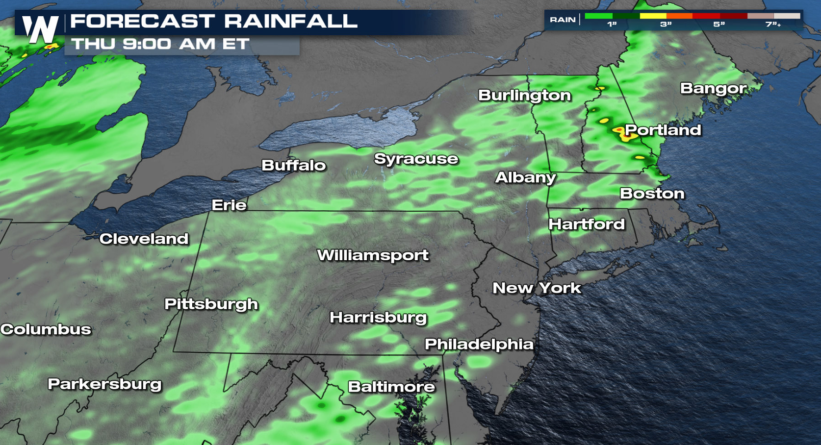 Storms will continue to fire into the early evening. The trough will move offshore by midnight, sweeping the severe weather threat out into the Atlantic.
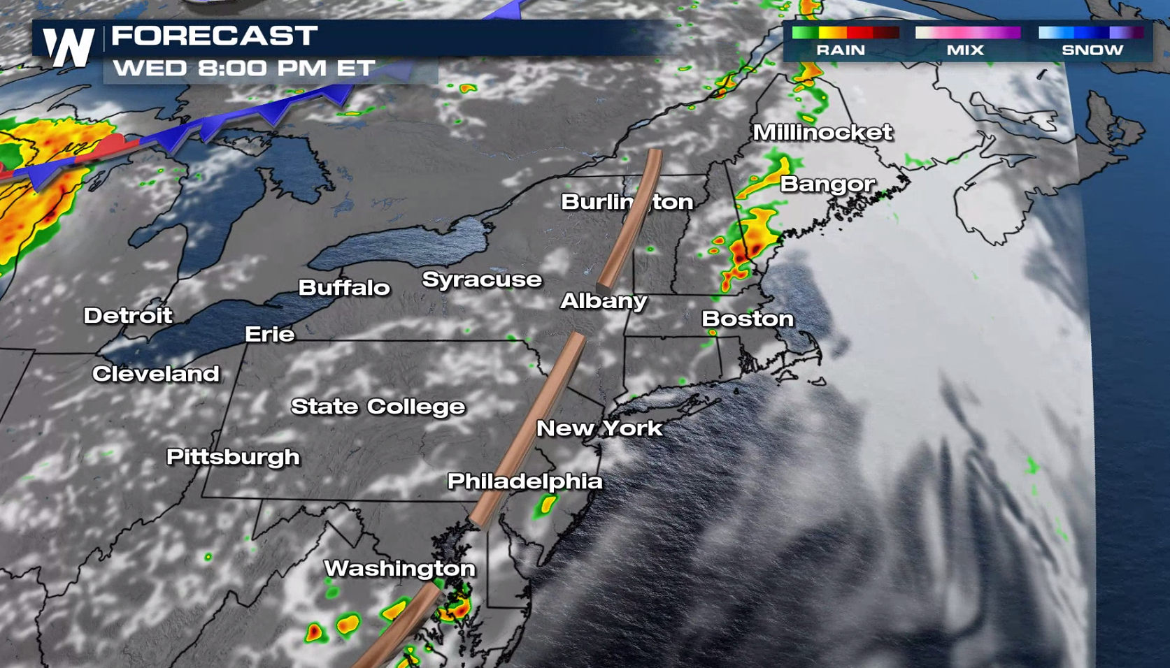 Most of the storms will move offshore by midnight, with just a few trailing storms left.
 We will be covering this on WeatherNation in our top weather headlines and in our Eastern regional forecast which airs :10 past the hour.
Strong downdraft winds are the main threats at this time but small hail and heavy rain could lead to localized flooding concerns. Some areas could see a couple of inches of rainfall on already saturated soils.
Storms will continue to fire into the early evening. The trough will move offshore by midnight, sweeping the severe weather threat out into the Atlantic.
Most of the storms will move offshore by midnight, with just a few trailing storms left.
We will be covering this on WeatherNation in our top weather headlines and in our Eastern regional forecast which airs :10 past the hour.All Weather News
More

Flooding, Severe Storms Target the Midwest Again
After an active week of storms across the nor
1 Aug 2026 1:40 AM


After Reaching Category 5, Genevieve Weakens in the Pacific
PacificFausto is now a post-tropical cyclone.
31 Jul 2026 1:30 AM

Flooding Risk Increases as Heavy Rain Targets the Tri-State Area
Tuesday, heavy rainfall moved across the Nort
30 Jul 2026 12:25 AM

Severe Weather: Energy From the Midwest Now in the Southeast
UPPER MIDWEST - Through Monday, dangerous tor
29 Jul 2026 10:30 PM