Keeping Our Eye on an Active Pacific!
Special Stories
16 Jul 2018 11:02 AM
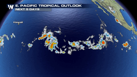
The eastern Pacific is showing us, once again, that it likes to be active!
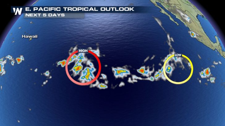 We now have two lows that we are keeping our eye on.
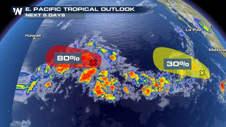 The storm closer to Hawaii has an 80 percent chance of developing into our next named storm! This one will need to be closely monitored due to the fact that it could make landfall with Hawaii! The storm trailing right behind it could possible be another named storm by the end of the week or weekend!
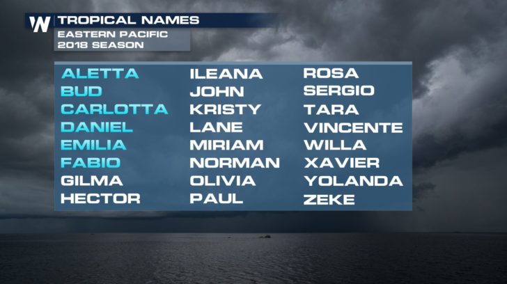 If both of these storms see favorable conditions in the Pacific, we could see Gilma and Hector soon!
For WeatherNation -Meteorologist Shelly Lindblade
If both of these storms see favorable conditions in the Pacific, we could see Gilma and Hector soon!
For WeatherNation -Meteorologist Shelly Lindblade
We now have two lows that we are keeping our eye on.
The storm closer to Hawaii has an 80 percent chance of developing into our next named storm! This one will need to be closely monitored due to the fact that it could make landfall with Hawaii! The storm trailing right behind it could possible be another named storm by the end of the week or weekend!
If both of these storms see favorable conditions in the Pacific, we could see Gilma and Hector soon!
For WeatherNation -Meteorologist Shelly LindbladeAll Weather News
More
Flooding, Severe Storms Target the Midwest Again
After an active week of storms across the nor
31 Jul 2026 8:05 PM


After Reaching Category 5, Genevieve Weakens in the Pacific
PacificFausto is now a post-tropical cyclone.
31 Jul 2026 1:30 AM

Flooding Risk Increases as Heavy Rain Targets the Tri-State Area
Tuesday, heavy rainfall moved across the Nort
30 Jul 2026 12:25 AM

Severe Weather: Energy From the Midwest Now in the Southeast
UPPER MIDWEST - Through Monday, dangerous tor
29 Jul 2026 10:30 PM