More Lake Effect Snow on the Way for Buffalo
The Buffalo Bills and Pittsburgh Steelers football game scheduled for Sunday, January 14 was rescheduled to Monday, January 15 at 4:30 p.m. ET due to the lake-effect snowfall. Fans were asked to come to help clear the stadium after convective snow, or thundersnow was reported across the Great Lakes on Sunday and Monday. Some parts of the lakeshore saw over 3 feet of snowfall and now more lake effect is on the way for the same areas of Buffalo and Watertown.
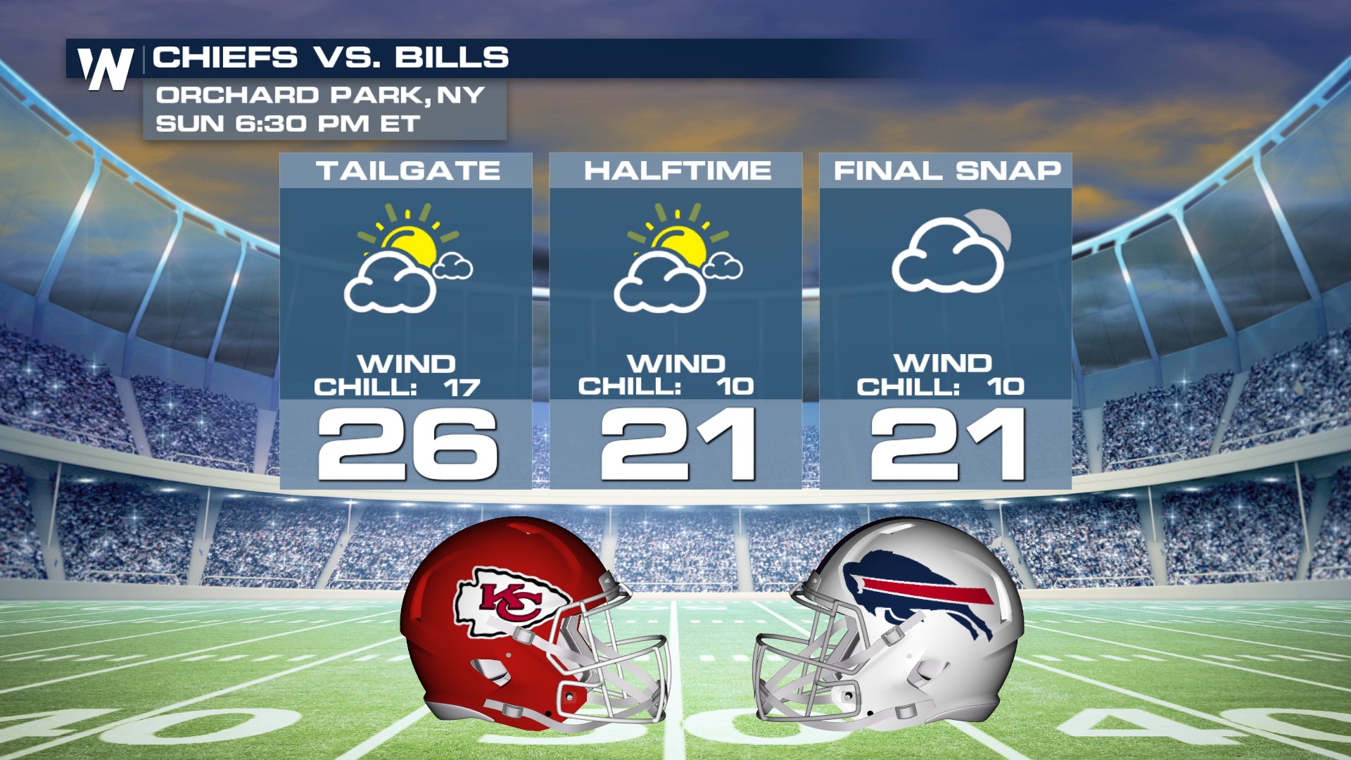
Now as we look ahead to another football game being played in Buffalo, will the league have to postpone another game due to snow this weekend? Well, it doesn't appear to be the case this time around when Kansas City visits!
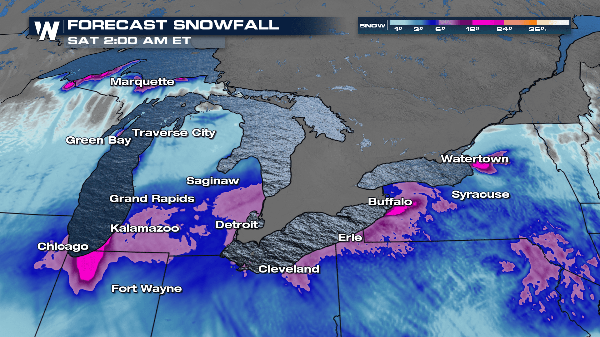
 More lake effect is expected through Thursday afternoon and evening, especially for the shores of Lake Erie and Ontario as well as the U.P. of Michigan. In the most intense snow bands up to another 1-2' of snow looks possible. Our heaviest snow period is anticipated overnight through Thursday before a storm system moves through the Plains, changing the wind direction and subsequent lake effect potential across the region.
Heavy snow rates of 2-4" per hour remain possible for the Buffalo and Watertown areas of New York.

This year's lake-effect snow season got off to a slow start. Across the Great Lakes, it has been a less-than-stellar lake-effect season, and many cities along the lakeshore like Buffalo, Rochester, and Chicago are at a seasonal snow deficit. The reason for the lack of ice and snow? Warm temperatures in December. In fact, many cities across the Great Lakes had some of their warmest December's on record. Buffalo is about 3 feet behind in season snowfall accumulation, so lake effect may not be wanted, but it is needed.
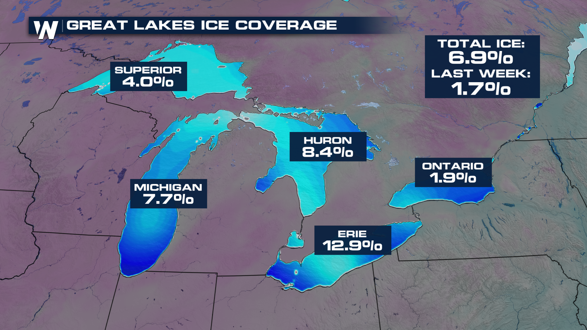
 Lake-effect snow requires two components: Cold air in the atmosphere and warmer lakeshore water. Typically by January, our lake-effect snow machines are winding down because they get covered with ice, limiting moisture release. This year over 6% of the surface of the Great Lakes is covered with ice which is a major increase since last week thanks to arctic air gripping the region! .