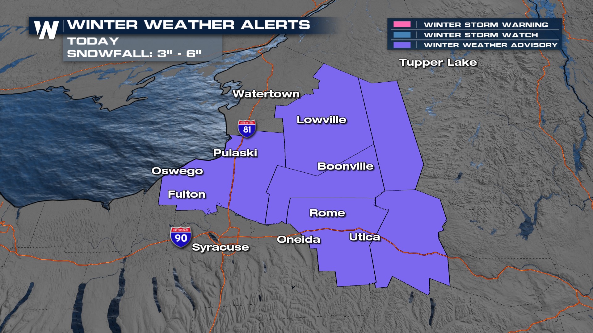
Lake Effect Snow for Lake Ontario Today

Lake effect snow remains in the forecast for New York, particularly off the eastern shores of Lake Ontario today. Models are picking up on the threat of an additional 3-6" of snow, but they tend to struggle with narrow bands of lake effect snow and all the ingredients that go into play for the weather-maker. As a result, we anticipate locally higher snowfall totals.
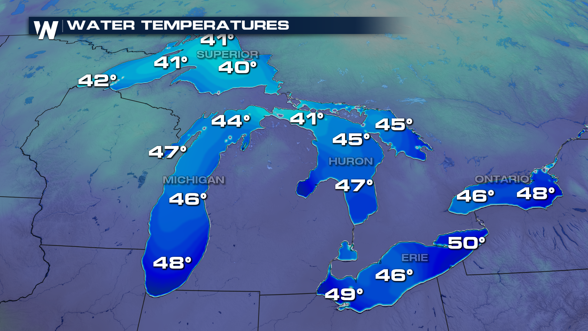
 Lake effect snow is caused by cooler air temperatures running parallel to the relatively warmer lake surface temperatures. We had a frontal boundary pass over the region on Tuesday, producing light snowfall, but westerly winds will aid in lake effect snow development today.
Air temperatures will be in the 20s and 30s during the day while lake water temperatures at the surface are still in the 40s on Lake Ontario, and even close to 50° for the eastern portion of Lake Erie near Buffalo. A good difference for lake effect snow is around 10° between air and water temp but we may have areas even close to 20° apart! All the ingredients look to be coming together for a meaningful lake effect event in New York so please use caution when traveling on I-81 or I-90!