Lake Effect Snow This Weekend for the Great Lakes
Special Stories
5 Jan 2018 5:00 PM
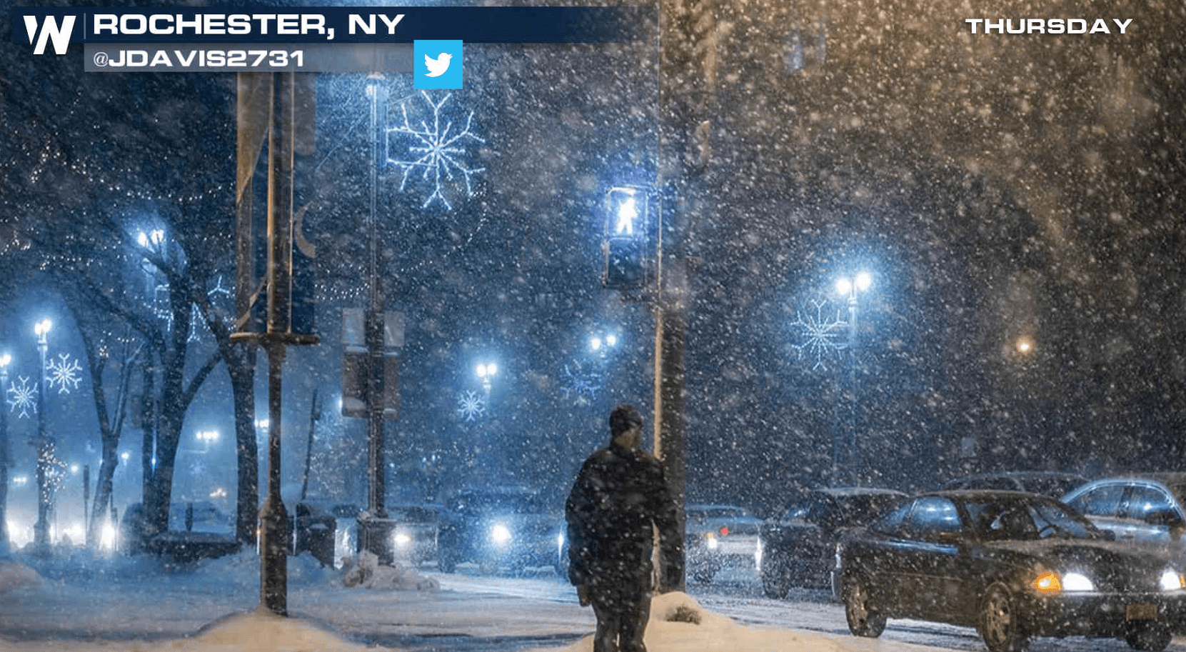
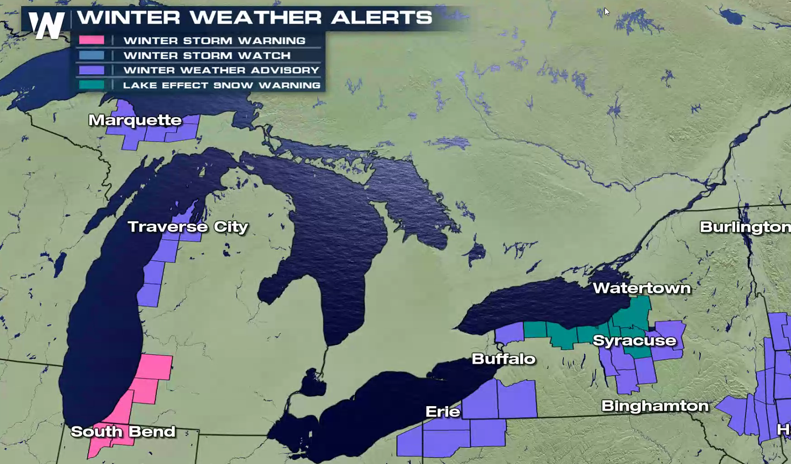
Cold air continues to funnel across the Great Lakes, producing lake effect snow bands. Winter Storm Warnings continue in Southwest Lower Michigan and Northwest Indiana. Lake Effect Snow Warnings are in effect around Lake Erie.
 https://twitter.com/NWSGrandRapids/status/949202472492523527
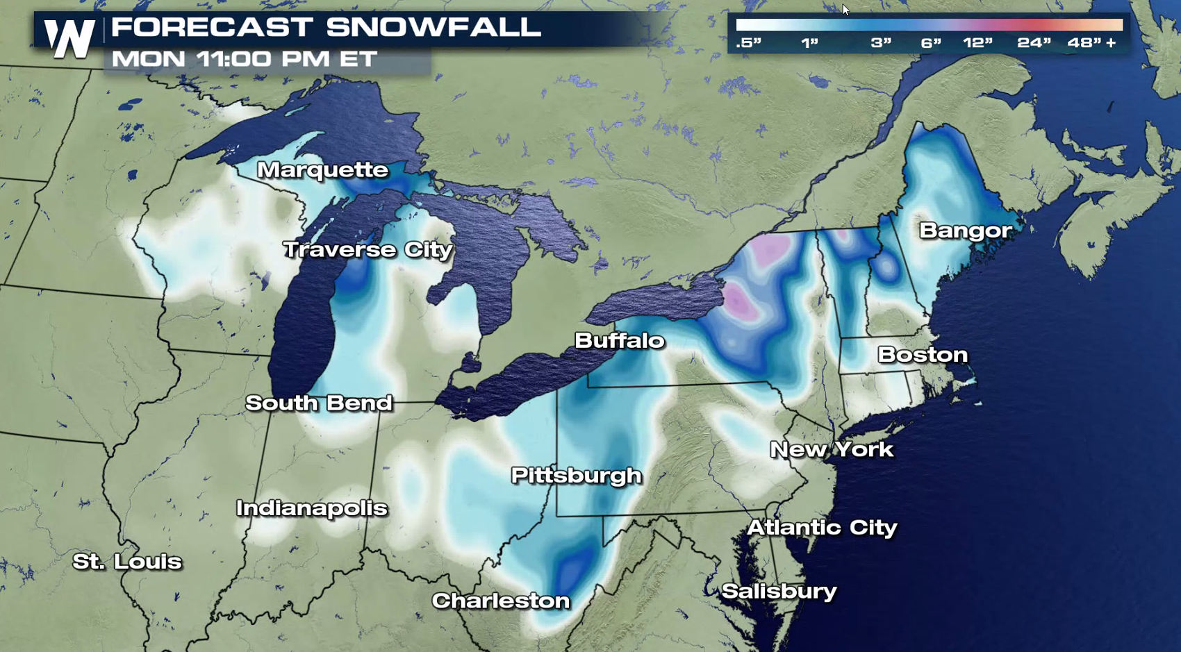
More than a foot of snow is possible in the heaviest snow squalls into this weekend. As a warm front approaches the region Sunday, temperatures will warm and the wind direction will shift, bringing and end to this round of lake effect snow.
https://twitter.com/NWSGrandRapids/status/949202472492523527
More than a foot of snow is possible in the heaviest snow squalls into this weekend. As a warm front approaches the region Sunday, temperatures will warm and the wind direction will shift, bringing and end to this round of lake effect snow.
 https://twitter.com/NWSBUFFALO/status/949238093403639808
For WeatherNation: Meteorologist Mace Michaels
https://twitter.com/NWSBUFFALO/status/949238093403639808
For WeatherNation: Meteorologist Mace Michaels
https://twitter.com/NWSGrandRapids/status/949202472492523527
More than a foot of snow is possible in the heaviest snow squalls into this weekend. As a warm front approaches the region Sunday, temperatures will warm and the wind direction will shift, bringing and end to this round of lake effect snow.
https://twitter.com/NWSBUFFALO/status/949238093403639808
For WeatherNation: Meteorologist Mace MichaelsAll Weather News
More
Where Rain Could Dampen Holiday Travel Plans
AAA is expecting over 70 million travelers to
2 Jul 2025 2:35 AM

Western Heat Continues With Some Relief
A large dome of hot, high pressure remains ac
2 Jul 2025 2:00 AM

Severe Storms For the East Coast Through Tuesday
A cold front moving through a moist airmass h
2 Jul 2025 1:00 AM


NHC Monitoring Front in the Southeast Ahead of 4th of July
SOUTHEAST - A frontal boundary moving through
1 Jul 2025 10:35 PM

Severe Weather Threat Continues in the Midwest
It has been an active, severe season across t
30 Jun 2025 9:00 PM