Lake Effect Snows Across the Great Lakes
Special Stories
8 Jan 2020 12:30 AM
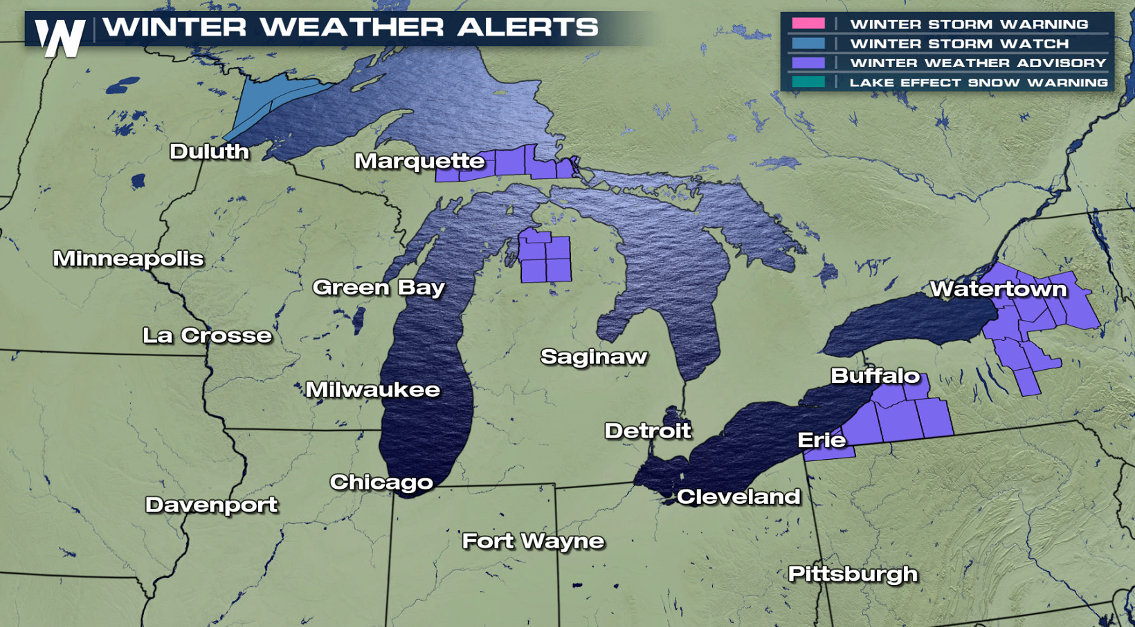
As cold winds sweep across the Great Lakes, lake effect snow bands will continue to develop throughout the region. Alerts have been issued from Lake Superior to Lake Ontario.
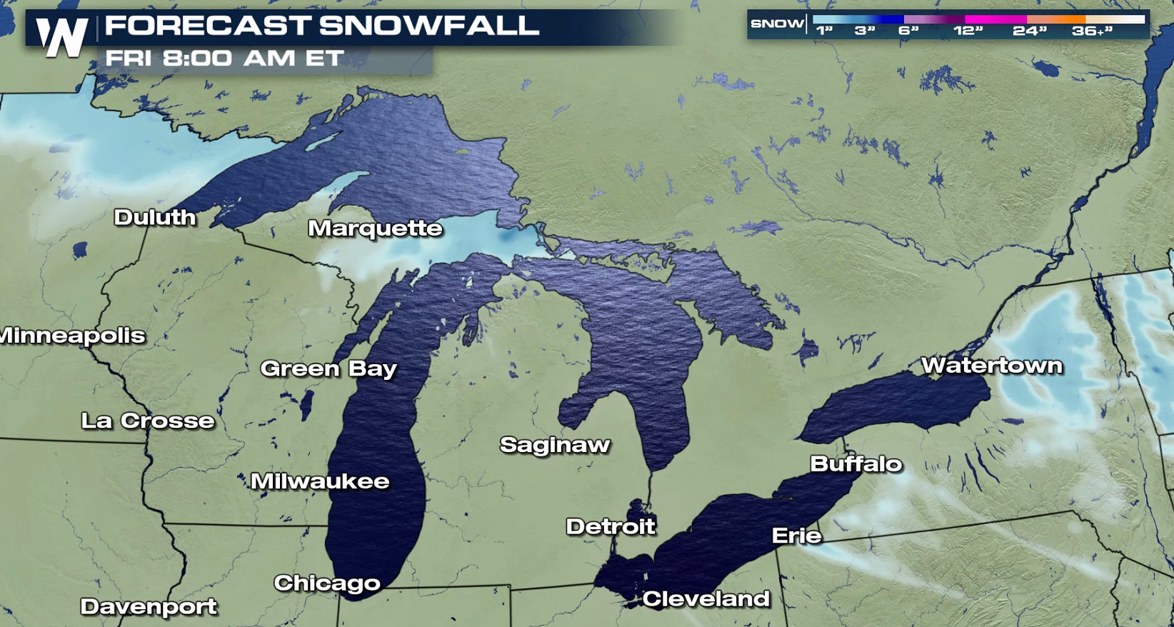
 Up to 5" of snow is possible in the alert areas downstream of the lakes by early Thursday. Along Minnesota's North Shore, more than 6" of lake enhanced snow is possible as a system approaches from the west through Thursday.
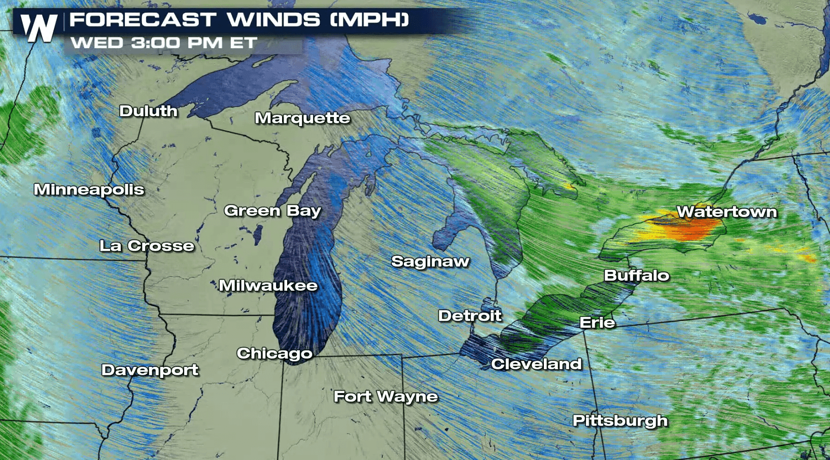
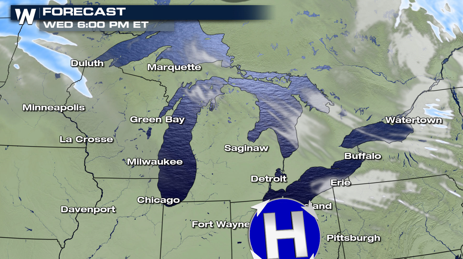
 Locally intense bands of lake effect snow will develop on and off over the next 24 hours throughout the Great Lakes into this evening. As a storm system approaches from the West, temperatures will warm and the wind direction will shift. This will bring an end to the lake effect snow in most areas, although enhanced snows will develop in Minnesota's Arrowhead.
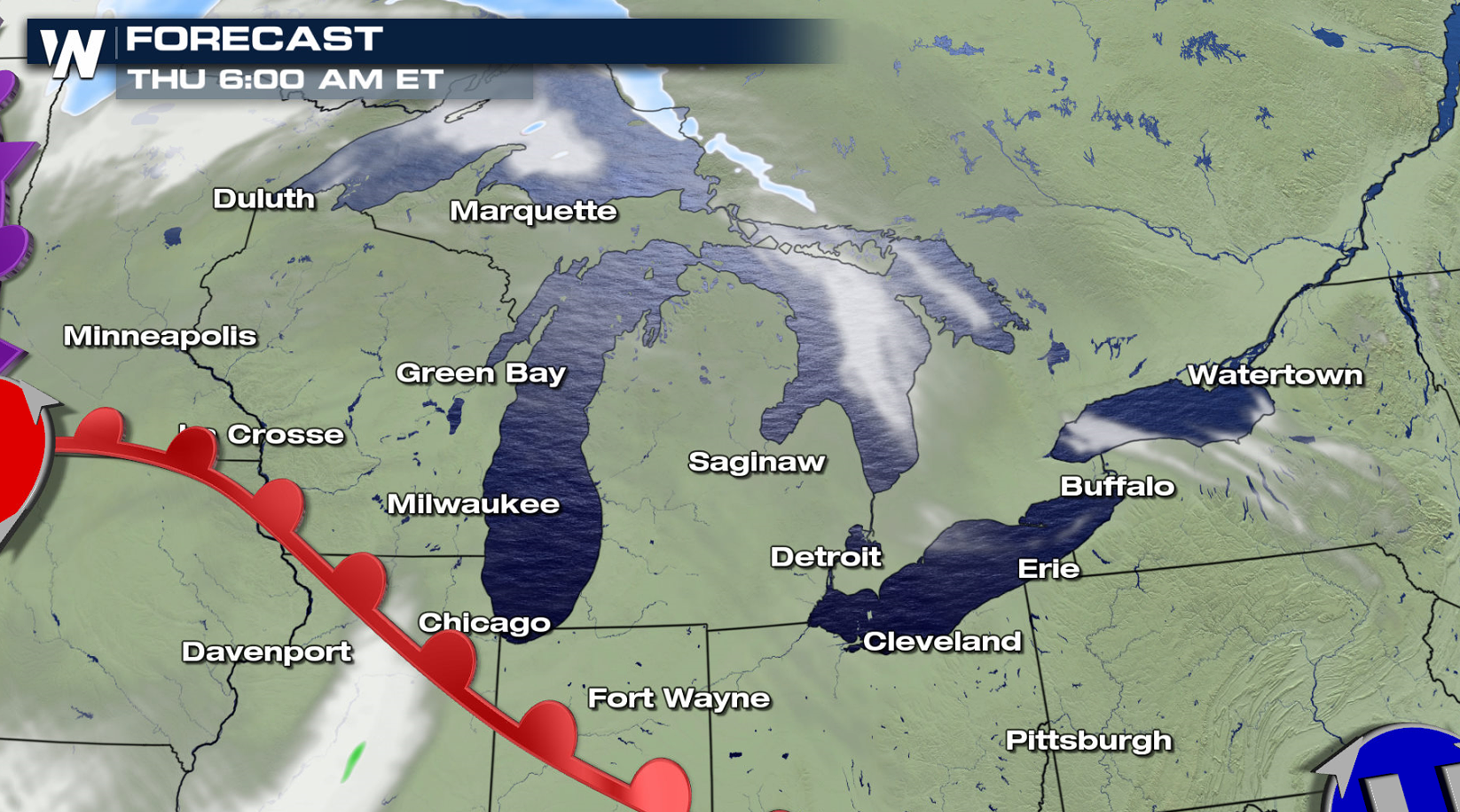
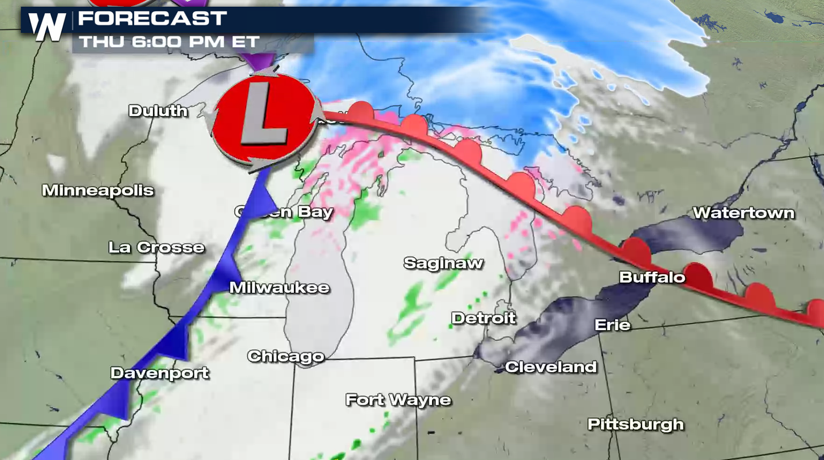 If you have travel plans in the alert areas across the Great Lakes, be sure to check ahead on travel conditions and stay tuned to WeatherNation on-air and online for forecast updates.
Up to 5" of snow is possible in the alert areas downstream of the lakes by early Thursday. Along Minnesota's North Shore, more than 6" of lake enhanced snow is possible as a system approaches from the west through Thursday.
Locally intense bands of lake effect snow will develop on and off over the next 24 hours throughout the Great Lakes into this evening. As a storm system approaches from the West, temperatures will warm and the wind direction will shift. This will bring an end to the lake effect snow in most areas, although enhanced snows will develop in Minnesota's Arrowhead.
If you have travel plans in the alert areas across the Great Lakes, be sure to check ahead on travel conditions and stay tuned to WeatherNation on-air and online for forecast updates.All Weather News
More


More Storms for the East Sunday and Monday
A low-pressure system crashing through the Mi
2 Aug 2026 2:20 AM

After Reaching Category 5, Genevieve Weakens in the Pacific
PacificGenevieve formed on last Friday south
2 Aug 2026 1:30 AM

Flooding, Severe Storms Target the Midwest Again
After an active week of storms across the nor
1 Aug 2026 1:40 AM

Flooding Risk Increases as Heavy Rain Targets the Tri-State Area
Tuesday, heavy rainfall moved across the Nort
30 Jul 2026 12:25 AM

Severe Weather: Energy From the Midwest Now in the Southeast
UPPER MIDWEST - Through Monday, dangerous tor
29 Jul 2026 10:30 PM