Large Hail and Tornadoes in the Forecast for North Texas Wednesday
Top Stories
19 Jun 2019 4:58 AM
A cold front will bring severe storms to areas of North Texas today and this includes the cities of Fort Worth and Dallas. The timing of these severe storms could be for your evening commute with the risk of large hail, tornadoes and damaging wind gusts. Here is the very latest.
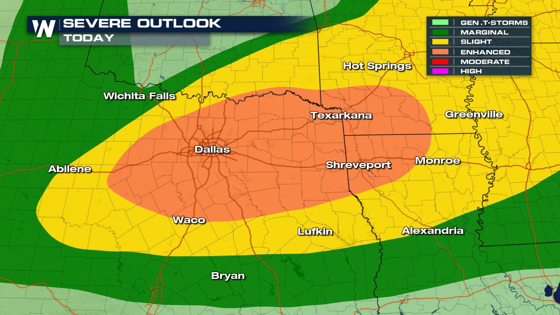
 A large area of the Nation is under a risk of severe storms from the High Plains to the Mississippi and Tennessee Valleys. The area that could see numerous severe storms will be North Texas in the ArkLaTex.
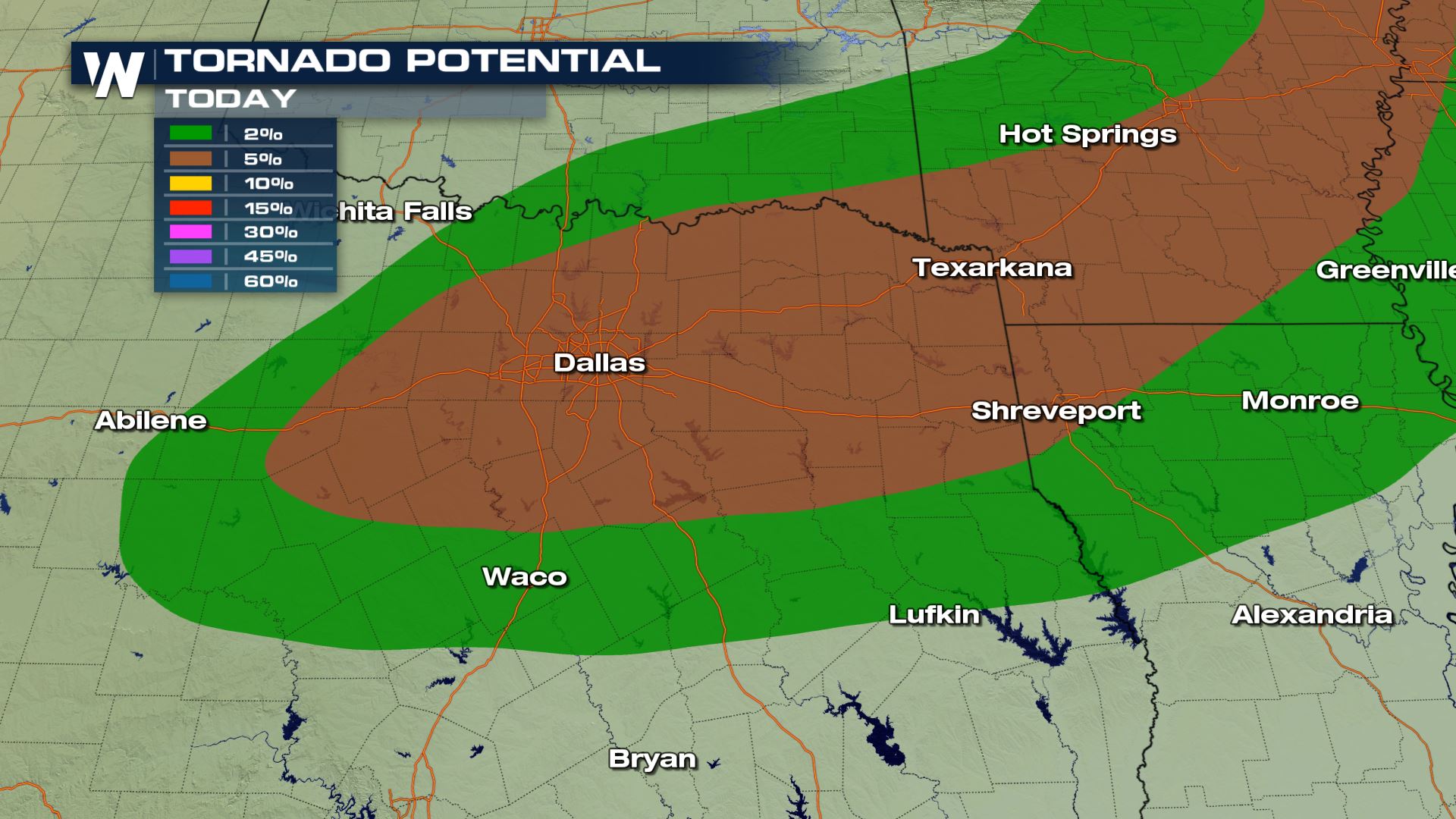 The biggest weather threats for North Texas will tornadoes and large hail (over 2" in diameter). Damaging wind and heavy rain will also be a severe risk for this afternoon and evening. Please be weather alert if you will be in this part of Texas today.
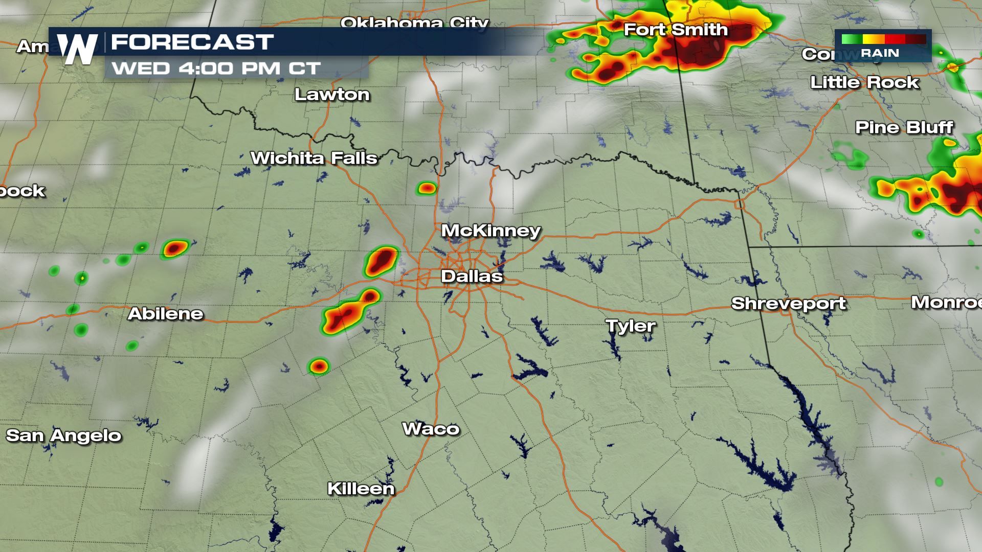
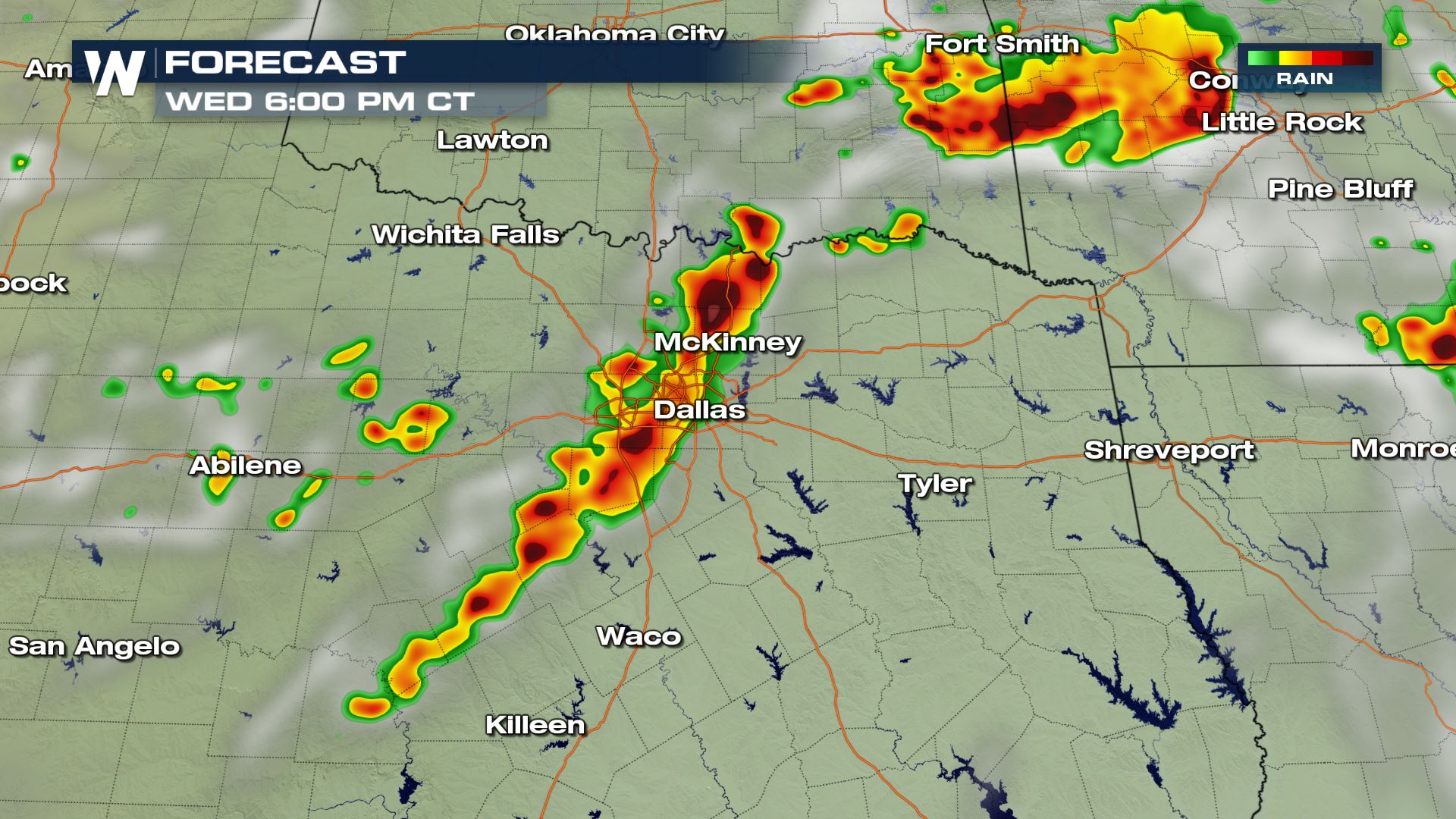
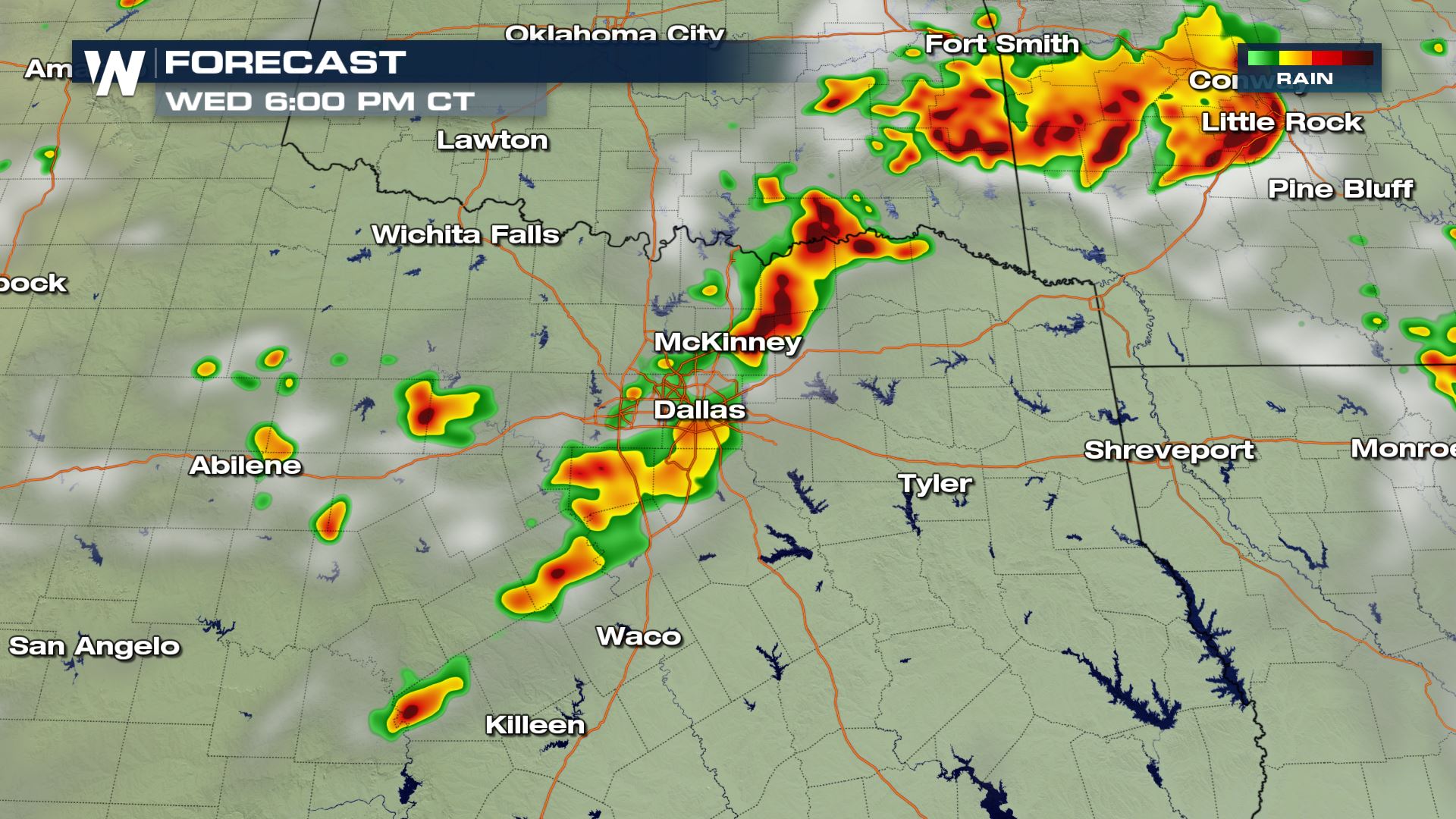 The timing for the storms will be for the late afternoon and into the early evening. These storms will begin with today's daytime heating, but strong upper-level winds could keep these storms going well into Thursday morning. Keep checking with WeatherNation for the very latest.
Severe Outlook
A large area of the Nation is under a risk of severe storms from the High Plains to the Mississippi and Tennessee Valleys. The area that could see numerous severe storms will be North Texas in the ArkLaTex.
Severe Risks
The biggest weather threats for North Texas will tornadoes and large hail (over 2" in diameter). Damaging wind and heavy rain will also be a severe risk for this afternoon and evening. Please be weather alert if you will be in this part of Texas today.
Forecast
The timing for the storms will be for the late afternoon and into the early evening. These storms will begin with today's daytime heating, but strong upper-level winds could keep these storms going well into Thursday morning. Keep checking with WeatherNation for the very latest.
All Weather News
More
Tropics: Tropical Storm Bertha Forms In the Atlantic, Eastern Pacific Active
In the Atlantic basin, we are keeping a very
21 Jul 2026 2:00 AM

Another Round of Storms Targets the Northeast
Another cold front is dropping east and will
21 Jul 2026 2:00 AM

Another Round of Severe Weather for the Upper Midwest and Great Lakes
The upper-level low train continues to keep t
21 Jul 2026 1:45 AM

Severe Storm Threat Continues for North Carolina
A slow-moving front has one more day's worth
20 Jul 2026 10:35 PM

Air Quality Improvements in the Forecast
Wildfires burning in Northwestern Ontario, Ca
20 Jul 2026 7:20 PM

Monsoon Moisture Brings Weekend Flood Threat
The monsoon has returned to the southwestern
19 Jul 2026 1:30 AM

After Historic Flooding, Flood Risk Moves West Saturday
TEXAS HILL COUNTRY - Life-threatening floodin
18 Jul 2026 1:00 AM