Late November Tornado Outbreak
Special Stories
30 Nov 2022 4:50 PM
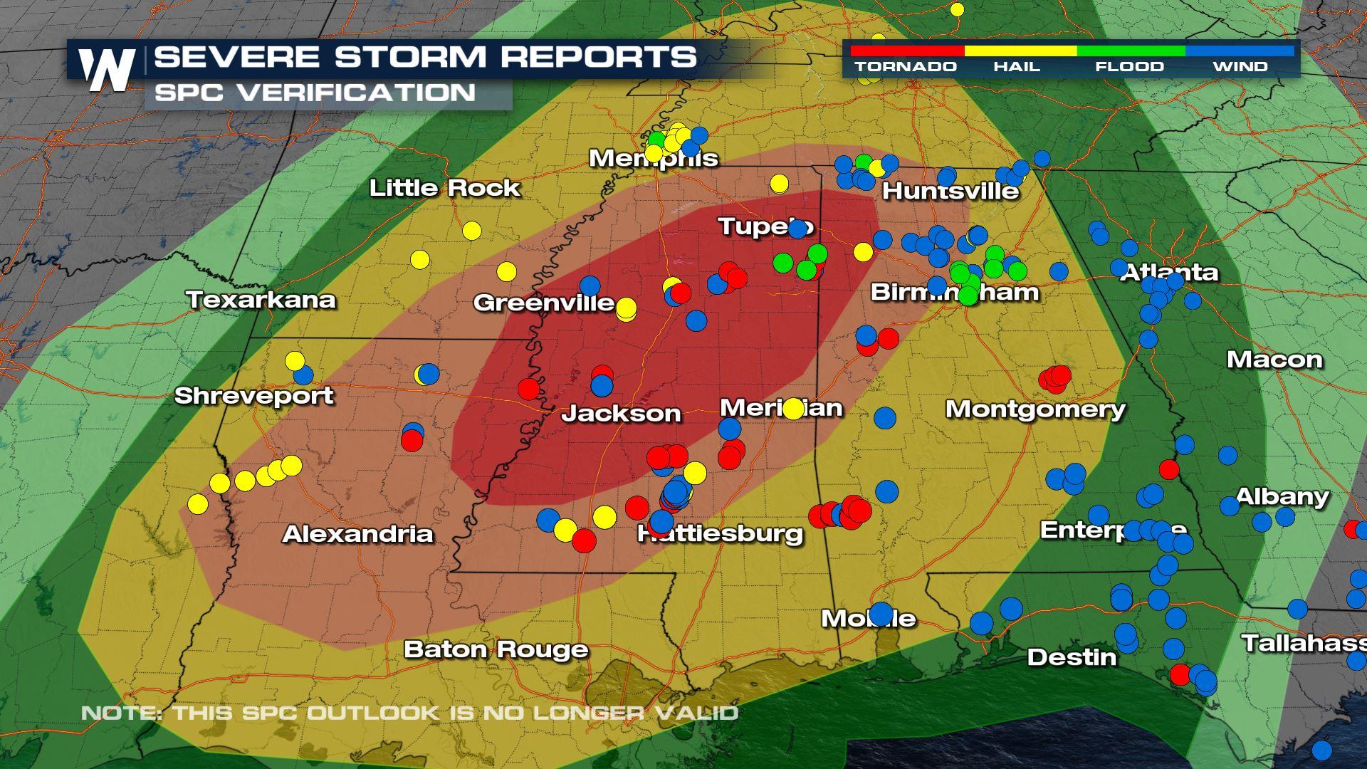
Strong thunderstorms moved through the Deep South Tuesday morning and continued through Wednesday in the early morning hours. Unfortunately, these tornadoes turned deadly into the overnight hours through Wednesday. The Storm Prediction Center had issued a MODERATE risk for severe thunderstorms on Tuesday. This was a level four out of five severe weather threat. After the day and into this morning, local storm reports from this tornado outbreak verified exactly where the highest probability of widespread tornadoes was likely. (ABOVE)
https://twitter.com/WeatherNation/status/1597973893364555780
A likely tornado brought damage to the Eutaw Alabama area as a tornado debris signature made its way through the area. Daylight revealed these damage scenes from this storm:
[embed]https://twitter.com/WeatherNation/status/1597998897636384768?s=20&t=0KofwZrAA52z_a57OaaHUg[/embed]
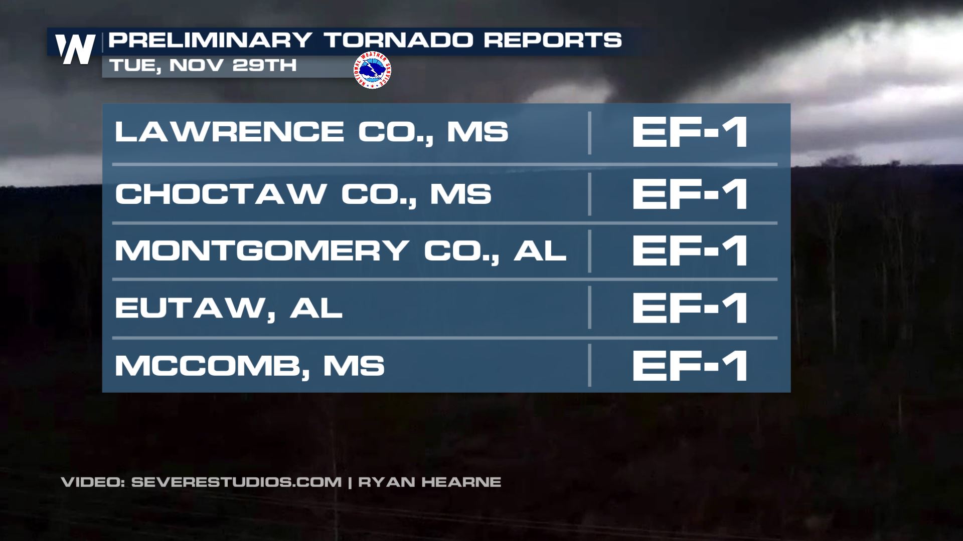
The National Weather Service offices out of Jackson MS, Birmingham AL, and Shreveport LA have sent their crews out and made preliminary tornado reports for some of the observed tornadoes from Tuesday. All have a preliminary rating of EF-1.
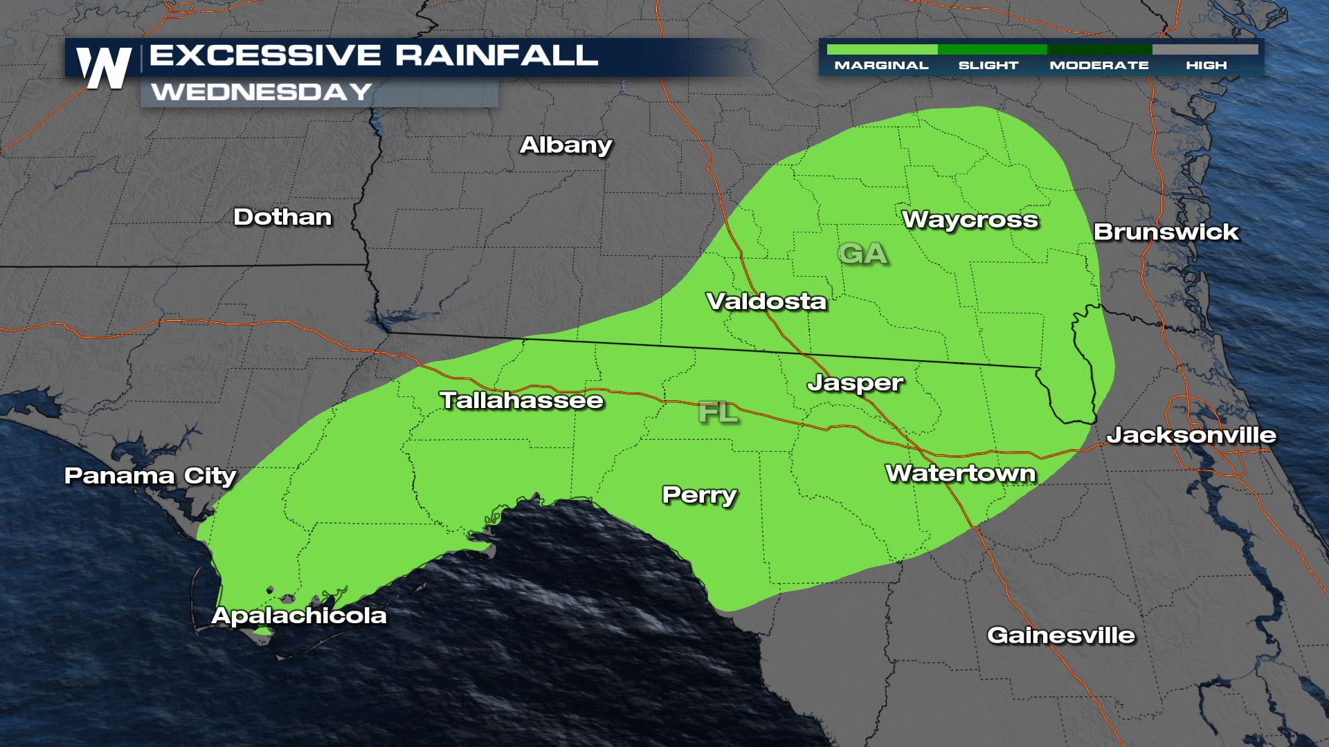
 The Weather Prediction Center has kept a marginal excessive rainfall risk through today to account for the leftover frontal boundary.
 The Eastern Regional Forecast can be found :10 past the hour, every hour.
The Weather Prediction Center has kept a marginal excessive rainfall risk through today to account for the leftover frontal boundary.
The Eastern Regional Forecast can be found :10 past the hour, every hour.All Weather News
More
Tropics: Tropical Storm Bertha Forms In the Atlantic, Eastern Pacific Active
In the Atlantic basin, we are keeping a very
21 Jul 2026 12:10 AM

Another Round of Storms Targets the Northeast
Another cold front is dropping east and will
20 Jul 2026 10:05 PM

Another Round of Severe Weather for the Upper Midwest and Great Lakes
The upper level low train continues to keep t
20 Jul 2026 9:55 PM

Air Quality Improvements in the Forecast
Wildfires burning in Northwestern Ontario, Ca
20 Jul 2026 7:20 PM

Severe Storm Threat Continues for North Carolina
A slow-moving front has one more day's worth
20 Jul 2026 7:20 PM

Monsoon Moisture Brings Weekend Flood Threat
The monsoon has returned to the southwestern
19 Jul 2026 1:30 AM

After Historic Flooding, Flood Risk Moves West Saturday
TEXAS HILL COUNTRY - Life-threatening floodin
18 Jul 2026 1:00 AM