Late Spring Snow Blankets the Western Mountains

Top Stories
19 May 2025 12:05 AM
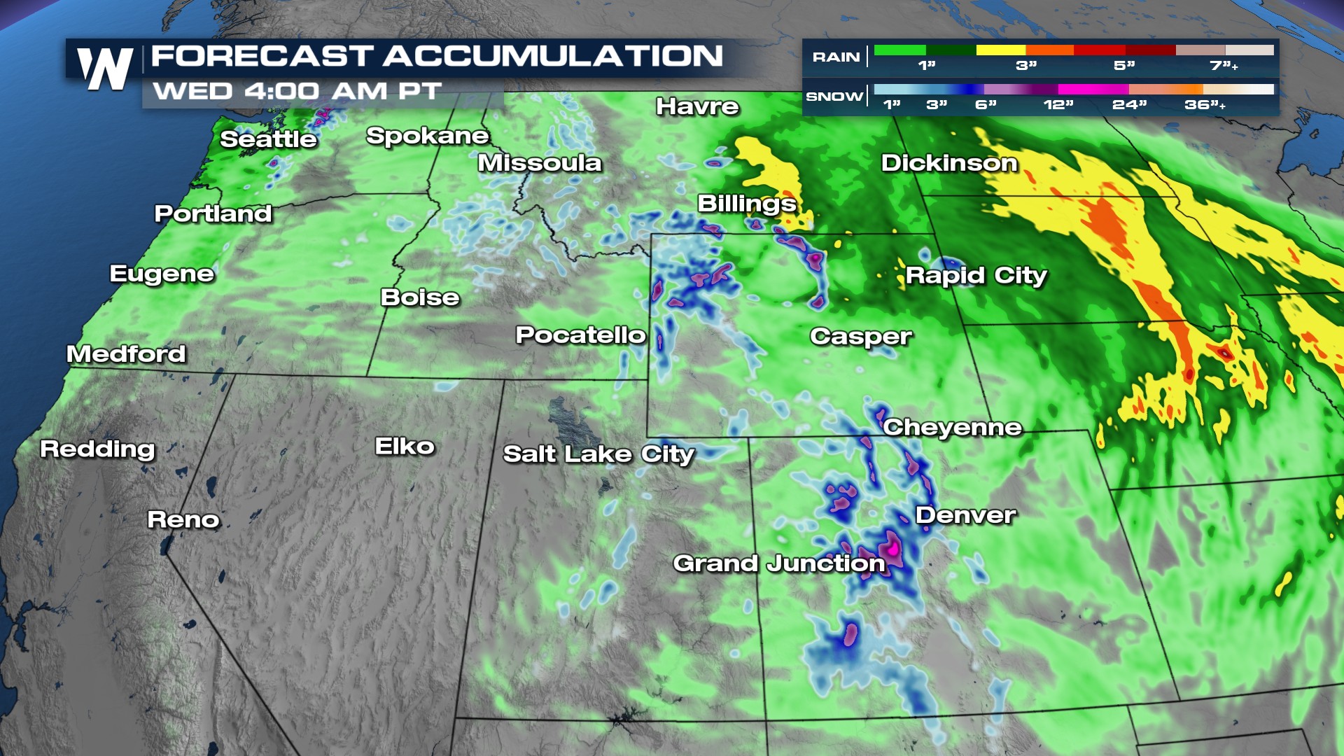
Winter continues across the high mountains of the West! A strong trough of low pressure slides across Idaho, Wyoming, Montana, Utah, and Colorado with valley rains and heavy snow above 8,000ft.
Timing
Precipitation
Heavy precipitation in the form of both rain and snow will be possible over the next couple of days and energy moves overhead. Travel could be treacherous over the mountain passes both Sunday and Monday.
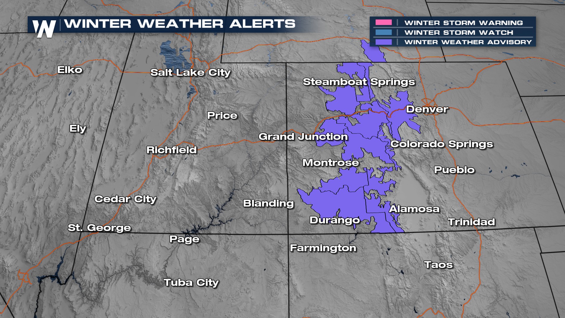
 Snow is likely above 8,000ft across Colorado's mountains. Most places can expect 5-10 inches with up to 15 inches above 10,000ft. Winter Weather Advisories are in effect.
 Stay with WeatherNation for the latest.
All Weather News
More

Severe Storms, Flash Flooding Overnight In Midwest
WHAT TO EXPECTIt was a very active day across
22 Jun 2026 1:50 AM


Summer Solstice Kicks Off Father's Day Sunday
Fathers across the country will have to share
21 Jun 2026 5:20 PM

Flood Risk Continues This Weekend for the Gulf Coast States
Numerous flash flood warnings were issued as
21 Jun 2026 1:15 PM

Dry T-Storms & Fire Danger in the West
A weak low-pressure system moving through the
20 Jun 2026 1:40 PM

Tornadoes Tear Through The Midwest, Isolated Severe Storms in the South
EARLIER THIS WEEKMONTROSE, IL - A dangerous t
20 Jun 2026 1:30 AM