Central and Southern Plains Set for Severe Weather Friday
Special Stories
17 May 2019 10:27 AM
The Storm Prediction Center (SPC) is expecting active weather into the weekend with the risk for severe thunderstorms returning to the Plains and portions of the Mid-Atlantic. Severe thunderstorms will remain likely in the middle of the nation into early next week.
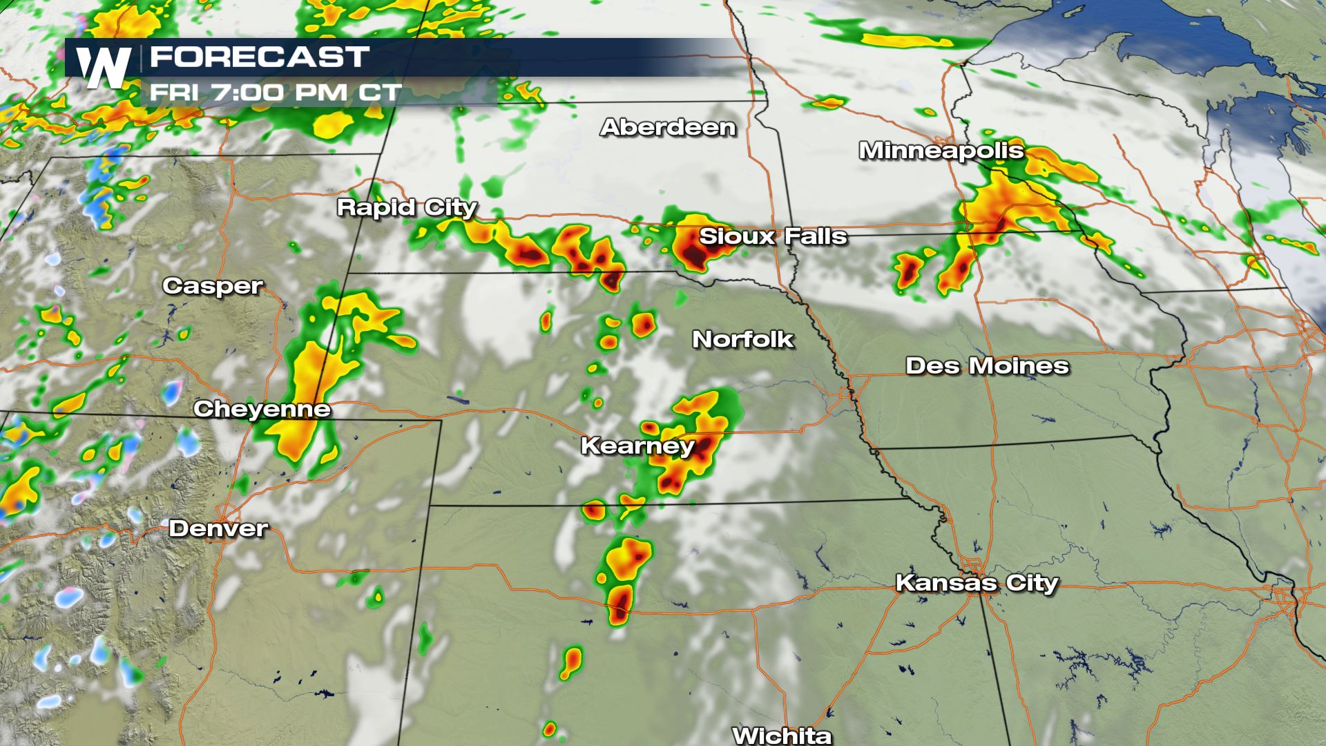
 Friday looks to be an active day for thunderstorms, as widespread severe weather is likely. We will see the potential for tornadoes, large hail and damaging winds, as multiple strong upper level waves in a very fast flow aloft will move through the Plains.
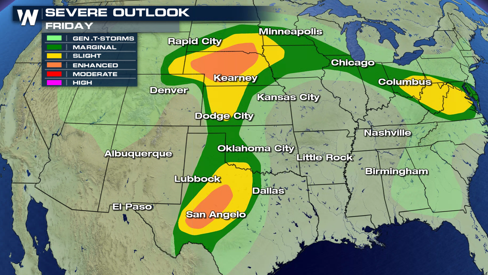
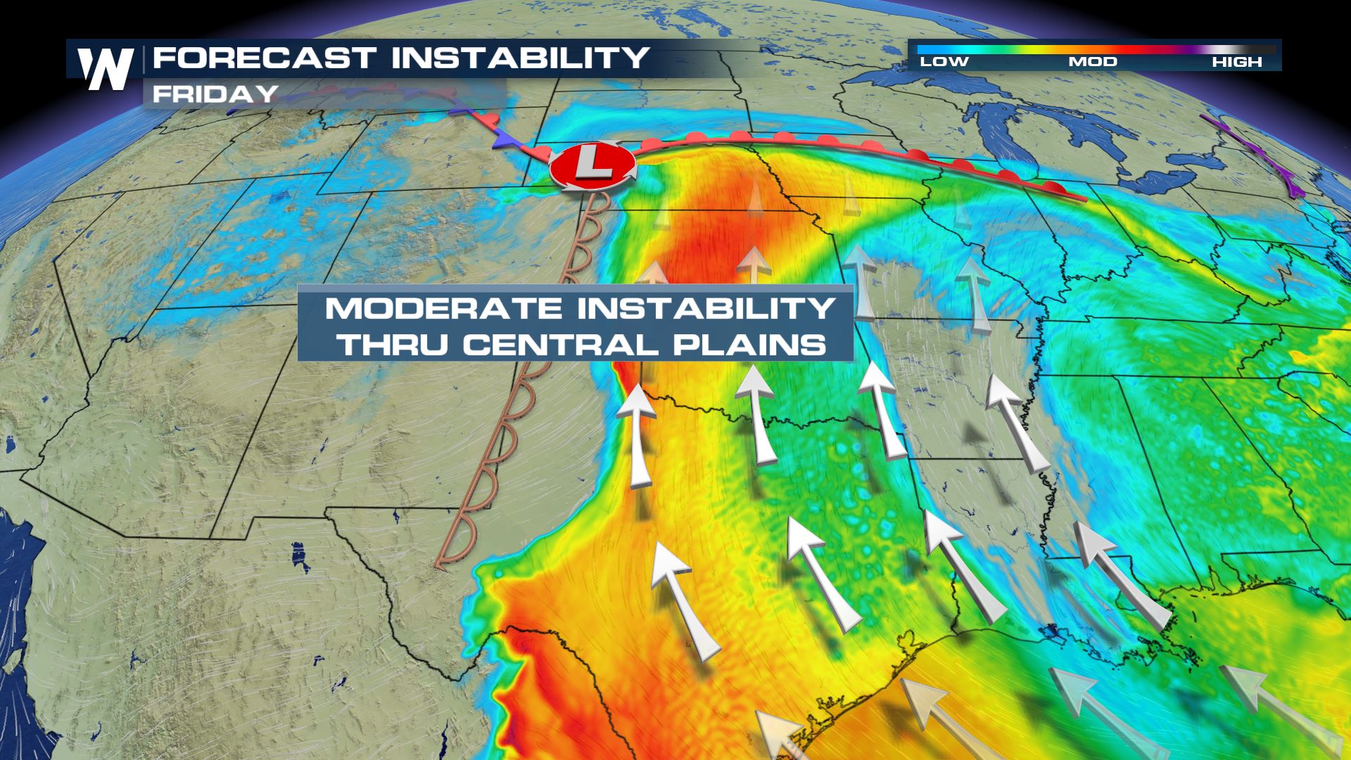
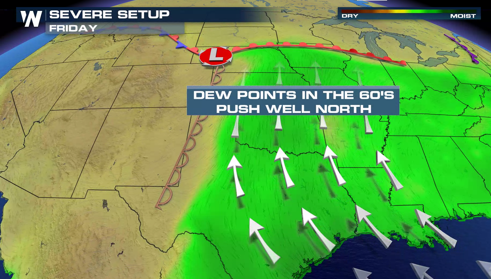
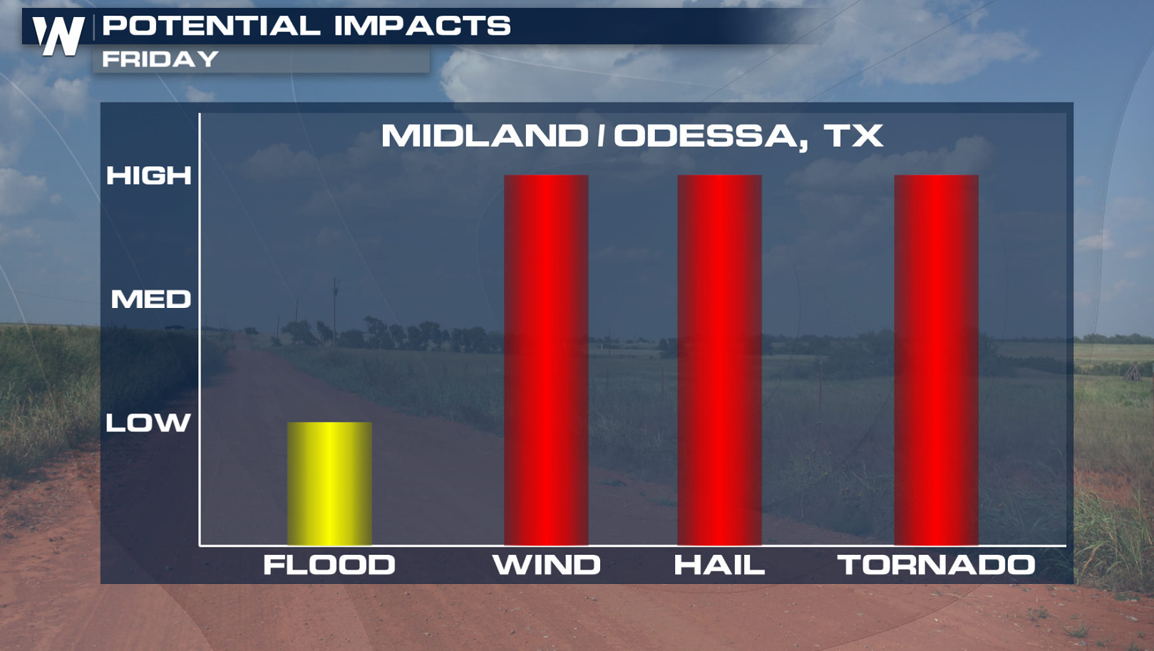
 The setup is this - stronger upper level winds will begin to spread across the Plains as a low pressure center begins to develop. The SPC has issued an enhanced risk for severe weather in Texas and Nebraska.
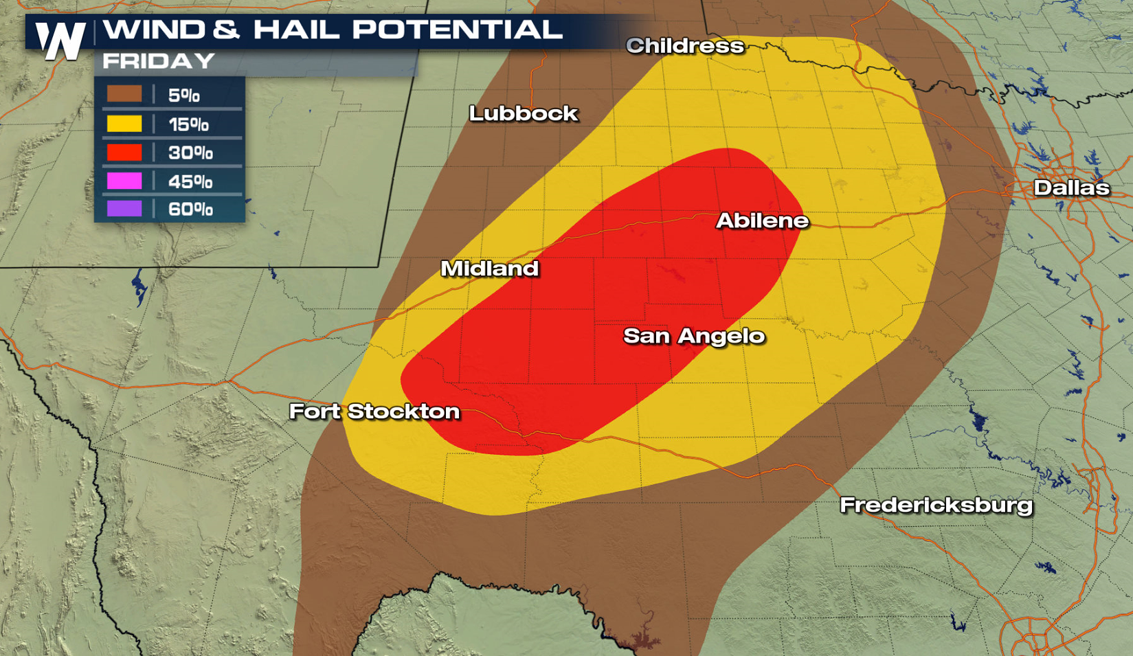 Humidity will be increasing ahead of a dryline in the central to southern Plains northward to a warm front in the Upper Midwest. Thunderstorms will develop in the late afternoon and continue through the night, with some supercells likely. All modes of severe weather are possible: tornadoes, large hail, and damaging wind gusts.
[Related Articles: What does an SPC enhanced risk mean?]
Humidity will be increasing ahead of a dryline in the central to southern Plains northward to a warm front in the Upper Midwest. Thunderstorms will develop in the late afternoon and continue through the night, with some supercells likely. All modes of severe weather are possible: tornadoes, large hail, and damaging wind gusts.
[Related Articles: What does an SPC enhanced risk mean?]
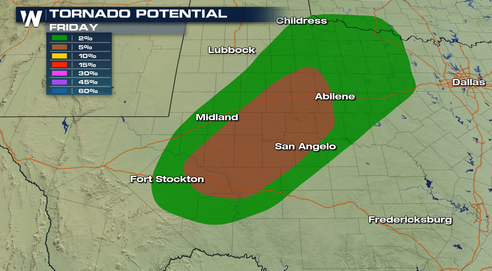
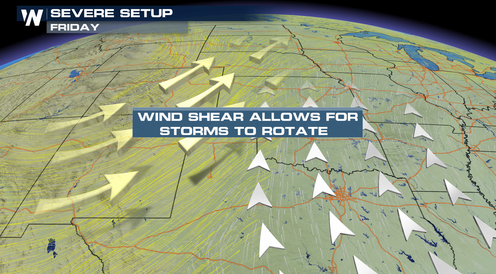
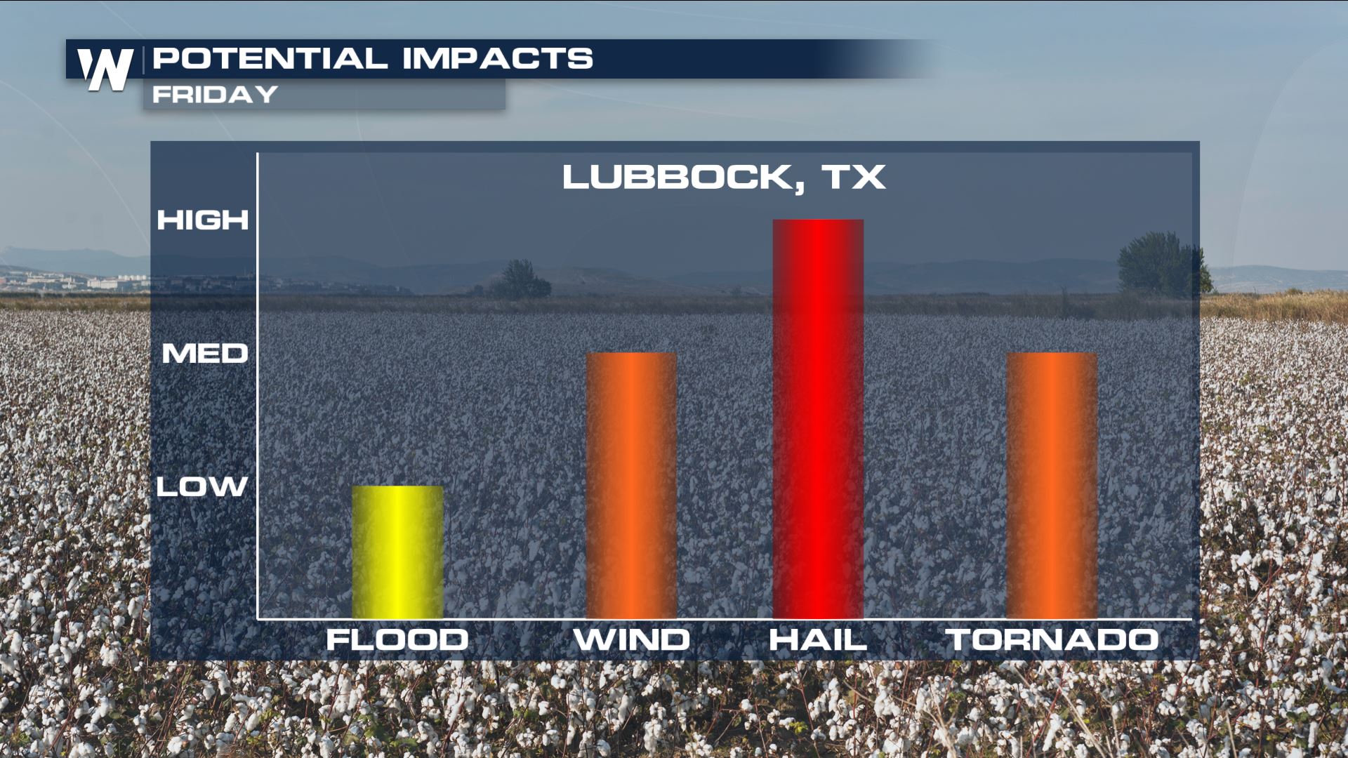
 In the southern enhanced region, more shear is present in the atmosphere. Turning of the winds with height adds rotation in the atmosphere. Large hail will be the primary threat for cities like Lubbock. Timing for this event could be into the overnight hours.
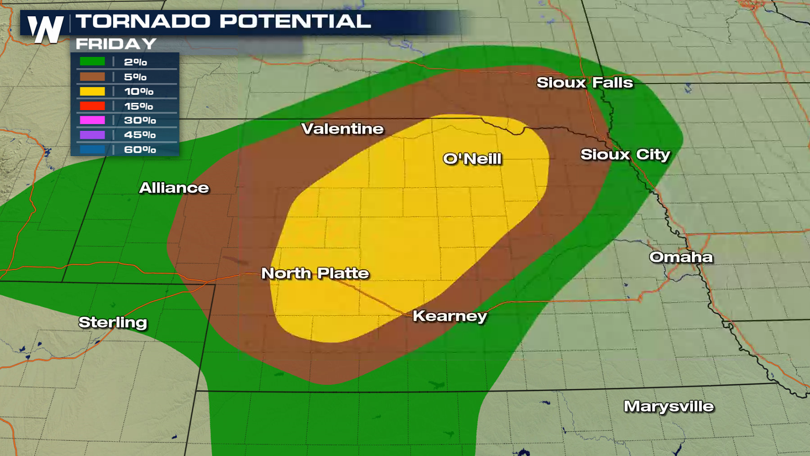
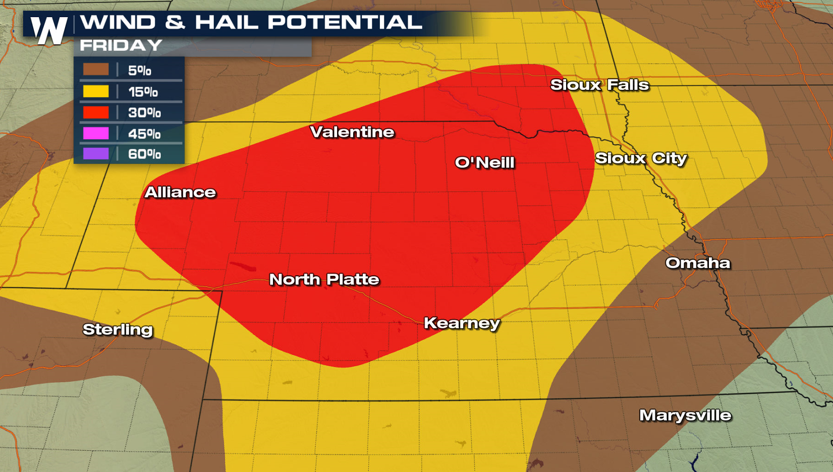
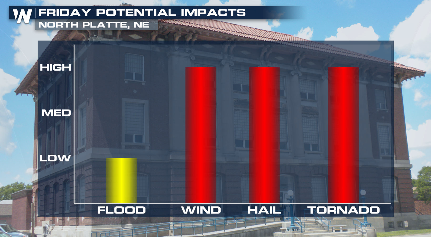
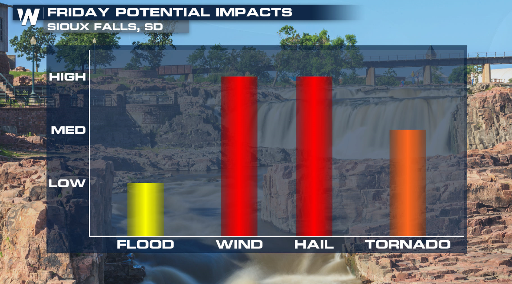
 In the Nebraska Enhanced Risk, an area of low pressure will track east. Moisture and instability will be plentiful, even that far north.
 If you are in the risk areas, stay storm aware with the latest information from WeatherNation on-air and online. We will have live reports from in the field, along with updated forecasts and current watches and warnings.
For WeatherNation: Meteorologist Mace Michaels
If you are in the risk areas, stay storm aware with the latest information from WeatherNation on-air and online. We will have live reports from in the field, along with updated forecasts and current watches and warnings.
For WeatherNation: Meteorologist Mace Michaels
Friday looks to be an active day for thunderstorms, as widespread severe weather is likely. We will see the potential for tornadoes, large hail and damaging winds, as multiple strong upper level waves in a very fast flow aloft will move through the Plains.
The setup is this - stronger upper level winds will begin to spread across the Plains as a low pressure center begins to develop. The SPC has issued an enhanced risk for severe weather in Texas and Nebraska.
Humidity will be increasing ahead of a dryline in the central to southern Plains northward to a warm front in the Upper Midwest. Thunderstorms will develop in the late afternoon and continue through the night, with some supercells likely. All modes of severe weather are possible: tornadoes, large hail, and damaging wind gusts.
[Related Articles: What does an SPC enhanced risk mean?]
In the southern enhanced region, more shear is present in the atmosphere. Turning of the winds with height adds rotation in the atmosphere. Large hail will be the primary threat for cities like Lubbock. Timing for this event could be into the overnight hours.
In the Nebraska Enhanced Risk, an area of low pressure will track east. Moisture and instability will be plentiful, even that far north.
If you are in the risk areas, stay storm aware with the latest information from WeatherNation on-air and online. We will have live reports from in the field, along with updated forecasts and current watches and warnings.
For WeatherNation: Meteorologist Mace MichaelsAll Weather News
More
Hurricane Center Monitoring Florida for Tropical Development
Residents and visitors to the Southeast will
30 Jun 2025 10:00 PM

Barry Makes Landfall, Watching Flossie Next
While the Eastern Pacific has made most of th
30 Jun 2025 9:40 PM

Severe Storms For the East Coast Through Tuesday
Frontal systems have been crossing the northe
30 Jun 2025 9:00 PM

Severe Weather Threat Continues in the Midwest
It has been an active, severe season across t
30 Jun 2025 9:00 PM


Where Rain Could Dampen Holiday Travel Plans
AAA is expecting over 70 million travelers to
30 Jun 2025 3:00 PM

Thunderstorms Possible in the Southeast Overnight
SOUTHEAST - Strong thunderstorms have develop
28 Jun 2025 2:40 AM