Possible Derecho Hit the Upper-Midwest Friday Morning

Another intense night of severe storms ripped through portions of the Upper-Midwest from Thursday night into Friday morning. Multiple bowing segments congealed into a large complex/squall line, which produced wind damage for over 300 miles across the states of Montana, North Dakota, and Minnesota. Thousands of households lost power while several structures have reported damage.
Will this be classified as a derecho? According to NWS Grand Forks, Thursday's night storm was not classified as a derecho. Listen why.
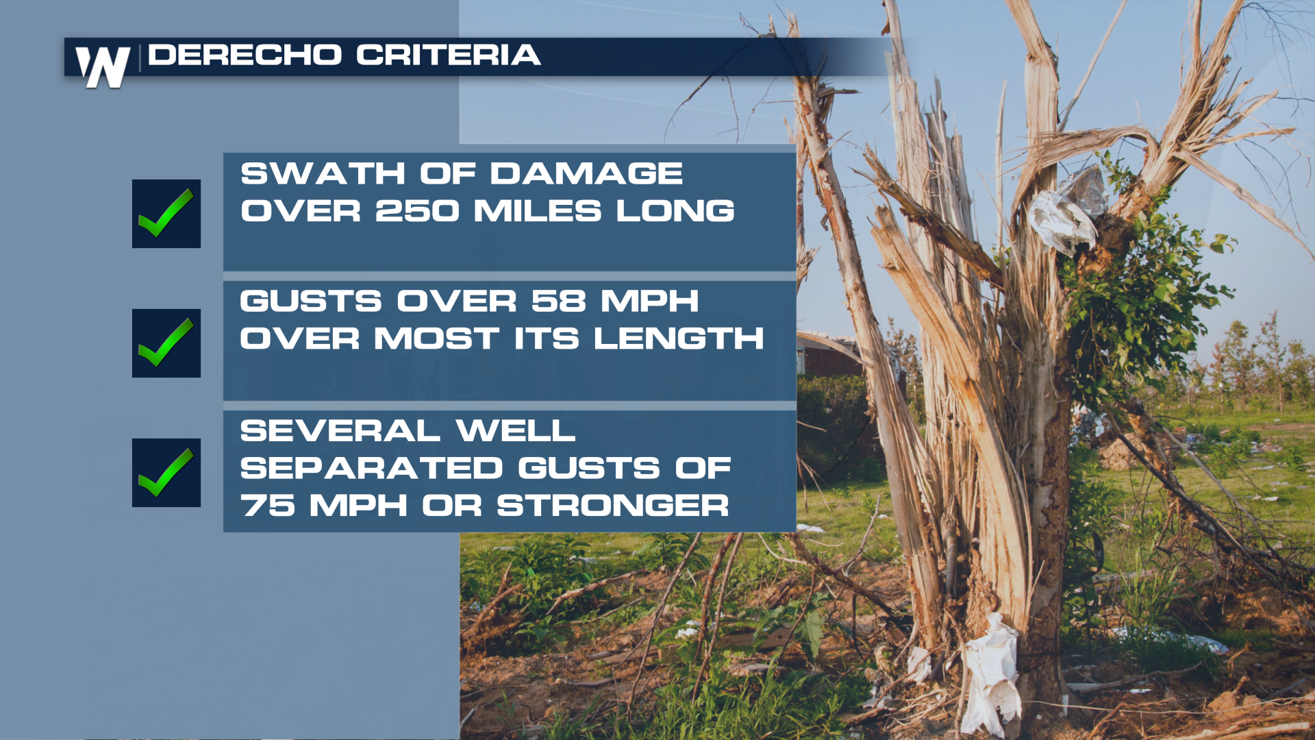
Again, NWS Grand Forks believes the factors of not enough higher end wind gusts, the duration of the wind event, and the coverage area was enough not to deem this event as a derecho. However, we can still learn more on what is a derecho! A big severe strength wind storm to say the least, but the Storm Prediction Center has a full definition including multiple criteria that have to be met.
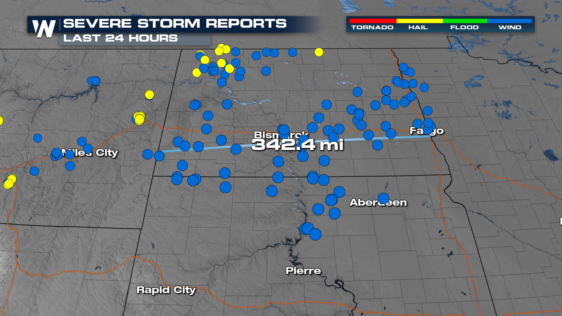
 It certainly appears this system will meet the spatial requirements for a derecho as damaging wind reports (58+ mph) stretch for over 300 miles.
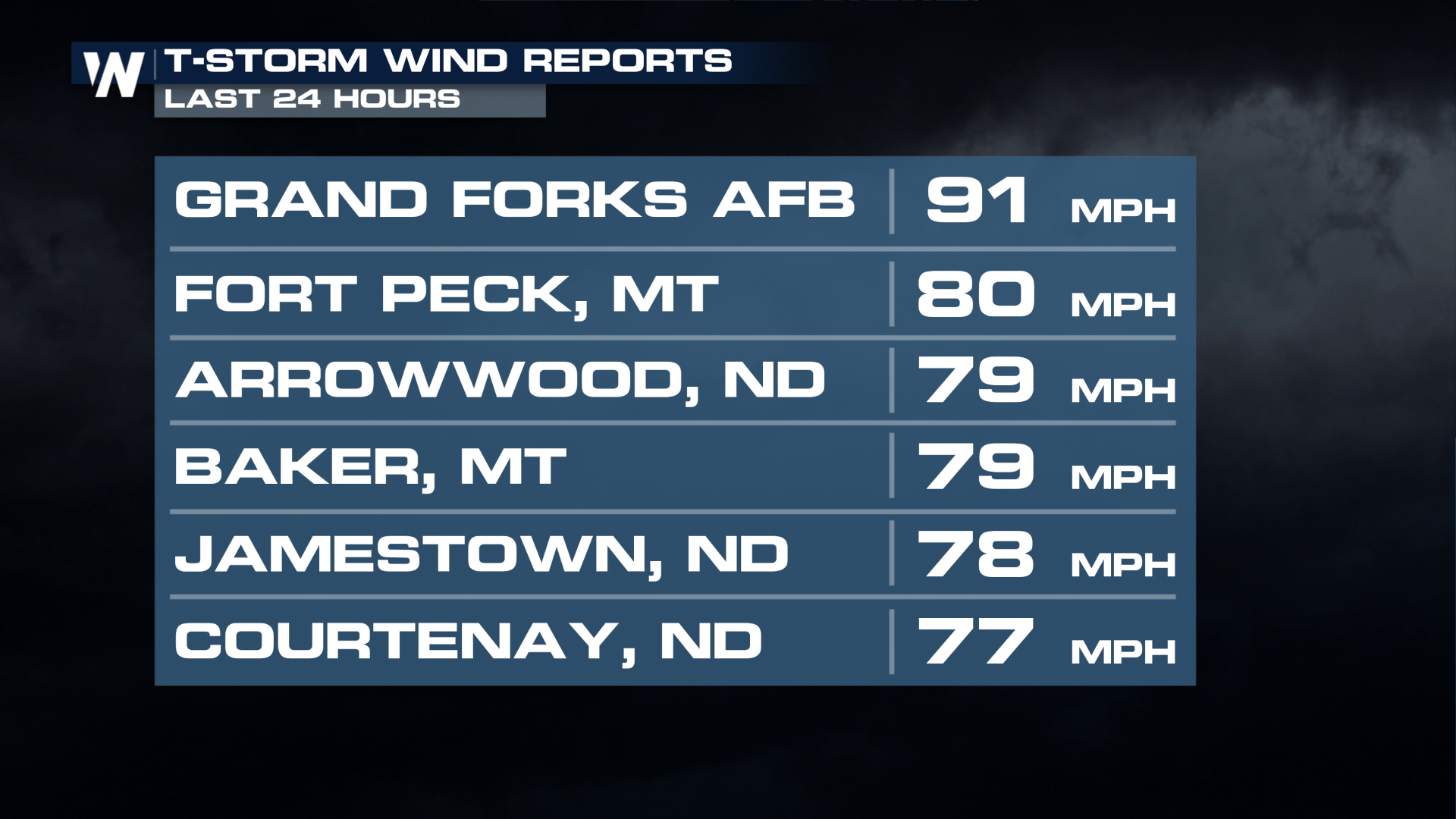
 Peak gusts were well over 75 mph, with a gust at Gran Forks Air Force Base measured at 91 mph!
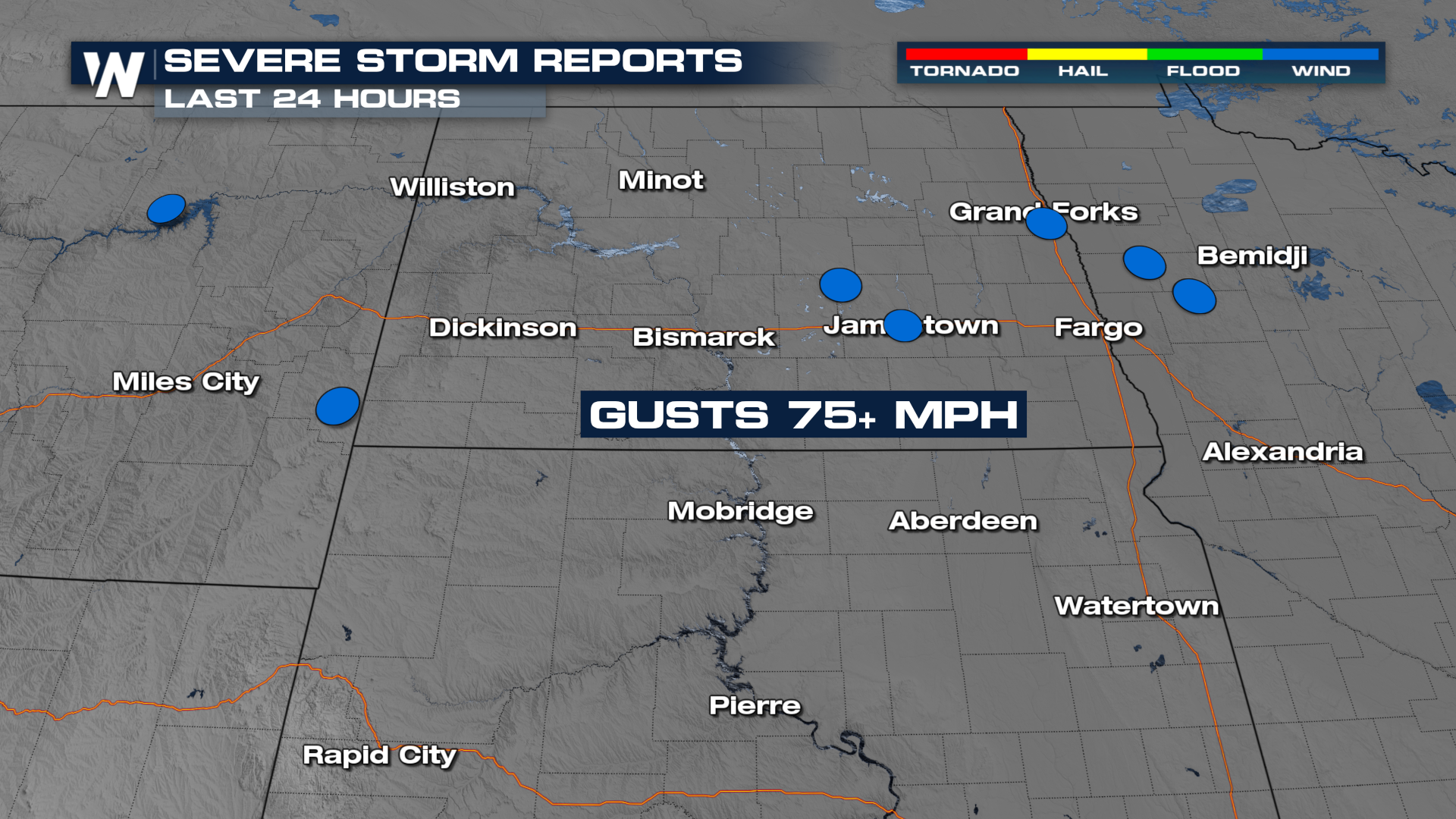
 This squall line produced several 75+ mph gusts, which appear to be well separated as well. This also appears to meet the requirement for a derecho.
 While it appears this system has met the basic 3 requirements for a derecho, other criteria (top of the page) have to be met as well. In addition, wind reports and reports of damage will have to be verified as accurate.
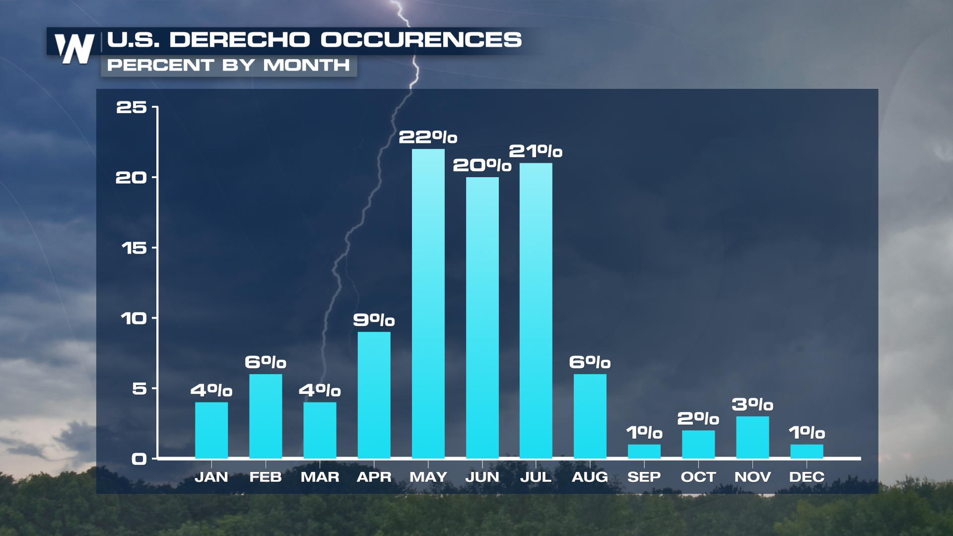
 Derechos most often occur from the late spring through the summer, with a typical drop off in August.